







GTL in mountain bike | Tappa 15B Bric del Cucco (Cravanzana) - Torre Bormida
Starting point Bric del Cucco, on the ridge that leads from Cravanzana to Castino. Leaving the town, you arrive at the crossroads called Crociera di Cravanzana.
After a few meters to the right, cross the...
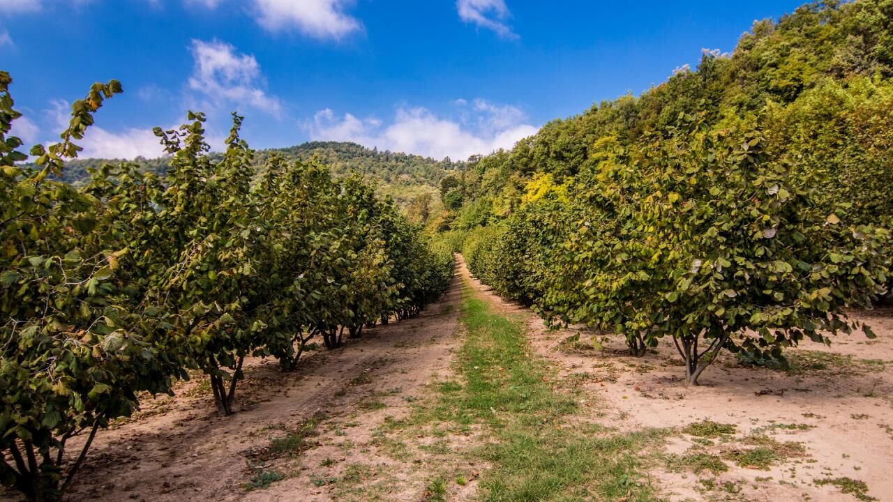
After a few meters to the right, cross the road and go up to the left of the small church dedicated to the Madonna del Rosario. The road climbs gently through the hazelnut groves, until it reaches the edge of the steepest side of the hill. A downhill stretch leads to the large hazelnut grove that surrounds the Cascina Guglielminetti and shortly leads to the crossroads for the Grella area.
Turn right, leaving the asphalt, onto a quiet gravel road and, skirting the chestnut forest that overlooks it, take a wide, panoramic bend. At the next crossroads, follow the flat road to the left, among the trees, which allows you to go around the Bric Grella (620 m above sea level).
From here the descent begins towards the town of Torre Bormida, which appears on our right in the center of a small plateau, suspended over the valley. Go down and, ignoring the road that leads to the houses in the Grella area, continue on the dirt road on the left which, on level ground, heads towards the woods. Keeping close to the edge of the ridge, you descend gently, admiring the beautiful vegetation of the undergrowth, up to a poorly marked crossroads, with some large stones that invite you to stop.
Continue on the dirt road that descends to the left, under the crest, into the woods made up almost exclusively of a copse of chestnut trees, very rich in primroses in spring. A curve to the left allows you to skirt a hazelnut grove for a while and, keeping to the dirt road that runs along the right edge, turn right at the crossroads, entering the woods, and then continue on the wide path that goes flat until you reach a source, just below the route, with numerous pools created by the small stream that flows from it.
After passing the source, a short climb leads to a curve and you pass onto the sunniest and driest side of the hill: consequently, the essences that make up the forest change and the specimens of Scots pine and downy oak become numerous again. You quickly reach a pass where four paths converge; on the left you can see a stone "termination" stuck in the ground. From the crossroads you need to go up a few steps to the left, following the ridge to the top of the hill, and then quickly descend, always on the path that proceeds, not very clearly, among the trees, mainly oaks in this stretch. You reach another saddle (with the usual intersection of paths) and continue along the flat ridge line.
On the left, among the vegetation, you can see the ruins of the castle that overlooks the town of Cortemilia, with the characteristic round tower that has become its symbol. A couple of particularly steep sections of descent (which require attention) lead to a small chapel located on the edge of the cultivated fields, almost all hazelnut groves obviously, that surround Torre Bormida. Having gone around the small church, proceed to the right on the flat gravel path, skirting an imposing dry-stone retaining wall, a characteristic presence in this stretch of the Alta Langa. Once you reach the asphalt, you soon reach the houses of the Fossata Soprana area.
Descend for a few more meters and then turn left at a crossroads, going around a beautiful cherry tree. Skirting yet another hazelnut grove you reach the Fossata Sottana area. At the next crossroads, go down to the right, reaching a tiny bridge and crossing the Lacciacode stream. From here you go up, still on asphalt, until you reach the houses of Torre Bormida, in the Pietra area, at the intersection with the provincial road that descends from Cravanzana.

 Získejte přehled
Vždy živě na místě s více než 9 500 webkamerami. bergfex Jako uživatel Pro si nyní můžete zobrazit odpovídající webové kamery pro mnoho prohlídek v aplikaci prohlídky z. Můžete si tak přímo prohlédnout aktuální podmínky.
Získejte přehled
Vždy živě na místě s více než 9 500 webkamerami. bergfex Jako uživatel Pro si nyní můžete zobrazit odpovídající webové kamery pro mnoho prohlídek v aplikaci prohlídky z. Můžete si tak přímo prohlédnout aktuální podmínky.
Oblíbené prohlídky v okolí
-
Sentiero "Giro delle 5 Torri" - Sentiero 5T in mountain bike
Mountainbike 29.4 km -
Sentiero anello di Merana - Sentiero 575 in camminata
Poutní stezka 10.5 km -
Sentiero "Giro delle 5 Torri" - Sentiero 5T in camminata
Poutní stezka 29.8 km -
Sentiero anello di Merana - Sentiero 575 in mountain bike
Mountainbike 10.5 km -
The hills of Count Cavour
světloSilniční kolo 35.8 km -
5.0
The Ascents of Champions
heavySilniční kolo 114.2 km -
Mombarcaro-San Benedetto Belbo Rundweg
světloTuristika 11.3 km -
Tour of the 5 towers in the langa astigiana: Stage 3 Roccaverano - Merana
světloCyklistika na velkou vzdálenost 24.5 km -
Tour of the 5 towers in the Langa astigiana: Stage 2 Monastero Bormida - Roccaverano
světloCyklistika na velkou vzdálenost 14.8 km -
Bar To Bar in mountain bike
heavyCyklistika na velkou vzdálenost 68.6 km
Pěší turistika a stopování


Nenechte si ujít nabídky a inspiraci pro vaši příští dovolenou
Vaše e-mailová adresa byl přidán do poštovního seznamu.





