


CESANA T.SE Monti della Luna
Úroveň obtížnosti: S2
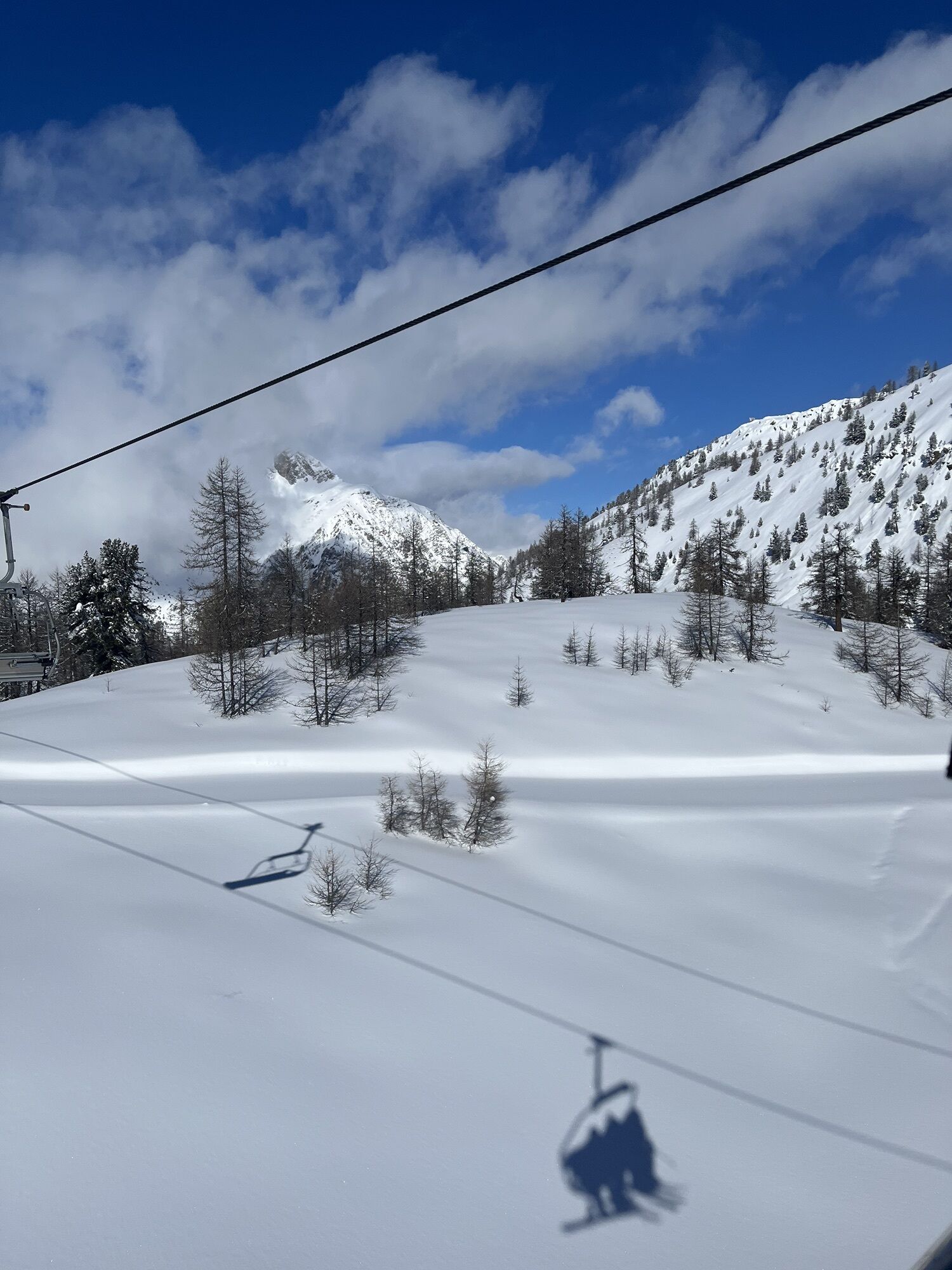


The route crosses an area that in winter turns into a ski resort located on the border with France, which is why the remains of World War II military installations placed to defend the border are still...
The route crosses an area that in winter turns into a ski resort located on the border with France, which is why the remains of World War II military installations placed to defend the border are still visible.
The goal is to pedal through lunar landscapes to reach Claviere: it is necessary to follow a route that includes several climbs, also challenging, necessary to cross the valleys that make up this area called Monti della Luna, also passing through the Val Thuras. The end of the route is near the Claviere tourist information office, from where it is possible to descend along the paved road back to the starting point.
Support and technical description by Jacopo Spatola - Bicycle tour guide


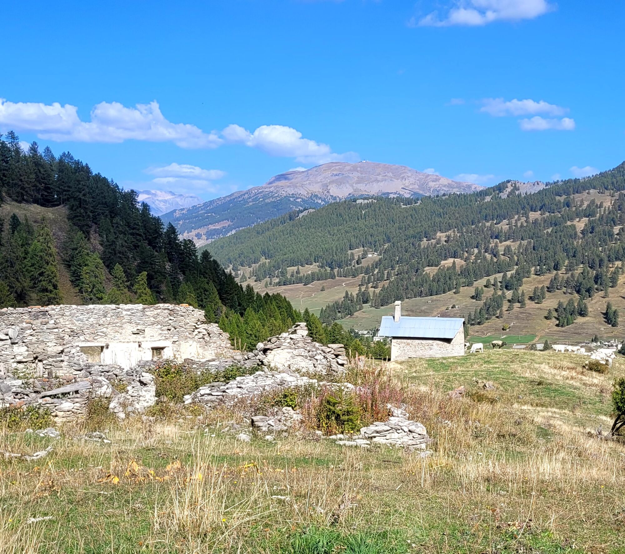


Departure from Cesana Torinese, near the Tourism Office, heading towards Sauze di Cesana: the first section is about 6 km and follows the course of the Ripa stream to the center of Bousson, from here we continue towards the settlement of Thures, a small village that has maintained its alpine village characteristics, the village is left along the Val Thuras to then climb with a challenging route towards the Capanna Mautino refuge.
To reach Claviere, it is necessary to follow a route that includes several climbs, also challenging, necessary to cross the valleys that make up this area called Monti della Luna. The end of the route is near the Claviere tourist information office, from where it is possible to descend along the paved road back to the starting point.
Ano
Route suitable for MTB and E-bike
CAI classification: BC
In some sections, the route is shared with other types of users and is subject to the highway code.
Pay attention to pedestrians and motor vehicles.
From Turin, follow the signs for the North Ring Road towards Trafori - Frejus. Take the A32 motorway towards Bardonecchia and exit the motorway at Monginevro Sestriere. After the tunnel exit continue to the right towards Cesana.
Reachable by public transport.
Train from Torino P.N to Bardonecchia (stop Oulx-Cesana-Claviere-Sestriere) + Bus Arriva line 285 from Oulx to Cesana.
Parking available near the Tourism Office in Piazza Vittorio Amedeo, along Viale IV Novembre (direction Bousson) with attention to parking time slots or, continuing along the same avenue, at the free parking lot opposite the ski lifts.
S2
- If you depart without food do not worry!
- After the effort you can take a break in one of the various refreshment points/refuges present on the Monti della Luna
- A BC classified route for bicycle tourists with good technical skills: route on very rough dirt roads or on mule tracks and trails with rather uneven but quite flowing or compact but irregular surface, with some natural obstacles (e.g., rock steps or roots).
Near the tourist information offices of Cesana and Claviere, there are freely accessible e-bike charging points; you can use your charger to connect it to these points and recharge your e-bike!
Oblíbené prohlídky v okolí
- 5,0
SESTRIERE Monte Rognosa
heavyTuristika 6,42 km BARDONECCHIA - Loop Colle della Scala - Col de Montgenèvre - Colle del Sestriere
heavySilniční kolo 91,9 km- 5,0
CESANA T.SE Thures - Cima Bosco
heavySněžnice 3,94 km - 5,0
CESANA T.SE Cesana - Fenils
světloTuristika 4,60 km CESANA T.SE Lago Nero - Seven Colors Lake
středníTuristika 3,51 kmGR® 5 La grande traversée des Alpes
středníTuristika 95,6 kmCESANA T.SE Val Thuras
středníTuristika 7,58 kmCESANA T.SE The Lakes Route
středníTuristika 10,2 kmCESANA T.SE Bousson - Lago Nero
středníSněžnice 4,68 kmPRAGELATO The winter charm of the Val Troncea Natural Park
světloSněžnice 4,62 km

Pěší turistika a stopování


Nenechte si ujít nabídky a inspiraci pro vaši příští dovolenou
Vaše e-mailová adresa byl přidán do poštovního seznamu.