


Pulkkilanharju Trail, Päijänne National Park, Asikkala


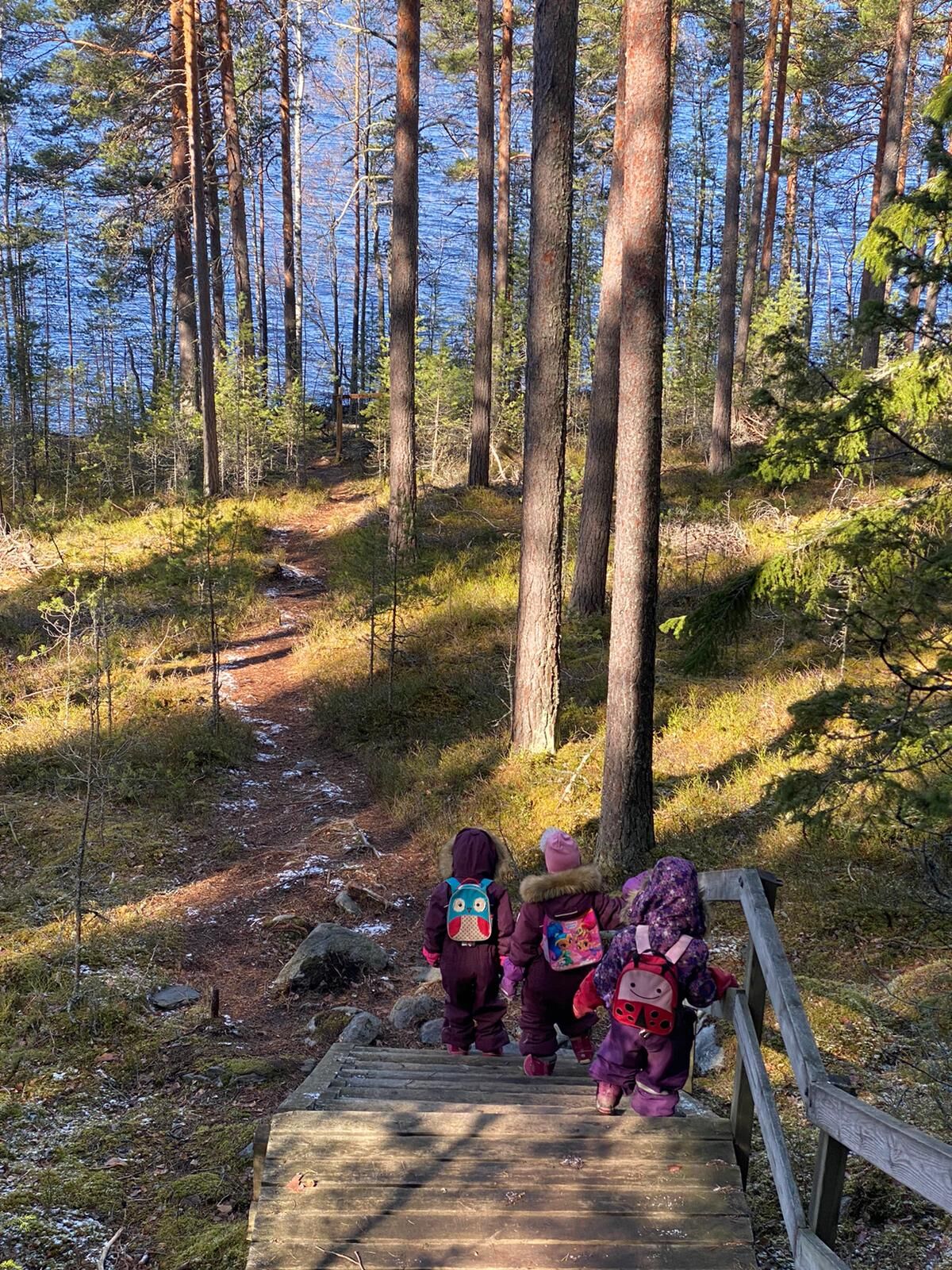
Visitors can explore the esker nature on a nature trail of about two kilometres that is mostly easy terrain. The nature trail begins at Karisalmi rest area by going under Karisalmi Bridge to the other...
Visitors can explore the esker nature on a nature trail of about two kilometres that is mostly easy terrain. The nature trail begins at Karisalmi rest area by going under Karisalmi Bridge to the other side of the road and then heading up to the esker. The information boards along the trail describe how the esker was formed and present the plant species of the area. You can also leave the nature trail and take a longer marked trail. This lengthens the walk back to the Karisalmi starting point to a total of about 4.5 kilometres. Most of the terrain is a fairly easy forest trail through the beautiful esker and lake landscape.
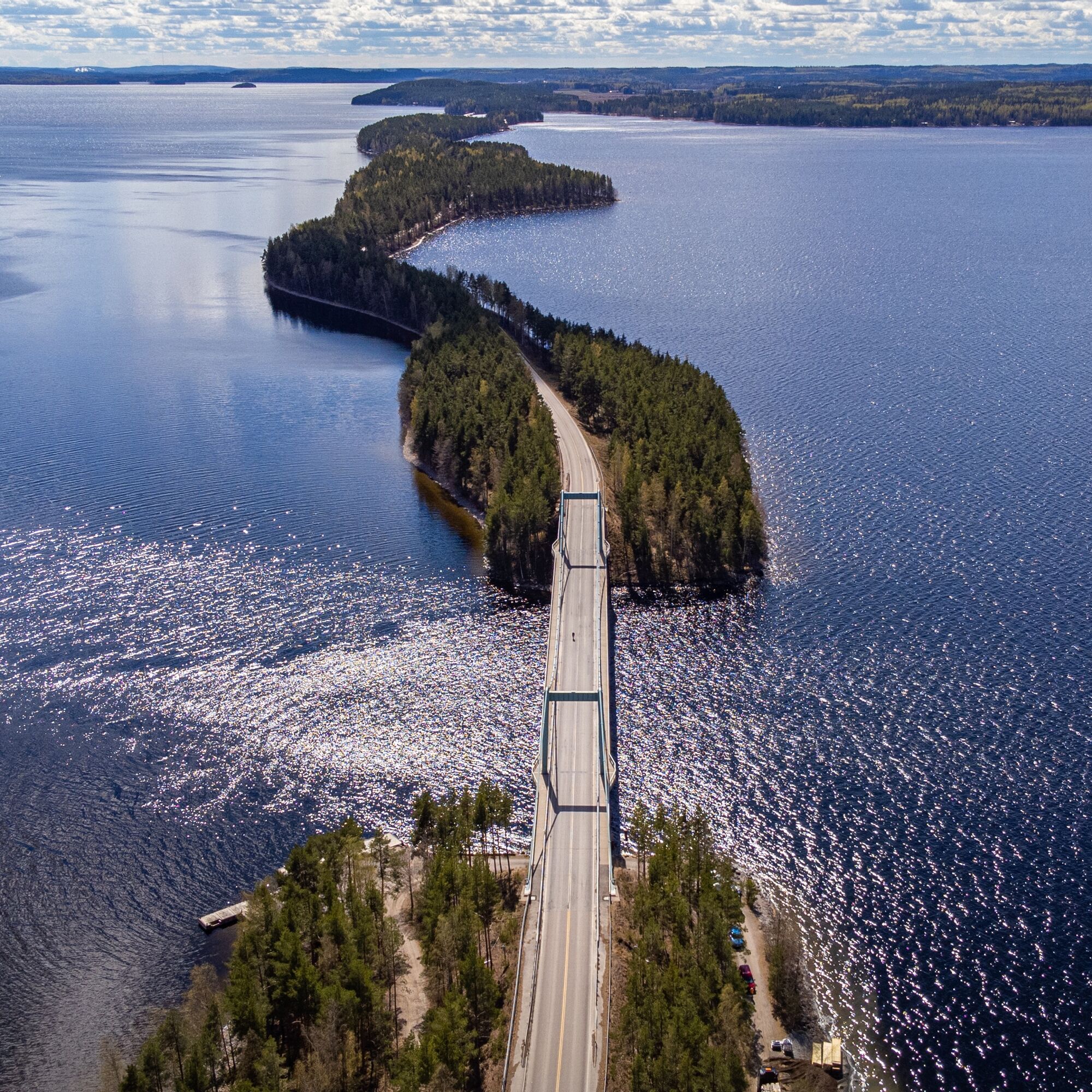
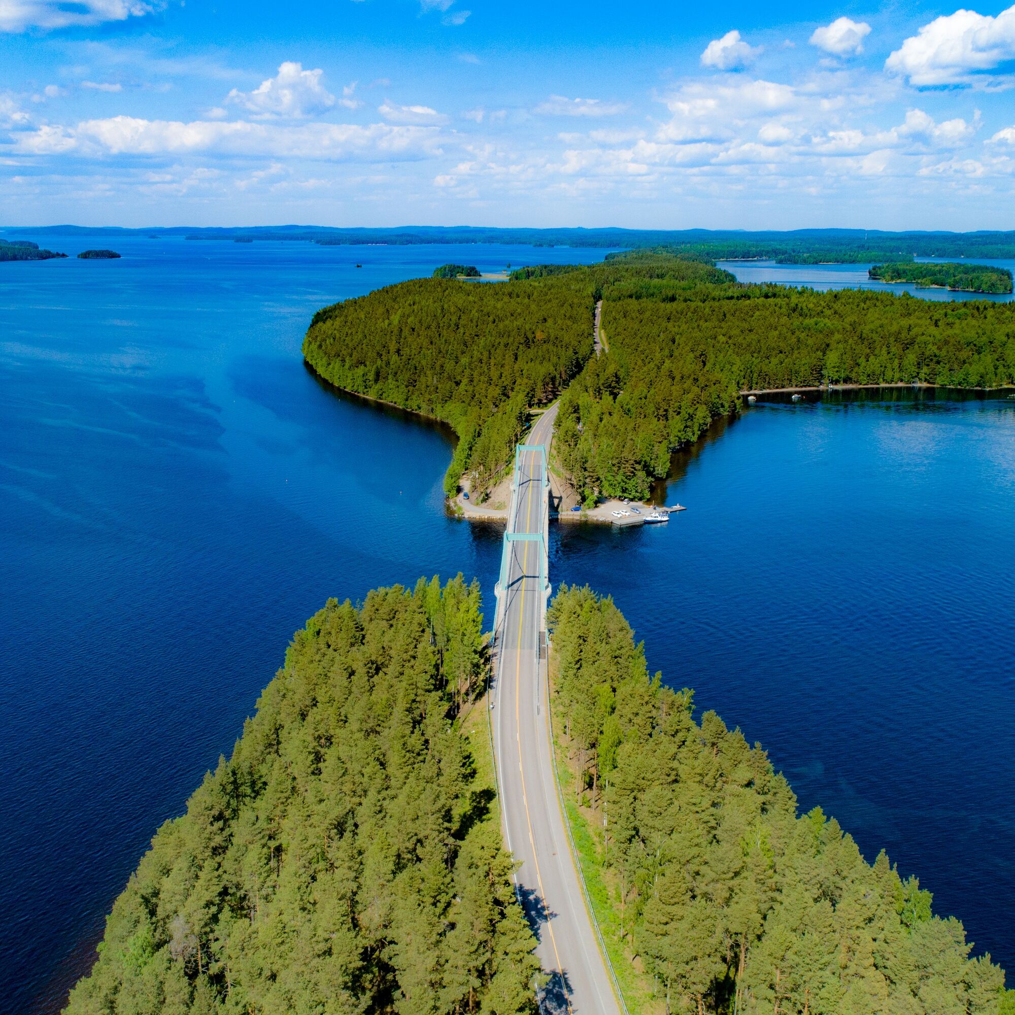
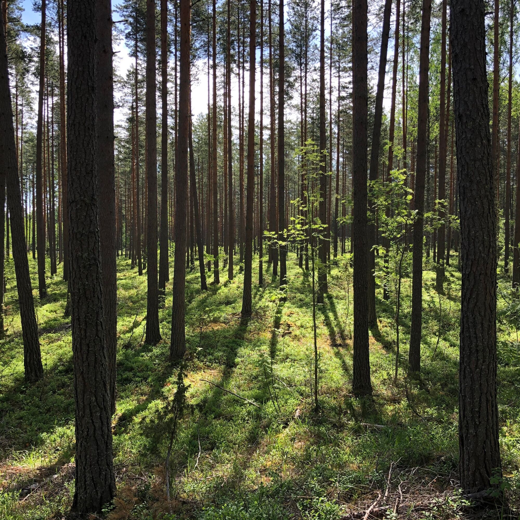
The 8-kilometre-long Pulkkilanharju Esker consists of esker islands and underwater ridges. The islands are connected to each other by bridges. Part of Pulkkilanharju Esker belongs to Päijänne National Park, which was established in 1993. The narrow Pulkkilanharju Esker, running across beautiful Lake Päijänne, is part of a nationally valuable landscape area and an important birdwatching site during the spring and autumn migrations. The Päijänne scenic road was named Finland’s most beautiful scenic route in 2014. The winning route begins in Vääksy and continues via Pulkkilanharju, Sysmä and Luhanka to Korpilahti.
Pulkkilanharju is part of an esker stretching from the Second Salpausselkä Ridge in Asikkala well into the Sysmä area. It is an internationally significant example of traces from the last Ice Age and one of the most important sites of the Salpausselkä UNESCO Global Geopark. Pulkkilanharju Esker was formed from layers of gravel and sand deposited by meltwaters at the site of a glacial meltwater stream flowing within the continental ice sheet. This took place at the end of the last Ice Age, about 11,500 years ago.

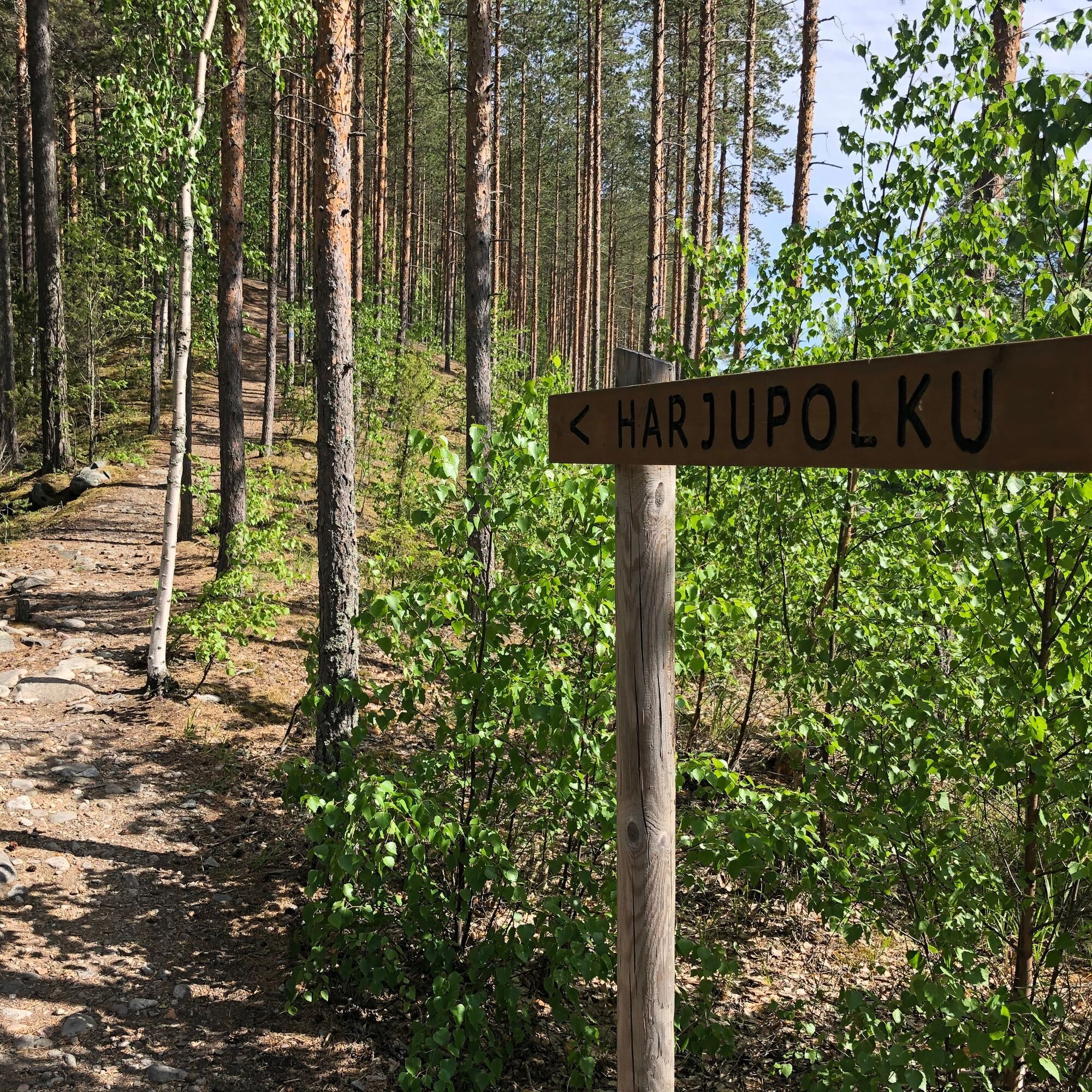
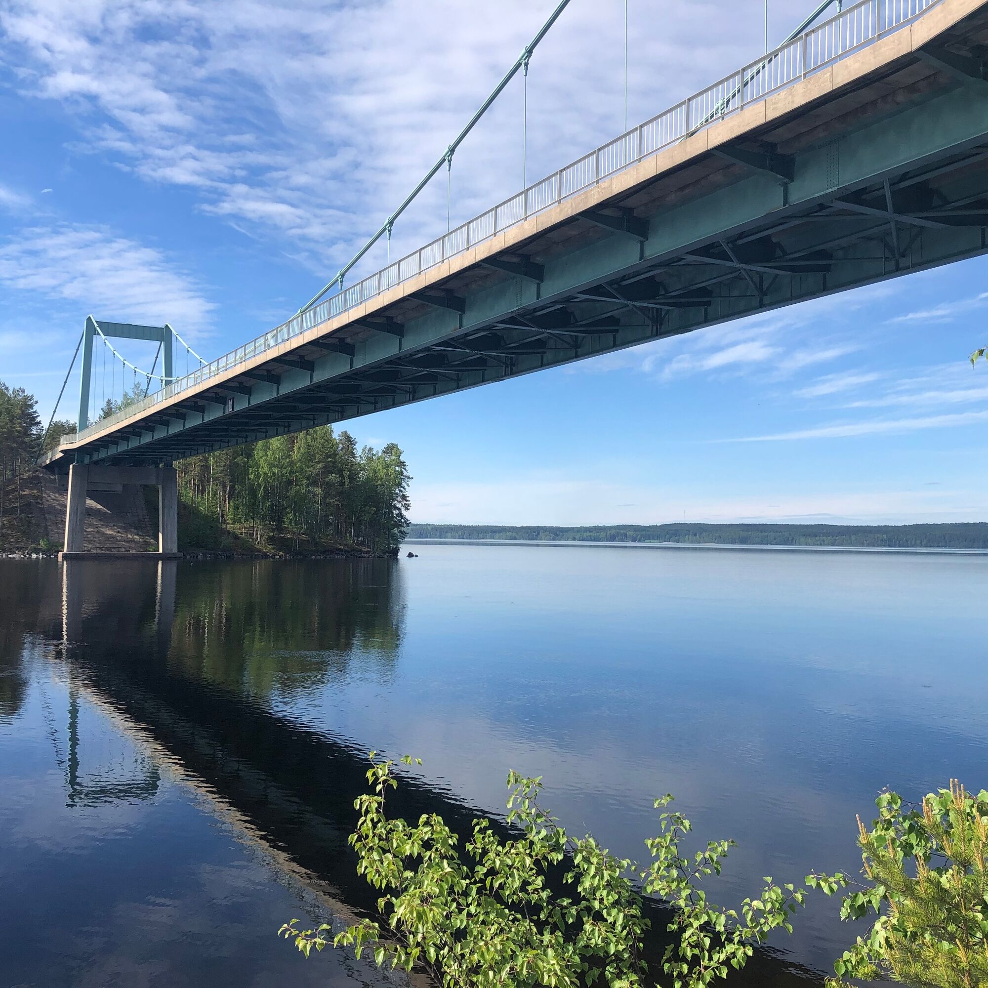
The route starts from the Karisalmi bridge parking lot and goes along a well-maintained path. Follow the trail signs and route markings which are marked in blue. You should be especially careful at crossroads and forest road crossings.
Ano
Ano
The steps on the route can be slippery, especially after rain.
You can get to Pulkkilanharju from Vääksy and Sysmä via road 314, either by bike, with your own car or by bus.
The start and end point of the route is at the Karisalmi bridge parking lot at Pulkkilantie 955, Asikkala.
Pulkkilanharju can be reached from Vääksy and Sysmä via road number 314 by bicycle, car or bus. See the bus timetables at www.matkahuolto.fi or Local and regional bus transport LSL.Please check the current timetable for the bus, there may be some changes from time to time.
There is a free parking at the Karisalmi bridge parking lot.
Please follow the rules of the national park and stay on the path so that the sensitive ridge vegetation is not damaged. Familiarize yourself with the instructions and rules of the national park.
The scenery from the Karisalmi bridge is wonderful.
In the summer, a ferry goes from Karisalmi bridge to Kelvenne island of Päijänne National Park.
Oblíbené prohlídky v okolí
Kultaisen Tassun kierros, Asikkala
středníTuristika1,95 kmKansallispuistomelonta Kelventeelle, Padasjoki
středníKajak / Kánoe30,0 kmAurinko-Ilves trail, Asikkala
střednídálková pěší trasa30,6 kmKaksi Kanavaa, Lahti-Heinola
heavyKajak / Kánoe72,0 kmRadwanderung auf dem Eiszeitweg von Asikkala
středníJízda na kole78,8 kmPäijänteen Paras -melontareitti Sysmästä
heavyKajak / Kánoe142,8 kmPäijänteen Paras -melontareitti Padasjoelta
heavyKajak / Kánoe142,6 kmAurinko-Ilves MTB, Asikkala
středníMountainbike30,5 kmKelvenne ridge trail, Padasjoki
středníTuristika9,40 kmMyllytonttu Nature Trail, Vääksy
světloTematická stezka0,43 km
Pěší turistika a stopování


Nenechte si ujít nabídky a inspiraci pro vaši příští dovolenou
Vaše e-mailová adresa byl přidán do poštovního seznamu.