The Perics tour
střední
Pořiďte si tuto prohlídku do mobilního telefonu
The Perics tour
střední
Turistika
47.52
km
Naskenujte QR kód a spusťte navigaci v aplikaci bergfex.

Pěší turistika a stopování


The Perics tour
střední
Vzdálenost
47.52
km
Doba trvání
07:00
h
Ascent
2242
hm
Hladina moře
1880 -
2581
m
Stažení skladby
The Perics tour
střední
Turistika
47.52
km
The Tour des Pérics loop goes from hut to hut. You must first reach one of them to begin.
There are several possibilities... Think of it as a warm-up.
From Ariège :
- Start by climbing to the Refuge d'en...
Popis
The Tour des Pérics loop goes from hut to hut. You must first reach one of them to begin.
There are several possibilities... Think of it as a warm-up.
From Ariège :
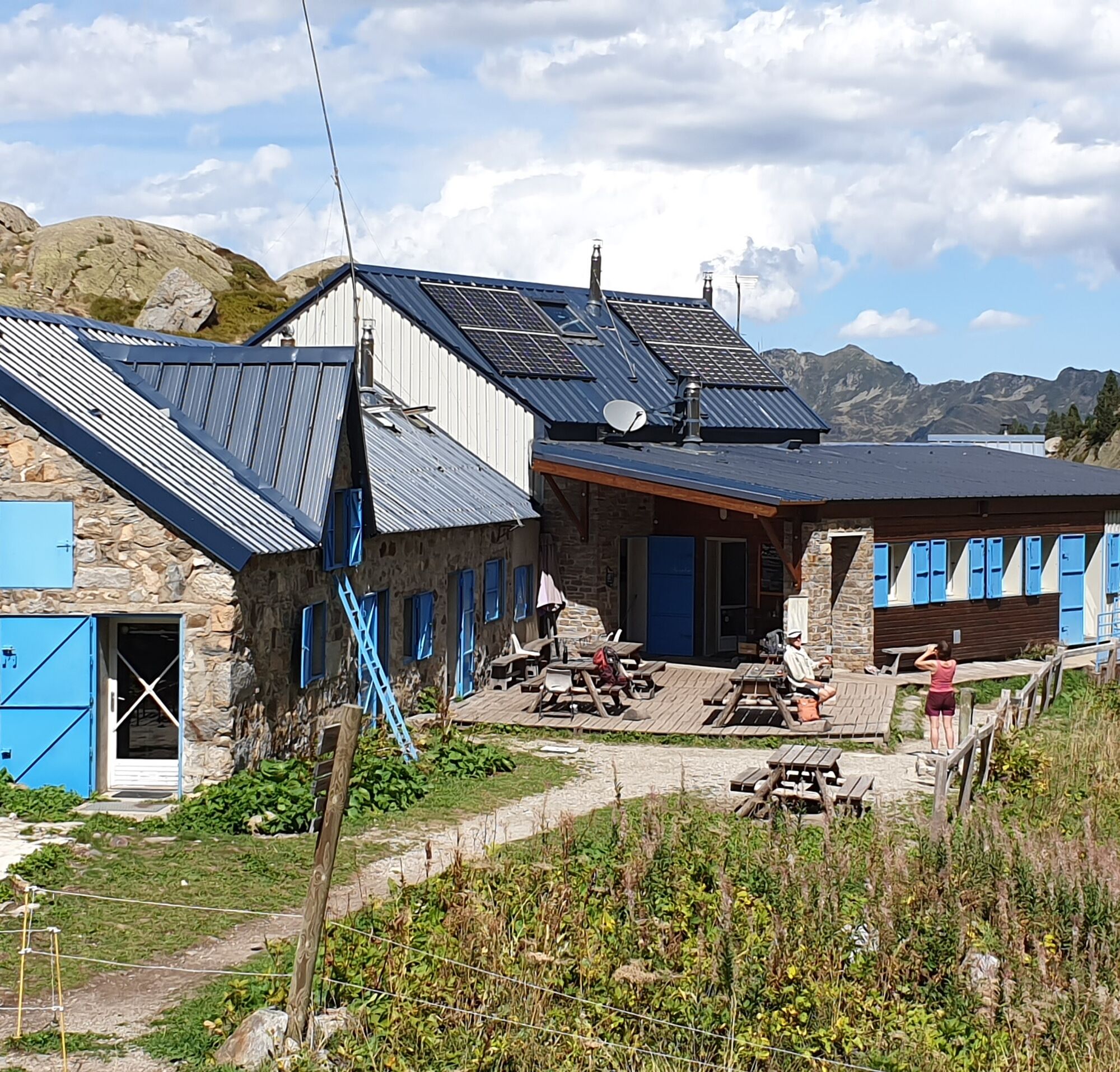
- Start by climbing to the Refuge d'en Beys, a 3-hour walk via the Orlu Reserve. Access to the start by car or train + hitchhiking
- Or climb to the Refuge des Bésines, also a 3-hour hike from l'Hospitalet-près-l'Andorre. The advantage of this option is its proximity to the SNCF train station.
From Pyrénées-Orientales :
- Either start by reaching the Refuge des Bouillouses (by car or shuttle bus). In summer, access to the Bouillouses site is by shuttle bus from Pla de Barrès. For shuttle times and prices, visit www.ledepartement66.fr. This departure allows you to save a day
- Or climb to the Refuge des Camporells via the greenhouse at Maury in 1h45. From Formiguères resort, follow the forest track to the parking lot at the arrival point of the Calmaseille chairlift (point 2095 m on the IGN).
There are several possibilities... Think of it as a warm-up.
From Ariège :
- Start by climbing to the Refuge d'en Beys, a 3-hour walk via the Orlu Reserve. Access to the start by car or train + hitchhiking
- Or climb to the Refuge des Bésines, also a 3-hour hike from l'Hospitalet-près-l'Andorre. The advantage of this option is its proximity to the SNCF train station.
From Pyrénées-Orientales :
- Either start by reaching the Refuge des Bouillouses (by car or shuttle bus). In summer, access to the Bouillouses site is by shuttle bus from Pla de Barrès. For shuttle times and prices, visit www.ledepartement66.fr. This departure allows you to save a day
- Or climb to the Refuge des Camporells via the greenhouse at Maury in 1h45. From Formiguères resort, follow the forest track to the parking lot at the arrival point of the Calmaseille chairlift (point 2095 m on the IGN).
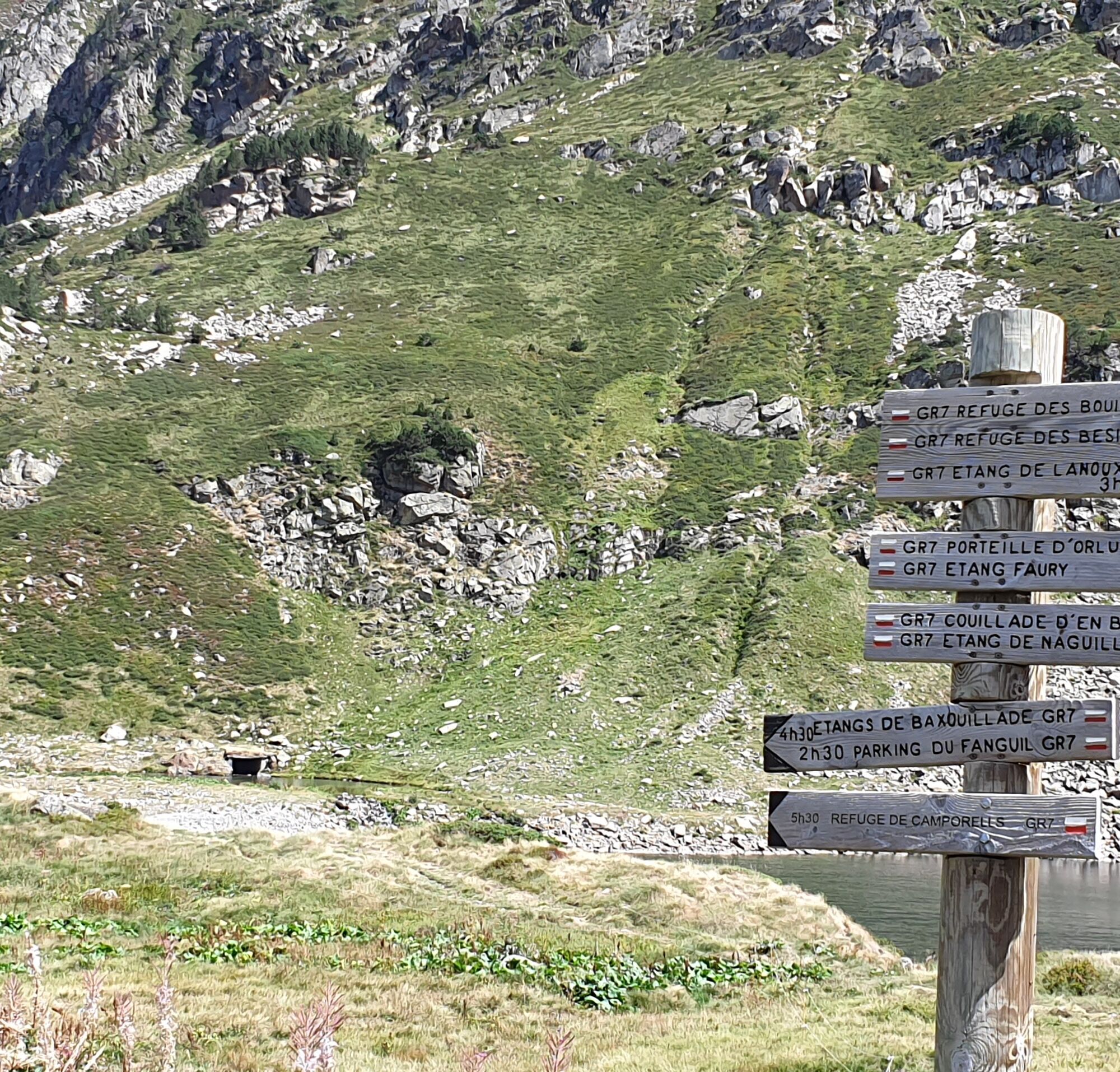
Trasa
Refuge des Besines
(2098 m)
Úkryt
0.0 km
Refuge des Bouillouses
(2007 m)
Úkryt
16.3 km
Refuge des Camporells
(2246 m)
Úkryt
27.3 km
Pic de Mortiers
(2605 m)
Summit
30.8 km
Cabane d'En Dela
(1964 m)
Útočiště (neřízené)
35.6 km
Portella de Lanós
(2492 m)
Horské sedlo
44.4 km
Refuge des Besines
(2098 m)
Úkryt
47.5 km
Trasa
The Perics tour
střední
Turistika
47.52
km
Refuge des Besines
(2098 m)
Úkryt
0.0 km
Cabane de Rouzet
(2258 m)
Útočiště (neřízené)
5.7 km
Auberge du Carlit
(2014 m)
Restaurace
15.8 km
Refuge des Bouillouses
(2007 m)
Úkryt
16.3 km
Refuge des Camporells
(2246 m)
Úkryt
27.3 km
Source
(2366 m)
Zdroj:
29.3 km
Pic de Mortiers
(2605 m)
Summit
30.8 km
Puig de Terrers
(2532 m)
Summit
32.0 km
Cabane d'En Dela
(1964 m)
Útočiště (neřízené)
35.6 km
Résurgence
(1955 m)
Zdroj:
38.0 km
Refuge d'En Beys
(1966 m)
Úkryt
38.5 km
Portella de Lanós
(2492 m)
Horské sedlo
44.4 km
Refuge des Besines
(2098 m)
Úkryt
47.5 km

Naposledy sledované
před 6 dny
Informace o trase
Trasa
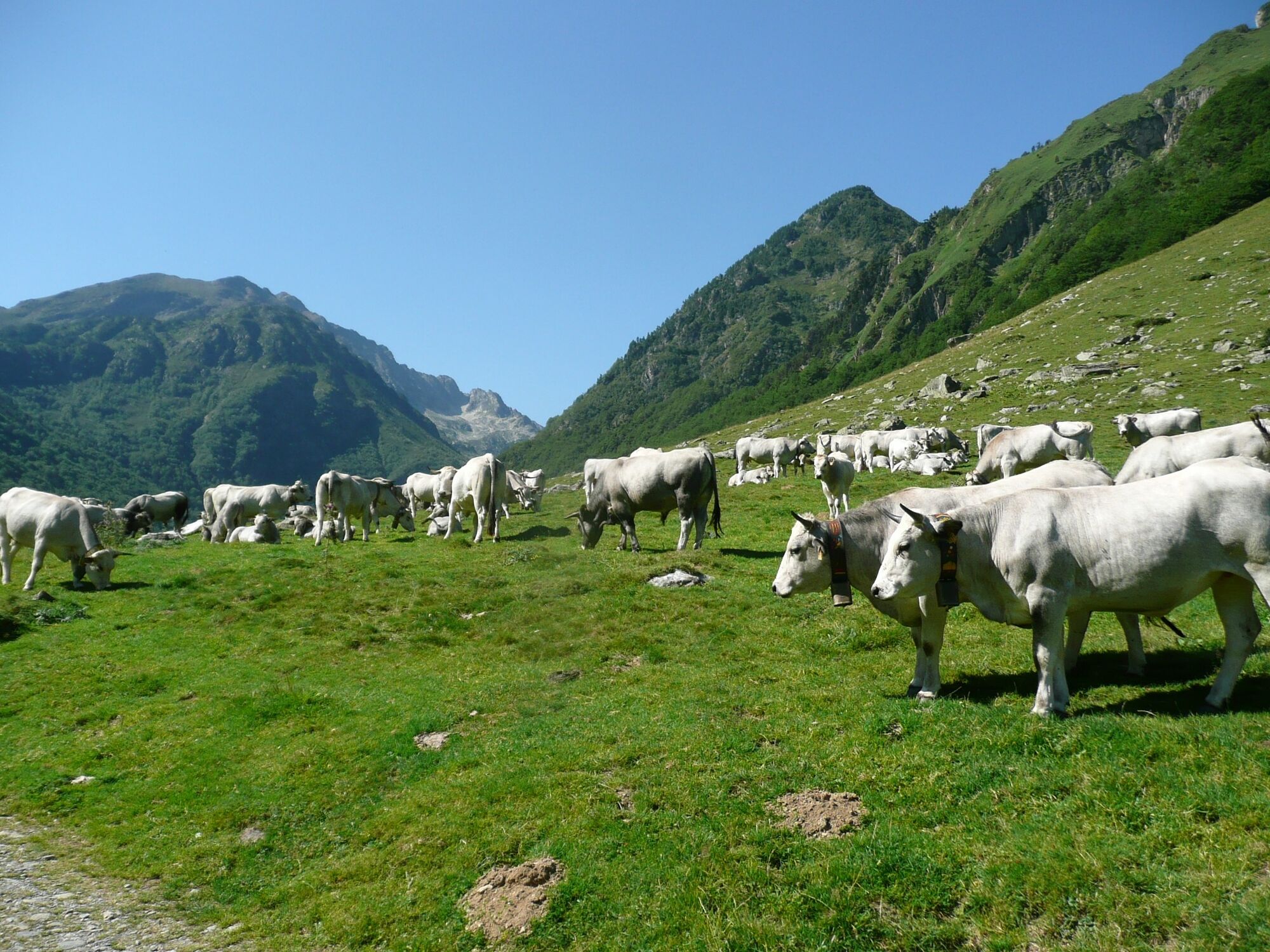
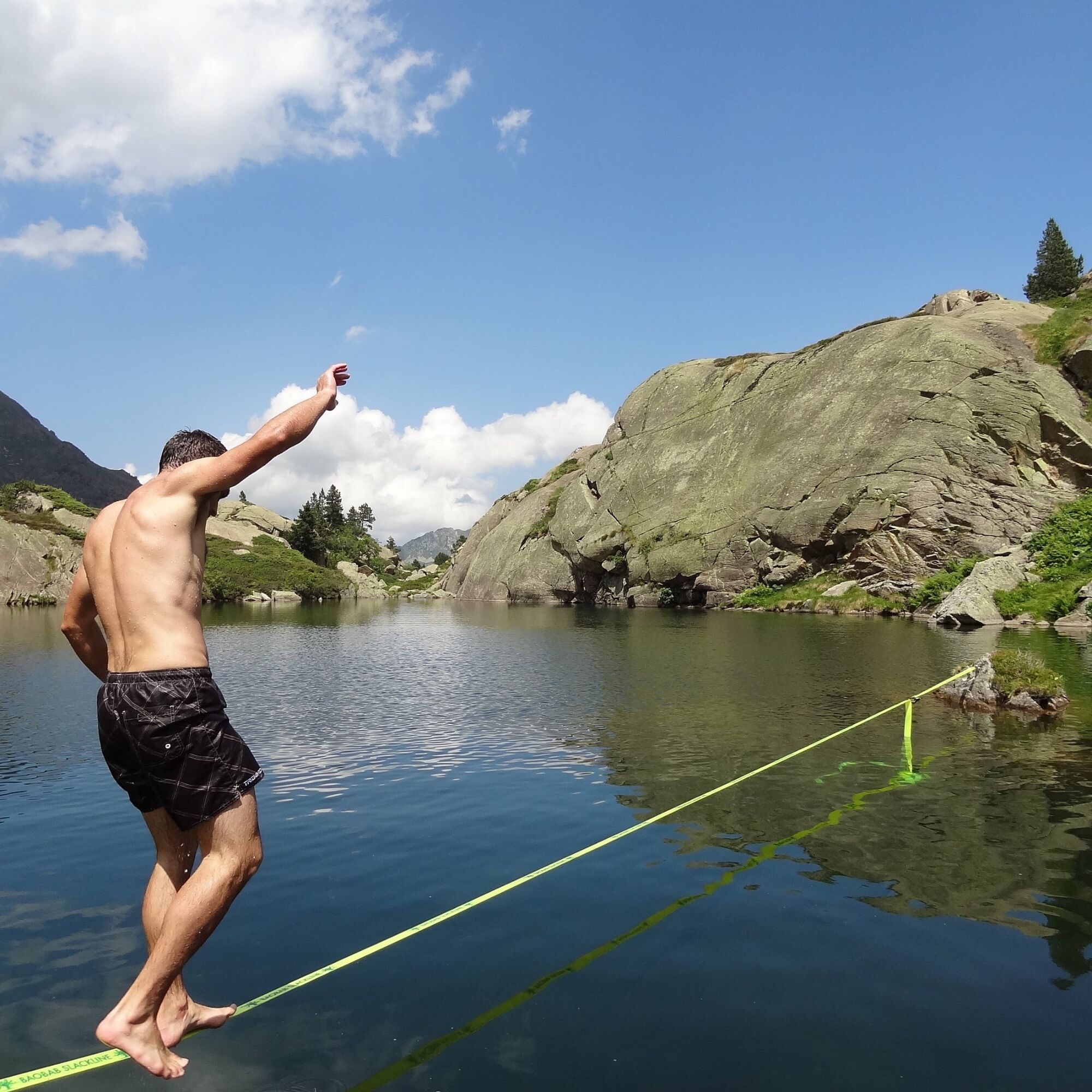
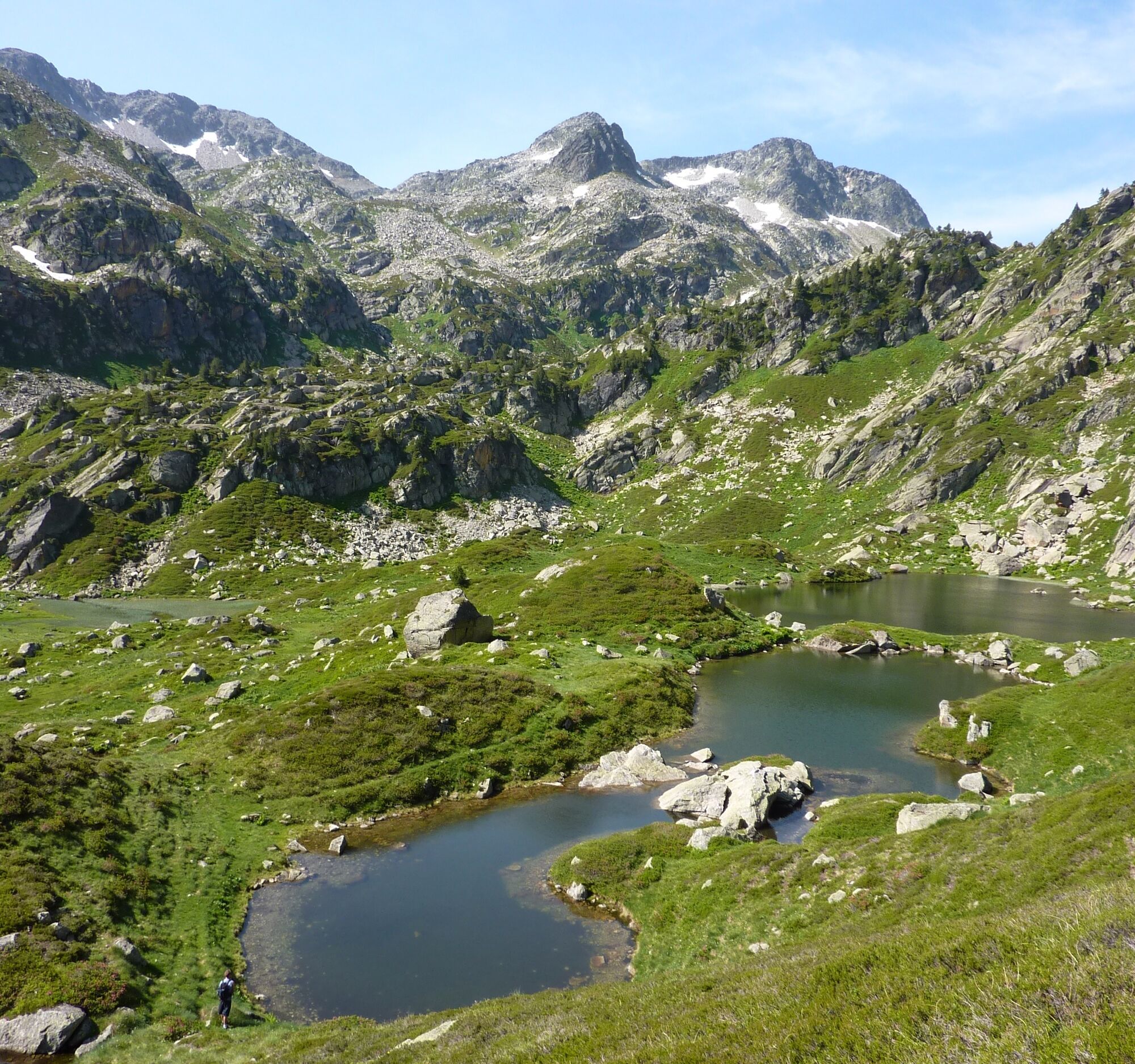
The Tour des Pérics is an itinerary devised by the refuge wardens themselves, who use it from time to time to visit their "neighbors". It can start from any refuge, but in any case the variety of landscapes on the dividing line between Ariège and Capcir, and the presence of a rich flora and fauna (Orlu National Reserve, PNR des Pyrénées Catalanes) are a feast for the eyes! This incredibly diverse massif is undoubtedly one of the most beautiful in the Pyrenees!
Full stage-by-stage description at www.tour-des-perics.com
Full stage-by-stage description at www.tour-des-perics.com
Zatím žádné recenze
Webové kamery z prohlídky

Oblíbené prohlídky v okolí
-
4.0
Pic de Tarbesou - Carena Runde - Etang Noir et Blue
středníTuristika 12.3 km -
Le Pic du Tarbésou
středníTuristika 2.82 km -
GR10 Pyrenäenweg Etappe 45
střednídálková pěší trasa 16.9 km -
Étang des Bésines and its refuge
světloTuristika 14.6 km -
Étang du Laurenti
světloTuristika 5.57 km -
Roc de la calma
středníTuristika 8.25 km -
The Dent d'Orlu
středníTuristika 4.88 km -
Balbonne Pond
světloTuristika 5.44 km -
Comte pond
světloTuristika 5.07 km -
En Beys pond and refuge
středníTuristika 16.6 km
Pěší turistika a stopování

Více než 550.000 návrhů výletů, podrobné mapy a intuitivní plánovač tras dělají z aplikace nezbytnou výbavu pro všechny milovníky přírody.

Nenechte si ujít nabídky a inspiraci pro vaši příští dovolenou
Přihlaste se k odběru newsletteru
Chyba
Došlo k chybě. Zkuste to prosím znovu.
Děkujeme za vaši registraci
Vaše e-mailová adresa byl přidán do poštovního seznamu.
Zájezdy po celé Evropě
Rakousko
Švýcarsko
Německo
Itálie
Slovenia
Francie
Nizozemsko
Belgie
Polsko
Lichtenštejnsko
Česko
Slovensko
Španělsko
Chorvatsko
Bosna a Hercegovina
Lucembursko
Andorra
Portugal
Iceland
United Kingdom
Ireland
Greece
Albania
North Macedonia
Malta
Norway
Montenegro
Moldova
Kosovo
Hungary
San Marino
Romania
Estonia
Latvia
Belarus
Cyprus
Lithuania
Serbia
Bulgaria
Monaco
Denmark
Sweden
Finland