


RAVIN DES ARCS HIKE
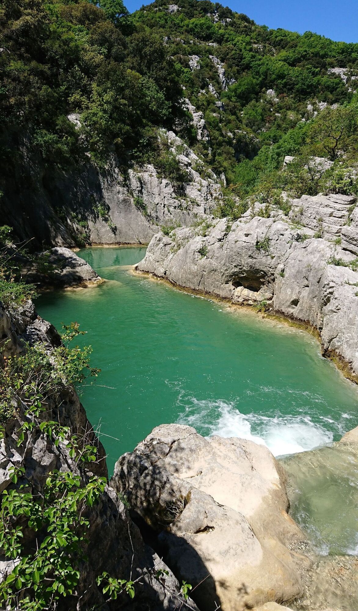
A small tributary of the Hérault River, the Lamalou, has carved out a narrow canyon in this garrigue landscape, bordered in places by high cliffs. In the bed of this temporary watercourse, the focal point...
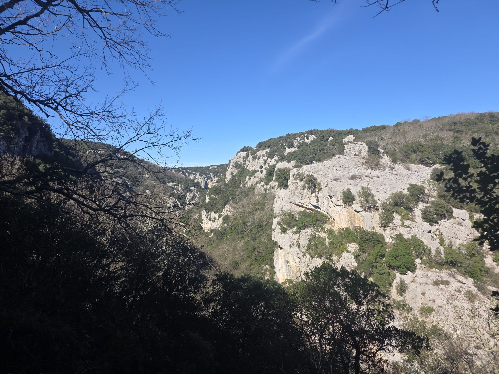
Discover a wild site on your way down from the Cévennes, in the Séranne massif. Close to the Pic Saint-Loup, the Hérault river has carved wild gorges, both verdant and mineral. They are a mosaic of grandiose, unspoilt landscapes, ideal for marvelling and recharging your batteries. Situated at the heart of the classified Grand Site de France Gorges de l'Hérault site, renewed in 2018, and two Natura 2000 sites, Ravin des Arcs is recognized for its high environmental and landscape value. It is home to several endangered species.

1
At the bottom of the parking lot, go through the barrier (chicane). Climb the stony path above the stream. Take the main path back down to the Garels wash house. This large, concave masonry structure, judiciously placed in the landscape, is used to collect water for watering livestock.
2
Go left up the hillside, through sparse vegetation: look for a small prickly shrub. This is the juniper known as cade. It's easily distinguished from its cousin, the common juniper, by the two white stripes on its spiny leaves. Further up, enter the oak undergrowth. Walk above the Lamalou gorges (follow the signs). Cross the scree slopes (with views of the gorges, Séranne mountain and Roc Blanc in the distance), through the Grabasses wood. The ground is blackened in places. These are the remains of former charcoal kilns, traces of past logging operations.
3
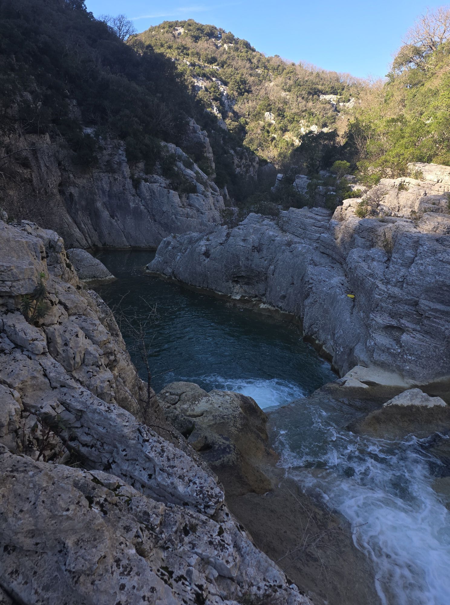
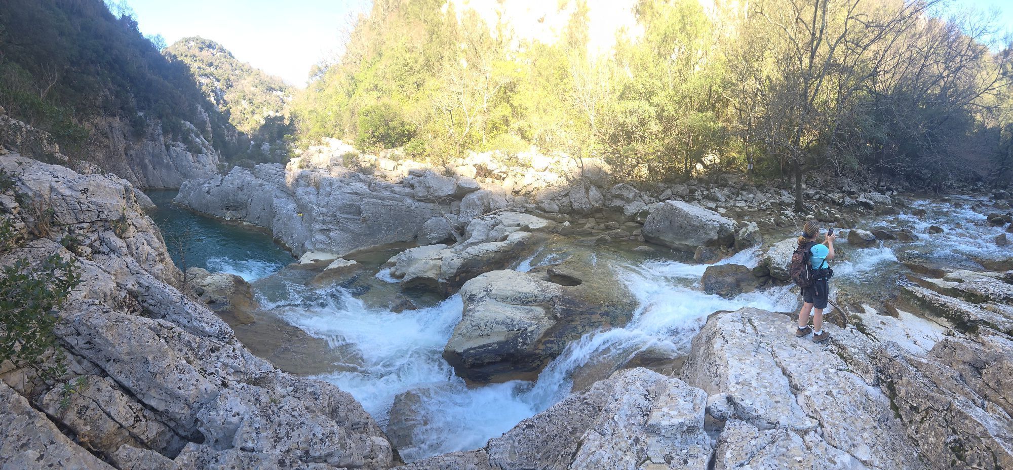
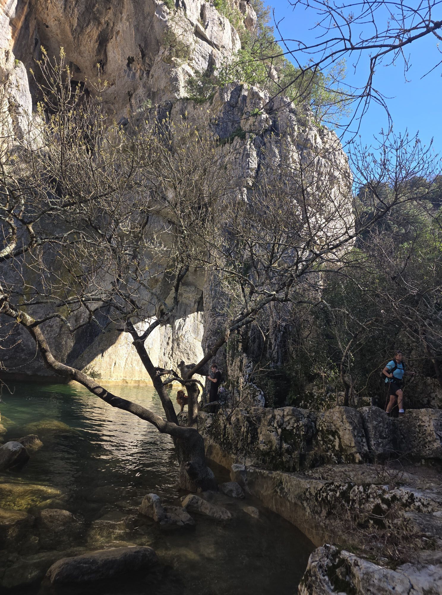
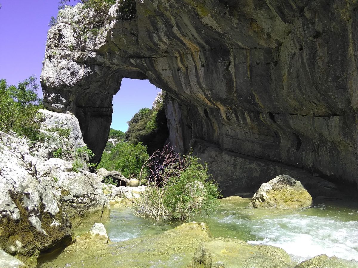
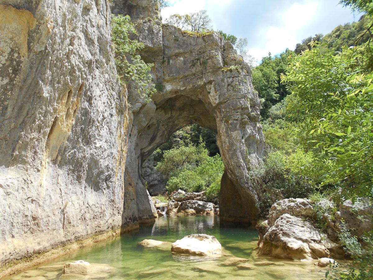
Descend to the right into the Ravin des Arcs (caution! slippery). There's a breathtaking view of the arch leaning against the cliff. This large arch is the result of the slow work of erosion on the rock. The winding path leads to the banks of the Lamalou.
4
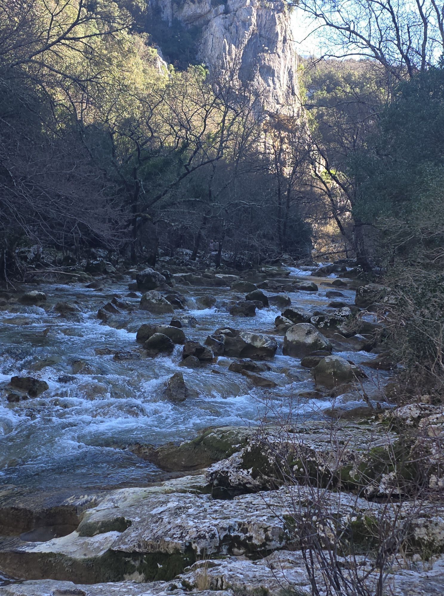
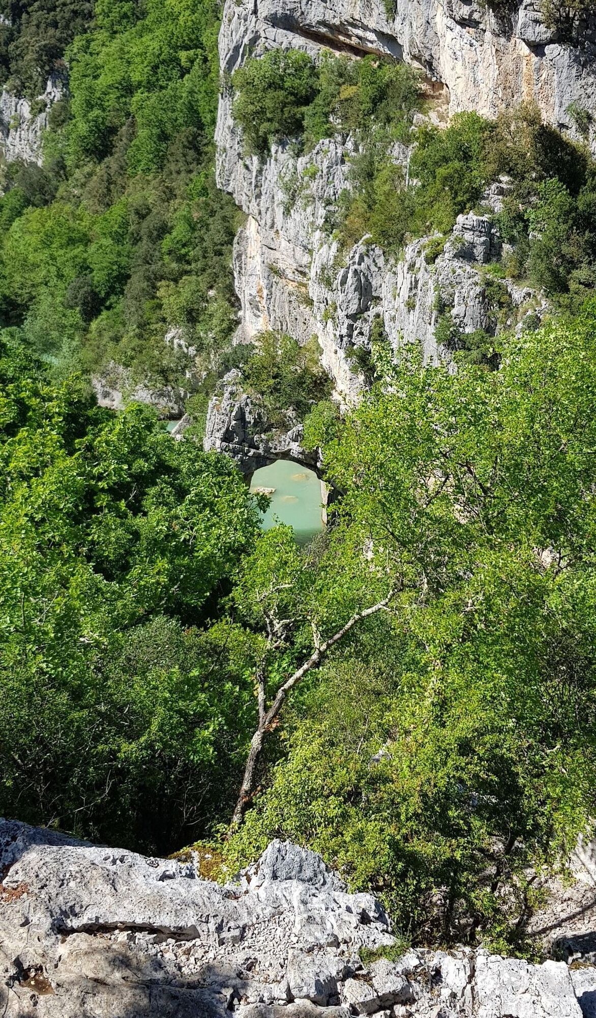
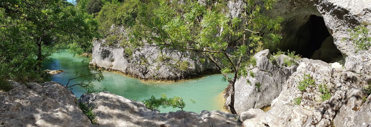
Descend the creek bed for around 150 m (caution: crossing the watercourse is forbidden in the event of flooding). Cross over to the right bank, before the large pools of water. These shapes are still the result of erosion.
5
Climb up the rock faces (steep, technical section!!). Follow the well-marked path, which winds through the Grand Bois de la Garde and its many tree species (the white oak is best recognized by the whitish down under its leaf).
6
On the plateau, turn right onto the stony path. Gradually descend, facing Pic Saint-Loup and the plaine de Londres, whose name derives from the old local dialect "terrain dundras", meaning a swampy, parched land. Further down in the grassy meadow, continue straight ahead and cross the Lamalou again. Return to the outward path at the lavogne. Follow the same route to the left to reach the starting parking lot.
Do not cross the river in the event of flooding (retrace your steps).
It is forbidden to leave the marked trail from January 15 to June 15. Follow the signs. This sensitive natural site is protected by an arrêté préfectoral de protection de biotope.
The hike is accessible to children, but please take care: delicate and slippery descent in wet weather, steep ascent, caution near cliffs, etc.
Bring a sufficient supply of water and protect yourself from the sun.
Bring walking shoes suitable for hiking.
Respect the natural environment and private property, cross pastures and close fences.
During hunting season, remain vigilant and respect signs indicating hunting in progress: for further information, contact the FDC34: 04 67 42 41 55 or fdc34.com.
PR Yellow
https://www.grandpicsaintloup-tourisme.fr
Office de Tourisme du Grand Pic Saint-Loup
PDESI
Oblíbené prohlídky v okolí
- 5.0
DRAILLES HIKE
světloTuristika 7.16 km RANDONNEE DE PEYRE MARTINE
středníTuristika 15.4 kmHIKE OF THE CHÂTEAU DE RESTINCLIERES
světloTuristika 7.86 km- 4.0
PIC SAINT LOUP HIKE
středníTuristika 2.64 km HIKING OF THE SERRE DE GRENOUILLET
středníTuristika 7.70 kmWINE ROUTE AROUND THE GORGES DE L'HERAULT
Motorrad 57.9 kmLOOP CYCLO N°18 - LA SOURCE DU LEZ
světloJízda na kole 13.9 kmWINE ROUTE IN THE SHADOW OF THE CHATEAU DE MONTFERRAND
Motorrad 49.8 kmHIKING THE TOUR DES VILLAGES DU PIC - GR® DE PAYS TOURS IN GRAND PIC SAINT-LOUP
středníTuristika 47.5 kmLA SERANNE PONTEL HIKE
středníTuristika 17.5 km

Pěší turistika a stopování


Nenechte si ujít nabídky a inspiraci pro vaši příští dovolenou
Vaše e-mailová adresa byl přidán do poštovního seznamu.