


CIT'ART HIKE THE BELVEDERES OF LA GARDIOLE
WARNING (information July 2025): following a major fire, a prefectural decree prohibits any access to the wooded massif of la Gardiole at least until July 15, 2025. After this date, check with the Archipel...
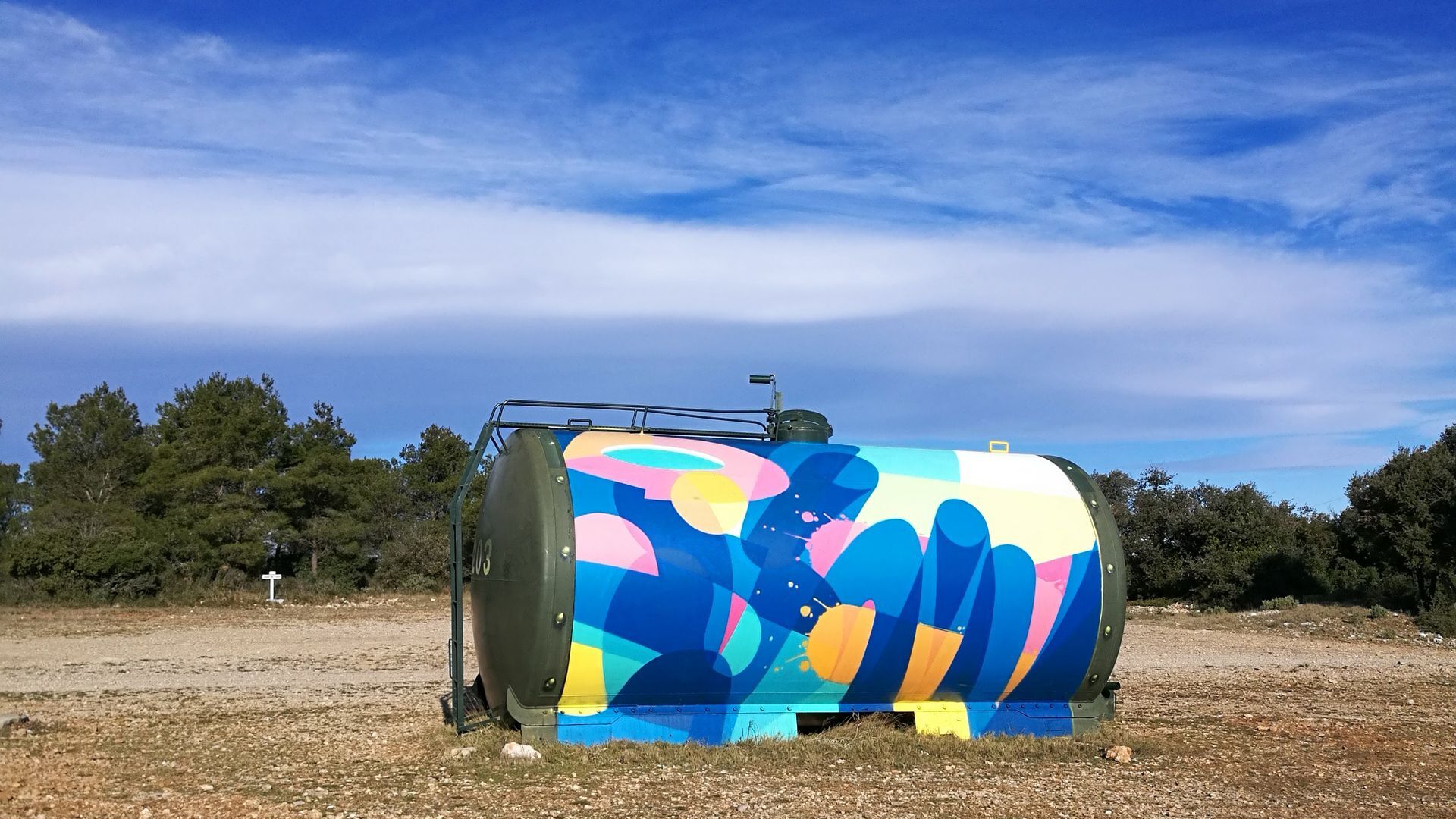
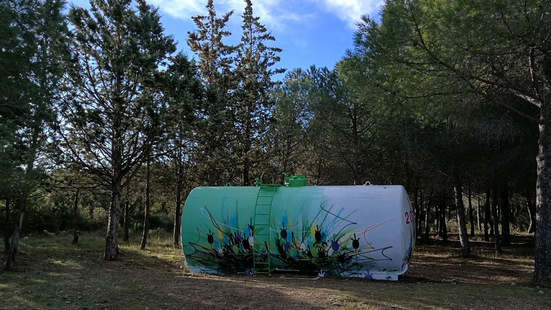
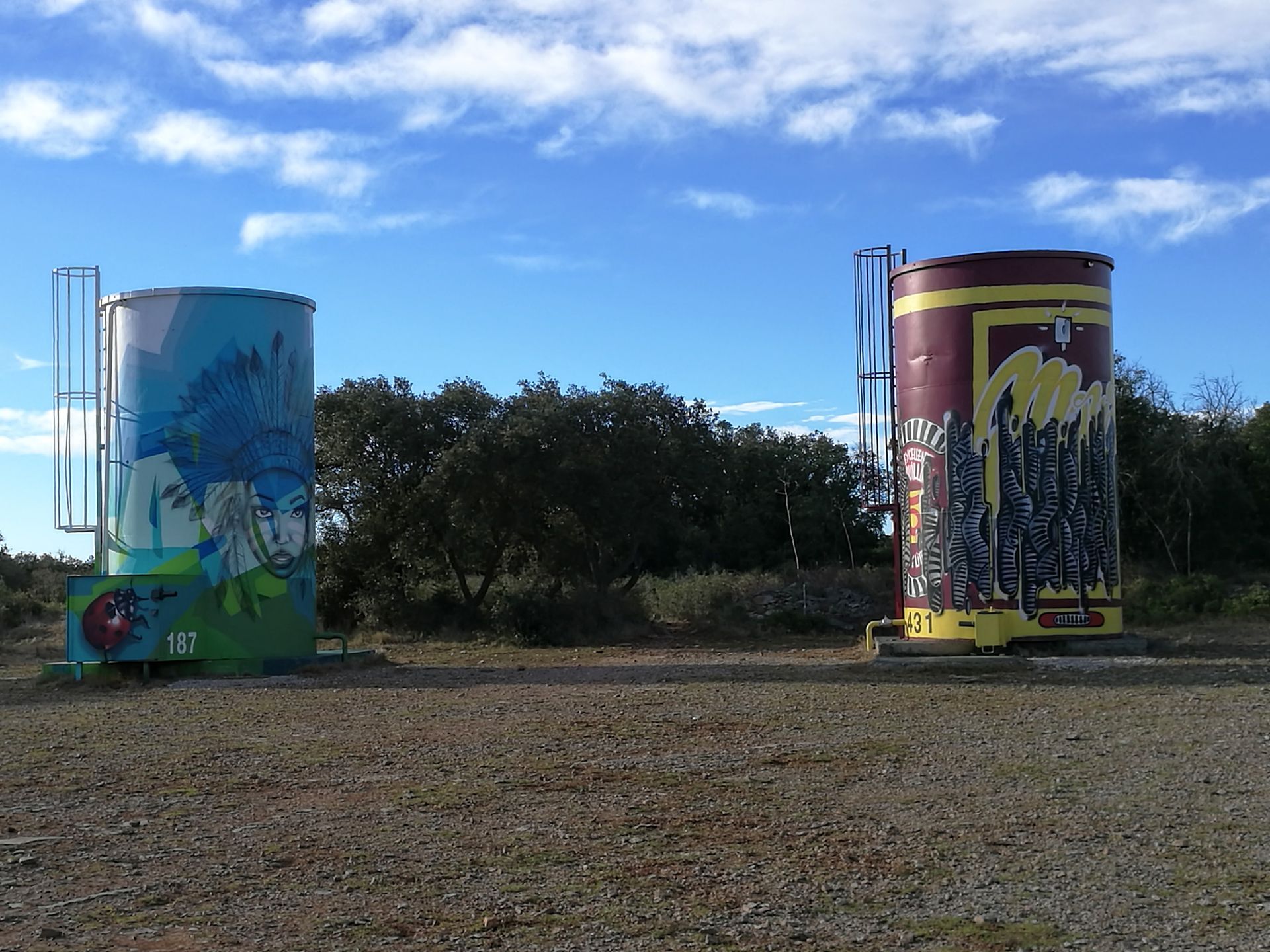
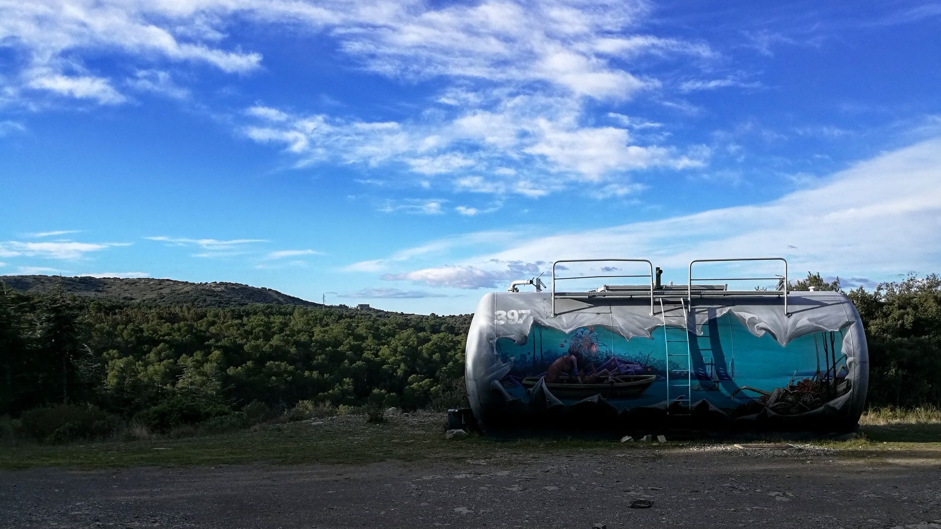
Along the path that brightens the garrigue landscapes of the Massif de la Gardiole, you will discover the tanks graffitied by the street artists from the Line up collective (Eackone, Honk, Maye, Momies, Vania, Zest) and Reda from the F.U collective.

1
From the parking lot, reach the entrance sign of the la Gardiole massif. Pass the barrier and climb up the DFCI track (GAR1) for about 500m.
2
Leave the main track to the right and cross a barrier. Along the straight track, reach the Saumade sheepfold. Turn left and enter the state forest. Pass under the high-voltage line (on the left, tank no. 2), then take a secondary track to the left for 200m (botanical trail sign).
3
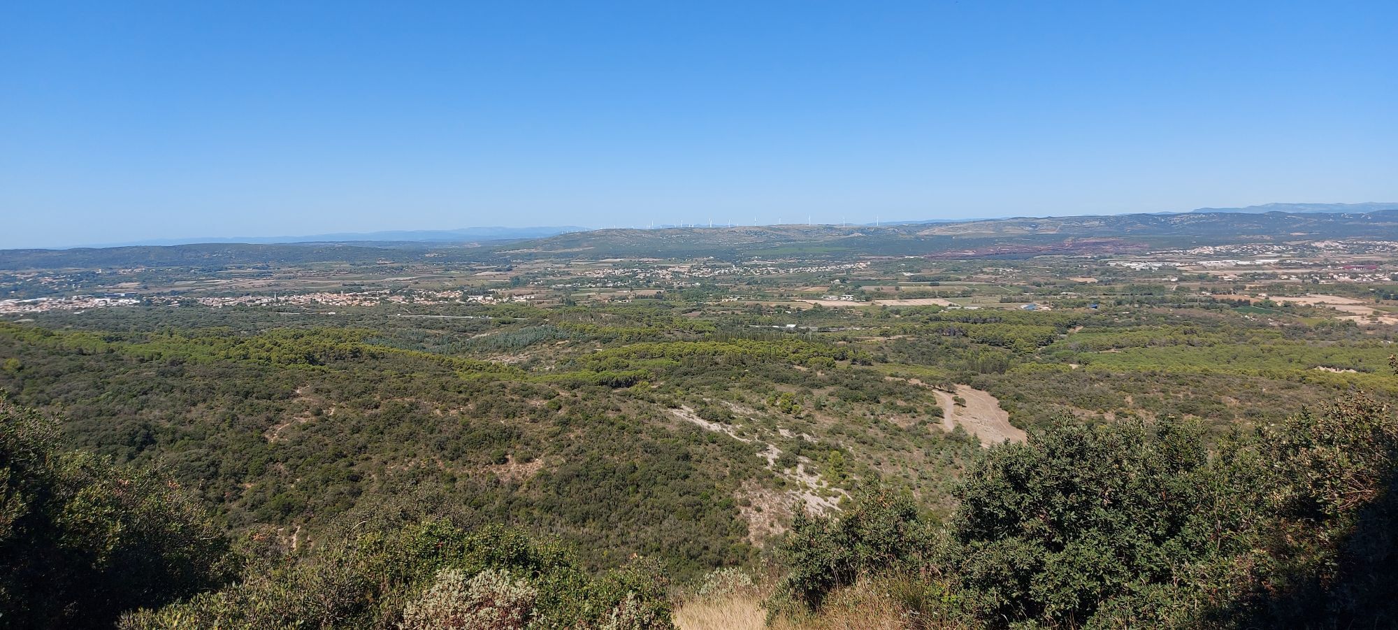
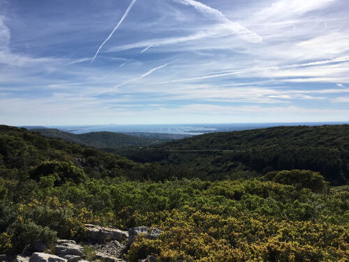
Follow the botanical trail to the right made by the National Forest Office, winding through the garrigue (information panels on flora). At the end of the trail, head right for 30m, then descend the track to the right (viewpoints on Pic Saint-Loup and Hortus). Continue left and reach a crossroads of tracks. Keep straight, go down and at the fork, stay on the left track. Pass under the high-voltage line and then, at the next intersection, climb left to the Neuve sheepfold.
4
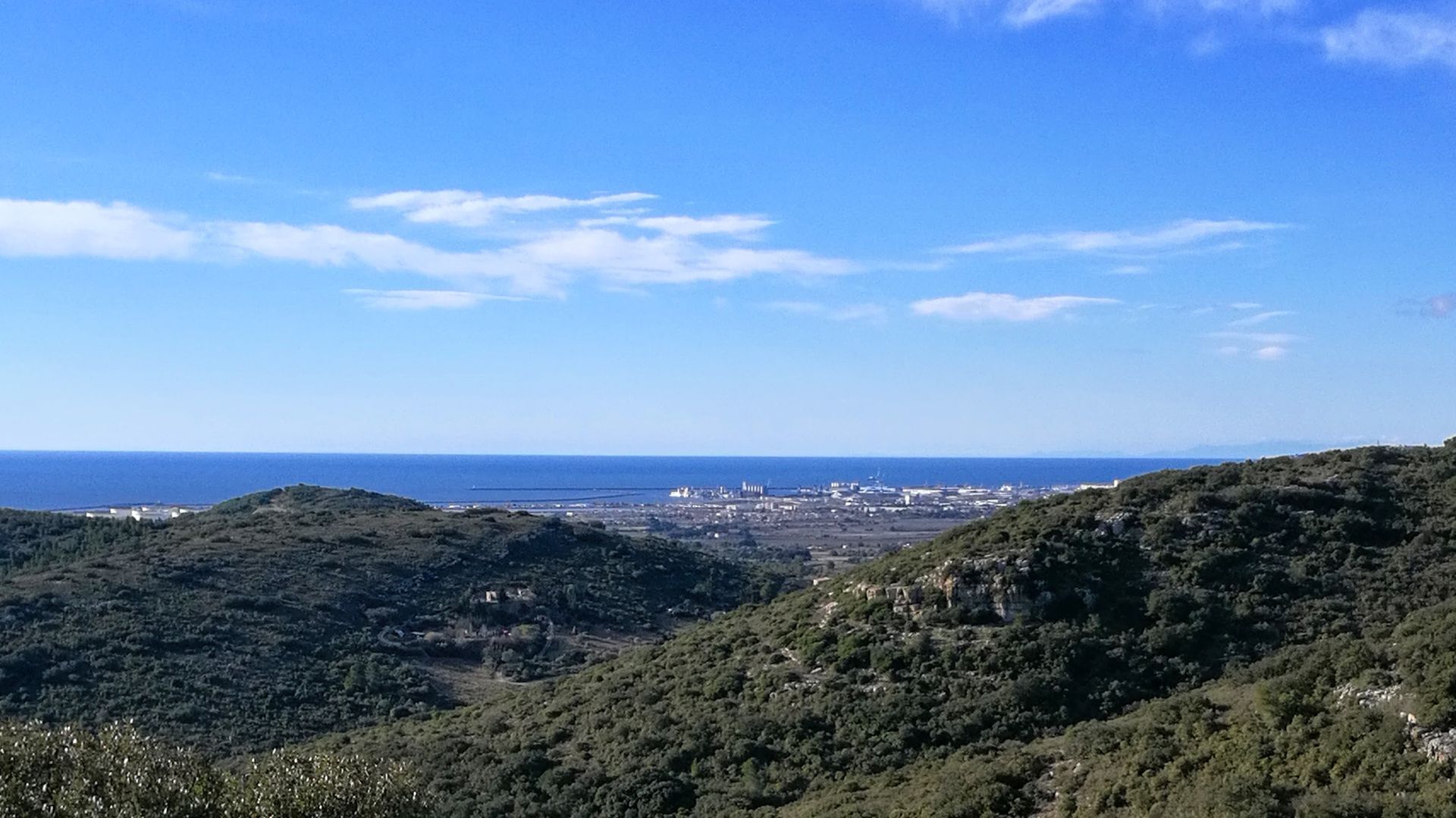
Go down to the right. At the crossroads, turn right and immediately go up left by a path. Reach a track at the level of a pylon. Climb left and reach a wide crossroads at tank no. 3. Climb left (viewpoint to the right on the Saint-Félix-de-Monceau abbey). At the next crossroads, continue left facing the watchtower.
5
> Short variant (7.5km – 2h00): continue along the track under Pioch de Camille and join the main route at marker 7. Climb right into the oak undergrowth. At the crossing, continue straight, climb to the Jasse pass and join the track.
6
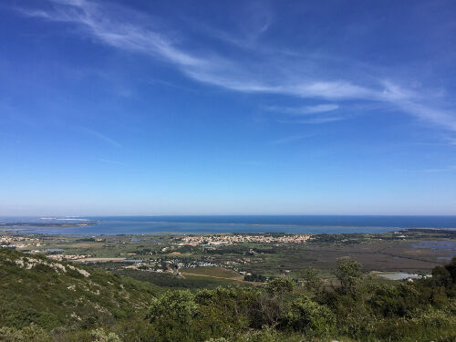
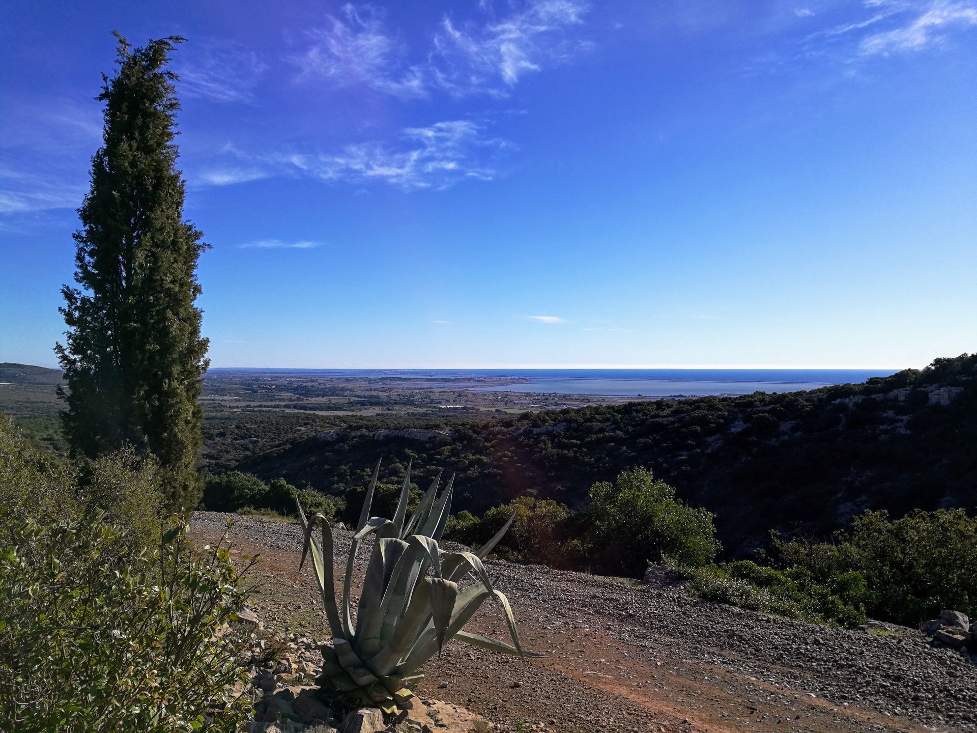
Climb left on the zigzag track, which bypasses Pioch de Camille (viewpoints over the plain and the foothills of the Cévennes). Reach the DFCI track (GAR1) at the plan de Lacan. > Access to tanks no. 4 and 5 (900m round trip), take the main track to the right. Return the same way. Continue left for about 400m and reach a crossroads at tank no. 6. > Access to the watchtower of Pioch de Camille (highest point of the route 224m alt.), 1km round trip. Turn left onto the track that leads to the viewpoint. Return the same way. Descend straight ahead on the main track, above the Arbousier hollow.
7
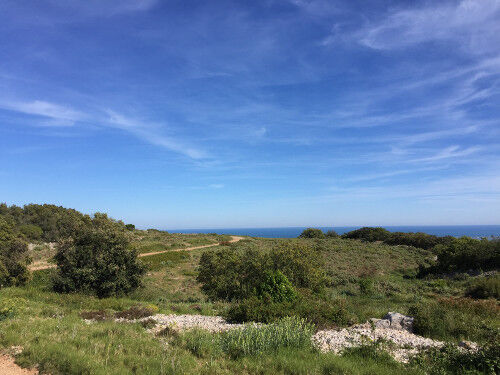
7 At the bottom of the track (junction with the variant), continue right and climb to the Pierre Plantée. > Viewpoint access (200m round trip): to the right, climb to the high point (177m alt.), panorama over the Hérault coast. Return the same way. Continue on the main track for about 300m. > Access to tank no. 7 (1.5km round trip), take the track to the right to the pass overlooking the Fourche hollow. Continue straight along the DFCI (GAR1) and return to the starting parking lot.
In case of emergency, call 112.
D114
D114
Yellow PR
PDESI
Oblíbené prohlídky v okolí
-
4.0
BALCONS DE THAU HIKE
světloTuristika 7.04 km -
5.0
MOURE HILLS HIKE
středníTuristika 13.1 km -
SENTIER DES TAMARIS HIKING TRAIL - PROTECTED NATURAL SITE OF MÉJEAN
světloTuristika 6.30 km -
LOOP CYCLO N°27 - LES ÉTANGS PALAVASIENS
světloJízda na kole 37.1 km -
RANDONNEE DES ARESQUIERS
světloTuristika 9.85 km -
OENORANDO® THE DRAGON TRAIL
středníTuristika 11.7 km -
RANDONNEE DES SALINES
středníTuristika 16.0 km -
SAINT-FELIX EN GARDIOLE HIKE
středníTuristika 13.7 km -
BALADE DES GUEULES ROUGES HIKING TRAIL
světloTuristika 6.16 km -
MEDIEVAL ROUTE BETWEEN POND AND VINEYARDS OF THE ARCHIPELAGO OF THAU
světloMotorrad 27.4 km

Pěší turistika a stopování


Nenechte si ujít nabídky a inspiraci pro vaši příští dovolenou
Vaše e-mailová adresa byl přidán do poštovního seznamu.