


THE FOUR QUARRIES TRAIL HIKE
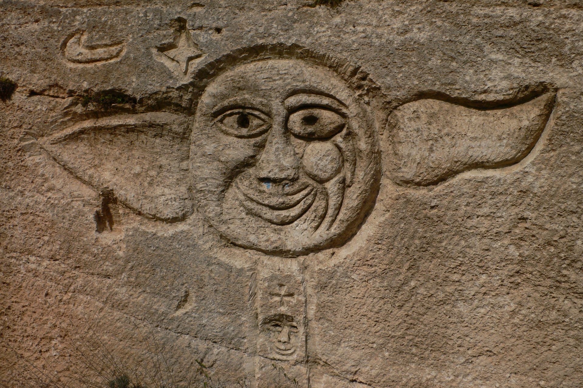
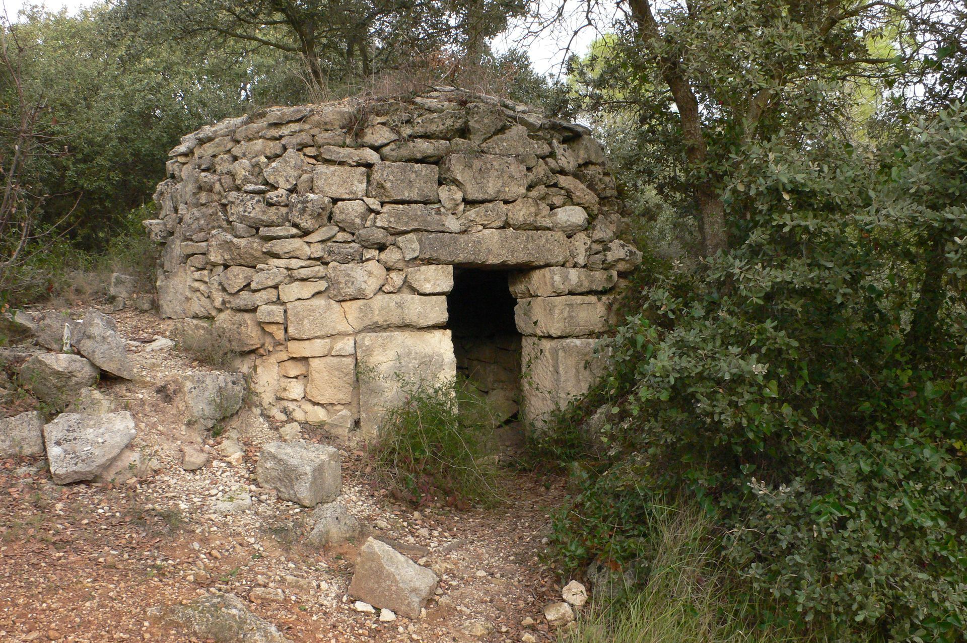
Set off from Sussargues to discover the old quarries, following in the footsteps of the "calus". In the shade of the evergreen oaks, you'll discover the footprints of the carts, embedded in the rock, as...
During the construction period, the starting point is the school parking lot, avenue de Lahntal.

1
Head for the small Olivettes shopping center. Turn left on chemin des Courtines to a square. Turn right onto the D54; cross it. Turn left into rue des Chênes-Verts and rejoin the D54; cross (heavy traffic) to join a track below.
2
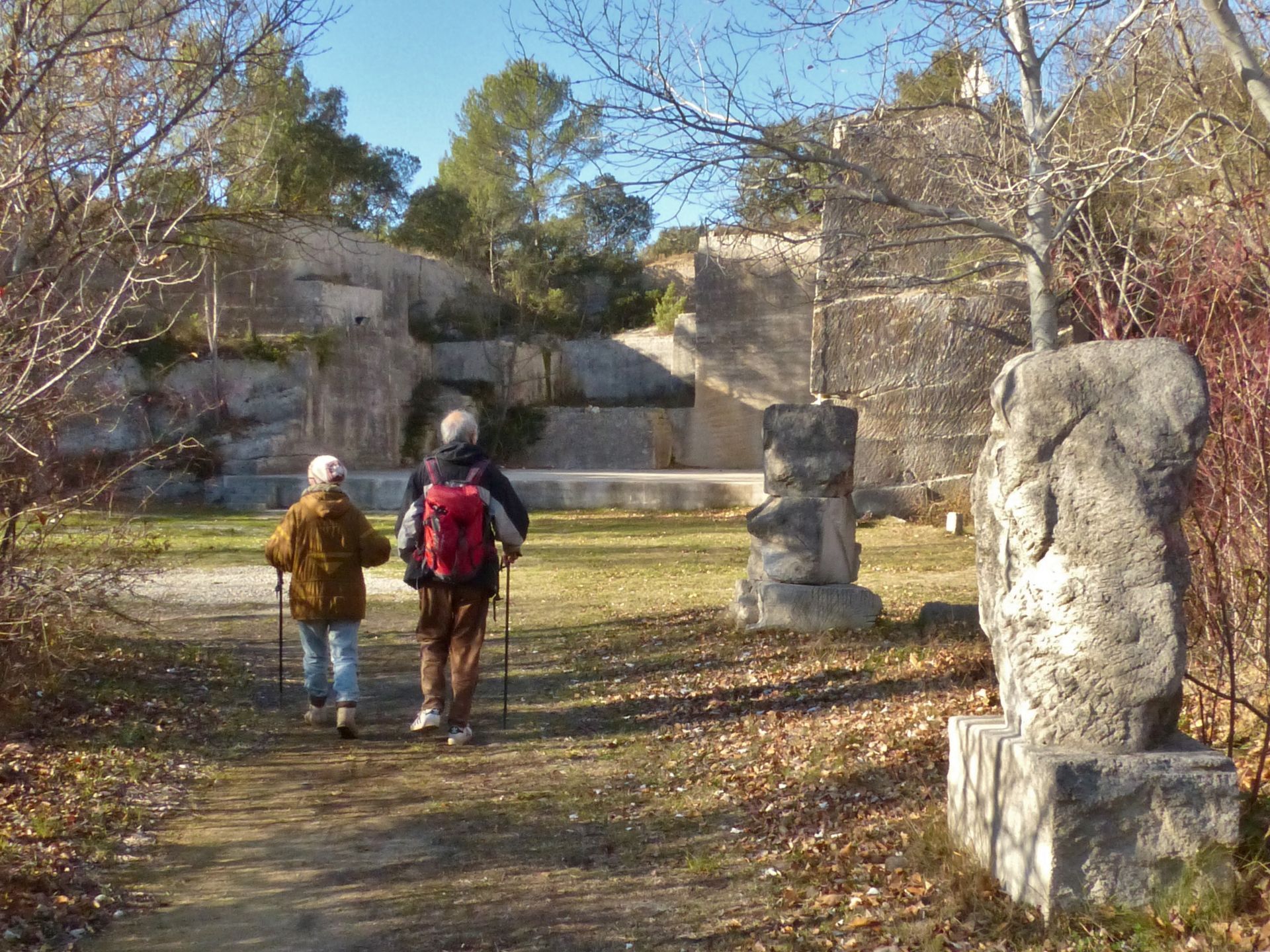
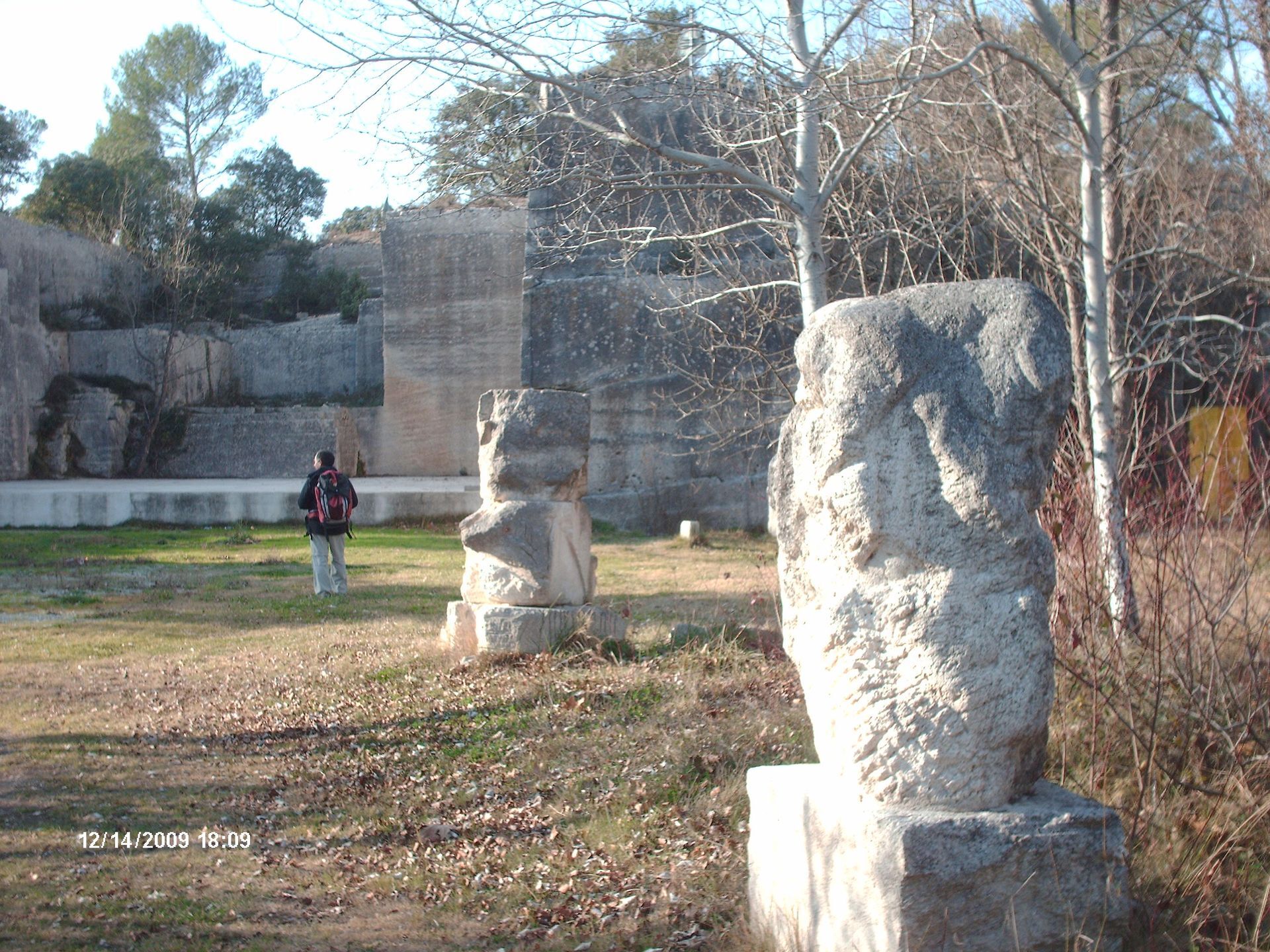
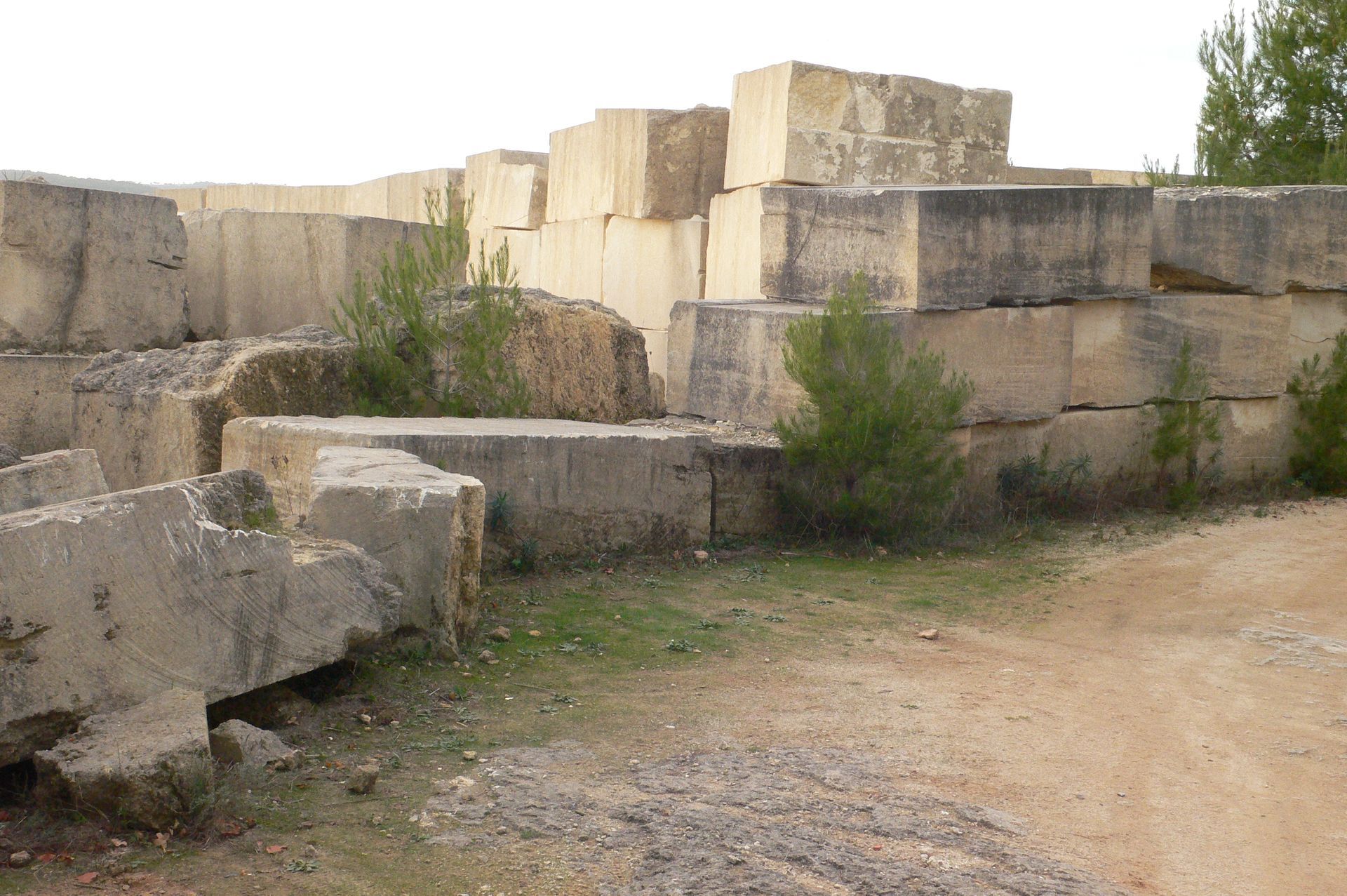
At the barrier, follow the grassy path, cross a median towards a metal chicane; pass it and descend towards the Font d'Armand quarry (sculptures). Climb a few steps to the right of the quarry and turn right on a gravel path to the housing estate (follow the signs). Walk along a wall.
3
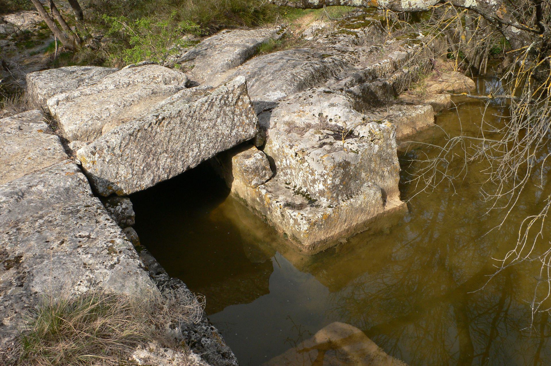
At the intersection, turn left onto the concrete road, cross the stream and turn left again onto the Chemin du Stade as far as a crossroads (bench). Walk through undergrowth (follow the signs), crossing a stream on a boulder bridge. At the house, continue on the track to the D 54E2; follow it to the left for 100 m.
4
Leave the road and walk through undergrowth to the Fondespierre parking lot. Go under the gantry and round the buildings to the right. Continue along the olive grove. At the crossroads in the pines, follow the DFCI MOE5 track to the left, leading to a path.
5
Turn right. At the next crossroads, turn right, then follow an old vineyard. Then turn left on a gravel track to reach a crossroads with a stand of holm oaks.
6
Go left and then right, into the pine forest. Further on, turn right.
7
At the crossroads, continue straight ahead. The path emerges from the undergrowth (follow the signs), passes a lavogne and comes out on the D 26E4; follow it to the right to reach the entrance to Sussargues, crossing the Valentibus.
8
Turn right into rue des Aires and keep left of the water tower until you reach the D54; cross this road (heavy traffic). Go left of the church, down an alley. At the bottom, turn right onto chemin de Beaulieu to reach the parking lot.
In case of emergency, call 112.
Jaune PR
+33 4 67 87 42 70
Sussargues Town Hall
PDESI
Oblíbené prohlídky v okolí
- 5.0
CHARBONNIERES HIKE
světloTuristika 5.24 km HIKING THE CASTRIES AQUEDUCT
světloTuristika 11.4 kmHIKE OF THE CHÂTEAU DE RESTINCLIERES
světloTuristika 7.86 kmOENORANDO® BETWEEN GRÉS DE MONTPELLIER AND PIC SAINT-LOUP
středníTuristika 15.0 km- 4.0
BOIS DE LÈQUE HIKE
světloTuristika 9.34 km LA BOUCLE DE REGANHAT HIKE
světloTuristika 4.33 kmLOOP CYCLO N°18 - LA SOURCE DU LEZ
světloJízda na kole 13.9 kmWINE ROUTE - LAND OF MUSCAT AND BULLS
Motorrad 54.9 kmFONTANARIDE HIKE
světloTuristika 4.35 kmBOUCLE CYCLO N°28 - THE ROUTE DES MAS AND THE CANAL DE LUNEL
světloJízda na kole 43.6 km

Pěší turistika a stopování


Nenechte si ujít nabídky a inspiraci pro vaši příští dovolenou
Vaše e-mailová adresa byl přidán do poštovního seznamu.