Navigace na stránkách
Pořiďte si tuto prohlídku do mobilního telefonu
Mapa
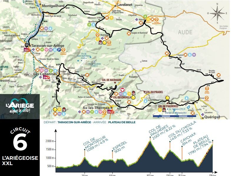
L'Ariégeoise xxl - circuit n°6

heavy
Silniční kolo
176.10 km
Naskenujte QR kód a spusťte navigaci v aplikaci bergfex.
QR Code
Pěší turistika a stopování

L'Ariégeoise xxl - circuit n°6
Vzdálenost
176.1 km
Doba trvání
10:00 h
Ascent
4826 hm
Hladina moře
457 - 1997 m
Stažení skladby
Mapa
L'Ariégeoise xxl - circuit n°6
heavy
Silniční kolo
176.10 km
Trasa
Trasa
Mapa
L'Ariégeoise xxl - circuit n°6
heavy
Silniční kolo
176.10 km
Tarascon-sur-Ariège
(473 m)
Vesnice
0.1 km
Bompas
(464 m)
Vesnice
2.4 km
Mercus
(478 m)
Vypořádání
3.4 km
Mercus-Garrabet
(493 m)
Vesnice
4.0 km
Le Cathare
(484 m)
Restaurace
4.1 km
Garrabet
(500 m)
Vypořádání
5.6 km
Saint-Antoine
(460 m)
Vypořádání
9.0 km
Saint-Paul-de-Jarrat
(495 m)
Vesnice
10.8 km
Grand-Chemin
(489 m)
Vypořádání
13.0 km
Celles
(493 m)
Vesnice
13.0 km
Les Clots
(492 m)
Vypořádání
13.2 km
Catufet
(506 m)
Koridor/terén
15.4 km
Palau
(533 m)
Koridor/terén
18.1 km
Église Saint-Jean-Baptiste
(637 m)
Místo konání bohoslužeb
20.3 km
Nalzen
(636 m)
Vesnice
20.4 km
Villeneuve-d'Olmes
(596 m)
Vesnice
25.9 km
Ô petit resto
(631 m)
Restaurace
26.9 km
La Cousinette
(681 m)
Sousedství
27.1 km
Montferrier
(691 m)
Vesnice
27.4 km
Église Saint-Barthélémy
(681 m)
Místo konání bohoslužeb
28.4 km
La Fount de Sicre
(693 m)
Zdroj:
28.6 km
Regunis
(898 m)
Vypořádání
30.6 km
Col du Tremblement
(1031 m)
Horské sedlo
33.0 km
Montségur
(910 m)
Vesnice
34.3 km
Moulin
(865 m)
Koridor/terén
35.3 km
Le Pigeonnier
(553 m)
Sousedství
41.9 km
Claouso
(551 m)
Sousedství
42.1 km
Le Cristol
(550 m)
Sousedství
42.2 km
Barrineuf
(549 m)
Vesnice
42.2 km
Camaüt
(544 m)
Sousedství
42.5 km
Le Martinet
(544 m)
Sousedství
42.8 km
Église Saint-Michel
(540 m)
Místo konání bohoslužeb
43.0 km
La Hille
(537 m)
Sousedství
43.0 km
Fougax
(537 m)
Vesnice
43.1 km
Delalaygue
(532 m)
Vypořádání
43.7 km
Fontaine intermittente de Fontestorbes
(518 m)
Zdroj:
45.7 km
Le Casteillat
(502 m)
Sousedství
46.9 km
Bélesta
(494 m)
Vesnice
46.9 km
Restaurant Auberge de la Scierie
(914 m)
Restaurace
61.3 km
Les Prats de Dejoux
(897 m)
Vypořádání
62.2 km
Espezel
(898 m)
Vesnice
62.7 km
La Devèse
(905 m)
Vypořádání
63.9 km
Mazuby
(939 m)
Vesnice
68.2 km
Rodome
(915 m)
Vesnice
71.2 km
Aunat
(940 m)
Vesnice
73.0 km
Bessède-de-Sault
(930 m)
Vesnice
76.5 km
Gesse
(545 m)
Vypořádání
82.2 km
Grotte du TM71
(722 m)
Vchod do jeskyně
89.0 km
La Fargue
(744 m)
Vypořádání
90.0 km
Usson-les-Bains
(777 m)
Vesnice
90.8 km
Usson
(868 m)
Vypořádání
91.7 km
Rouze
(982 m)
Vesnice
92.8 km
Mijanès
(1130 m)
Vesnice
95.0 km
Port de Pailleres
(1928 m)
Vypořádání
106.9 km
Lavail
(1115 m)
Vypořádání
117.3 km
Restaurant Bar Gîte d'étape
(1089 m)
Restaurace
117.8 km
Goulours
(1084 m)
Vypořádání
118.1 km
Ascou
(1011 m)
Vesnice
120.6 km
Église Saint-Simon et Saint-Jude
(1002 m)
Místo konání bohoslužeb
120.6 km
Sorgeat
(1056 m)
Vesnice
122.1 km
Ignaux
(1006 m)
Vesnice
123.0 km
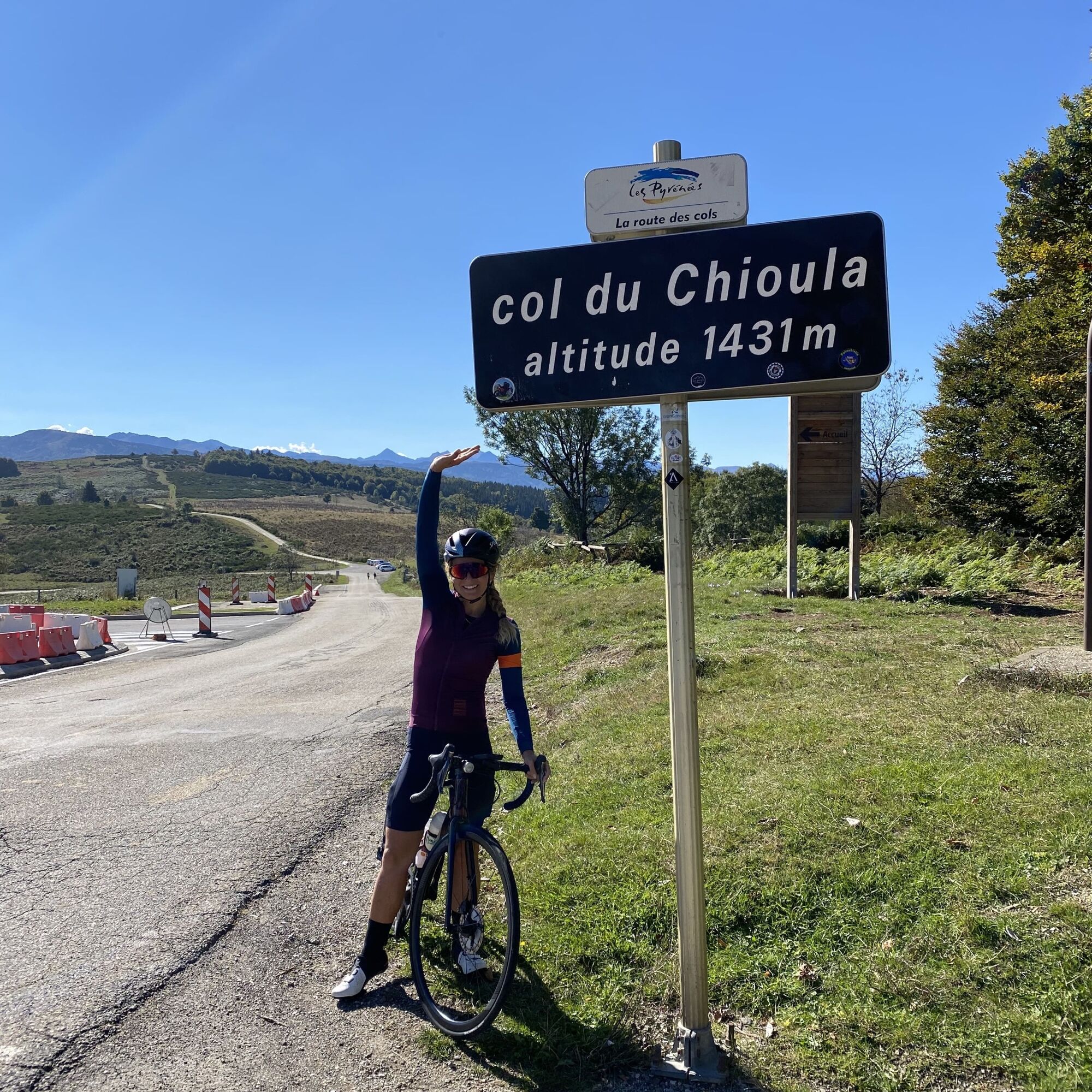
Col du Chioula
(1449 m)
Horský průsmyk
127.8 km
Fontaine de Biron
(1329 m)
Zdroj:
130.8 km
Chapelle Saint-Roch
(867 m)
Místo konání bohoslužeb
140.4 km
Caussou
(853 m)
Vesnice
140.6 km
Église Saint-Jean Baptiste
(863 m)
Místo konání bohoslužeb
140.8 km
Bestiac
(853 m)
Vesnice
142.1 km
Vernaux
(752 m)
Vesnice
144.8 km
Lordat
(885 m)
Vesnice
145.2 km
Gérul
(880 m)
Koridor/terén
146.1 km
Église Saint-Julien
(885 m)
Místo konání bohoslužeb
146.6 km
Axiat
(886 m)
Vesnice
147.0 km
Appy
(955 m)
Vesnice
149.4 km
Caychax
(906 m)
Vesnice
150.5 km
Senconac
(933 m)
Vesnice
151.9 km
Chapelle de Sourdeign
(849 m)
Místo konání bohoslužeb
155.1 km
Verdun
(568 m)
Vesnice
158.5 km
Pech
(580 m)
Vesnice
159.6 km
Les Cabannes
(537 m)
Vesnice
159.8 km
Château-Verdun
(544 m)
Vesnice
161.2 km
Informace o prohlídce

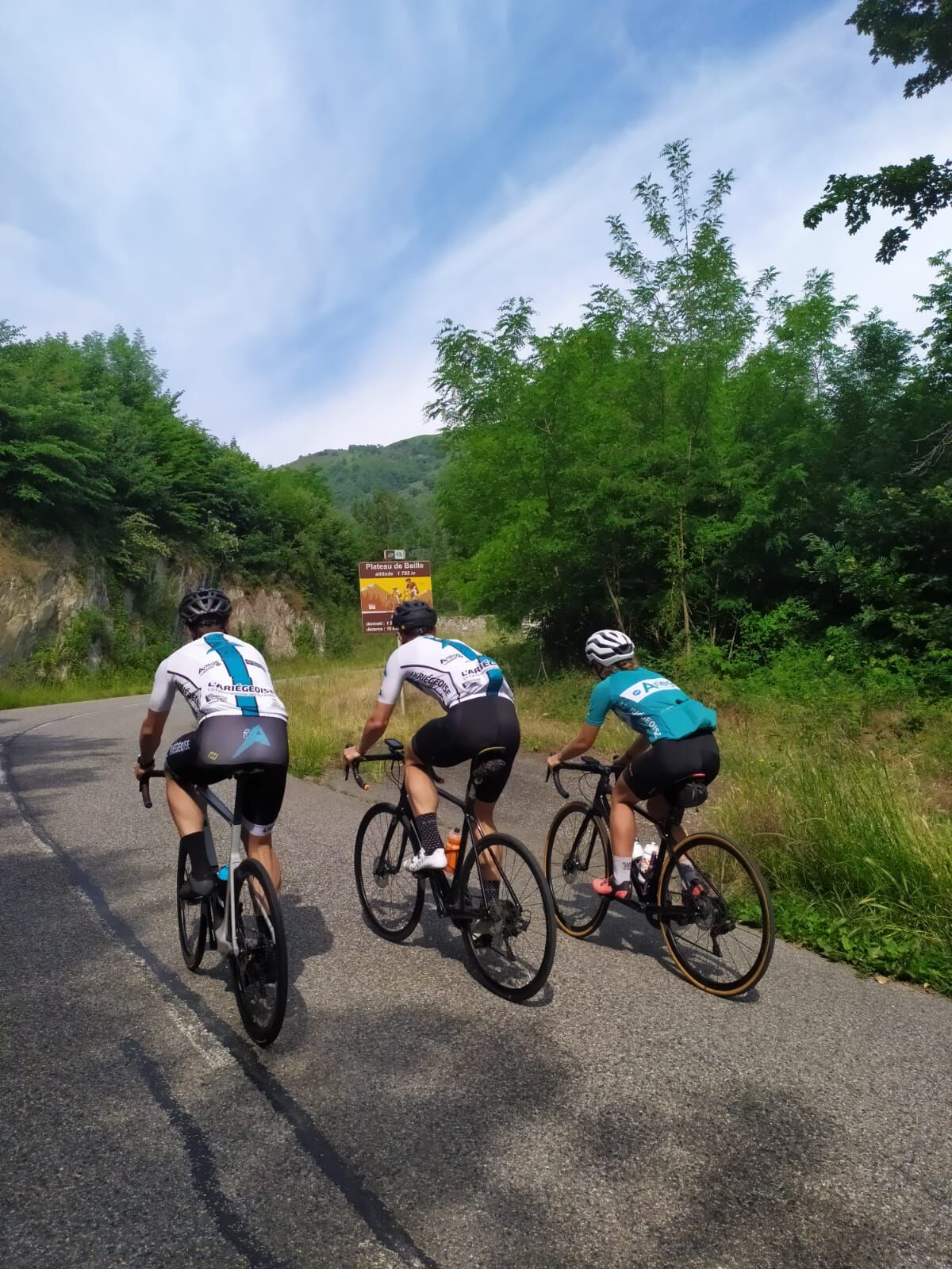
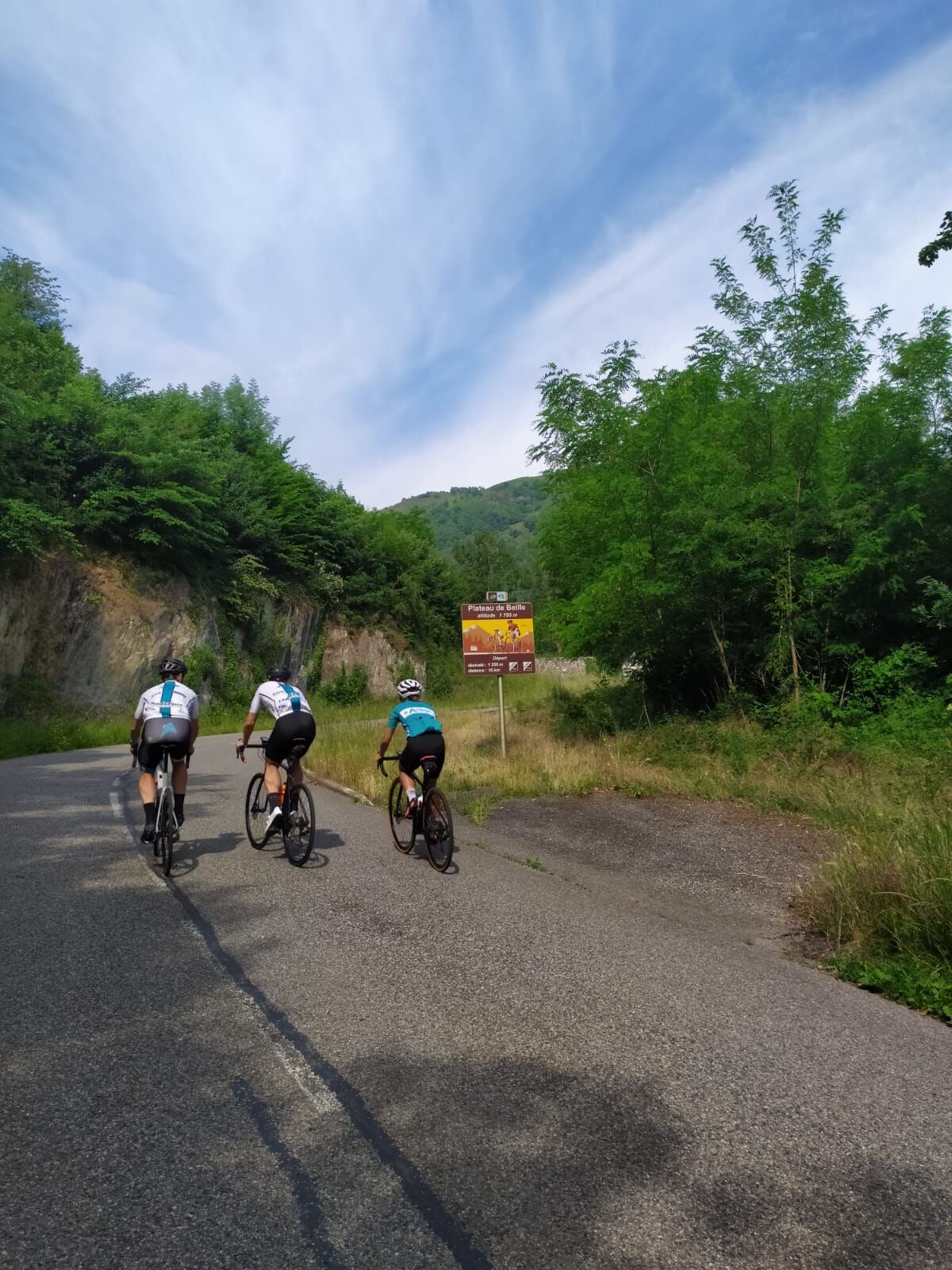
An ULTRA itinerary! 5 famous Tour de France passes are on the menu: Montségur, the cross of the dead, the "roof of the Ariège passes": Pailhères at 2m, the Chioula pass, and finally the emblematic Beille plateau at 001m .

Technologie
n.a.
Stav
6 / 6
Krajina
n.a.
Zkušenosti
n.a.
Sdílet prohlídku
Mapa
L'Ariégeoise xxl - circuit n°6
heavy
Silniční kolo
176.10 km
Chyba
Došlo k chybě. Zkuste to prosím znovu.
Informace o trase
Trasa

1 - FROM TARASCON-SUR-ARIÈGE TO THE MONTSÉGUR PASS
Leaving from the Tarascon-sur-Ariège Tourist Office, catch up with Avenue Victor Pilhès D618. Pass Mercus Garrabet, arrive at the Saint Antoine roundabout, la charmille, first right towards D117 Lavelanet, pass Saint Paul de Jarrat, Celles, Nalzen. At the veterinary clinic turn right D509 direction Montségur. Pass Villeneuve d'Olmes, direction Montferrier D9. Climb to the Col de Montségur, descend to the village.
2 - FROM MONTSÉGUR TO ESPEZEL
Continue to Bélesta via Fougax and Barrineuf D9. After the intermittent Fontestorbe fountain and the lemonade, pay attention to the junction, turn right on the D16 towards Belcaire / Querigut Mijanes. Climb through the forest, pass the cross of the dead. Arrive in the Aude department D29. Pass the Bénagues. Continue to the sawmill inn, turn left on the D613 towards Espezel. Drive, turn right D29 Espezel / Belfort. Enter the village of Espezel.
3 - FROM ESPEZEL TO ROUZE
Cross Espezel at the stop sign in the village, go straight ahead, still on the D29. At the give way go straight on D29 towards Mazuby. Go down into the forest to reach a junction, turn right D107 towards Aunat. Continue on the 107 to turn left, go up on the D20 to Rodome, then Aunat. Stay on the D20 to Bessède de Sault. At the fork, turn right towards Gesse. Go down in the bends, at the fork, turn right towards Quérigut / Mijanes D118. Stay on the D118, pass the old Usson baths. Turn right on D16 towards Rouze. Begin the ascent to reach Rouze.
4 - FROM ROUZE TO COL DE PAILHÈRES AND THEN COL DU CHIOULA
On leaving Rouze, turn right on the D116 towards Mijanès. On leaving Mijanès turn right D25 Col de Pailhères/Mijanès. Ascent of the pass then descent. Pass the station of Ascou then the village. After Ascou turn right towards Ignaux D613 Col du Chioula. Leave Ignaux and Sorgeat to climb to the pass. From the Col du Chioula to the Col de Marmare, route des Corniches then Plateau de Beille. From the col du chioula go down to the col de Marmare then turn left D20 towards Caussou/ route des corniches. Continue on the D20 past Bestiac, Lordat, Axiat, Appy, Caychax. After Senconac turn left before descending on the D120 to reach Verdun and Les Cabannes. Arrive at Cabannes, take the direction of Plateau de Beille by the D522.
5 - RETURN TO THE CABANNES
Arriving at Les Cabannes, head towards the SNCF station to take the train.

Zatím žádné recenze
Napište recenzi

Recenze pomáhají ostatním uživatelům při výběru dalšího dobrodružství. Hodnoťte prosím pouze prohlídku, nikoli počasí nebo svačinu.

Výběrem jedné z hvězdiček ohodnotíte prohlídku
Špatné turné
Slabé turné
Průměrné turné
Dobrá prohlídka
Vynikající prohlídka
bergfex logo Získejte přehled Vždy živě na místě s více než 9 500 webkamerami. bergfex Jako uživatel Pro si nyní můžete zobrazit odpovídající webové kamery pro mnoho prohlídek v aplikaci prohlídky z. Můžete si tak přímo prohlédnout aktuální podmínky.
Pěší turistika a stopování

Pěší turistika a stopování

Pěší turistika a stopování
Více než 550.000 návrhů výletů, podrobné mapy a intuitivní plánovač tras dělají z aplikace nezbytnou výbavu pro všechny milovníky přírody.
bergfex