
Cycling Circuit - C12 The routes of Laurent Jalabert
heavy
Pořiďte si tuto prohlídku do mobilního telefonu
Cycling Circuit - C12 The routes of Laurent Jalabert
heavy
Silniční kolo
78.20
km
Naskenujte QR kód a spusťte navigaci v aplikaci bergfex.


Pěší turistika a stopování





Cycling Circuit - C12 The routes of Laurent Jalabert
heavy
Vzdálenost
78.2
km
Doba trvání
04:30
h
Ascent
1920
hm
Hladina moře
241 -
1202
m
Stažení skladby
Cycling Circuit - C12 The routes of Laurent Jalabert
heavy
Silniční kolo
78.20
km
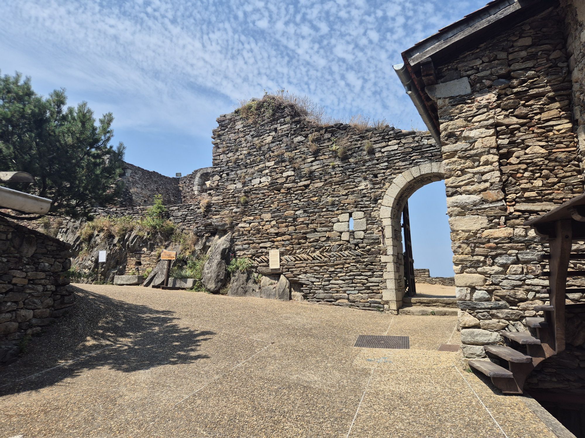
THE BLACK MOUNTAIN: The strange name of this massif comes from its dark appearance when seen from afar, resulting from the combination of the thickness of its vegetation and its climatic situation as a...
Popis
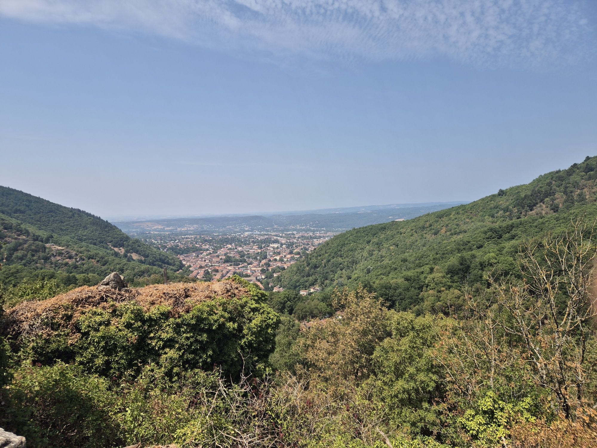
THE BLACK MOUNTAIN: The strange name of this massif comes from its dark appearance when seen from afar, resulting from the combination of the thickness of its vegetation and its climatic situation as a “border” between oceanic and Mediterranean influences. Traveling through it, this land reveals its secret forests, numerous waterfalls and panoramas, lakes, but also sites and villages marked by history.
MAZAMET: This town was founded by the survivors of the locality of Hautpoul ravaged by Simon de Montfort's army during the Albigensian Crusade (name given to the Cathars). Long torn by conflicts between Catholics and Protestants, it developed rapidly in the 19th century thanks to the textile and wool industry, becoming the most important and renowned wool pulling center in the world.
To discover: The House of Memories - Catharism Museum, 3 urban trails to explore the city.
FONT BRUNO: The Font Bruno monument was erected in memory of the Black Mountain Free Corps, a resistance group of over a thousand men who fought here.
To discover: the crypt.
LE HAUT-CABARDES (Aude): Laprade Lake - the villages of Miraval-Cabardès, Mas-Cabardès, Roquefère, etc. - Cubserviès waterfall.
PIC DE NORE at 1211m altitude, this highest point of the Black Mountain offers you an exceptional panorama from the Mediterranean to the Pyrenees and up to the last foothills of the Massif Central.
HAUTPOUL: Formidable fortress founded in 413 by the Visigoths, Hautpoul overlooks the surrounding valleys. Besieged and taken by Simon de Montfort in 1212, the former Cathar citadel was partly dismantled, pushing its inhabitants to seek refuge in the valley near the Arnette River, thus founding Mazamet.
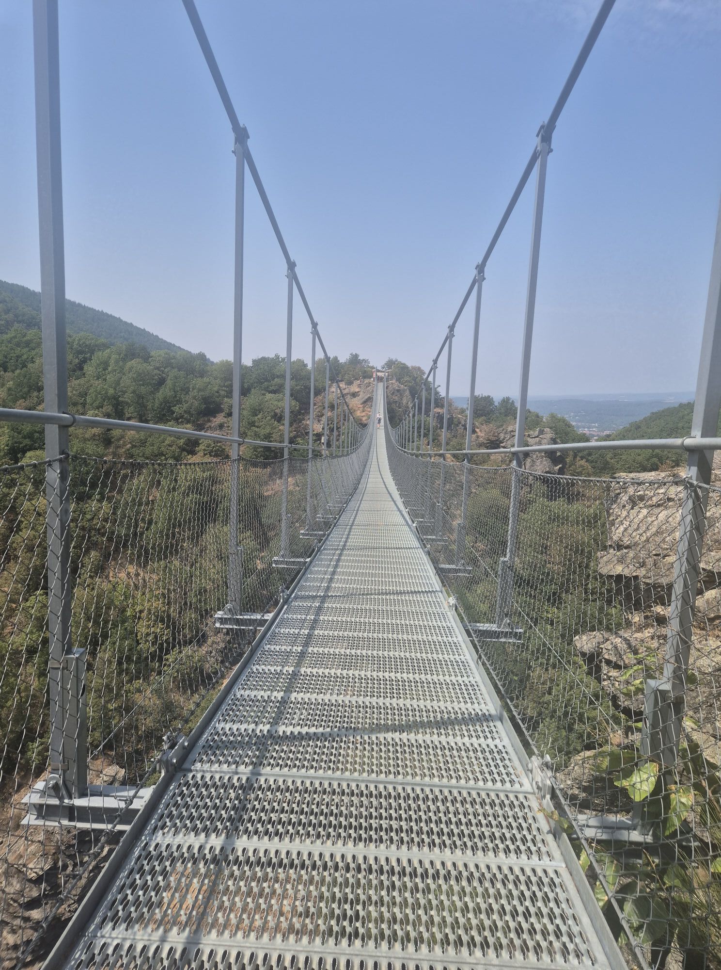
To discover: The medieval town - the viewpoints - the old castle - the House of Rocque d’Hautpoul - medieval garden - the footbridge - the House of Wood and Toy - artisan shops.
MAZAMET: This town was founded by the survivors of the locality of Hautpoul ravaged by Simon de Montfort's army during the Albigensian Crusade (name given to the Cathars). Long torn by conflicts between Catholics and Protestants, it developed rapidly in the 19th century thanks to the textile and wool industry, becoming the most important and renowned wool pulling center in the world.
To discover: The House of Memories - Catharism Museum, 3 urban trails to explore the city.
FONT BRUNO: The Font Bruno monument was erected in memory of the Black Mountain Free Corps, a resistance group of over a thousand men who fought here.
To discover: the crypt.
LE HAUT-CABARDES (Aude): Laprade Lake - the villages of Miraval-Cabardès, Mas-Cabardès, Roquefère, etc. - Cubserviès waterfall.
PIC DE NORE at 1211m altitude, this highest point of the Black Mountain offers you an exceptional panorama from the Mediterranean to the Pyrenees and up to the last foothills of the Massif Central.
HAUTPOUL: Formidable fortress founded in 413 by the Visigoths, Hautpoul overlooks the surrounding valleys. Besieged and taken by Simon de Montfort in 1212, the former Cathar citadel was partly dismantled, pushing its inhabitants to seek refuge in the valley near the Arnette River, thus founding Mazamet.
To discover: The medieval town - the viewpoints - the old castle - the House of Rocque d’Hautpoul - medieval garden - the footbridge - the House of Wood and Toy - artisan shops.
Trasa
Mazamet
(246 m)
Město
0.0 km
Église Sainte-Claire
(346 m)
Místo konání bohoslužeb
5.7 km
Église Saint-Louis
(860 m)
Místo konání bohoslužeb
29.2 km
Église Notre-Dame-de-la-Lauze
(391 m)
Místo konání bohoslužeb
42.5 km
Église Sainte-Foy
(326 m)
Místo konání bohoslužeb
46.9 km
Pic de Nore
(1211 m)
Summit
60.1 km
Église Saint-Sauveur
(254 m)
Místo konání bohoslužeb
77.0 km
Trasa
Cycling Circuit - C12 The routes of Laurent Jalabert
heavy
Silniční kolo
78.20
km
Mazamet
(246 m)
Město
0.0 km
Aussillon
(349 m)
Vesnice
1.3 km
Roussoulp
(290 m)
Vypořádání
2.4 km
Calmon
(292 m)
Vypořádání
3.2 km
La Seignarié
(319 m)
Vypořádání
4.1 km
Les Vignals
(341 m)
Vypořádání
4.9 km
Aiguefonde
(344 m)
Vesnice
5.6 km
Église Sainte-Claire
(346 m)
Místo konání bohoslužeb
5.7 km
Aupillac
(314 m)
Vypořádání
7.0 km
Caunan Engelis
(314 m)
Vypořádání
9.7 km
Pas du Rieu
(834 m)
Vypořádání
26.6 km
Laprade
(849 m)
Vesnice
28.6 km
Église Saint-Louis
(860 m)
Místo konání bohoslužeb
29.2 km
Laprade Basse
(779 m)
Vypořádání
31.9 km
Les Trois Fontaines
(766 m)
Restaurace
34.9 km
Les Martys
(787 m)
Vesnice
35.3 km
Miraval-Cabardès
(384 m)
Vesnice
42.4 km
Église Notre-Dame-de-la-Lauze
(391 m)
Místo konání bohoslužeb
42.5 km
Saint-Pierre-de-Vals
(348 m)
Vypořádání
43.6 km
Mas-Cabardès
(327 m)
Vesnice
45.0 km
Église Sainte-Foy
(326 m)
Místo konání bohoslužeb
46.9 km
Roquefère
(325 m)
Vesnice
46.9 km
Labastide-Esparbaïrenque
(447 m)
Vesnice
48.5 km
Les Jouys
(764 m)
Vypořádání
52.5 km
Pradelles-Cabardès
(815 m)
Vesnice
54.6 km
Pic de Nore
(1211 m)
Summit
60.1 km
Les Yès
(725 m)
Vypořádání
68.4 km
Castaunouze
(360 m)
Vypořádání
74.0 km
Hautpoul
(466 m)
Vesnice
74.5 km
Moulin de l'Oule
(345 m)
Vypořádání
74.7 km
Passerelle de Mazamet
(333 m)
Úhel pohledu
74.8 km
Église Saint-Sauveur
(254 m)
Místo konání bohoslužeb
77.0 km
Mazamet
(246 m)
Město
77.3 km
Autor
Poskytuje Tarn Tourisme
Prohlídku Cycling Circuit - C12 The routes of Laurent Jalabert zajišťuje outdooractive.com.


Zatím žádné recenze
Oblíbené prohlídky v okolí
- 5.0
Les Escaunelles
světloTuristika 6.87 km Au fil de l'Eau 6,5km / 2h30
heavyTuristika 6.45 kmLe Carbonéral
heavyTuristika 18.3 kmSentier Randonnée du Patrimoine 13km / 3h30
světloTuristika 13.0 kmHiking: The Wibault route
heavyTuristika 9.26 kmGR7® Montagne Noire
heavyTuristika 73.5 kmHiking: The Gentlemen Glassmakers 18km / 5h30
heavyTuristika 16.9 kmLe Puech d'en Blanc 15km / 4h30
heavyTuristika 14.7 kmTour du Tarn à cheval : Peyremaux / Mazamet
heavyJízda na koni 25.4 kmLastours, Okzitanien/Frankreich
Turistika 3.12 km
Pěší turistika a stopování

Více než 550.000 návrhů výletů, podrobné mapy a intuitivní plánovač tras dělají z aplikace nezbytnou výbavu pro všechny milovníky přírody.

Nenechte si ujít nabídky a inspiraci pro vaši příští dovolenou
Přihlaste se k odběru newsletteru
Chyba
Došlo k chybě. Zkuste to prosím znovu.Děkujeme za vaši registraci
Vaše e-mailová adresa byl přidán do poštovního seznamu.
Zájezdy po celé Evropě
Rakousko Švýcarsko Německo Itálie Slovenia Francie Nizozemsko Belgie Polsko Lichtenštejnsko Česko Slovensko Španělsko Chorvatsko Bosna a Hercegovina Lucembursko Andorra Portugal Iceland United Kingdom Ireland Greece Albania North Macedonia Malta Norway Montenegro Moldova Kosovo Hungary San Marino Romania Estonia Latvia Belarus Cyprus Lithuania Serbia Bulgaria Monaco Denmark Sweden Finland





