


Lourdes Hautacam
Úroveň obtížnosti: 5
The ascent of Hautacam, made legendary by the Tour de France and recently marked in 2022 by Vingegaard's victory in a duel with Pogacar, offers an unforgettable cycling experience.
With every pedal stroke,...
The ascent of Hautacam, made legendary by the Tour de France and recently marked in 2022 by Vingegaard's victory in a duel with Pogacar, offers an unforgettable cycling experience.
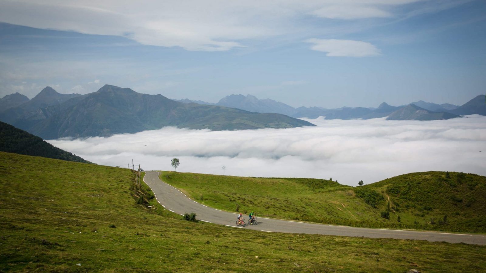
With every pedal stroke, you will be rewarded with panoramic views of the Argelès Valley, the Val d'Azun, and the majestic peaks of the Vignemale massif, motivating you to overcome this hors catégorie climb. Once at the summit, indulge in the visual pleasure before embarking on a magical descent of over 14 km.
However, keep in mind the changing conditions, sometimes fog, as well as the possible presence of grazing animals such as horses, cows, or sheep. In clear weather, the valley view is simply magical.

Ano
Ano
Before setting off:
Ensure the bike is in perfect mechanical condition, including tires and brakes Adjust the bike properly to your body shape Wearing a helmet is highly recommended Bring a repair kit Remember that traffic laws apply to cyclists at all times Never ride more than two abreast and move into a single file when traffic conditions require it Respect other road users as you would like to be respected Choose a route suited to your physical abilities Inform your relatives of your itinerary Check the weather conditions A first aid kit is not essential but can be very useful Know and keep the emergency numbers Respect the environment by not throwing food wrappers alongside the road If you must return at dusk, make sure you can see and be seenIn case of emergency, dial 112
Consider carpooling
Parking near the starting point
5
To learn more about our destination, visit our website
Although short, this ascent is demanding due to its very uneven elevation gain. A memorable cycling experience combining challenge, natural beauty, and adrenaline in a spectacular mountain setting.
Oblíbené prohlídky v okolí
THE TOURMALET LOOP VIA LA MONGIE
heavyJízda na kole 99,0 kmBERNADETTE'S PATH TO BARTRÈS
světloTuristika 4,52 kmLourdes Vélosud (V81) along the Gave
světloJízda na kole 33,0 kmK 11. Etappe Gripp-Argeles, Okzitanien/Frankreich
heavyJízda na kole 50,1 kmTHE GAVES GREENWAY BY BIKE
světloJízda na kole 18,8 kmLe Pic du Montaigu
heavyTuristika 4,65 km- 5,0
Lourdes - Lourdes Lake Circuit
světloMountainbike 6 km Le circuit du lac Bleu
středníTuristika 14,9 kmEntre cascade et torrent
středníTuristika 8,74 kmLingous Pass Loop, Castelloubon valley
světloJízda na kole 20,9 km

Pěší turistika a stopování


Nenechte si ujít nabídky a inspiraci pro vaši příští dovolenou
Vaše e-mailová adresa byl přidán do poštovního seznamu.