
Navigace na stránkách
Pořiďte si tuto prohlídku do mobilního telefonu
Mapa
THE COL D'AUBISQUE VIA THE OSSAU VALLEY

heavy
Jízda na kole
94.50 km
Naskenujte QR kód a spusťte navigaci v aplikaci bergfex.
QR Code
Pěší turistika a stopování
Stáhnout pro iOS
Stáhnout pro Android

THE COL D'AUBISQUE VIA THE OSSAU VALLEY

Vzdálenost
94.5 km
Doba trvání
05:40 h
Ascent
2364 hm
Hladina moře
289 - 1783 m

Úroveň obtížnosti: 6

Stažení skladby
Mapa
THE COL D'AUBISQUE VIA THE OSSAU VALLEY
heavy
Jízda na kole
94.50 km

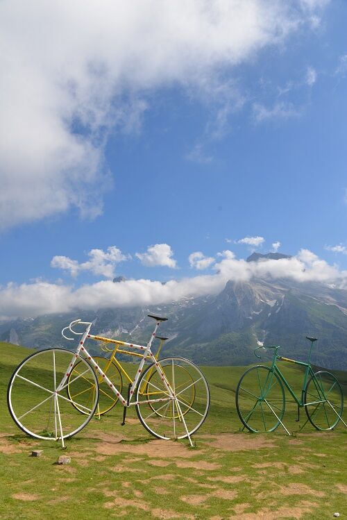
Climb the famous Col d'Aubisque via its steepest side, that of the Ossau valley. This pass was first crossed by the Tour de France in 1910, during the famous Luchon-Bayonne stage. The route leading you...

Popis

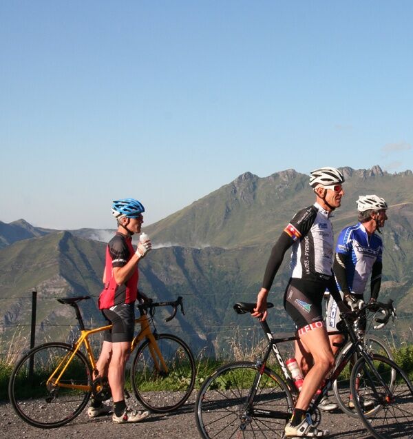
Climb the famous Col d'Aubisque via its steepest side, that of the Ossau valley. This pass was first crossed by the Tour de France in 1910, during the famous Luchon-Bayonne stage. The route leading you to Laruns takes you from Bigorre to Béarn along small and splendid foothill roads. The climb will be rewarded by the splendid view from the pass and the crossing of the Litor cirque. The descent will introduce you to the wild Arbéost valley where the cheese-making tradition will surely make you stop! An exceptional loop, between foothill and high mountain landscapes, for a challenging outing.

Trasa
Église Saint-Pierre
(354 m)
Místo konání bohoslužeb
0.1 km
Église Saint-Michel
(339 m)
Místo konání bohoslužeb
17.7 km
Chapelle Notre-Dame de l'Ayguelade
(426 m)
Místo konání bohoslužeb
31.1 km
Gère
(513 m)
Vesnice
35.5 km
Notre-Dame-des-Neiges de Gourette
(1364 m)
Místo konání bohoslužeb
52.1 km
Église Saint-Pierre
(554 m)
Místo konání bohoslužeb
69.5 km
Lestellette
(426 m)
Summit
88.1 km
Trasa
Mapa
THE COL D'AUBISQUE VIA THE OSSAU VALLEY
heavy
Jízda na kole
94.50 km
Saint-Pé-de-Bigorre
(355 m)
Vesnice
0.0 km
Trattoria Romana
(355 m)
Restaurace
0.0 km
Église Saint-Pierre
(354 m)
Místo konání bohoslužeb
0.1 km
Bout du Pont
(334 m)
Vypořádání
0.4 km
Le Vieux Logis
(312 m)
Restaurace
3.1 km
Chapelle Notre-Dame de Betharram
(306 m)
Místo konání bohoslužeb
4.3 km
Lestelle Café
(306 m)
Restaurace
5.2 km
Église Saint-Jean-Baptiste
(305 m)
Místo konání bohoslužeb
5.2 km
Le Central
(306 m)
Restaurace
5.3 km
Lestelle-Bétharram
(306 m)
Vesnice
5.6 km
La Châtaigneraie
(293 m)
Vypořádání
7.7 km
Asson
(317 m)
Vesnice
11.1 km
Chez Naty
(317 m)
Restaurace
11.2 km
Le Squash
(317 m)
Restaurace
11.2 km
Café du commerce
(310 m)
Restaurace
15.8 km
Bruges
(310 m)
Vesnice
16.0 km
Mifaget
(338 m)
Vypořádání
17.7 km
Église Saint-Michel
(339 m)
Místo konání bohoslužeb
17.7 km
Pè-d-Estarres
(353 m)
Vypořádání
21.7 km
Auberge de la Vallée d'Ossau
(415 m)
Restaurace
28.5 km
Louvie-Juzon
(417 m)
Vesnice
28.5 km
Castet
(433 m)
Vesnice
30.6 km
Hôtel Logis L'Ayguelade
(428 m)
Restaurace
31.1 km
Chapelle Notre-Dame de l'Ayguelade
(426 m)
Místo konání bohoslužeb
31.1 km
Laspalettes
(433 m)
Vypořádání
31.4 km
Lanne deu Miey
(441 m)
Koridor/terén
32.1 km
Béon
(448 m)
Vesnice
33.6 km
Deu Countenté
(444 m)
Koridor/terén
33.9 km
Bélesten
(454 m)
Vesnice
35.0 km
Gère
(513 m)
Vesnice
35.5 km
Devant Monplaisir
(470 m)
Koridor/terén
36.6 km
Geteu
(476 m)
Vypořádání
37.1 km
Debat Gêtre
(499 m)
Sousedství
38.4 km
Hière de Bas
(486 m)
Koridor/terén
38.7 km
Bellevue
(527 m)
Sousedství
38.9 km
Gêtre
(525 m)
Vypořádání
39.1 km
Laruns
(525 m)
Vesnice
39.5 km
La Gare
(507 m)
Sousedství
39.8 km
Boy
(507 m)
Sousedství
40.3 km
Pon
(504 m)
Vypořádání
40.6 km
Eaux-Bonnes
(724 m)
Vesnice
44.3 km
Cascade du Valentin
(696 m)
Vodopád
44.4 km
Cascade du Gros Hêtre
(867 m)
Vodopád
46.6 km
Pont de Ley
(1164 m)
Koridor/terén
49.7 km
Gourette
(1347 m)
Vesnice
51.8 km
Sendeits
(1357 m)
Sousedství
51.8 km
Notre-Dame-des-Neiges de Gourette
(1364 m)
Místo konání bohoslužeb
52.1 km
Tortes
(1386 m)
Sousedství
52.2 km
Las Cassies
(876 m)
Koridor/terén
66.5 km
Grillois
(718 m)
Koridor/terén
67.8 km
Hougarou
(566 m)
Vypořádání
69.1 km
Église syriaque orthodoxe de Ferrières
(554 m)
Místo konání bohoslužeb
69.4 km
Église Saint-Pierre
(554 m)
Místo konání bohoslužeb
69.5 km
Ferrières
(544 m)
Vesnice
69.6 km
Claverie
(539 m)
Sousedství
69.8 km
Moulin de Ferrières
(492 m)
Restaurace
71.4 km
La Herrère
(475 m)
Vypořádání
72.5 km
Perez
(398 m)
Vypořádání
78.2 km
Arthez-d'Asson
(400 m)
Vesnice
79.9 km
Lestellette
(426 m)
Summit
88.1 km
Le Vieux Logis
(312 m)
Restaurace
90.9 km
Bout du Pont
(334 m)
Vypořádání
93.6 km
Église Saint-Pierre
(354 m)
Místo konání bohoslužeb
94.2 km
Saint-Pé-de-Bigorre
(355 m)
Vesnice
94.2 km
Trattoria Romana
(355 m)
Restaurace
94.2 km
Informace o prohlídce
Technologie
6 / 6
Stav
6 / 6
Krajina
6 / 6
Zkušenosti
6 / 6
Nejlepší roční období
Led
Úno
Bře
Dub
Kvě
Čen
Čec
Srp
Zář
Říj
Lis
Pro
Sdílet prohlídku
Mapa
THE COL D'AUBISQUE VIA THE OSSAU VALLEY
heavy
Jízda na kole
94.50 km
Chyba
Došlo k chybě. Zkuste to prosím znovu.
Bezpečnostní pokyny

In case of emergency, dial 112

Informace o příjezdu
Příjezd

Ascent of the famous Col d'Aubisque via Laruns and descent through the secret valley of Ferrières.

Veřejná doprava

Prefer the train for your travel

Parkování

Saint-Pé-De-Bigoore, Place des Arcades.

Další informace a tipy
Úroveň obtížnosti

6

Další informace
Col d'Aubisque: 1160 m altitude 16.60 km ascent from Laruns Maximum gradient: 10% Average gradient: 7.17%

Kilometric markings on the ascent of Col d'Aubisque from Les Eaux Bonnes
Tipy

Recommended period: from April to November (depending on snowfall)
Gear ratios: from 39 x 25 to 34 x 25
Kilometric markings during the ascent of the Aubisque and between the Col d'Aubisque and Col du Soulor.

Pěší turistika a stopování

Pěší turistika a stopování

ke stažení pro iOSstáhnout pro Android
Pěší turistika a stopování
Více než 550.000 návrhů výletů, podrobné mapy a intuitivní plánovač tras dělají z aplikace nezbytnou výbavu pro všechny milovníky přírody.
bergfex