







A CAR-FREE NATURE GETAWAY THROUGH THE MAJOR SIGHTS — FROM CARCASSONNE TO BÉZIERS VIA THE SOUTH
Úroveň obtížnosti: 3
A Gentle Immersion Through the Landscapes
Along the Canal du Midi and through millennia-old vineyards, from the medieval fortress of Carcassonne to Béziers—with a stop at Fontcaude Abbey along the way—the...
Along the Canal du Midi and through millennia-old vineyards, from the medieval fortress of Carcassonne to Béziers—with a stop at Fontcaude Abbey along the way—the Grands Sites can be explored at the pace of the landscapes, nestled between vineyards and mountains. Whether in the heart of nature or in the villages, these itineraries invite you to take the time to explore and connect with others. Men and women who are passionate about sharing the unique identity of their region and its terroir welcome you year-round. To guide you, Nathalie and Pierre, along with Marika and Mehdi, set out without a car to explore the many facets of three remarkable landscapes in the Hérault and Aude departments: the Canal du Midi—Béziers, the City of Minerve, the Cesse and Brian Gorges, and the City of Carcassonne. Discover the story of their adventure as they journey through these landscapes...
Marika and Mehdi, followed by Elisa and Chantal, tried the route FROM CARCASSONNE TO BÉZIERS VIA THE SOUTH: they loved it!


1
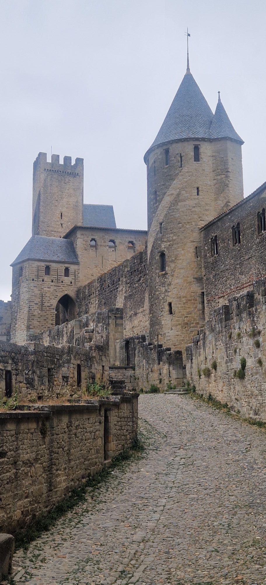
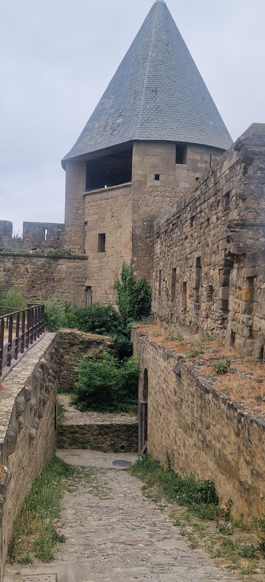
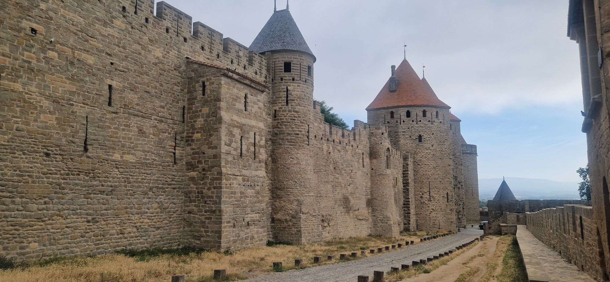
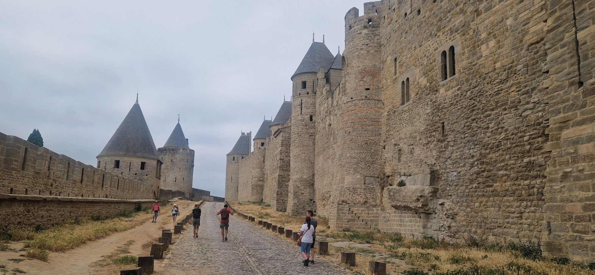
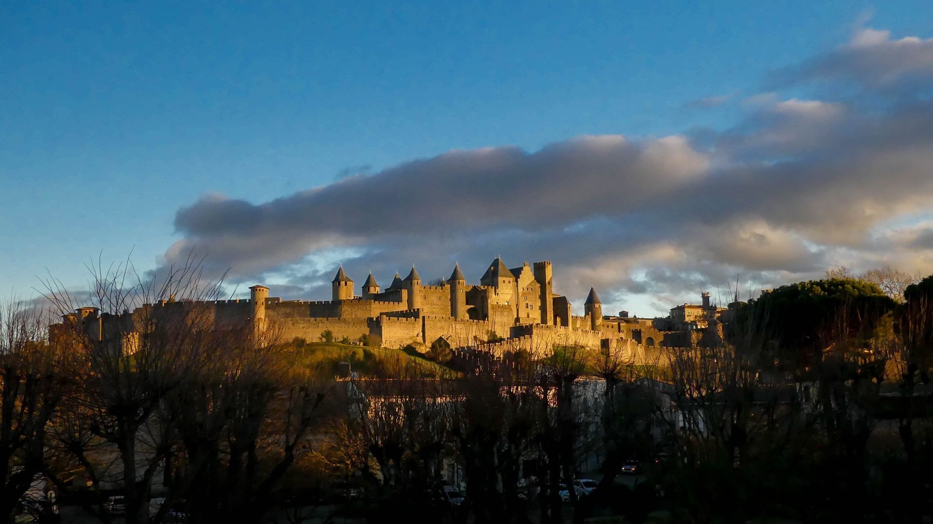
Stage 1: Carcassonne – Lagrasse: 44.5 km / +610 m, -590 m Starting from the Carcassonne train station, cross the Carcassonne lock bridge to reach the André Chénier Garden, then take Rue Albert Tomey, which runs through the Bastide Saint-Louis. There you’ll discover the Saint-Vincent Church, whose bell tower offers a panoramic view of the city. (You can take a short detour to Place Carnot, the true heart of the Bastide, to enjoy its plane trees, terraces, and friendly atmosphere.) Otherwise, continue straight ahead on Rue Albert Tomey. After Les Halles, turn left onto Rue Aimé-Ramond, which leads to Square Gambetta, where the Museum of Fine Arts is located. Cross the square to reach Rue du Pont-Vieux. At the end of this street, after crossing the historic bridge with its magnificent view of the fortified city and its ramparts, continue straight ahead on Rue Trivalle for about 200 meters. Then, at the first intersection, turn right onto Rue de la Gaffe and, on your left, take Rue du Lavoir, passing under an archway. You’ll arrive at Place Saint-Gimer and its historic church. Next, take Montée Porte-d’Aude, one of the two gateways to the medieval citadel. Continue straight ahead, walking along the outside of the ramparts until you reach the Porte Narbonnaise. Then turn right onto Chemin des Anglais, walking alongside the cemetery, and turn left at the next intersection to follow the GR® 36 for 3 km toward Saint-Croix. Cross over the A61 highway, then turn left onto the Chemin de Bazalac. Continue on this road until you reach the roundabout at the parking lot for the Lac de la Cavayère recreation center, which marks the entrance to a more rural area. At the roundabout, leave the GR® 36 trail by taking the first exit on the right, which leads to La Cavayère. Continue on Chemin de la Métairie to pass through La Cavayère, then turn right onto Chemin des Chênes Verts until the next intersection, where you’ll turn left toward La Frigola. The first vineyard-covered hills come into view. At the next roundabout, turn left, pass through Saint-Estève, walk past the sports fields, and continue until you reach the D42, which you’ll follow for 18 km toward Arquettes-en-Val. You’ll then enter the Corbières wine-growing region. The hills draw closer and the road becomes more undulating. You’ll arrive in Arquettes-en-Val; take the D714 on your left toward Carcassonne, then the D3 toward Lagrasse (drive carefully). Follow it for 11 km, first along the Alsou River and then the Orbieu River, until you reach Lagrasse. The valley narrows between limestone hills and vineyards on the hillsides, with the river accompanying your journey. Your arrival in the village, with its old bridge and stone facades, marks the end of this first stage between the Aude plain and the hills of the Corbières.
2
Stage 2: Lagrasse – Sallèles d’Aude: 68 km / +260 m -370 m From Lagrasse, take the D212 toward Ribaute, following the Orbieu Valley for 3 km as it winds through limestone hills and terraced vineyards typical of the Corbières region. At the village entrance, take the first left, pass in front of the church, and head to the bridge to cross the Orbieu River; then leave the marked trail after the second intersection on the right. Continue straight ahead. Ardolou Castle appears on your right, high above the vineyard-covered hillsides. Cross the Mattes Stream, then turn right at the intersection toward Camplong-d’Aude. Pass through the village and continue toward Fabrezan, through a landscape dotted with vineyards. At the entrance to Fabrezan, join the D212, then turn right onto the D611. Follow it for 1 km until the second left turn. Pass through La Nielle and continue for 4 km to Villerouge-la-Crémade, where you’ll join the D106 on your right. The terrain gradually levels out, signaling the transition to more open landscapes. At the intersection with the D613, leave the departmental road and continue straight ahead on a local road for 3 km, then take the first left. Cross two streams before arriving in Thézan-des-Corbières, nestled among vineyards and scrubland. Join the D611 briefly, then take the first left toward Montséret on the D423. Drive through Montséret and continue on the D423 toward Saint-André-de-Roquelongue. Then join the D613 on your right and follow it for 4 km until you reach the Via Domitiana, an ancient Roman road winding through the vineyard-dotted countryside. Then turn right toward Fontfroide Abbey, nestled in the heart of a massif of pine forests and dry hills, which we invite you to explore. After your visit, retrace your steps back to the D613, cross it, then pass under the Deux Mers Expressway (A61) to reach Bizanet. Drive through the village via Rue de la Gare; at the intersection with the Gourgue stream, turn right, then take the first left toward Ornaisons. In the village, turn left at the third major intersection. After the bridge, turn left onto the D24, then take the first right in Cruscades onto the D1624. Cross over the railroad tracks and continue to the intersection with the D6113; turn left, then immediately turn right toward La Domèque. Continue to Canet, pass the church, and leave the village toward the Aude via the Chemin du Moulins; the landscape then becomes flatter and more agricultural. Cross the bridge over the Aude (D26) on your left, take the first right, then the first left to cross the Canal du Midi and reach Ventenac-Minervois. Then follow the north bank of the canal along the bike path for 4 km toward Béziers. Here, the riverbanks mark the transition from the rolling hills of the Corbières to the Narbonne plain. Continue on to Le Somail, an iconic hamlet along the Canal du Midi, with its humpback bridge and charming buildings—a must-see stop. When you reach the water tower, cross the bridge to the opposite bank, then continue toward Sallèles-d’Aude. Then leave the village via the Chemin de Mandosse, take the first road on the left, pass by a solar farm, and turn right. Finally, join the D1118 before turning left to cross the Cesse Bridge and reach Sallèles-d’Aude, the end of this second stage.
3
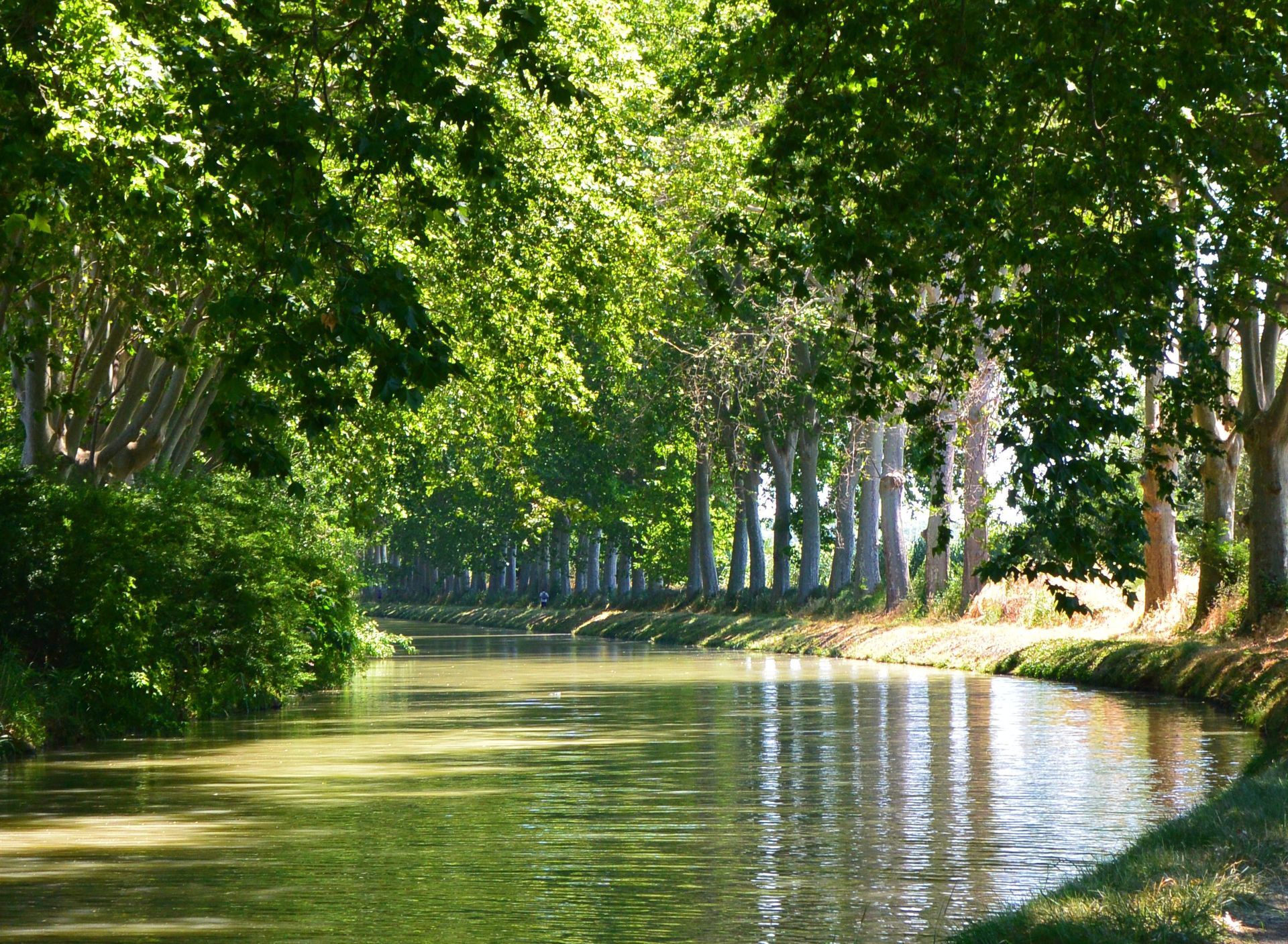
Stage 3: Sallèles-d’Aude – Quarante: 24.8 km / +160 m -65 m From Sallèles-d’Aude, cross the village via Rue du Portail de Notre-Dame to reach the banks of the Canal de Jonction heading toward the Gailhousty spillway. Cross the lock, then take the towpath toward Sallèles-d’Aude, where you’ll find the signage for the GRP Aude Romaine et Médiévale trail. At the bridge located before the Sallèles-d’Aude lock, stay on the same bank and continue along the Jonction Canal, lined with century-old pine trees for 3 km. Several locks dot this peaceful stretch, offering beautiful views of the canal’s structures. Along the way, you’ll pass near Amphoralis, a former site for the production of Gallo-Roman amphorae that bears witness to the region’s rich ancient history. Continue straight ahead without changing banks until you reach the Truilhas Bridge, where you’ll leave the GRP Aude Romaine et Médiévale trail. Cross the bridge toward Le Somail. In Le Somail, cross the bridge and then turn immediately right onto Allée des Cyprès to walk along the Canal du Midi. This pleasant stretch along the water leads you to the Porte du Minervois in Mirepeisset. Before the Cesse canal bridge, turn left after the small bridge that crosses the stream flowing into the canal. You’ll then follow the Cesse River for 2 km through a cooler, shadier setting, under a remarkable avenue of plane trees, some of which are several centuries old, until you reach the Sinan Bridge. Cross the bridge, then take the first street on the left (Rue du Pont) to reach the D326, then turn left onto Chemin Roger Massac toward Argeliers. At the intersection with the D5, head toward downtown and enter the village, following the Marcelin Albert Promenade. Then reach the canal via Allée des 87 and Rue du Port until you reach the Pont de la Province. Cross the bridge to reach the south bank of the Canal du Midi and the “Méditerranée à Vélo” (EV8) route. Follow this route for 4 km to La Croisade (Sériège Bridge). Then leave the canal, cross the bridge on your left to reach the D36, and take a pleasant path through vineyards and pine forests toward Quarante, where this stage ends (blue markers for the “Les Berges du Canal” hike for 4 km).
4
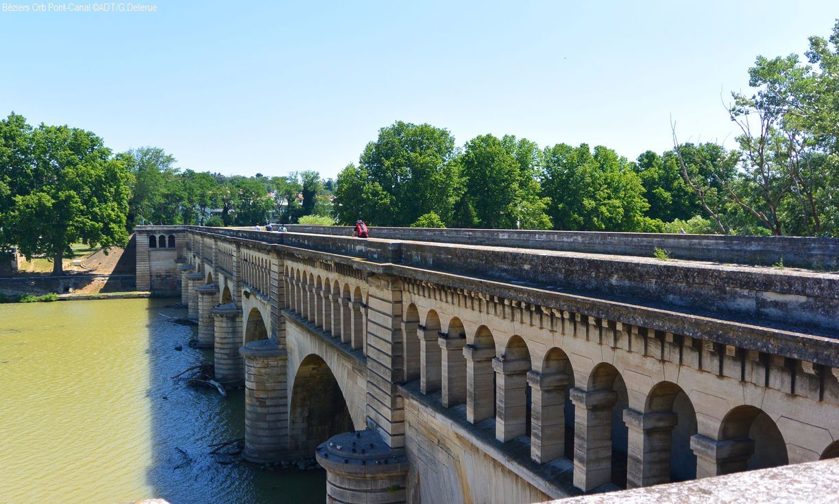
Stage 4: Quarante – Béziers 32.7 km / +78 m -169 m From the village center, follow Avenue de la Gare for 1 km to reach the old Quarante train station, the starting point of the Camin’Arts greenway, which you’ll follow for 11.5 km to Capestang. This former railroad right-of-way offers a smooth and safe route through the vineyard landscapes from Saint-Chinian to the Canal du Midi, punctuated by works of art installed along the way. After 2.7 km, at the intersection near the recycling center, a sign points to the Château and Domaine de Roueïre — Center for Arts and Heritage, accessible via a 1.6-km round trip (a remarkable heritage site combining history, contemporary art, and arts education). After Puisserguier and before Capestang, be careful when crossing the D16 at the Saisse Bridge. Upon arrival in Capestang, take the opportunity to visit the historic center and the Saint-Étienne Collegiate Church, which overlooks the village. Then continue along the south bank of the Canal du Midi, following the “Méditerranée à Vélo” (EV8) route for 10 km to the Malpas site. Rows of trees, hydraulic structures, and the open landscapes of the plain accompany you as you ride along the water. In Poilhes, enjoy the peaceful atmosphere of this typical canal-side village. From the Malpas site (visitor center and bike rest stop), a detour to the Ensérune oppidum is highly recommended to enjoy a remarkable panoramic view of the ponds and the Béziers plain. Switch to the other bank and continue along the “Méditerranée à Vélo” route, taking in the atmosphere of the Colombiers harbor as you pass through. A few kilometers further on, you’ll reach the Fonseranes Locks. This spectacular series of locks marks the approach to Béziers and is one of the most iconic sites along the Canal du Midi. The “Méditerranée à Vélo” route then leads you to the canal bridge over the Orb River. At Port Neuf, a footbridge provides easy access to the Béziers SNCF train station.
5
Before catching the train, take some time to explore Béziers’ historic center, its cathedral, and the narrow streets of the upper town overlooking the Orb Valley by following the “Between the Canal du Midi and Béziers” urban hiking trail (8 km, easy, marked with yellow PR signs). Link: https://www.herault-tourisme.com/fr/fiche/itineraires-touristiques/randonnee-entre-canal-du-midi-et-beziers-beziers_TFOITILAR034V51S3RR/
Carcassonne SNCF Train Station
Carcassonne SNCF Train Station
3
The Canal du Midi and its heritage sites are maintained on a daily basis (new plantings, maintenance of bridges and other structures, etc.). Before your trip, we recommend checking the condition of the towpath you plan to use at vnf.fr/vnf/regions/vnf-sud-ouest/. Bicycle touring currently takes place on unpaved terrain; some paths may be rough. To ensure a pleasant experience, we recommend using a suitable bike, such as a mountain bike or hybrid bike.
Traffic laws apply along the route; please be considerate of other users (pedestrians, cyclists, and horseback riders). Safety is no joke: wearing a helmet is recommended when cycling!
When you go on a hiking trip, leave your bike in a secure place—either at your lodging if possible, or in a private or public location (restaurant, guesthouse, etc.). If you leave your bike in an unattended area, be sure to lock it with the lock provided by your rental company and remove the battery.
Check with your bike rental company to see if they can provide you with one or more panniers, and ask about their dimensions to ensure your belongings will fit. And check if they provide a repair kit and a bike pump, as well as an effective nighttime lighting system.
Travel light and have your luggage delivered to your next stop using luggage transport services like Bagafrance: bagafrance.com
Some accommodations do not have an ATM. Be sure to bring a checkbook and cash before you leave.
During hunting season, don’t forget to check the dates of hunting drives.
https://www.herault-tourisme.com/fr/
Hérault Tourism
Car-Free Nature Getaway
Získejte přehled
Vždy živě na místě s více než 9 500 webkamerami. bergfex Jako uživatel Pro si nyní můžete zobrazit odpovídající webové kamery pro mnoho prohlídek v aplikaci prohlídky z. Můžete si tak přímo prohlédnout aktuální podmínky.
Oblíbené prohlídky v okolí
-
DE BÉZIERS À CARCASSONNE, SUR LE GR® 78 CHEMIN DU PIEMONT PYRENEEN
světloTuristika 110.9 km -
Béziers - Église Saint-Saturnin - Église paroissiale Notre-Dame de la Rominguière - Port Barcarès
Jízda na kole 111.0 km -
5.0
Peyriac-de-Mer - Mour
světloTuristika 5.92 km -
Narbonne - La table de Fontfroide
světloTuristika 3.59 km -
Gruissan - Église Notre-Dame-de-l'Assomption - Église Saint-Jean - Fitou
Motorrad 93.9 km -
Narbonne - Église Saint-Hippolyte - Église Saint-Saturnin - Pastouret
Motorrad 50.8 km -
Lézignan-Corbières - Ferrals-les-Corbières - Église Saint-Félix - Église Saint-Mamès
Turistika 53.5 km -
Lézignan-Corbières - Ferrals-les-Corbières - Église Saint-Félix - Église Saint-Mamès
středníSilniční kolo 53.6 km -
Bistro des Beaux-Arts - Le Portanel - Église Saint-Martin - Les Jardins de Bages
světloTuristika 1.98 km -
Narbonne - Église Saint-Hippolyte - Église Saint-Saturnin - Église Saint-Pierre-ès-Liens
středníSilniční kolo 76.2 km

Pěší turistika a stopování


Nenechte si ujít nabídky a inspiraci pro vaši příští dovolenou
Vaše e-mailová adresa byl přidán do poštovního seznamu.





