Bournaca - Lectoure
světlo
Navigace na stránkách
Navigace na stránkách
Pořiďte si tuto prohlídku do mobilního telefonu
Bournaca - Lectoure
světlo
Mountainbike
10.70
km
Naskenujte QR kód a spusťte navigaci v aplikaci bergfex.

Pěší turistika a stopování


Bournaca - Lectoure
světlo
Vzdálenost
10.70
km
Doba trvání
01:10
h
Ascent
174
hm
Hladina moře
85 -
198
m
Stažení skladby
Bournaca - Lectoure
světlo
Mountainbike
10.70
km
Along the route you will discover:
- The Corhaut Tower
- Arrajado Fountain.
- Saint-Michel Fountain
- The "Brescon hall" (former fortified house).
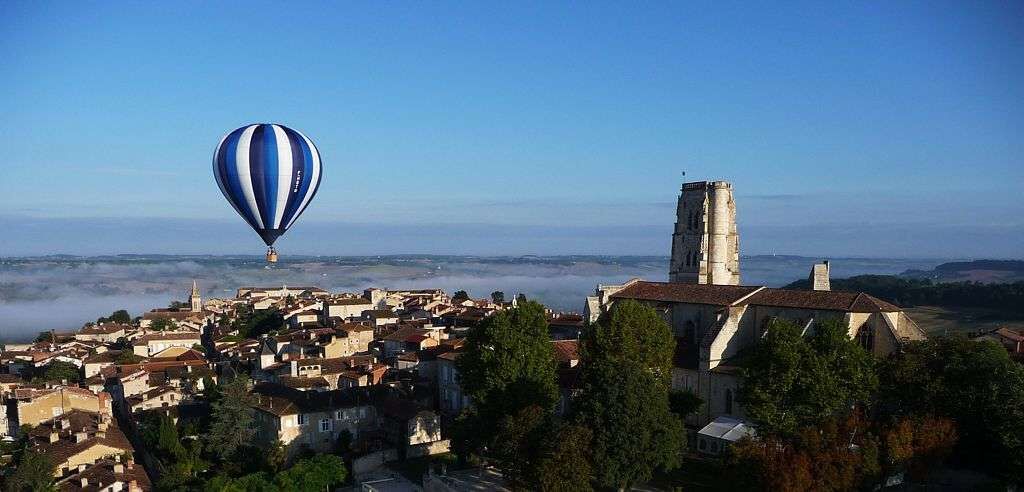
- View of the city of Lectoure
- The "St-Mamet"...
Popis
Along the route you will discover:
- The Corhaut Tower
- Arrajado Fountain.
- Saint-Michel Fountain
- The "Brescon hall" (former fortified house).
- View of the city of Lectoure
- The "St-Mamet" Chapel.
- The hamlet of Petit Vaucluse
- The Vacquier (or Baqué) charterhouse.
- The Bournaca and Saint-Jourdain valleys.
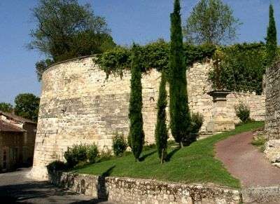
- The ramparts of Boulevard du Nord
- The Corhaut Tower
- Arrajado Fountain.
- Saint-Michel Fountain
- The "Brescon hall" (former fortified house).
- View of the city of Lectoure
- The "St-Mamet" Chapel.
- The hamlet of Petit Vaucluse
- The Vacquier (or Baqué) charterhouse.
- The Bournaca and Saint-Jourdain valleys.
- The ramparts of Boulevard du Nord
Trasa
Trasa
Bournaca - Lectoure
světlo
Mountainbike
10.70
km
Bezpečnostní pokyny
In case of emergency, dial 112
Informace o příjezdu
Příjezd
Between Auch and Agen
Parkování
Free parking near the starting point
Další informace a tipy
Další informace
To learn more about the destination, visit our website Pays Portes de Gascogne
Zatím žádné recenze
Oblíbené prohlídky v okolí
-
Bike ride in Lectourois – Lectoure
heavyJízda na kole 88.6 km -
Vélo Pour Tous à Lectoure
světloJízda na kole 8.60 km -
La Romieu - On the GR652
světloMountainbike 14.6 km -
La Romieu - hills of petit Auvignon
středníMountainbike 23.3 km -
Lectoure - In the footsteps of the pilgrims
středníMountainbike 34.7 km -
Entre Arratz et Auroue en coteaux de Lomagne
středníJízda na kole 30.7 km -
Lectoure - medieval Lomagne
středníMountainbike 19.6 km -
Vélo Pour Tous à Fleurance
světloJízda na kole 14.3 km -
Saint-Clar - The Auroue loop
světloMountainbike 21.2 km -
La Romieu - Collines, vallées et bois
světloMountainbike 16.4 km
Pěší turistika a stopování

Více než 550.000 návrhů výletů, podrobné mapy a intuitivní plánovač tras dělají z aplikace nezbytnou výbavu pro všechny milovníky přírody.

Nenechte si ujít nabídky a inspiraci pro vaši příští dovolenou
Přihlaste se k odběru newsletteru
Chyba
Došlo k chybě. Zkuste to prosím znovu.
Děkujeme za vaši registraci
Vaše e-mailová adresa byl přidán do poštovního seznamu.
Zájezdy po celé Evropě
Rakousko
Švýcarsko
Německo
Itálie
Slovenia
Francie
Nizozemsko
Belgie
Polsko
Lichtenštejnsko
Česko
Slovensko
Španělsko
Chorvatsko
Bosna a Hercegovina
Lucembursko
Andorra
Portugal
Iceland
United Kingdom
Ireland
Greece
Albania
North Macedonia
Malta
Norway
Montenegro
Moldova
Kosovo
Hungary
San Marino
Romania
Estonia
Latvia
Belarus
Cyprus
Lithuania
Serbia
Bulgaria
Monaco
Denmark
Sweden
Finland