


To the Triftsteig in the Kalkalpen National Park


Fotografie našich uživatelů
-

 © StrawanzerVytvořeno dne 22.10.2025
 -
 © StrawanzerVytvořeno dne 22.10.2025
 -
 © StrawanzerVytvořeno dne 22.10.2025
 -
 © StrawanzerVytvořeno dne 22.10.2025
 -
 © StrawanzerVytvořeno dne 22.10.2025
 -
 © StrawanzerVytvořeno dne 22.10.2025
 -
 © Herbert PühringerVytvořeno dne 21.10.2025
 -
 © Herbert PühringerVytvořeno dne 21.10.2025
 -
 © NixelineVytvořeno dne 19.10.2025
 -
 © NixelineVytvořeno dne 19.10.2025
 -
 © NixelineVytvořeno dne 19.10.2025
 -
 © NixelineVytvořeno dne 19.10.2025
 -
 © NixelineVytvořeno dne 19.10.2025
 -
 © Ulrich KromoserVytvořeno dne 09.06.2025
 -
 © Bergheil15Vytvořeno dne 12.10.2025
 -
 © Bergheil15Vytvořeno dne 12.10.2025
 -
 © Bergheil15Vytvořeno dne 12.10.2025
 -
 © Bergheil15Vytvořeno dne 12.10.2025
 -
 © Bergheil15Vytvořeno dne 12.10.2025
 -

 © AndreasVytvořeno dne 03.10.2025
 -
 © AndreasVytvořeno dne 03.10.2025
 -
 © AndreasVytvořeno dne 03.10.2025
 -
 © AndreasVytvořeno dne 03.10.2025
 -

 © David HinczizaVytvořeno dne 27.09.2025
 -
 © David HinczizaVytvořeno dne 27.09.2025
 -
 © David HinczizaVytvořeno dne 27.09.2025
 -
 © Andreas HadererVytvořeno dne 31.08.2025
 -
 © Fritz MittererVytvořeno dne 15.08.2025
 -
 © Fritz MittererVytvořeno dne 15.08.2025
 -
 © Franz hoferVytvořeno dne 25.07.2025
 -
 © Andrea K.Vytvořeno dne 03.07.2025
 -
 © Andrea K.Vytvořeno dne 03.07.2025
 -
 © Andrea K.Vytvořeno dne 03.07.2025
 -
 © Andrea K.Vytvořeno dne 03.07.2025
 -
 © Andrea K.Vytvořeno dne 03.07.2025
 -
 © Andrea K.Vytvořeno dne 03.07.2025
 -
 © Andrea K.Vytvořeno dne 03.07.2025
 -
 © Andrea K.Vytvořeno dne 03.07.2025
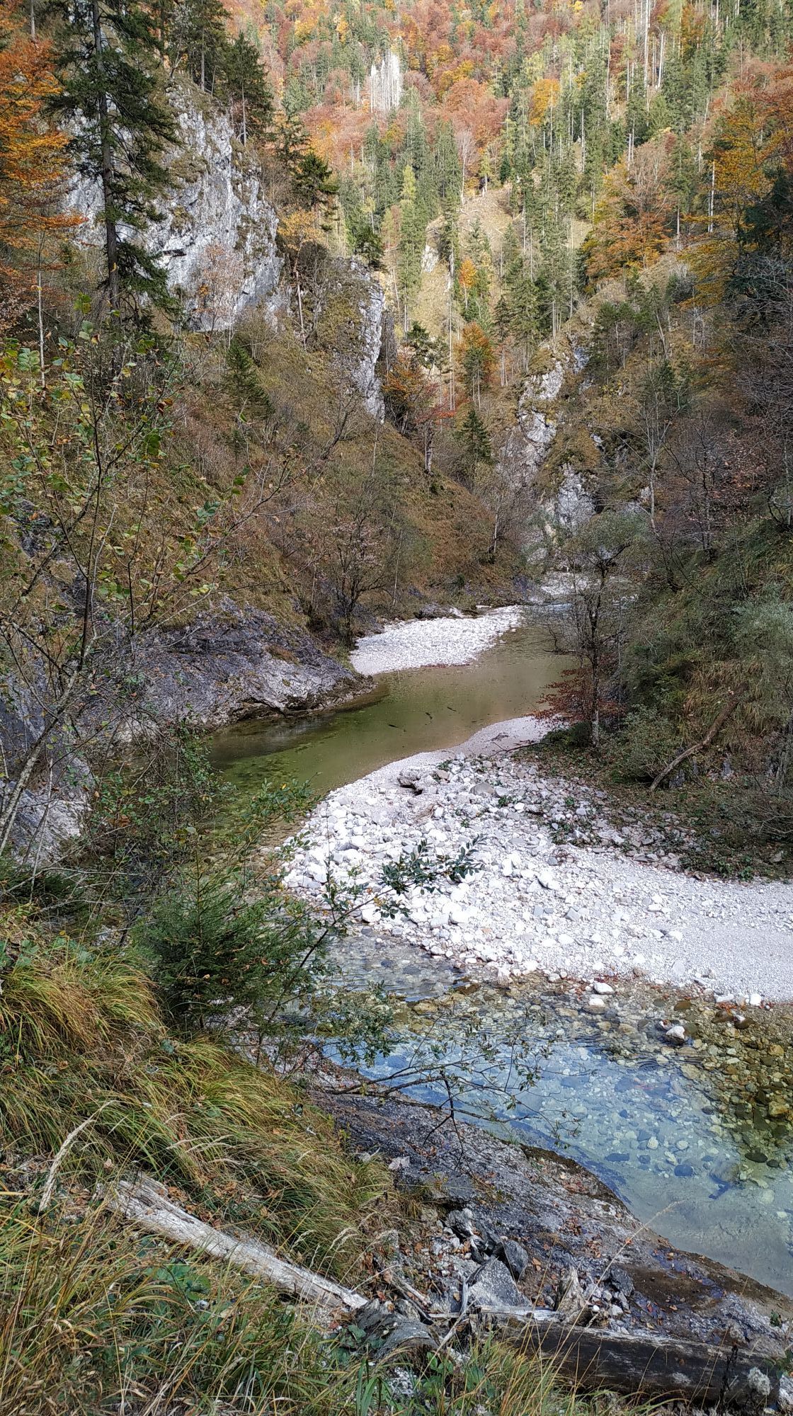

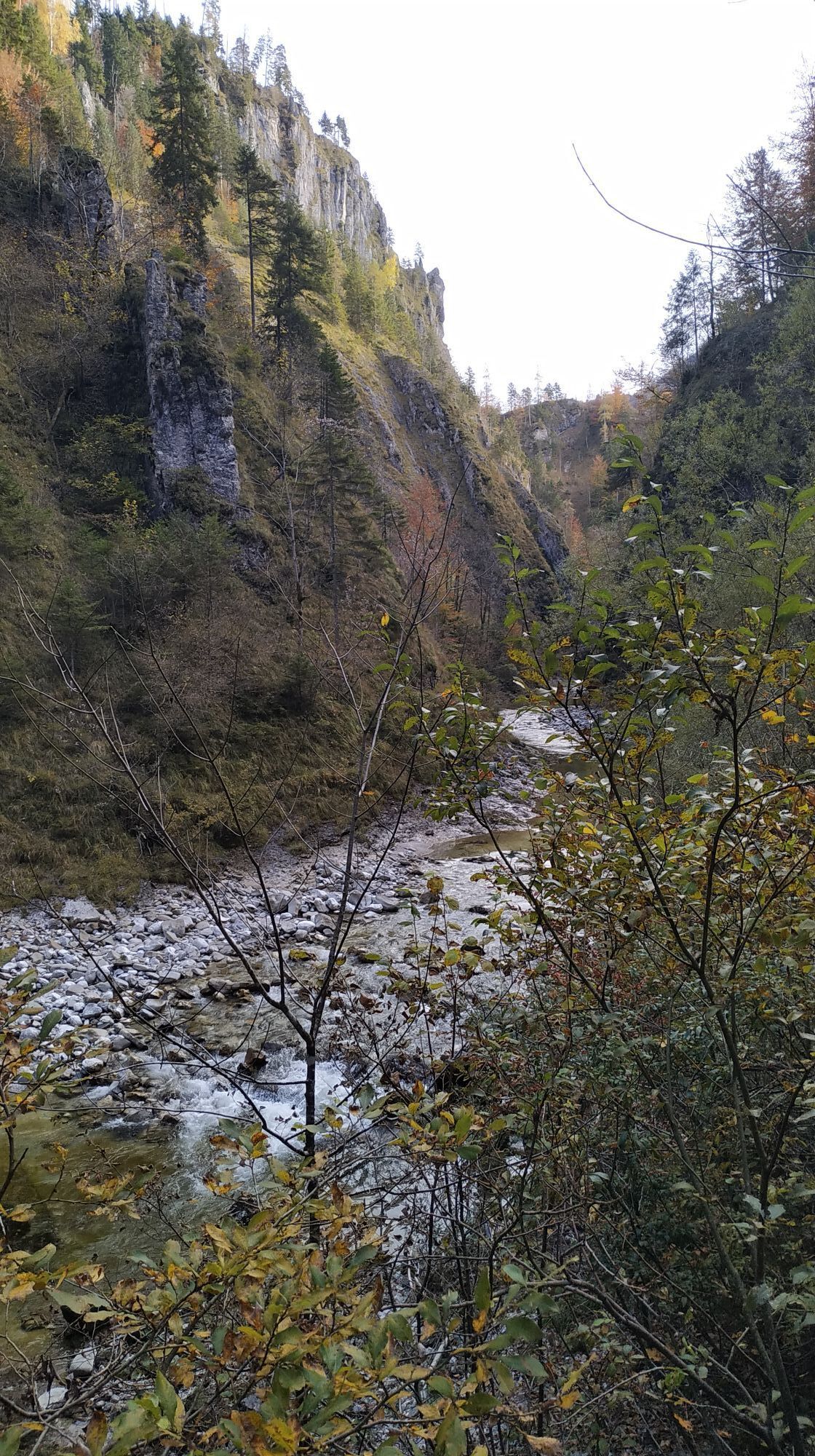

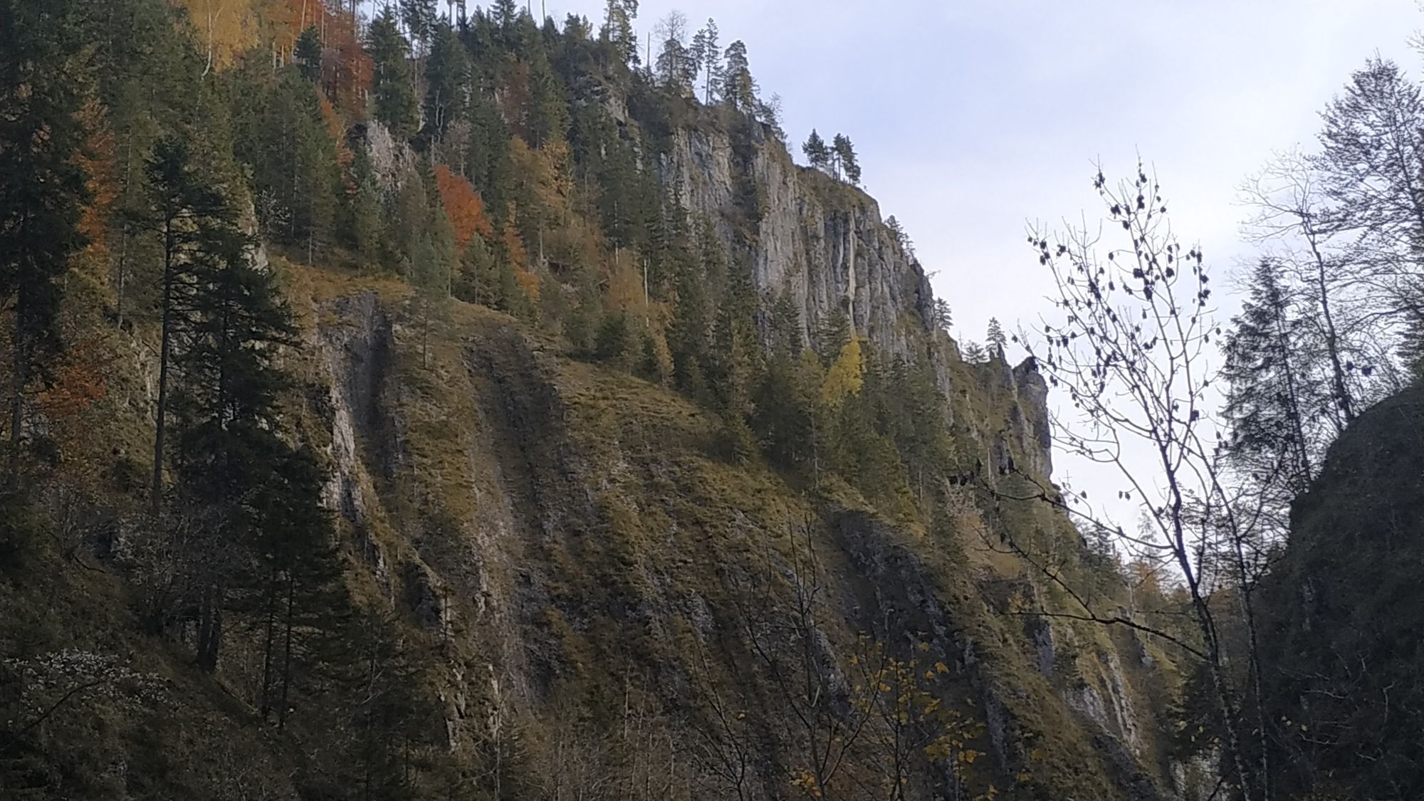
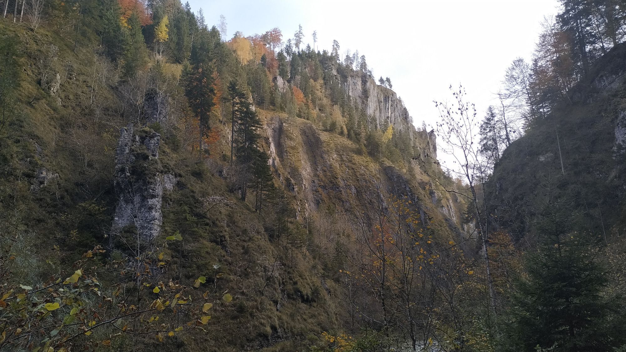


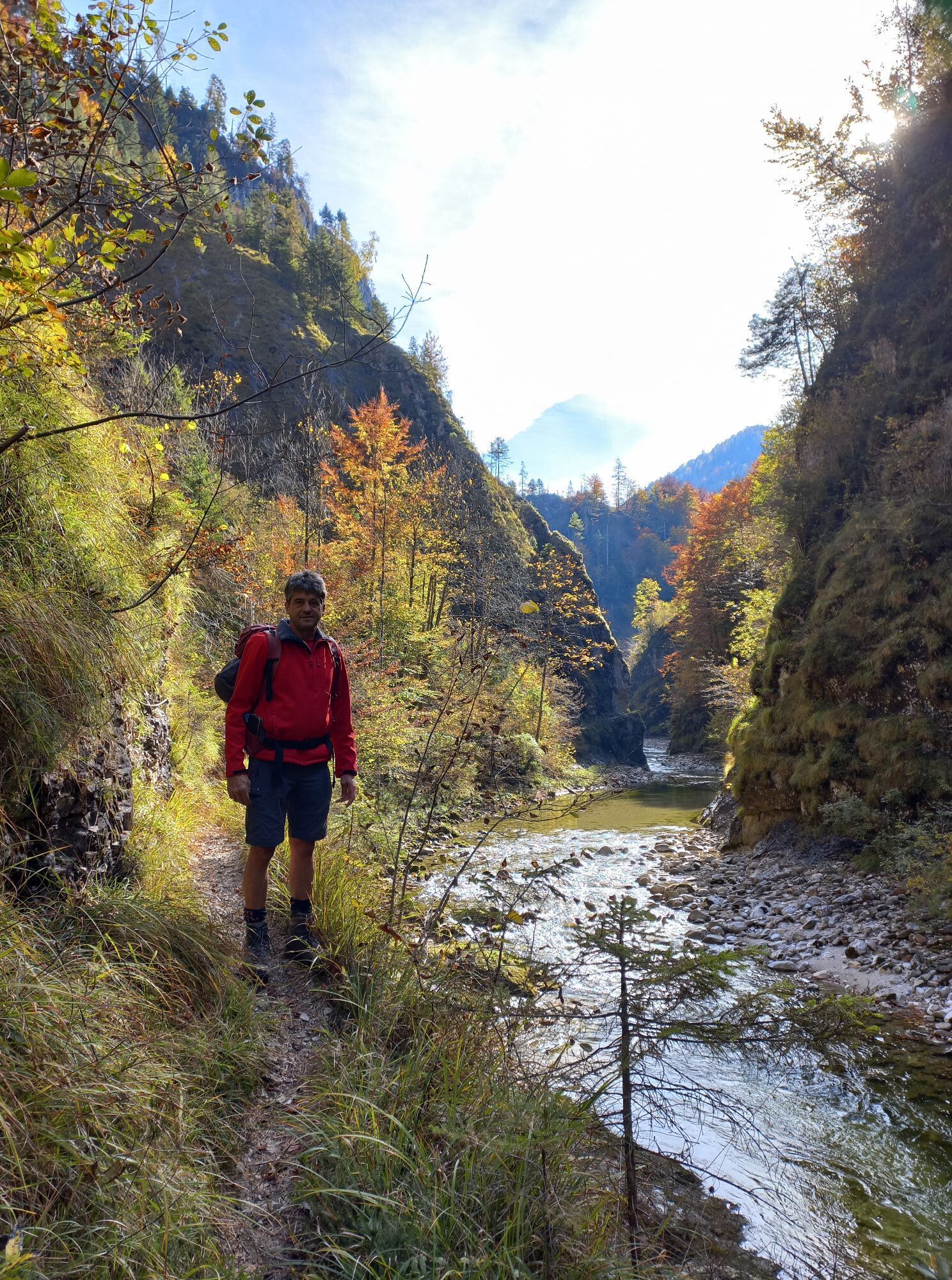

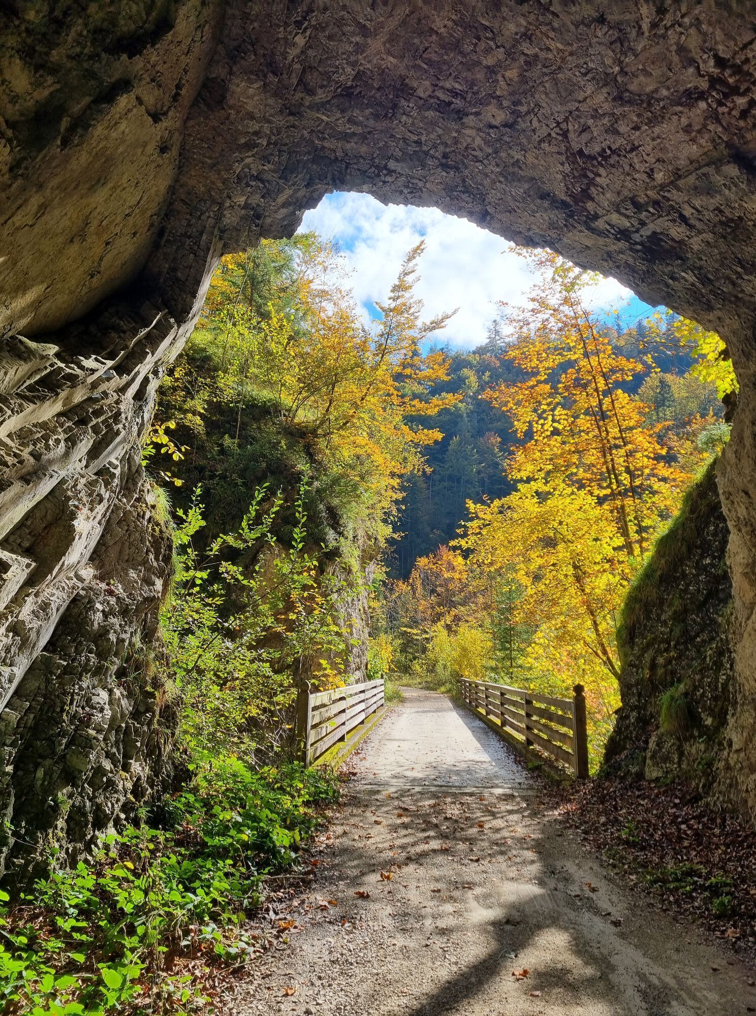
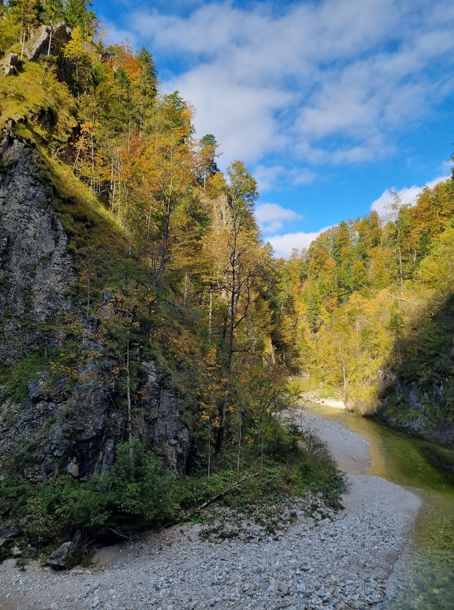
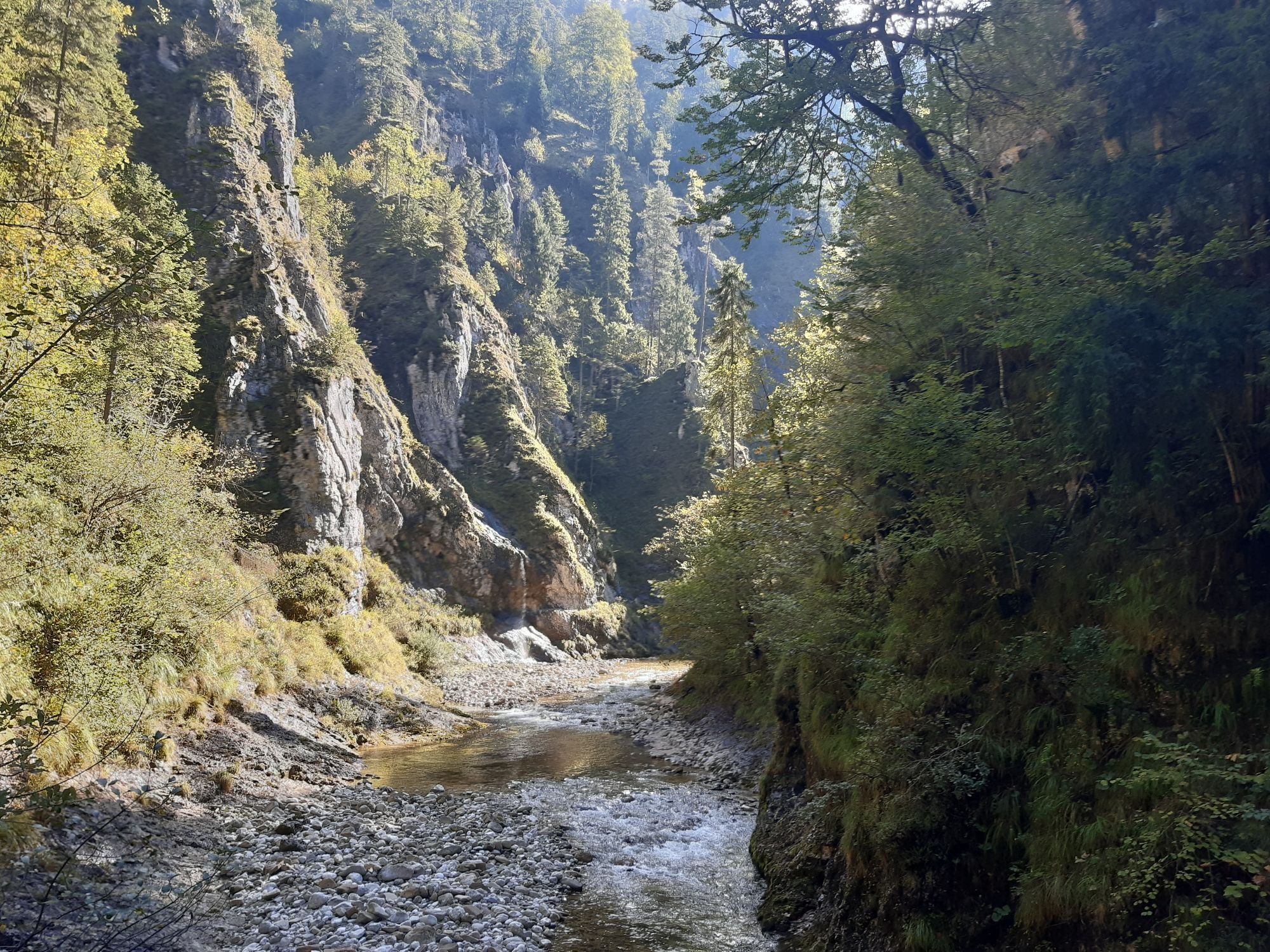
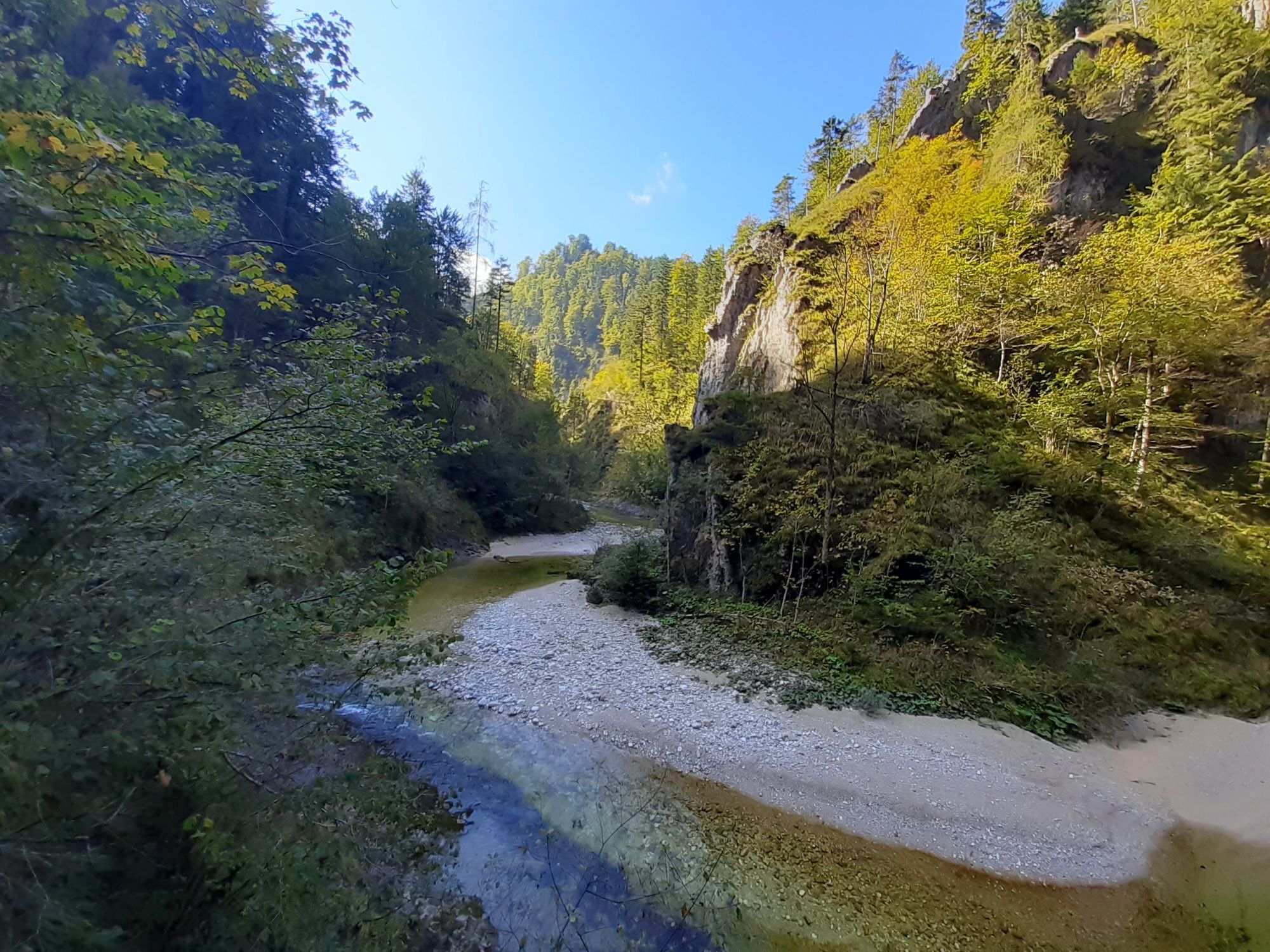


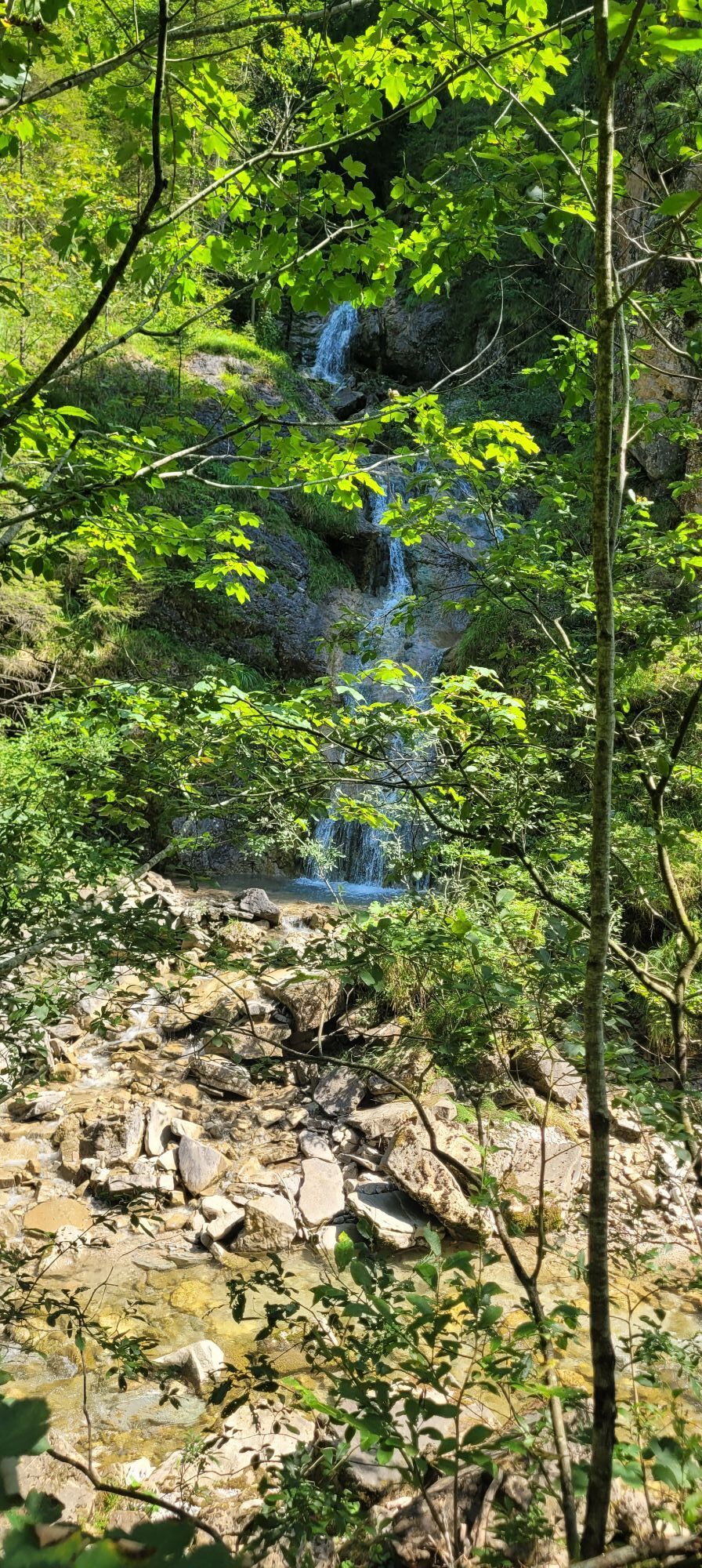

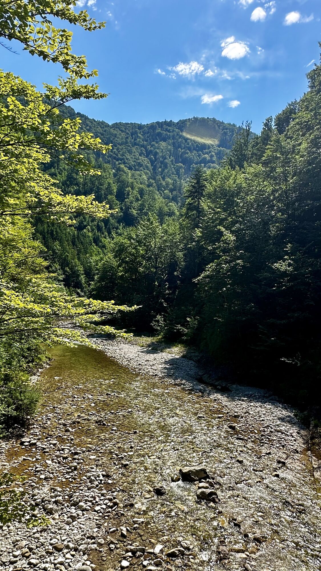
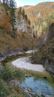
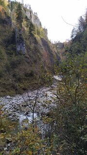
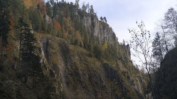
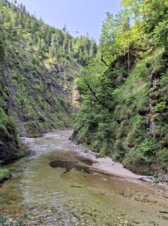
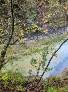
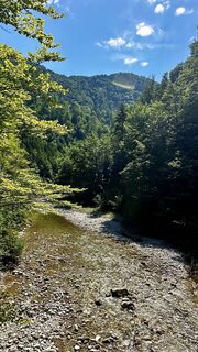
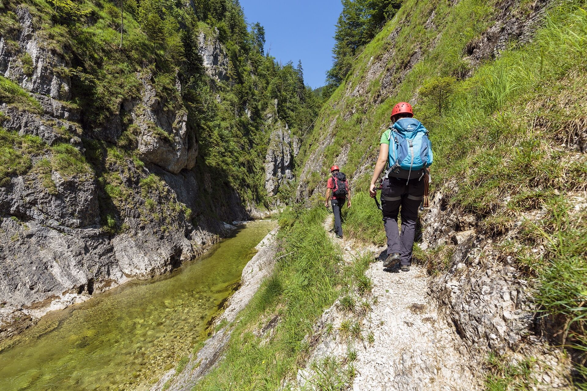
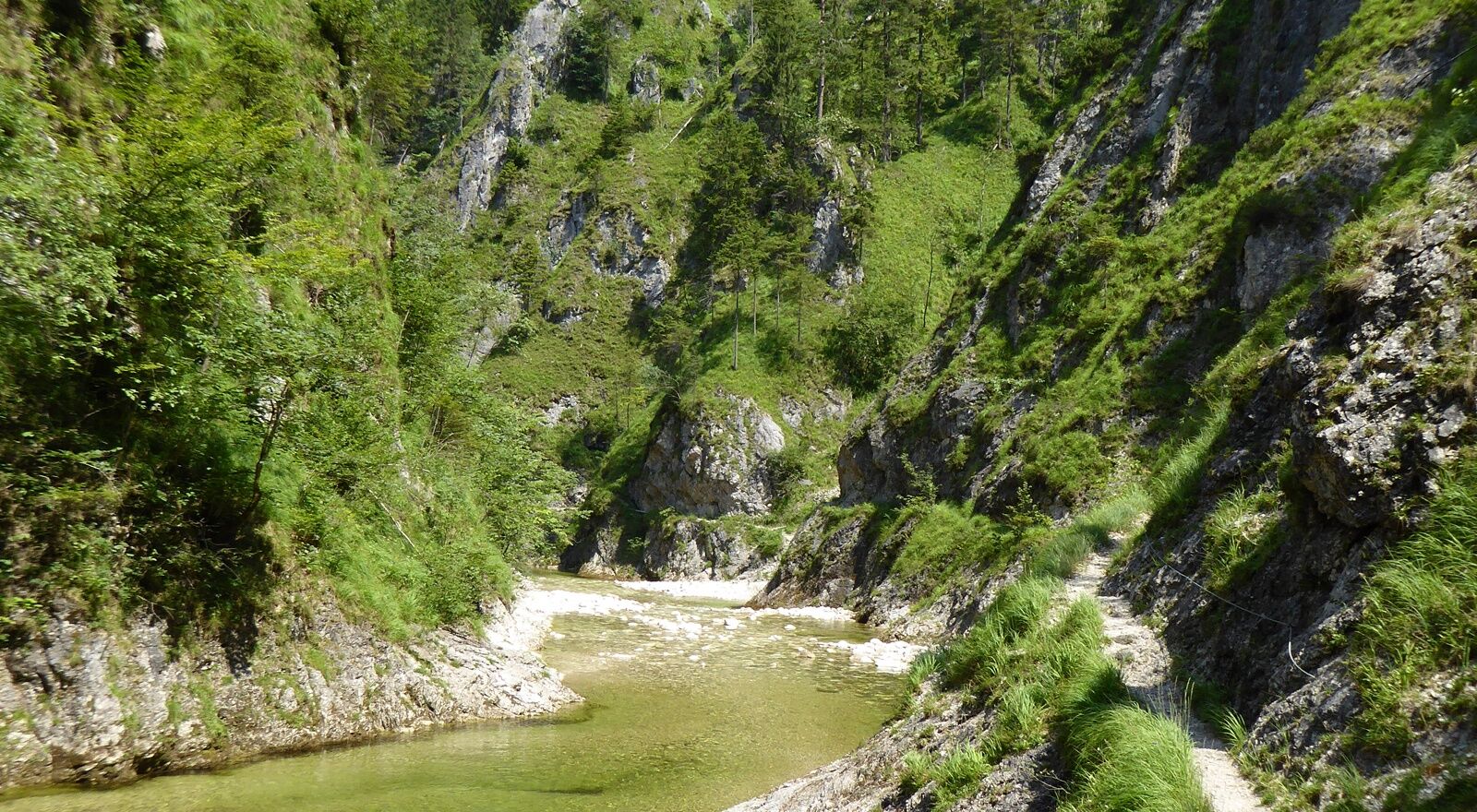
The Reichraminger Hintergebirge is one of the most beautiful and largest primeval landscapes in Austria. The so-called "Große Bach" (Great Brook) flows through the central part, where timber used to be...
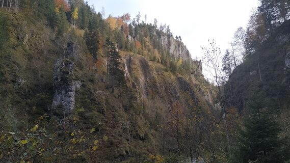
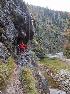
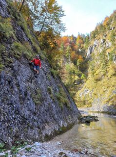
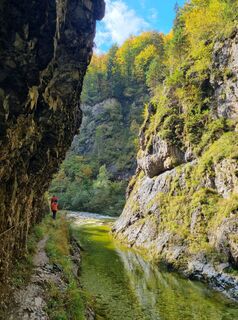
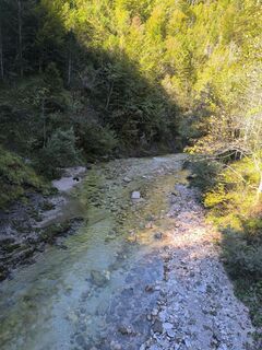
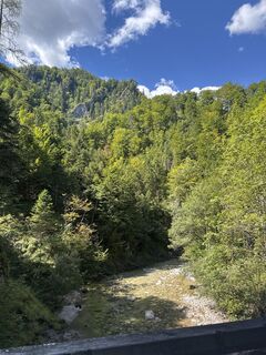
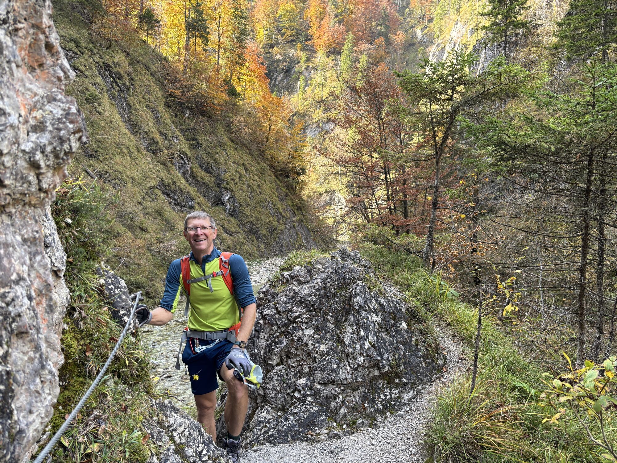
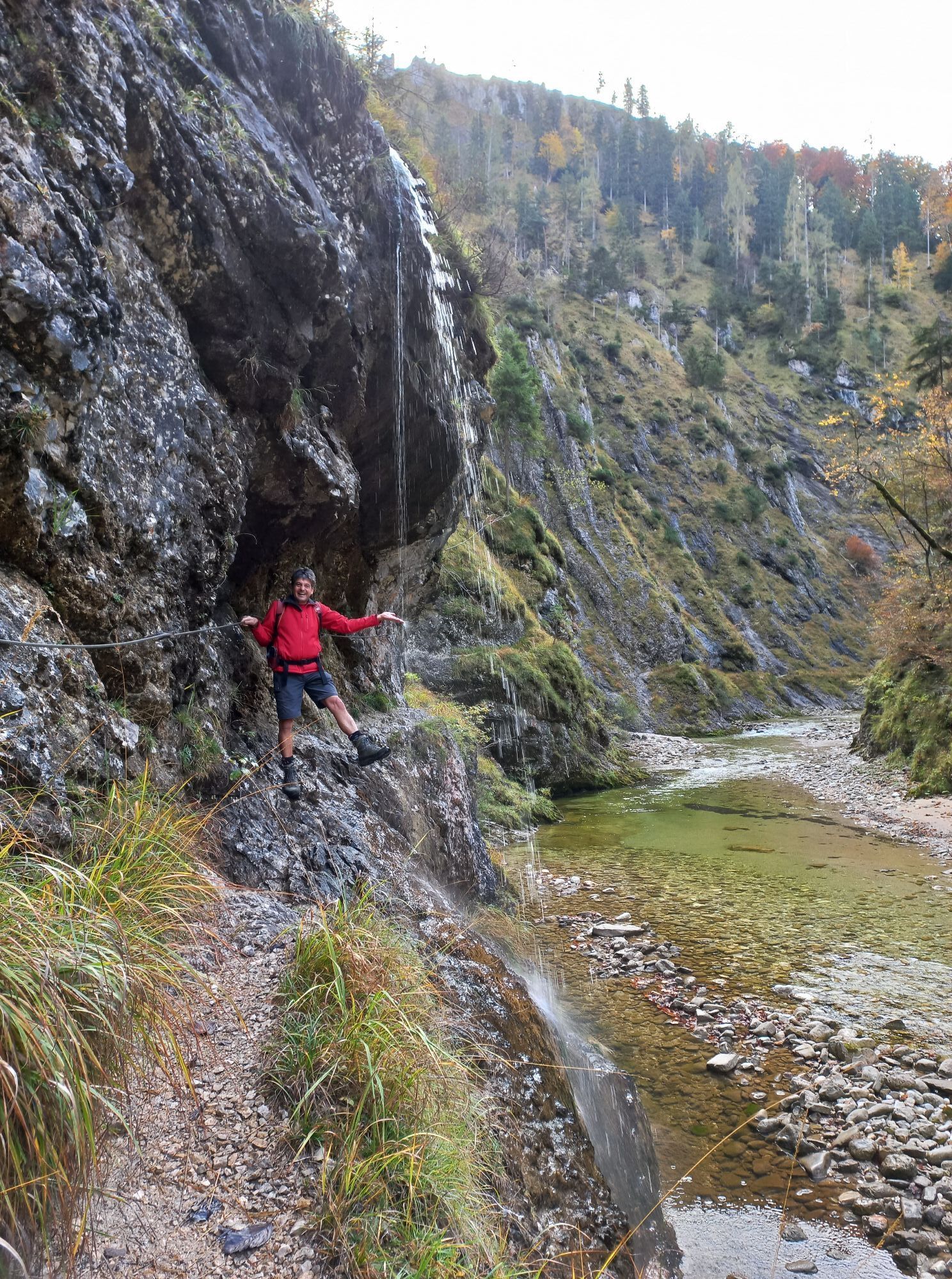
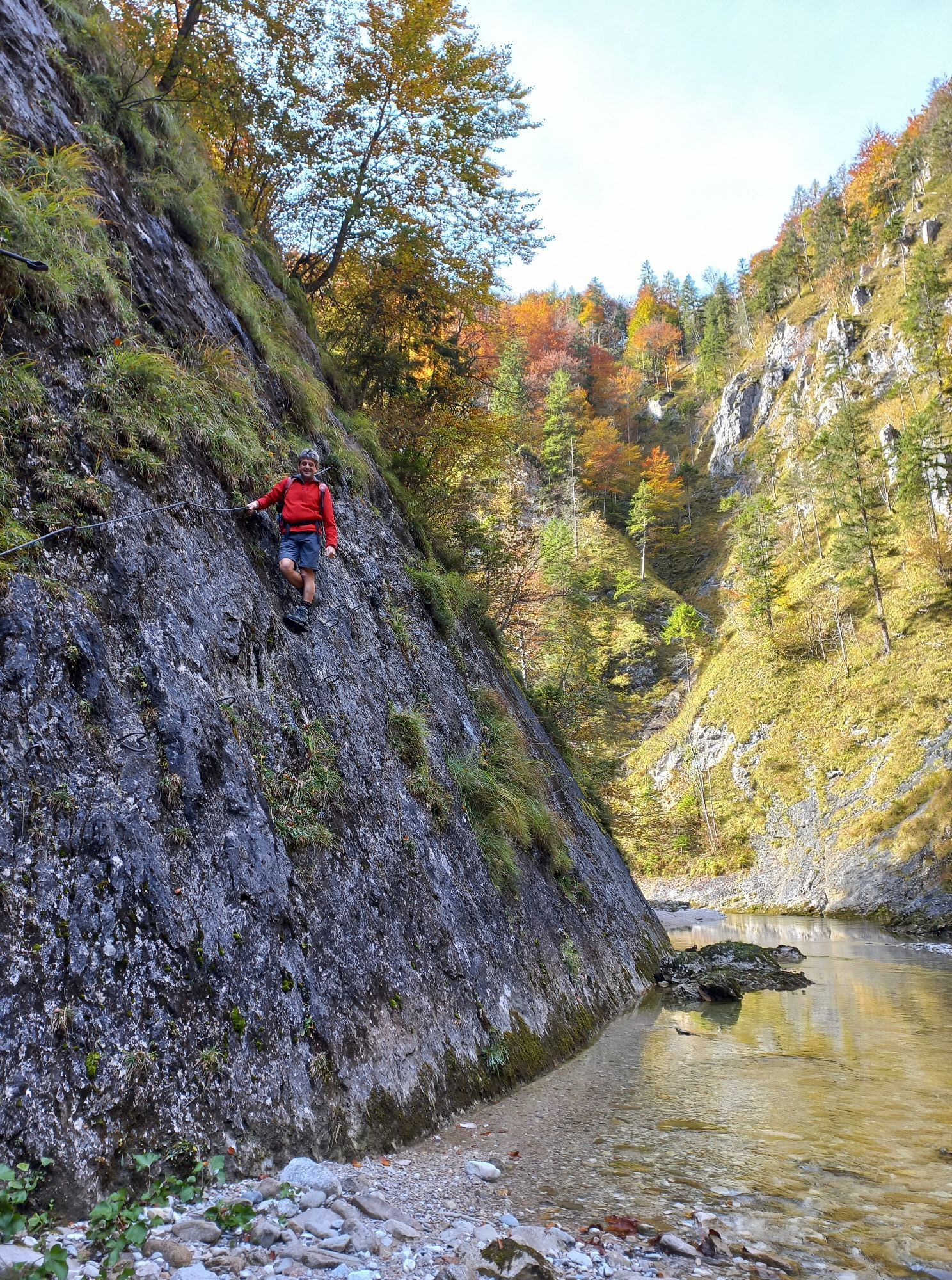
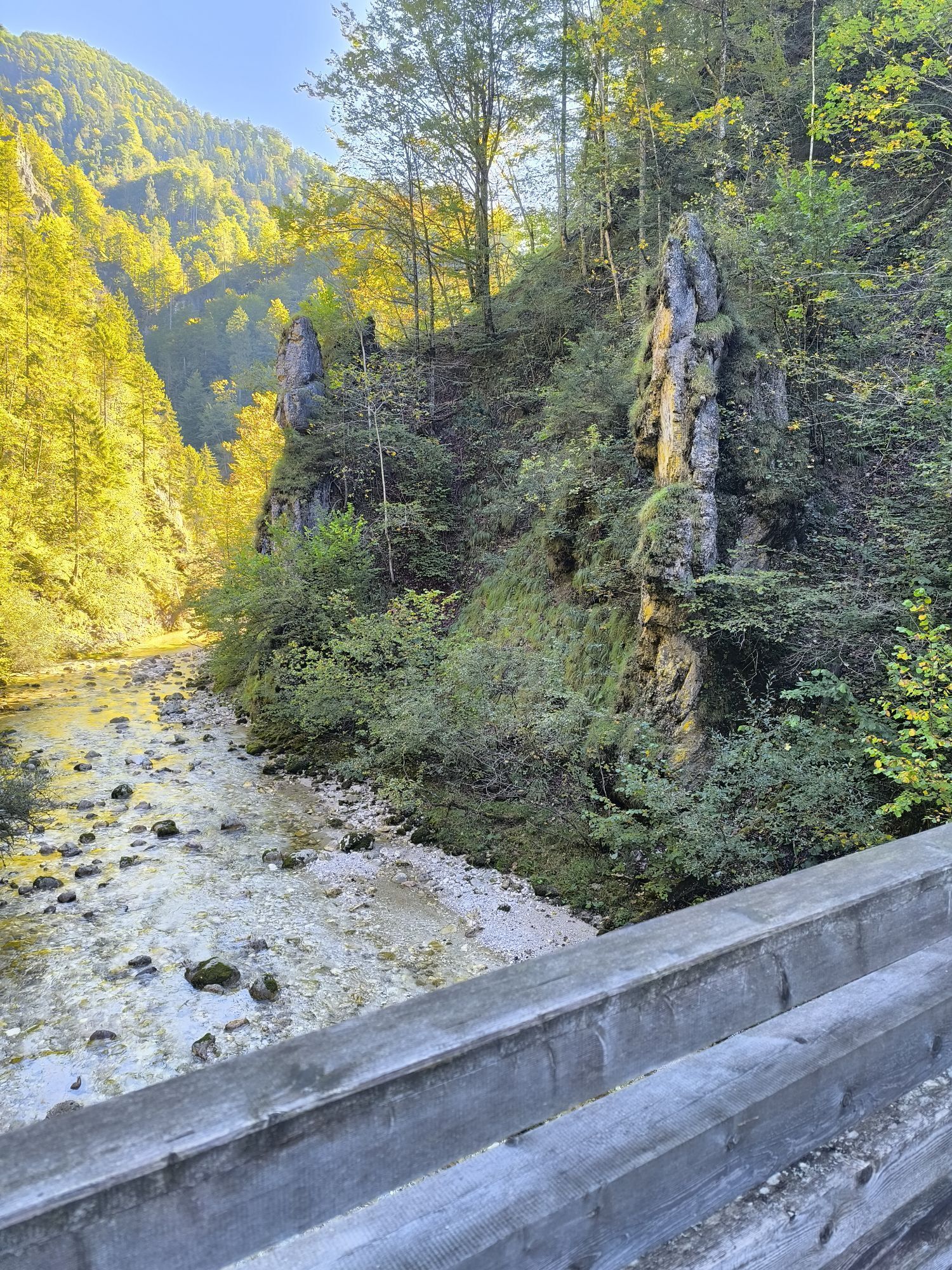
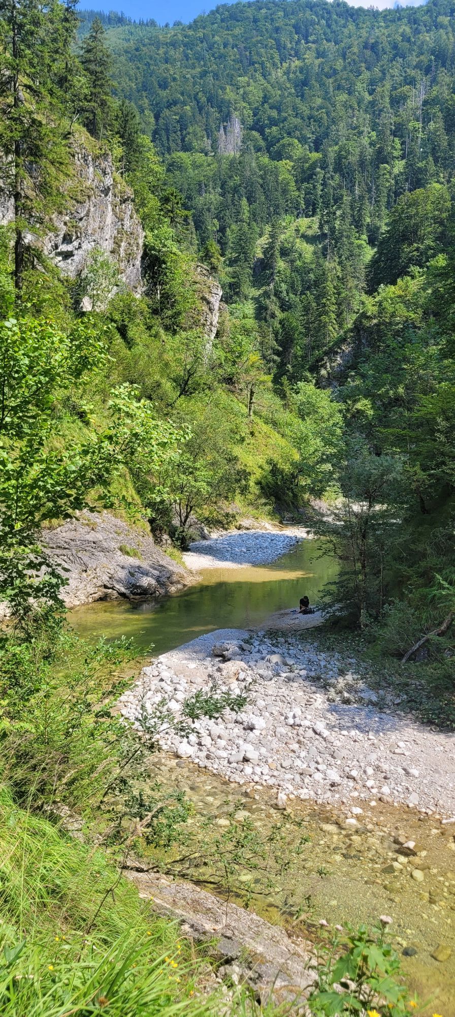
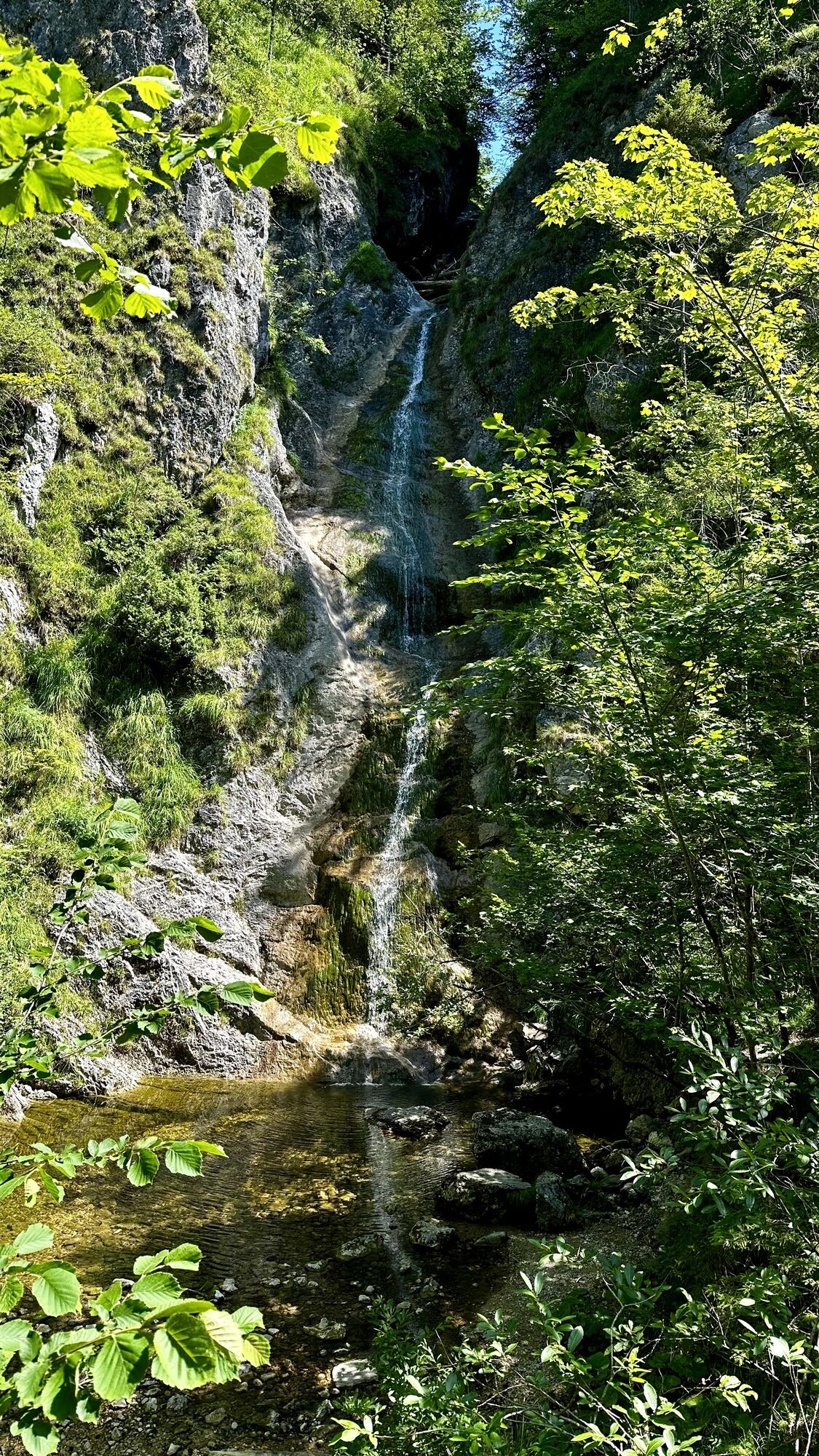
The Reichraminger Hintergebirge is one of the most beautiful and largest primeval landscapes in Austria. The so-called "Große Bach" (Great Brook) flows through the central part, where timber used to be drifted. Between the Schleierfall and the Annerlsteg is the narrowest and most interesting part of the gorge. In 1987, the Triftsteig was renovated and made passable again with steel ropes and clamps. The via ferrata partly follows the old course of the Triftsteig, which was only equipped with narrow wooden footbridges at the time, and gives an idea of the dangerous work of the wooden raftsmen of that time.

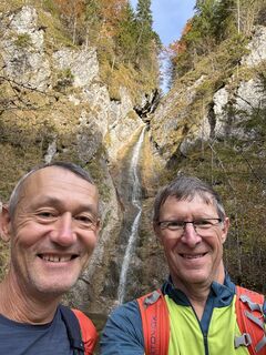
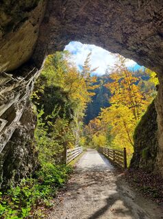
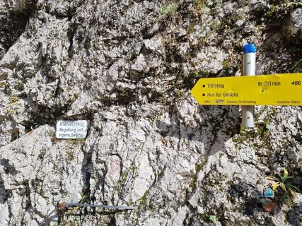
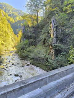
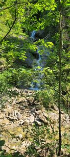
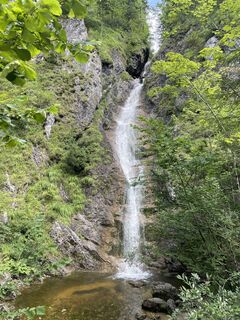
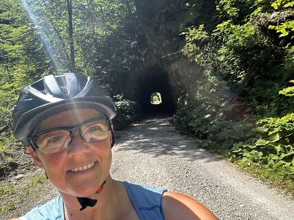
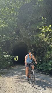
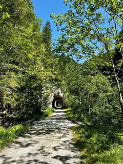
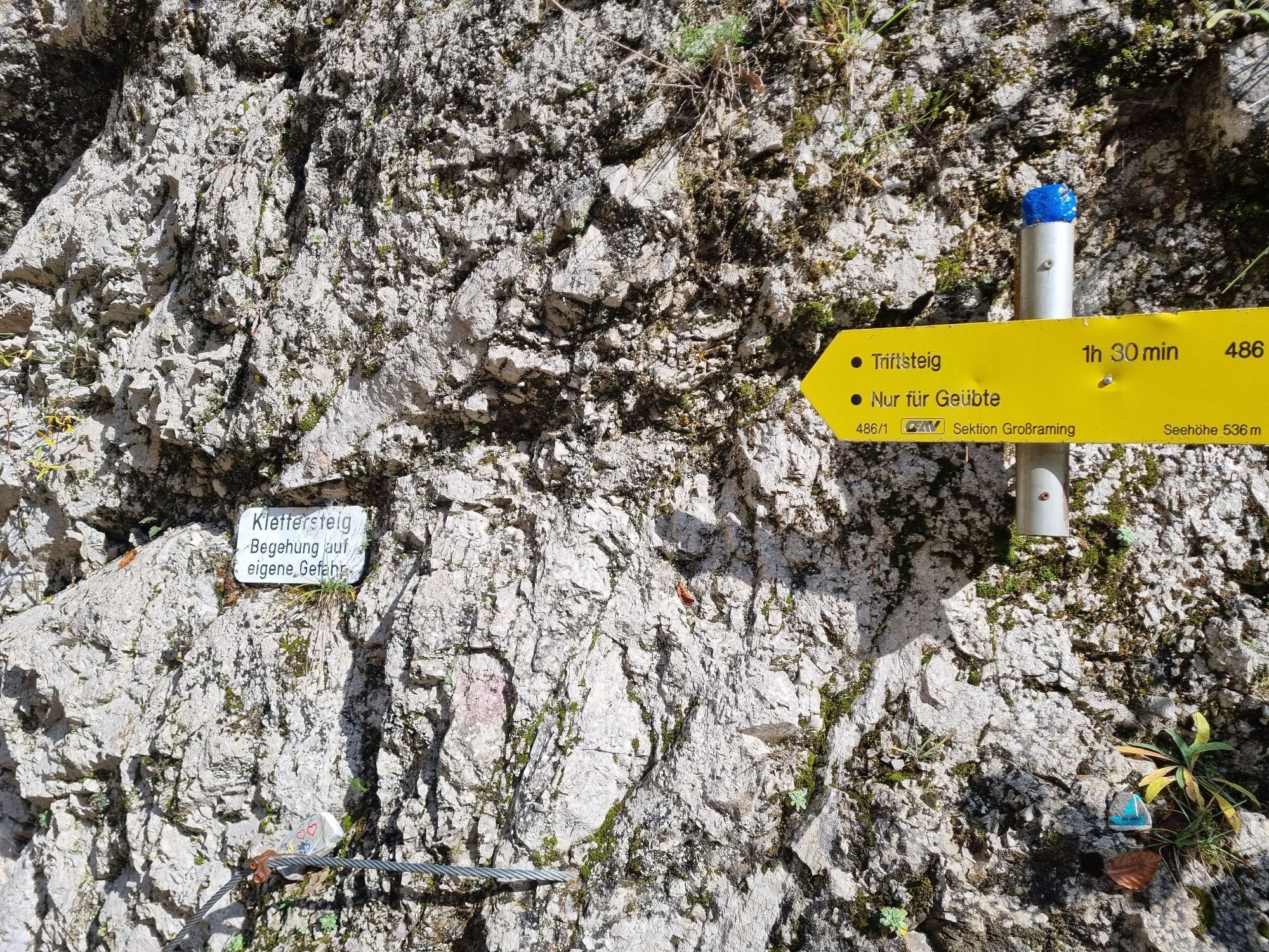
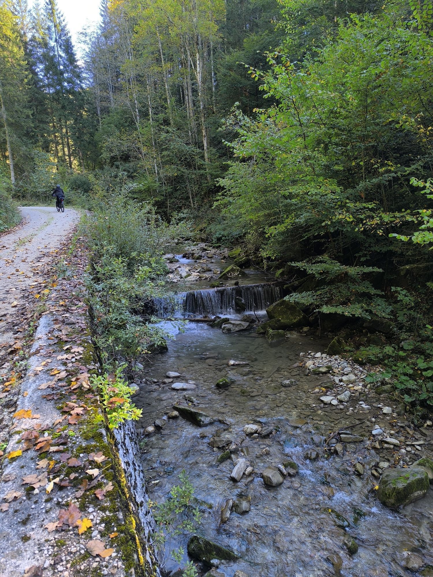
Access approx. 1 h from the car park, the trail leads along the gently descending forest road downstream until you reach the cross-cutting main ditch after about 2 km at a bridge. After the bridge, turn right and continue for about 3 km to the "Schleierfall" (striking, small waterfall on the right of the road; here, turn off to the Anlaufalm via the so-called "Hochschlacht"; sign). About 100m after the "Schleierfall" (at the next bridge to the tunnel), the "Triftsteig" branches off to the right (sign: 1. Klettersteig").
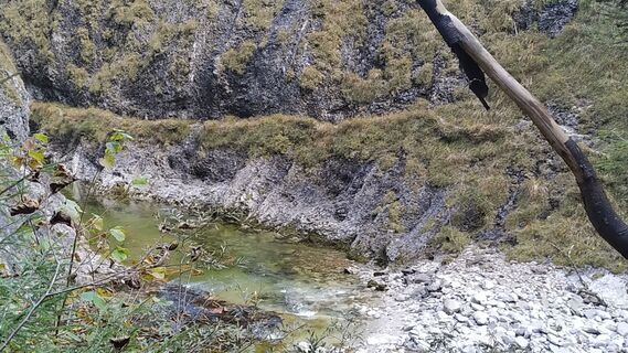
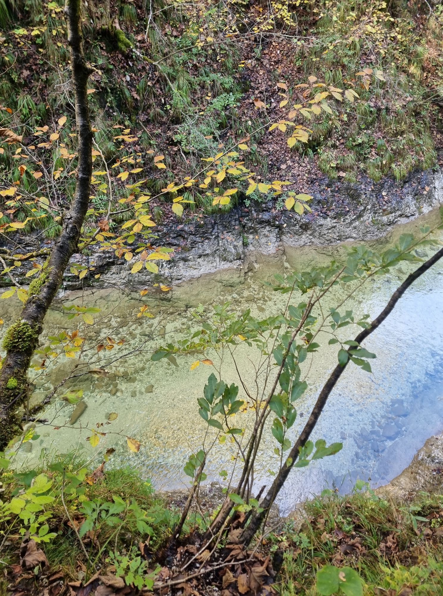
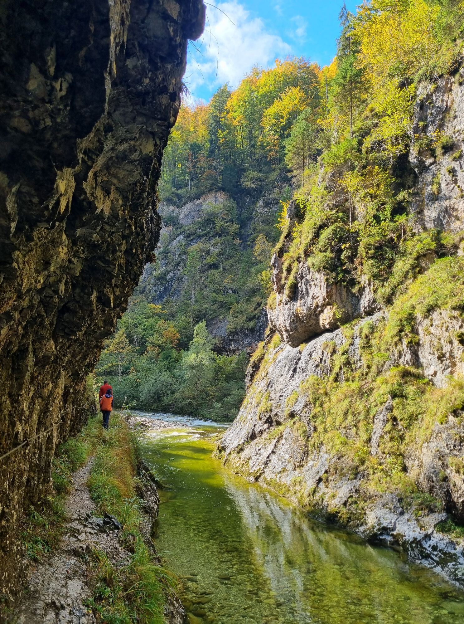
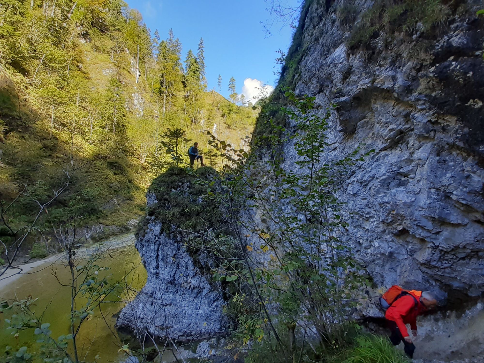
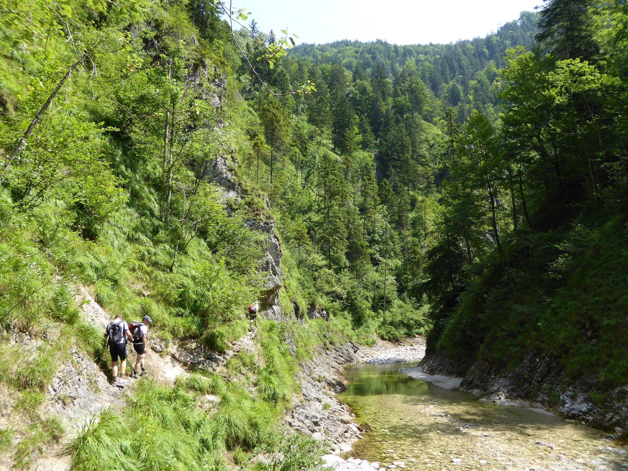
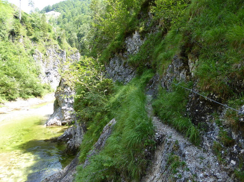
Triftsteig: The rope belay begins immediately at the bridge and you cross the wild and romantic gorge on the right bank of the stream, ascending and descending for about 2 km until you meet the forest road at the so-called "Annerlsteg" bridge.The path is secured throughout and you are exposed in places and always just above the water surface of the "Großer Bach". In between, there is always walking terrain on a narrow path, which can be wet in places due to small watercourses running across it. The Triftsteig can be walked in both directions.
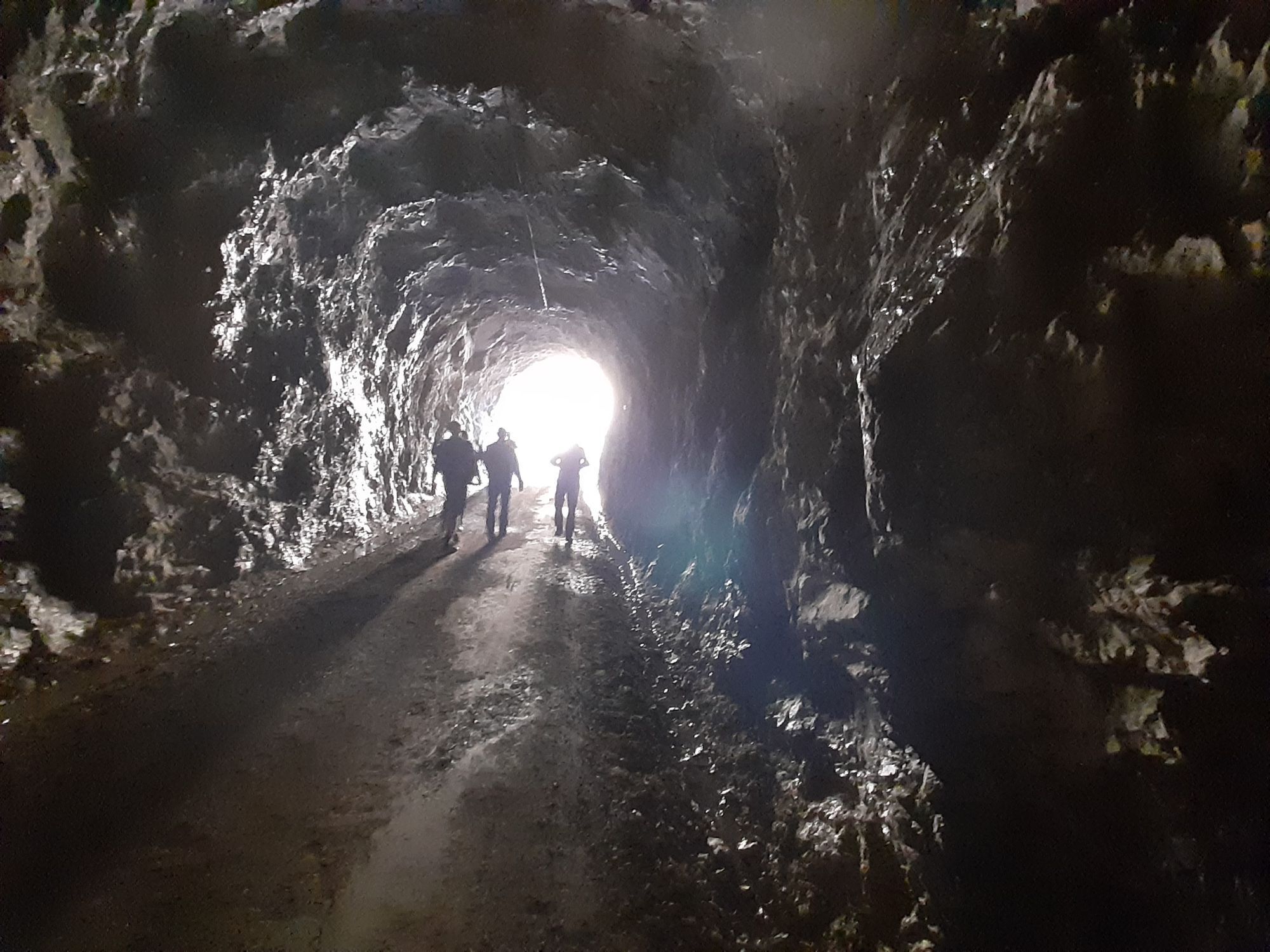
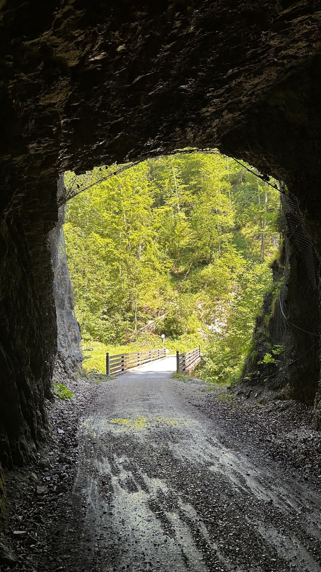
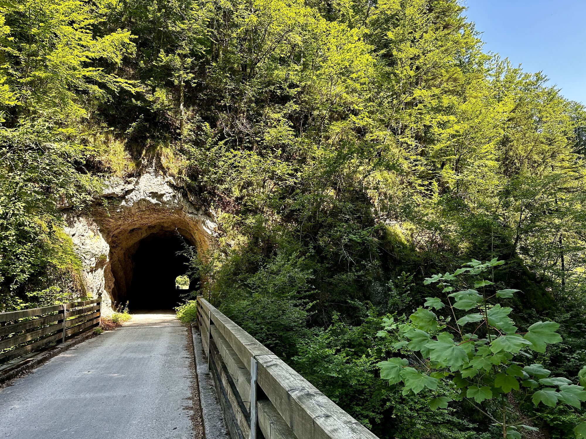
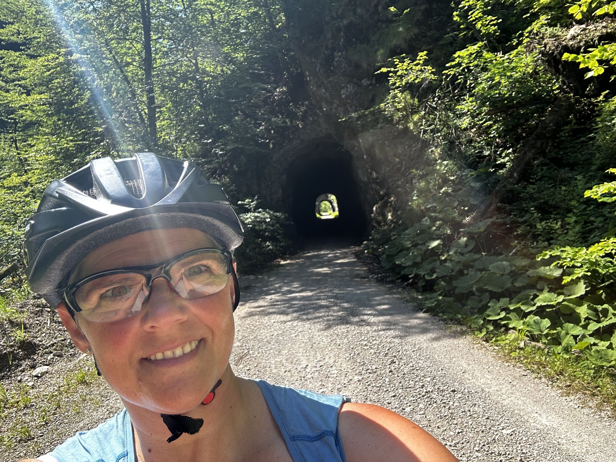
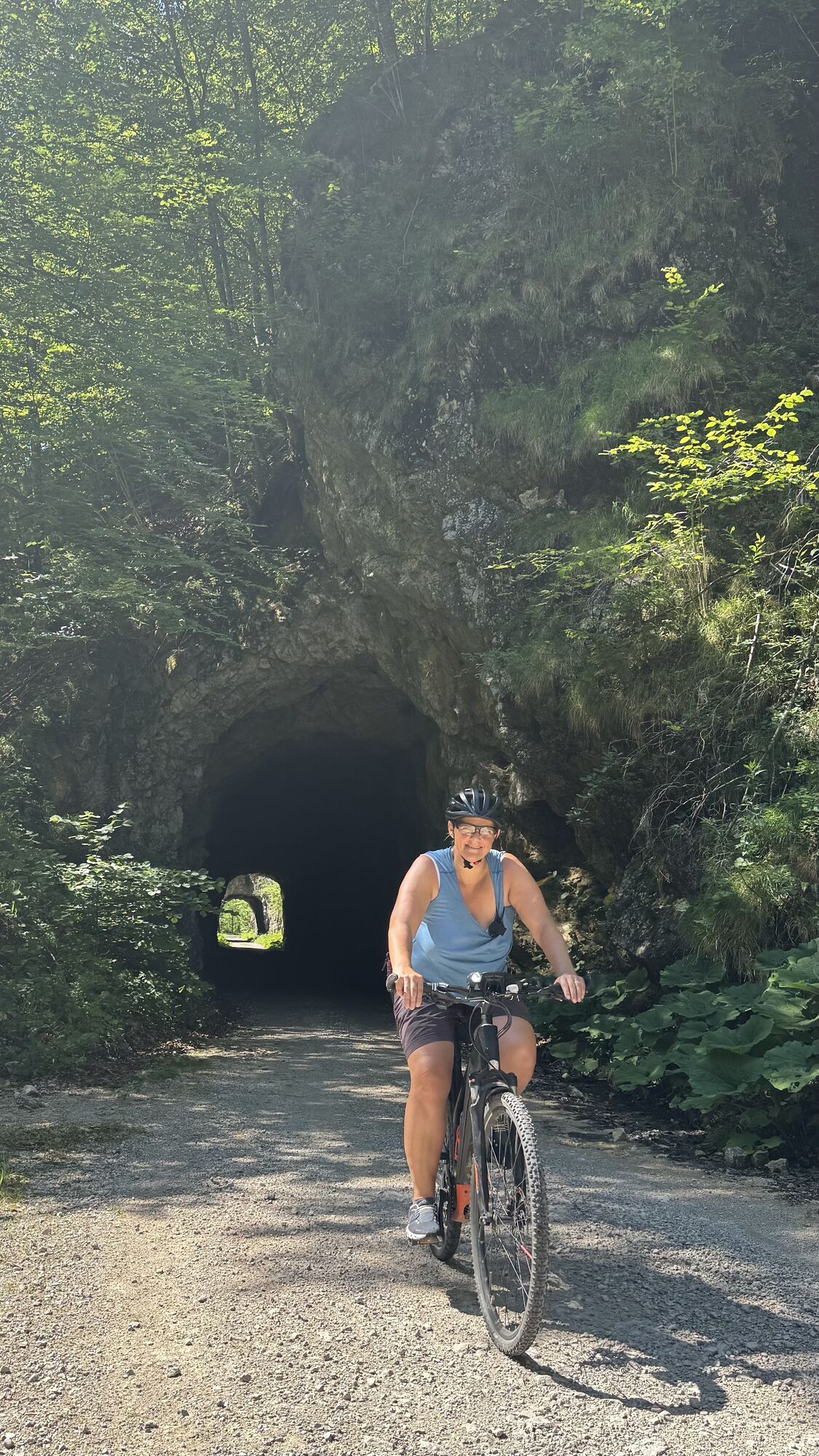
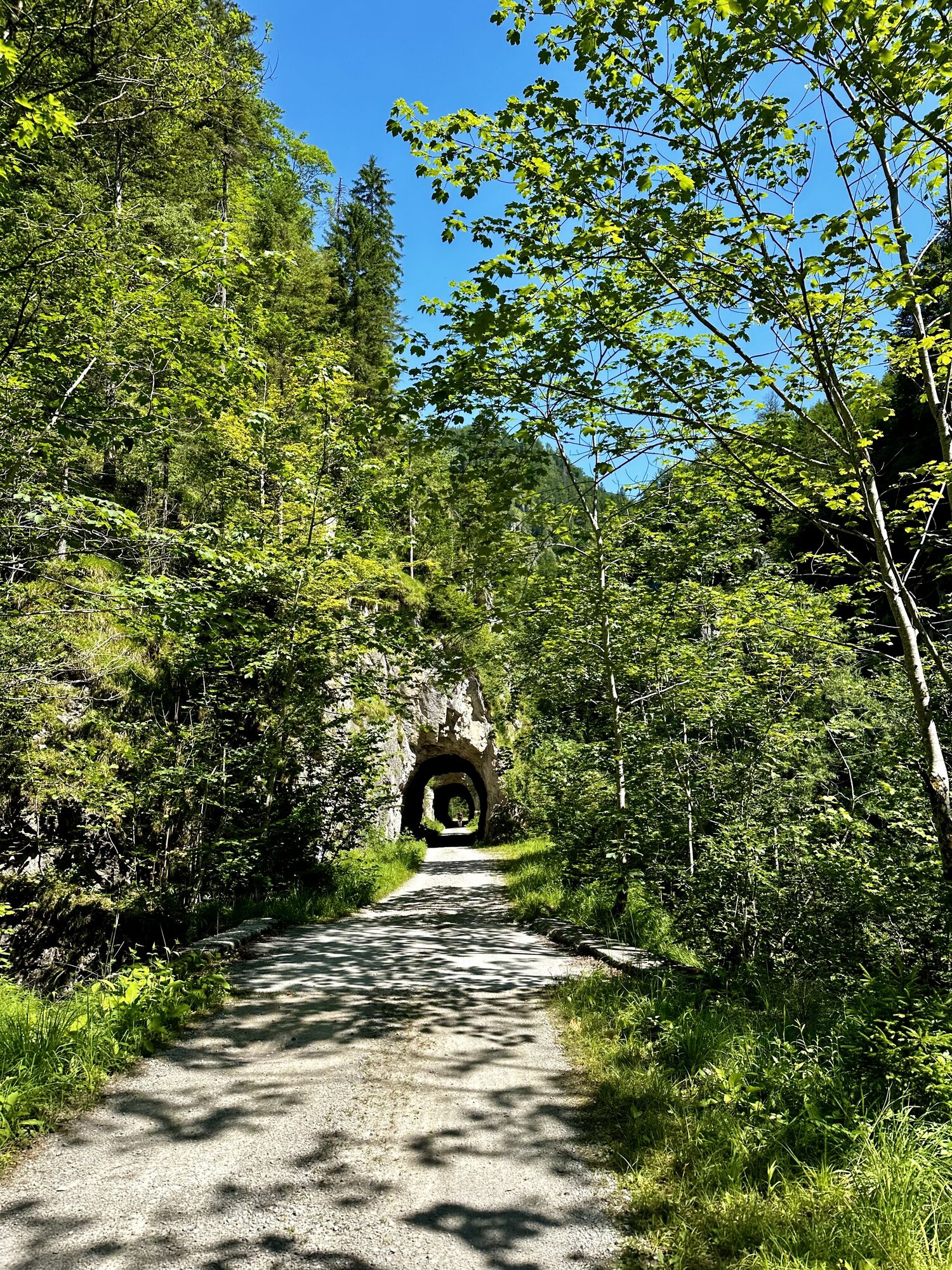
The "Triftsteig" has a length of about 2 km, leads slightly up and down along the right bank of the stream to the "Annerlsteg" (can also be walked in the opposite direction).Time required: "Triftsteig": 1 - 1.5 hrs.Total time required without round tour via the Anlaufalm: 3.5 - 4 hrs.RETURN via the forest road (several, longer tunnels; possibly torch) back to the Schleierfall and continue as for access.
VARIANT Return via Anlaufalm: 450 m altitude difference - 1.5 - 2 hrs; longer but highly recommended. As with a) back to the Schleierfall. Here branch off (sign: "Hochschlacht") on the partly steep trail (marked red, surefootedness required!) along the very beautiful Hochschlachtbach stream (view down to the "Triftsteig") up to the large alpine pasture area south of the Hochkogel. East to the Anlaufalm (982 m) and in the direction of the "Hirschkogelsattel" (no sign!) to the so-called "3 Bilder` (Marterl). Descend via the Sonnbergbach road to the starting point. All in all, a very beautiful and wildly romantic circular tour.
Ano
Via ferrata similar: mostly A, two short passages each A/B and B; in between always walking terrain, partly exposed (above the water surface). Partly secured with bolts and steel ropes. Only for experienced climbers!
Check the weather forecast before starting the tour. In summer, approaching thunderstorms in the Hintergebirge are often seen too late. There is no exit along the Triftsteig. Surefootedness and no fear of heights - only for experienced hikers!
Weißwasser car park, access via 8934 Unterlaussa/Mooshöhe (past the miners' house in the direction of Mooshöhe).Attention with navigation devices - access via Brunnbach is not possible! Driving ban and barriers at forest road
Car park Weißwasser, free of charge
For children and the less experienced, basic via ferrata equipment and possibly a short safety rope (for children) is recommended.
Oblíbené prohlídky v okolí
-
4.8
Kleiner Pyhrgas
středníTuristika 9.64 km -
4.3
Mannsberg
světloTuristika 7.62 km -
4.8
Ennser Hut - Almkogel (from Bamacher car park)
středníTuristika 3.53 km -
4.7
GROSSRAMING Bamacher, Burgspitz, Almkogel, Ennshütte 20240730
středníTuristika 10 km -
3.8
Wasserklotz
středníTuristika 5.81 km -
3.8
Ebenforstalm Rundtour
světloMountainbike 44.6 km -
4.7
Hoher Nock von Rettenbach Rettenbach, Windischgarsten,
středníTuristika 11.5 km -
5.0
Hoher Nock Rundweg über Hagler
heavyTuristika 15.4 km -
3.5
Hoher Nock
středníTuristika 16 km -
4.0
Ennser Hütte, Stallburgalm, Burgspitz, Almkogel
středníTuristika 11.6 km
Pěší turistika a stopování


Nenechte si ujít nabídky a inspiraci pro vaši příští dovolenou
Vaše e-mailová adresa byl přidán do poštovního seznamu.