







The gorges of the Chavanon
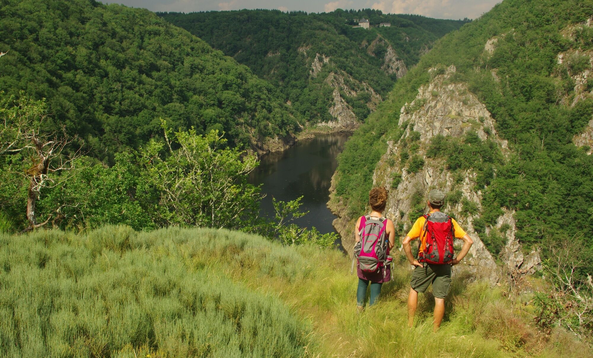
The Chavanon flows through a narrow valley to join the Dordogne. The steep slopes, covered with deciduous trees, shelter many plant and animal species.
Following the old railway line you will walk along...
The Chavanon flows through a narrow valley to join the Dordogne. The steep slopes, covered with deciduous trees, shelter many plant and animal species.
Following the old railway line you will walk along the Chavanon, near which you will discover the remains of former economic activities linked to water and fire: the Lagarde dam, mills, lime kilns of Gioux.

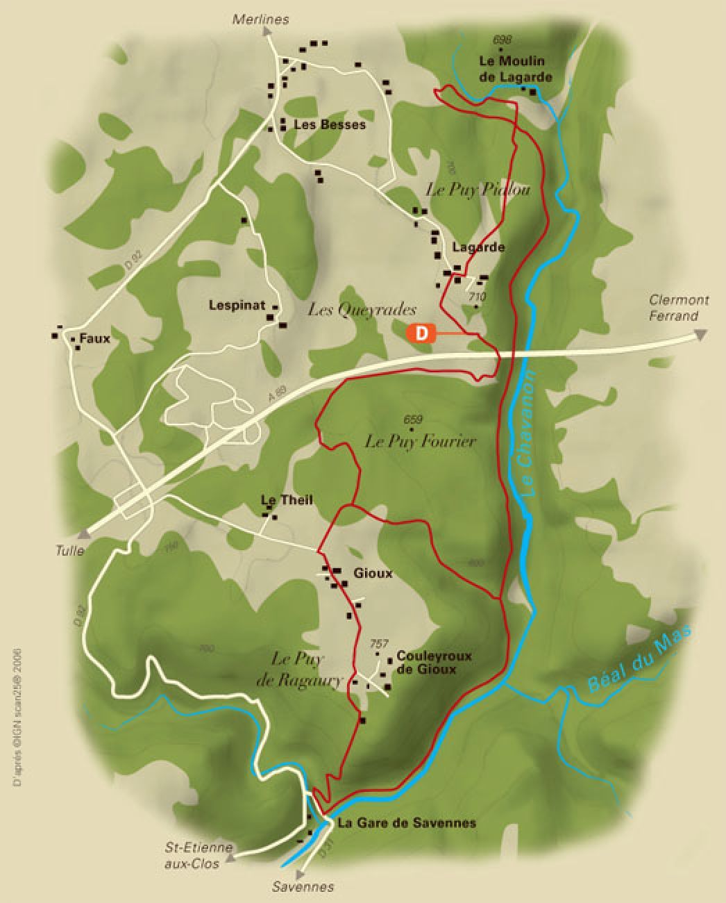

Follow the green waymarking.
Ano
Clothing suitable for the season and conditions (cold, hot, humid...)
Hiking boots suitable for the terrain (even for children!)
Hiking poles (useful for stability and to relieve joints)
Mobile phone and spare battery
Before departure:
Check the general and local weather ensuring no precipitation Get information on the approach walk, route elevation, duration, possible bailout (IGN map, GPS, guidebook, etc.) Assess possible risks by consulting mountain professionals, refuges, lodges Inform a close person of your plan and contact them in case of change: departure and return times, number of participants with each phone number, vehicle(s), parking Avoid going alone, use equipment suited to the activity, adjusted and in good condition, headlamp, complete first aid kit, survival blanket, etc.In case of problem
Alert: call 112 (European emergency number)
5 key points to communicate your alert:
Where? municipality, place, route, altitude Who? identity, phone number What? type of accident, number of victims, severity, fall dynamics When? time of accident Weather? wind, visibilityConsider carpooling
Parking available close to the starting point.
Please respect traffic rules.
Corrèze Tourism
45 Quai Aristide Briand,
19000 Tulle
Oblíbené prohlídky v okolí
-
La Corrézienne MTB
středníMountainbike 968.8 km -
A story along the water
heavyTuristika 13.4 km -
Leisure bike route La Vallée du Chavanon
světloJízda na kole 14.6 km -
Leisure bike route The Eygurande Plateau
středníJízda na kole 15.0 km -
Avèze - Plantades - Cheminade - Église de l'Assomption
středníTuristika 9.84 km -
La Courtine - Saint-Oradoux-de-Chirouze - Le Léoneix - Puy du Vareyron
heavyJízda na kole 29.2 km -
Lanobre - Église de la Translation-de-Saint-Martin - Église de la Sainte-Trinité - Église Saint-Jean-Baptiste
heavyMountainbike 57.3 km -
Au Petit Breuil - Église Saint-Médard - Église Saint-Martial-de-Limoges - Église de l'Assomption-de-la-Très-Sainte-Vierge
středníSilniční kolo 57.4 km -
Église Saint-Martin - La Borie - Église Saint-Martial-de-Limoges - Sornac
středníSilniční kolo 48.5 km -
Église Saint-Rémi - Église Saint-Martial-de-Limoges - Église Saint-Loup - Saint-Rémy
středníSilniční kolo 45.0 km
Pěší turistika a stopování


Nenechte si ujít nabídky a inspiraci pro vaši příští dovolenou
Vaše e-mailová adresa byl přidán do poštovního seznamu.





