Montelladonne - Église Saint-Laurent - Église Saint-Georges - Église Sainte-Croix
heavy
Navigace na stránkách
Navigace na stránkách
Pořiďte si tuto prohlídku do mobilního telefonu
Montelladonne - Église Saint-Laurent - Église Saint-Georges - Église Sainte-Croix
heavy
Silniční kolo
78.59
km
Naskenujte QR kód a spusťte navigaci v aplikaci bergfex.

Pěší turistika a stopování


Montelladonne - Église Saint-Laurent - Église Saint-Georges - Église Sainte-Croix
heavy
Vzdálenost
78.59
km
Doba trvání
04:12
h
Ascent
1346
hm
Hladina moře
430 -
760
m
Stažení skladby
Montelladonne - Église Saint-Laurent - Église Saint-Georges - Église Sainte-Croix
heavy
Silniční kolo
78.59
km
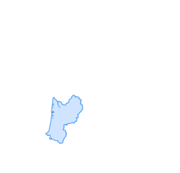
Trasa
Église Saint-Martial
(546 m)
Místo konání bohoslužeb
3.4 km
Église de l'Assomption-de-la-Très-Sainte-Vierge
(603 m)
Místo konání bohoslužeb
9.1 km
Église Saint-Laurent
(657 m)
Místo konání bohoslužeb
20.3 km
Chapelle de la Visitation
(733 m)
Místo konání bohoslužeb
27.9 km
Église Saint-Georges
(742 m)
Místo konání bohoslužeb
42.3 km
Église Sainte-Croix
(453 m)
Místo konání bohoslužeb
64.4 km
Saint-Amand
(544 m)
Vesnice
69.4 km
Trasa
Montelladonne - Église Saint-Laurent - Église Saint-Georges - Église Sainte-Croix
heavy
Silniční kolo
78.59
km
Montelladonne
(541 m)
Vypořádání
0.0 km
La Jonchère
(532 m)
Vypořádání
0.6 km
Le Foussat
(546 m)
Vypořádání
1.7 km
Saperlipopette
(547 m)
Restaurace
3.3 km
Église Saint-Martial
(546 m)
Místo konání bohoslužeb
3.4 km
Champagnat
(544 m)
Vesnice
3.4 km
Chez Gorce
(539 m)
Vypořádání
3.5 km
La Prade
(551 m)
Vypořádání
6.0 km
Chez Mafrand
(555 m)
Vypořádání
6.9 km
Chez Livet
(581 m)
Vypořádání
7.5 km
Le Montgeteix
(575 m)
Vypořádání
7.9 km
Bellegarde-en-Marche
(603 m)
Vesnice
9.0 km
Église de l'Assomption-de-la-Très-Sainte-Vierge
(603 m)
Místo konání bohoslužeb
9.1 km
Saint-Silvain-Bellegarde
(584 m)
Vesnice
10.2 km
Chez Aufaure
(531 m)
Vypořádání
11.2 km
Le Puy de Faux
(493 m)
Vypořádání
12.0 km
Le Faux
(499 m)
Vypořádání
12.7 km
Chez Villatte
(500 m)
Vypořádání
13.6 km
Chez Taverne
(526 m)
Vypořádání
14.5 km
Le Moulin Tixier
(508 m)
Vypořádání
14.9 km
Chez Mursolles
(567 m)
Vypořádání
16.2 km
Barreix
(576 m)
Vypořádání
16.6 km
Murzeix
(605 m)
Vypořádání
17.7 km
La Villetelle
(655 m)
Vesnice
20.1 km
Église Saint-Laurent
(657 m)
Místo konání bohoslužeb
20.3 km
La Celle
(669 m)
Vypořádání
21.4 km
La Marche
(674 m)
Vypořádání
21.9 km
Le Mazendreau
(698 m)
Vypořádání
22.5 km
Le Mouneix
(665 m)
Koridor/terén
23.2 km
Le Montély
(664 m)
Vypořádání
24.5 km
Chez Canard
(634 m)
Vypořádání
25.3 km
Chez Pilat
(665 m)
Vypořádání
25.9 km
Église Saint-Éloi
(761 m)
Místo konání bohoslužeb
27.8 km
Crocq
(742 m)
Vesnice
27.9 km
Chapelle de la Visitation
(733 m)
Místo konání bohoslužeb
27.9 km
Le Naberon Haut
(736 m)
Vypořádání
30.6 km
Le Naberon Bas
(692 m)
Vypořádání
31.1 km
Le Commandeur
(666 m)
Vypořádání
31.9 km
Longeaigue
(665 m)
Vypořádání
32.9 km
La Salandrouze
(628 m)
Vypořádání
35.3 km
La Cour
(587 m)
Vypořádání
38.9 km
La Nétange
(647 m)
Vypořádání
40.7 km
La Montagne Noire
(743 m)
Restaurace
42.2 km
Église Saint-Georges
(742 m)
Místo konání bohoslužeb
42.3 km
Saint-Georges-Nigremont
(739 m)
Vesnice
42.5 km
La Clidelle
(713 m)
Vypořádání
43.3 km
Chersoubre
(735 m)
Vypořádání
43.9 km
Les Cantines
(755 m)
Koridor/terén
45.4 km
Senoueix
(693 m)
Vypořádání
48.5 km
Felletin
(544 m)
Vesnice
53.9 km
L'auberge Felletinoise
(538 m)
Restaurace
54.0 km
Le Pont des Malades
(513 m)
Vypořádání
55.1 km
Charasse Plaine
(582 m)
Vypořádání
58.9 km
Les Châtres
(560 m)
Vypořádání
61.4 km
L'Arbre de la Vierge
(552 m)
Vypořádání
62.0 km
Aubusson
(431 m)
Město
64.2 km
Église Sainte-Croix
(453 m)
Místo konání bohoslužeb
64.4 km
Les Combadeaux
(469 m)
Vypořádání
66.4 km
Le Fôt
(494 m)
Vypořádání
67.6 km
Les Combas
(533 m)
Vypořádání
68.5 km
Les Clauzets
(532 m)
Vypořádání
68.9 km
Saint-Amand
(544 m)
Vesnice
69.4 km
Chez la Marcelle
(547 m)
Restaurace
69.5 km
Les Ardeliers
(558 m)
Sousedství
69.6 km
Poux
(576 m)
Vypořádání
70.3 km
Le Courtioux
(571 m)
Vypořádání
70.6 km
La Croix de la Fortune
(603 m)
Koridor/terén
71.8 km
La Chaussade
(615 m)
Vesnice
72.2 km
La Fayolle
(564 m)
Vypořádání
73.5 km
Seauve
(524 m)
Vypořádání
76.4 km
Montelladonne
(541 m)
Vypořádání
78.6 km
Zatím žádné recenze
Oblíbené prohlídky v okolí
-
Around the Nigremont
středníMountainbike 7.92 km -
Aubusson and its valley route
středníTuristika 7.86 km -
Valleys and Castles Route - Felletin
středníTuristika 21.0 km -
The pond loop
světloTuristika 2.74 km -
D'Aubusson à Felletin par le GR ®4/ GR®46 et le GR® 89 en écomobilité
středníTuristika 37.2 km -
Circuit de randonnée : Autour du Nigremont
světloTuristika 7.85 km -
Circuit de randonnée : Le tour du Jarissou
světloTuristika 3.43 km -
Boucle Vélo N°32 - Autour de Nigremontis
světloJízda na kole 23.5 km -
Circuit de randonnée chemin des Douaniers
středníTuristika 11.7 km -
Boucle vélo N°42 - de la Beauze à la Creuse
heavyJízda na kole 31.4 km
Pěší turistika a stopování

Více než 550.000 návrhů výletů, podrobné mapy a intuitivní plánovač tras dělají z aplikace nezbytnou výbavu pro všechny milovníky přírody.

Nenechte si ujít nabídky a inspiraci pro vaši příští dovolenou
Přihlaste se k odběru newsletteru
Chyba
Došlo k chybě. Zkuste to prosím znovu.
Děkujeme za vaši registraci
Vaše e-mailová adresa byl přidán do poštovního seznamu.
Zájezdy po celé Evropě
Rakousko
Švýcarsko
Německo
Itálie
Slovenia
Francie
Nizozemsko
Belgie
Polsko
Lichtenštejnsko
Česko
Slovensko
Španělsko
Chorvatsko
Bosna a Hercegovina
Lucembursko
Andorra
Portugal
Iceland
United Kingdom
Ireland
Greece
Albania
North Macedonia
Malta
Norway
Montenegro
Moldova
Kosovo
Hungary
San Marino
Romania
Estonia
Latvia
Belarus
Cyprus
Lithuania
Serbia
Bulgaria
Monaco
Denmark
Sweden
Finland