Boucle de Veyrignac
světlo
Pořiďte si tuto prohlídku do mobilního telefonu
Boucle de Veyrignac
světlo
Mountainbike
13,79
km
Naskenujte QR kód a spusťte navigaci v aplikaci bergfex.

Pěší turistika a stopování


Boucle de Veyrignac
světlo
Vzdálenost
13,79
km
Doba trvání
01:43
h
Ascent
285
hm
Hladina moře
94 -
191
m
Stažení skladby
Boucle de Veyrignac
světlo
Mountainbike
13,79
km
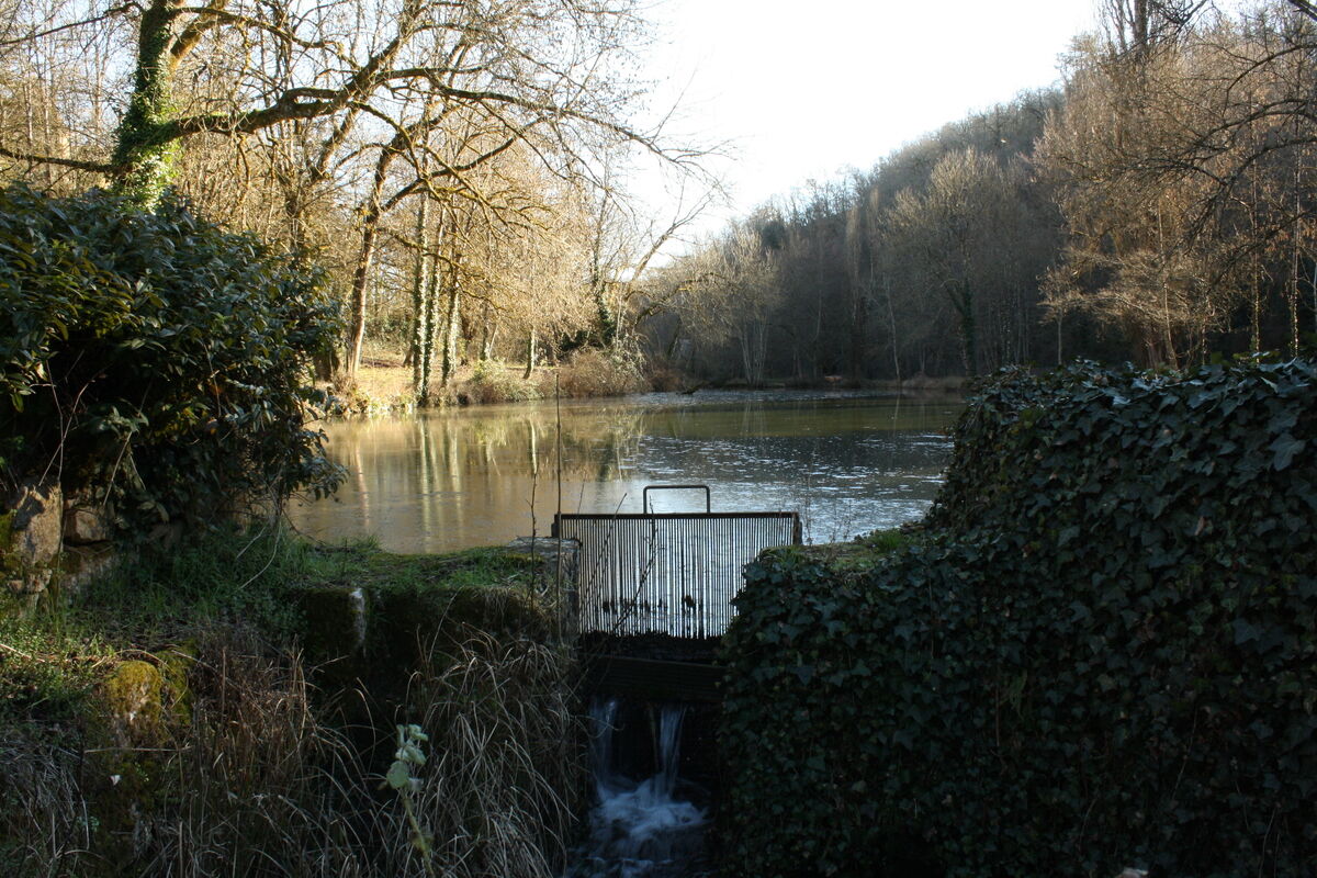
You will begin the hike by the village of Veyrignac, typical village of the Périgord Noir. Your route will be marked out by beautiful stone buildings: fountain, stone hut, mills...
From the call sign located...
Popis
You will begin the hike by the village of Veyrignac, typical village of the Périgord Noir. Your route will be marked out by beautiful stone buildings: fountain, stone hut, mills...
From the call sign located on the municipal parking lot, join the road and go left in the direction of "Château de Fénelon". After 30m, at the crossroads, take the small road on the left. 100m further, at the gate of a large property, turn right and follow the stone wall. After about 50m, turn right towards the church, then the communal oven. At the end of the village, leave the road and take a grassy path on the right that goes down to a fountain.
The topoguide containing the route of this hike is available for purchase in our tourist offices in Carlux and Salignac.
Trasa
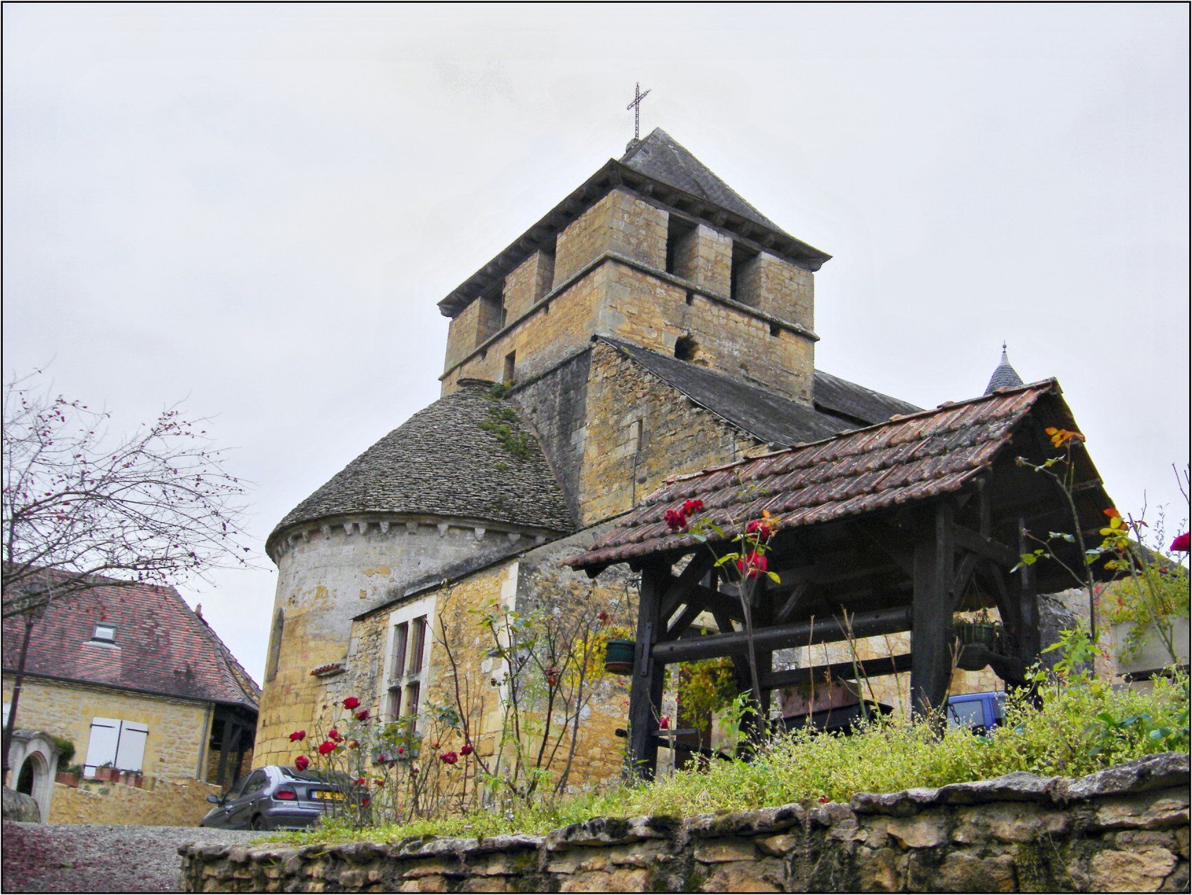
Église Saint-Pierre-ès-Liens
(116 m)
Místo konání bohoslužeb
0,4 km
La Gauille
(94 m)
Vypořádání
0,7 km
La Rue
(122 m)
Vypořádání
3,3 km
Sainte-Mondane
(83 m)
Vesnice
4,2 km
Au Pigeonnier
(177 m)
Vypořádání
8,4 km
La Barthe
(135 m)
Vypořádání
11,8 km
Barajoux
(129 m)
Vypořádání
13,0 km
Trasa
Boucle de Veyrignac
světlo
Mountainbike
13,79
km
Valeille
(127 m)
Vypořádání
0,0 km
Mespoulet
(132 m)
Vypořádání
0,2 km
Église Saint-Pierre-ès-Liens
(116 m)
Místo konání bohoslužeb
0,4 km
Veyrignac
(116 m)
Vesnice
0,4 km
La Gauille
(94 m)
Vypořádání
0,7 km
Sur la Font
(106 m)
Vypořádání
0,8 km
Vigier
(107 m)
Vypořádání
1,1 km
Combe Long
(127 m)
Vypořádání
1,6 km
La Rue
(122 m)
Vypořádání
3,3 km
Redon
(116 m)
Vypořádání
3,5 km
Le Moulin Haut
(92 m)
Vypořádání
3,6 km
La Baraque
(137 m)
Vypořádání
3,9 km
Sainte-Mondane
(83 m)
Vesnice
4,2 km
Le Moulin du Roc Blanc
(120 m)
Vypořádání
5,9 km
Ponchet
(172 m)
Vypořádání
7,3 km
Rocanadel
(184 m)
Vypořádání
7,6 km
Au Pigeonnier
(177 m)
Vypořádání
8,4 km
Le Pas de la Lande
(151 m)
Vypořádání
10,6 km
Les Chauprières
(144 m)
Vypořádání
11,0 km
Réchou
(142 m)
Vypořádání
11,3 km
La Barthe
(135 m)
Vypořádání
11,8 km
Labarthe
(140 m)
Vypořádání
12,5 km
Le Grézal
(141 m)
Vypořádání
13,0 km
Barajoux
(129 m)
Vypořádání
13,0 km
Valeille
(127 m)
Vypořádání
13,2 km
Veyrignac
(116 m)
Vesnice
13,6 km

Informace o trase
Vhodné pro invalidní vozíky
Ano
Další informace a tipy
Další informace
OT du pays de Fénelon
Tipy
Zatím žádné recenze
Oblíbené prohlídky v okolí
Boucle La Salamandre
světloTuristika 5,57 kmBoucle de Montfort
světloTuristika 7,85 kmTrail de la Vallée
středníTrailrunning 14,9 kmBoucle des Gabarres
světloTuristika 3,25 kmBoucle des Cygnes Noirs
středníTuristika 2,72 km- 5,0
Jardins et villages du Sarladais
heavyJízda na kole 53,1 km Boucle du Paluel
středníTuristika 10,3 kmGRP® du Pays de Fénelon
středníTuristika 174,6 kmBoucle des Chênes Verts
světloTuristika 9,71 kmCarlux en écomobilité - Plein les yeux à la gare Doisneau
světloJízda na kole 16,8 km
Pěší turistika a stopování

Více než 550.000 návrhů výletů, podrobné mapy a intuitivní plánovač tras dělají z aplikace nezbytnou výbavu pro všechny milovníky přírody.

Nenechte si ujít nabídky a inspiraci pro vaši příští dovolenou
Přihlaste se k odběru newsletteru
Chyba
Došlo k chybě. Zkuste to prosím znovu.Děkujeme za vaši registraci
Vaše e-mailová adresa byl přidán do poštovního seznamu.
Zájezdy po celé Evropě
Rakousko Švýcarsko Německo Itálie Slovenia Francie Nizozemsko Belgie Polsko Lichtenštejnsko Česko Slovensko Španělsko Chorvatsko Bosna a Hercegovina Lucembursko Andorra Portugal Iceland United Kingdom Ireland Greece Albania North Macedonia Malta Norway Montenegro Moldova Kosovo Hungary San Marino Romania Estonia Latvia Belarus Cyprus Lithuania Serbia Bulgaria Monaco Denmark Sweden Finland