
Boucle VTT Rouffignac-Le Moustier (N°5)
světlo
Pořiďte si tuto prohlídku do mobilního telefonu
Boucle VTT Rouffignac-Le Moustier (N°5)
světlo
Mountainbike
47.45
km
Naskenujte QR kód a spusťte navigaci v aplikaci bergfex.


Pěší turistika a stopování



Boucle VTT Rouffignac-Le Moustier (N°5)
světlo
Vzdálenost
47.4
km
Doba trvání
05:01
h
Ascent
815
hm
Hladina moře
64 -
291
m

Navigujte po trase v aplikaci
Nainstalujte si aplikaci zdarma a mějte trasu vždy na očích díky GPS navigaci a sledování polohy.
Využijte nyní službu „ bergfex “ v aplikaci
Naskenuj QR kód pomocí fotoaparátu
Jakmile je aplikace nainstalována, obsah se otevře přímo. Pokud aplikaci ještě nemáš, budeš přesměrován na stránku, kde si ji můžeš zdarma stáhnout.
Stažení skladby
Boucle VTT Rouffignac-Le Moustier (N°5)
světlo
Mountainbike
47.45
km
This very difficult loop (black), in the heart of the Vézère valley in Périgord Noir, proposes to discover mainly the village of Rouffignac-St Cernin close to the hundred mammoths cave, then Tursac with...
Popis
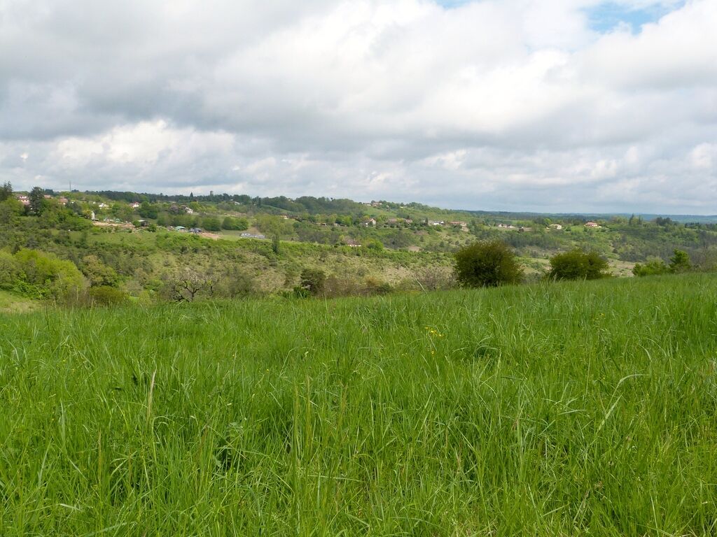
This very difficult loop (black), in the heart of the Vézère valley in Périgord Noir, proposes to discover mainly the village of Rouffignac-St Cernin close to the hundred mammoths cave, then Tursac with the sites of the Madeleine and the Maison Forte of Reignac, the village of Peyzac Le Moustier with the troglodytic site of the Roque St Christophe and finally the village of Plazac with its beautiful point of view.
The departure is from the sports complex (ESES). At the starting point, there is a bicycle rental and repair service, a bicycle washing station, toilets, restaurants and overnight accommodation.
The departure is from the sports complex (ESES). At the starting point, there is a bicycle rental and repair service, a bicycle washing station, toilets, restaurants and overnight accommodation.
Trasa
Rouffignac
(283 m)
Vesnice
0.9 km
Urgyen Samye Chöling
(124 m)
Místo konání bohoslužeb
31.3 km
Cordestieux
(96 m)
Vypořádání
37.6 km
Plazac
(117 m)
Vesnice
37.8 km
La renaissance
(278 m)
Restaurace
46.4 km
Église Saint-Germain-de-Rouffignac
(279 m)
Místo konání bohoslužeb
46.5 km
Rouffignac
(283 m)
Vesnice
46.7 km
Trasa
Boucle VTT Rouffignac-Le Moustier (N°5)
světlo
Mountainbike
47.45
km
Rouffignac
(283 m)
Vesnice
0.9 km
Lespinasse
(85 m)
Vypořádání
26.9 km
Le Moustier
(67 m)
Vypořádání
29.5 km
Urgyen Samye Chöling
(124 m)
Místo konání bohoslužeb
31.3 km
Cordestieux
(96 m)
Vypořádání
37.6 km
Plazac
(117 m)
Vesnice
37.8 km
La renaissance
(278 m)
Restaurace
46.4 km
Église Saint-Germain-de-Rouffignac
(279 m)
Místo konání bohoslužeb
46.5 km
Rouffignac
(283 m)
Vesnice
46.7 km
Autor
Poskytuje Intense Périgord Noir
Prohlídku Boucle VTT Rouffignac-Le Moustier (N°5) zajišťuje outdooractive.com.


Informace o trase
Trasa
Seguire le indicazioni arancioni del triangolo MTB, adesivo nero n. 5
Vhodné pro invalidní vozíky
Ano
Vybavení
To be seen by motorists on stretches of country road.
Bezpečnostní pokyny
In the event of a problem, call 112 or 15 / For the deaf, hard of hearing or aphasic: call 114
Informace o příjezdu
Příjezd
From Périgueux: follow signs for Thenon / Brive, then in Thenon, take the D67 towards Rouffignac-Saint-Cernin.
From Sarlat: take the D47 via Les Eyzies, then the D31 towards Fleurac/Rouffignac.
Parkování
Parking available at the Rouffignac multisport complex
Další informace a tipy
Další informace
OT Lascaux Dordogne Vallée Vézère
www.lascaux-dordogne.com
Tipy
Yellow
Zatím žádné recenze
Oblíbené prohlídky v okolí
-
5.0
Boucle de la Turançonnaise n°14 / La Chapelle Aubareil
středníTuristika 9.42 km -
5.0
Boucle Promenade de Lascaux n° 17 / Montignac
středníTuristika 6.95 km -
5.0
Boucle de la Ferrassie n° 26 / Savignac de Miremont
světloTuristika 7.46 km -
Boucle La Combe du Loup
světloTuristika 12.9 km -
5.0
Boucle de l'Albaroise n° 15 / La Chapelle Aubareil
středníJízda na koni 9.86 km -
Boucle de la Fontaine des Graves
středníTuristika 8.99 km -
Voie verte Les Eyzies/Saint-Chamassy
světloTuristika 22.1 km -
5.0
Boucle de la Forêt Sud / de la Marquise n° 4 / Campagne
světloJízda na koni 3.87 km -
Boucle de Saint Quentin
středníTuristika 14.0 km -
5.0
Boucle des Combes à Audrix n° 35 / Audrix
světloTuristika 4.41 km
Pěší turistika a stopování

Více než 550.000 návrhů výletů, podrobné mapy a intuitivní plánovač tras dělají z aplikace nezbytnou výbavu pro všechny milovníky přírody.

Nenechte si ujít nabídky a inspiraci pro vaši příští dovolenou
Přihlaste se k odběru newsletteru
Chyba
Došlo k chybě. Zkuste to prosím znovu.
Děkujeme za vaši registraci
Vaše e-mailová adresa byl přidán do poštovního seznamu.
Zájezdy po celé Evropě
Rakousko
Švýcarsko
Německo
Itálie
Slovenia
Francie
Nizozemsko
Belgie
Polsko
Lichtenštejnsko
Česko
Slovensko
Španělsko
Chorvatsko
Bosna a Hercegovina
Lucembursko
Andorra
Portugal
Iceland
United Kingdom
Ireland
Greece
Albania
North Macedonia
Malta
Norway
Montenegro
Moldova
Kosovo
Hungary
San Marino
Romania
Estonia
Latvia
Belarus
Cyprus
Lithuania
Serbia
Bulgaria
Monaco
Denmark
Sweden
Finland


