


GR® de Pays du Midi Corrézien
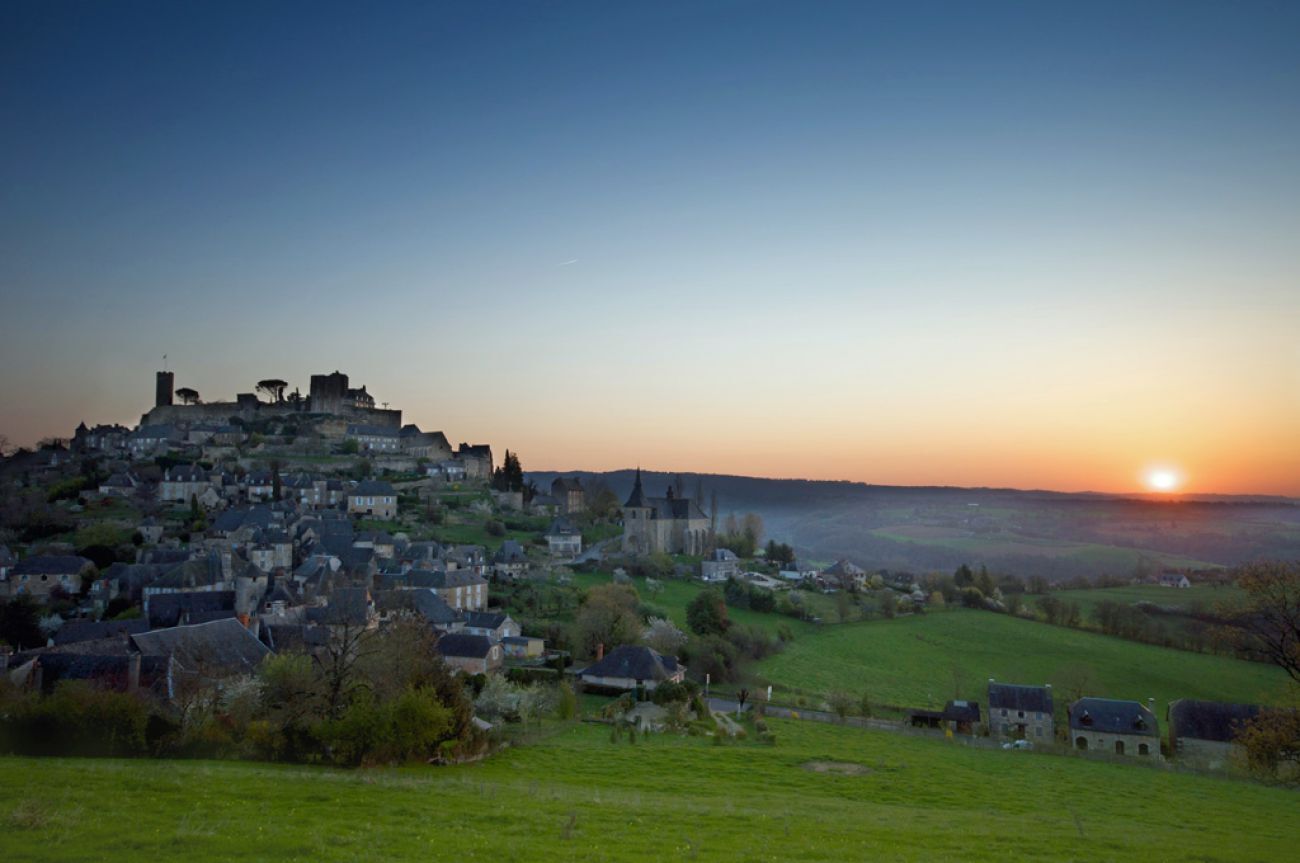
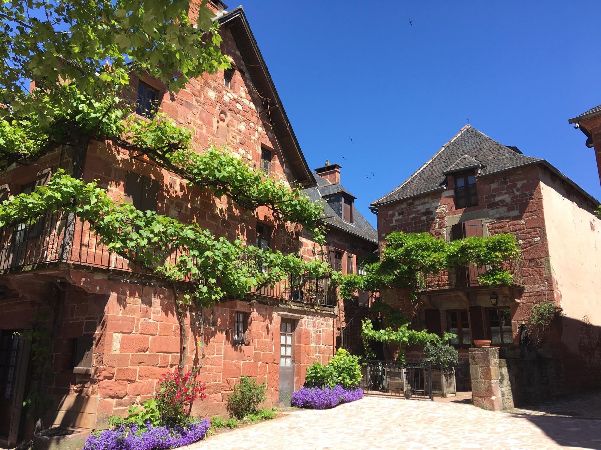
Come and be amazed and enjoy an exceptional heritage throughout your stay where each stage has many discoveries in store for you: Turenne and its castle, the fortified church of Noailhac, Collonges la...
Come and be amazed and enjoy an exceptional heritage throughout your stay where each stage has many discoveries in store for you: Turenne and its castle, the fortified church of Noailhac, Collonges la Rouge with its castles and houses in turrets, Meyssac and its grain hall, Curemonte with its three castles, three churches and its orientation table, Saillac with its church with a polychrome tympanum and its oil mill...
For a stopover in accommodation, a restaurant or the transport of your luggage, the "travel companions" of the Corrèze Departmental Hiking Committee will give you the best welcome.

Pavement markings: yellow and red.
Ano
Ano
Adapted clothing for the season and conditions (cold, hot, wet…)
Hiking shoes adapted to the terrain (even for children!)
Hiking boots (useful for stability and to take the strain off the joints)
Hiking boots (useful for stability and to take the strain off the joints)
Mobile phone and spare battery
Before you leave:
Find out about the general and local weather, making sure there are no precipitations Inform yourself about the approach walk, height of the route, travel time, possible map (IGN map, GPS, topo-guide, etc…) Evaluate the possible risks by getting information from mountain professionals, refuge, gîtes Inform someone close to you of your objective and contact them again if there are any changes: departure and return times, number of participants with the telephone number of each, vehicle(s), parking Avoid going alone, use equipment that conforms to the practice of the activity, that is safe and in good condition, a headlamp, a complete first aid kit, a survival blanket, etc.In case of problems
Alerter: call 112 (European emergency number)
5 key points to pass on your alert:
Where? commune, location, route, altitude Who? identity, telephone number What? type of accident, number of victims, gravity, fall kinetics When? time of the accident. When? wind, visibility.Take exit 53 from the A20, then continue on the D19 following the direction of Turenne.
Please note that parking is available in the village opposite the Turenne tourist office or near the post office.
Departmental FFRandonnet Committee of the Corrèze
Tél. : 05 55 26 91 90
Email: correze@ffrandonnee.fr
www.correze.ffrandonnee.fr
Oblíbené prohlídky v okolí
-
The most beautiful Corrèze villages... and the most beautiful climbs
heavySilniční kolo 74.3 km -
Around the castles
světloTuristika 6.83 km -
From the Puy to the Canal
středníTuristika 9.36 km -
The Straw Wine and Castles Route
světloSilniční kolo 18.0 km -
Leisure cycling route: the red stones
světloJízda na kole 14.2 km -
At the borders of Quercy
středníMountainbike 15.4 km -
The Roche de Vic Path
světloMountainbike 16.4 km -
The Étang de Miel
světloMountainbike 13.5 km -
Special quiet roads in the South of Corrèze
středníSilniční kolo 48.9 km -
Les Petites Crêtes
světloMountainbike 9.61 km
Pěší turistika a stopování


Nenechte si ujít nabídky a inspiraci pro vaši příští dovolenou
Vaše e-mailová adresa byl přidán do poštovního seznamu.