


Route "1291" Stage 6: Entlebuch – Sursee
Úroveň obtížnosti: 2
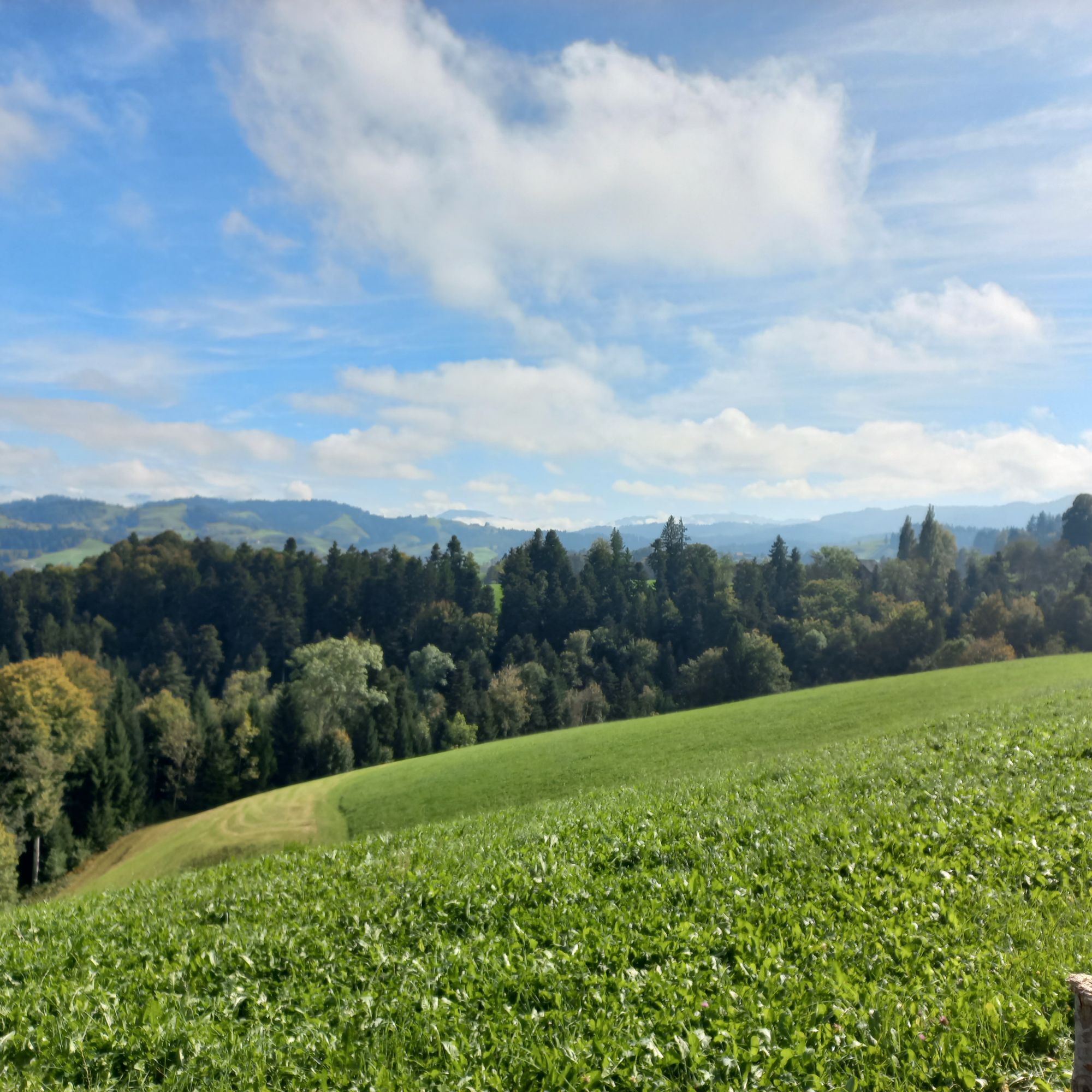
Today's stage is characterized by contrasts: The start is in the village of Entlebuch, from where the route leads via Doppleschwand and Romoos towards the Napf area. You follow the Napf heart loop and...
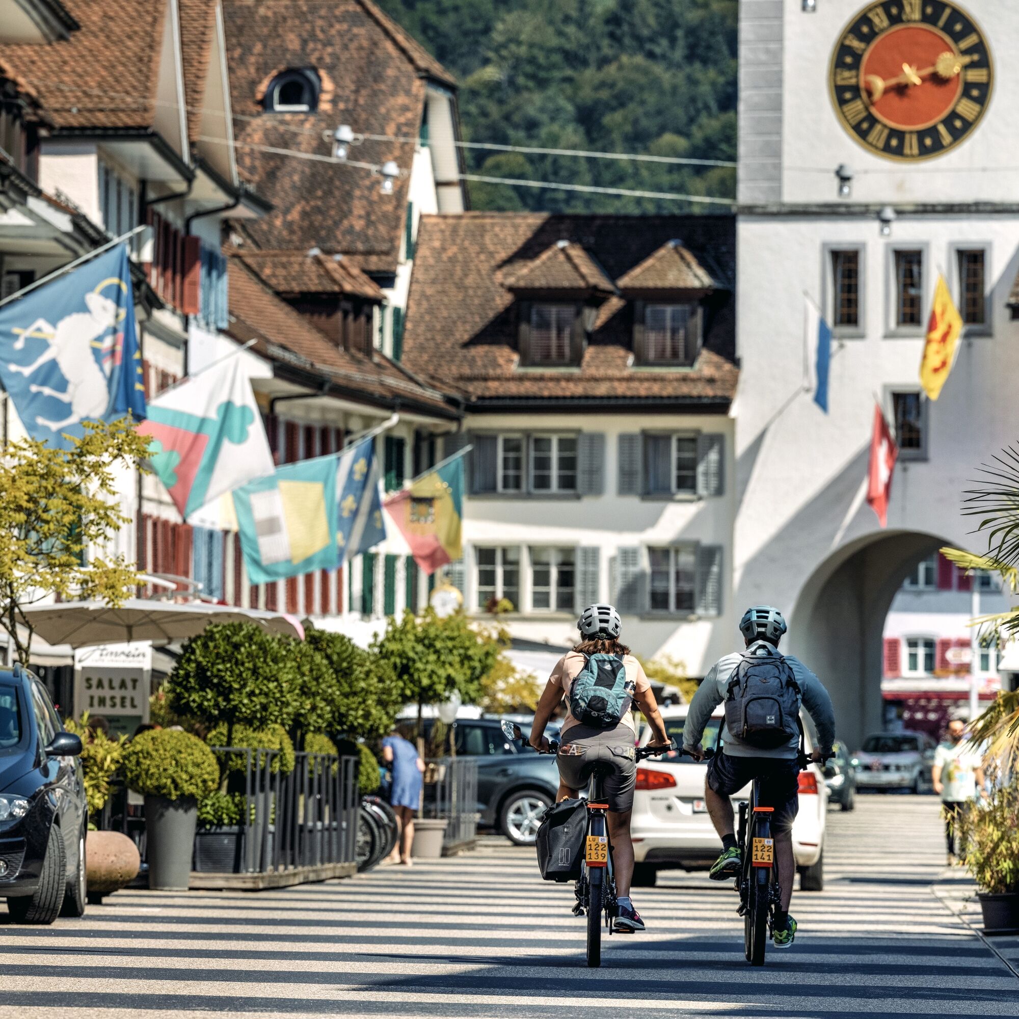
Today's stage is characterized by contrasts: The start is in the village of Entlebuch, from where the route leads via Doppleschwand and Romoos towards the Napf area. You follow the Napf heart loop and reach Menzberg, Luthern, and finally Hergiswil near Willisau. The landscape now becomes not only flatter but also more urban. A small detour through the historic town of Willisau is another highlight of Route 1291. Soon another follows, as just a few kilometers further is the town of Sursee, which also impresses with historic buildings and city walls.
Route length: approx. 70 km | ascent 1354 m | descent 1570 m

From Entlebuch, the route leads along the Napf heart loop via Doppleschwand, Romoos, Menzberg, and Luthern to Willisau. From here, you follow the path to Ettiswil and further into the historic town of Sursee.
On this route, observe the local signage. On some sections, there is partly a ban on fast e-bikes (45 km/h with yellow number). Here you will find the traffic signals and their meaning.
When passing through farms, we thank you on behalf of the farmers for passing at an adapted, reduced speed.
If you do not own your own e-bike, we recommend "Rent a Bike". Rent the e-bike suitable for you online and pick it up conveniently at Lucerne station.
Please stay on the path and do not ride on meadows and pastures. Pay closer attention to other road users in the busy traffic around Willisau and Sursee.
On this route, observe the local signage. On some sections, there is partly a ban on fast e-bikes (45 km/h with yellow number). Hereyou will find the traffic signals and their meaning.
When passing through farms, we thank you on behalf of the farmers for passing at an adapted, reduced speed.
2
Historical Highlights of stage 6
Willisau: Old townCulinary Highlights of stage 6
Willisau: Café Amrein
Kottwil: Regiochäsi WillisauAccommodation tips for stage 6
Entlebuch: Hotel Drei Könige, BnB Schafbuur Sursee: Hotel SurseeTreat yourself to an original Willisauer Ringli in the old town of Willisau: original Willisauer Ringli.
In Sursee, the historic old town and the refreshing Lake Sempach are attractions.
Oblíbené prohlídky v okolí
- 3.9
Menzberg - Napf - Menzberg
středníTuristika 17.7 km - 5.0
"Grosse Welt" round walk in Schwarzenberg
Turistika 7.46 km - 5.0
Morgen Marsch auf Napf?
středníTuristika 7.21 km - 5.0
Napf im Emmental
světloTuristika 6.99 km - 4.5
Heiligkreuz - First - Heiligkreuz
světloTuristika 5.81 km - 3.3
Luthern Bad - Napf - Grüeblihängst - Eyflue
středníTuristika 8.67 km Circular route Willisau - Wyher Water Castle - Alberswil
světloJízda na kole 24.2 km- 5.0
Luthern Bad - Napf - Grüeblihängst - Gasthaus Hirschen
heavySněžnice 8.52 km Finsterwald - Wissenegg- Alpiliegg - Feldmoos
světloTuristika 9.37 km- 5.0
Round tour Ebnet - Staldig
světloTuristika 11.6 km

Pěší turistika a stopování


Nenechte si ujít nabídky a inspiraci pro vaši příští dovolenou
Vaše e-mailová adresa byl přidán do poštovního seznamu.