







The road vegia de la Bratta

A narrow, steep mule track. This was the only link between Bratta and the village along with a few other paths until the middle of the last century. In the 1950s the construction of a new driveway began,...
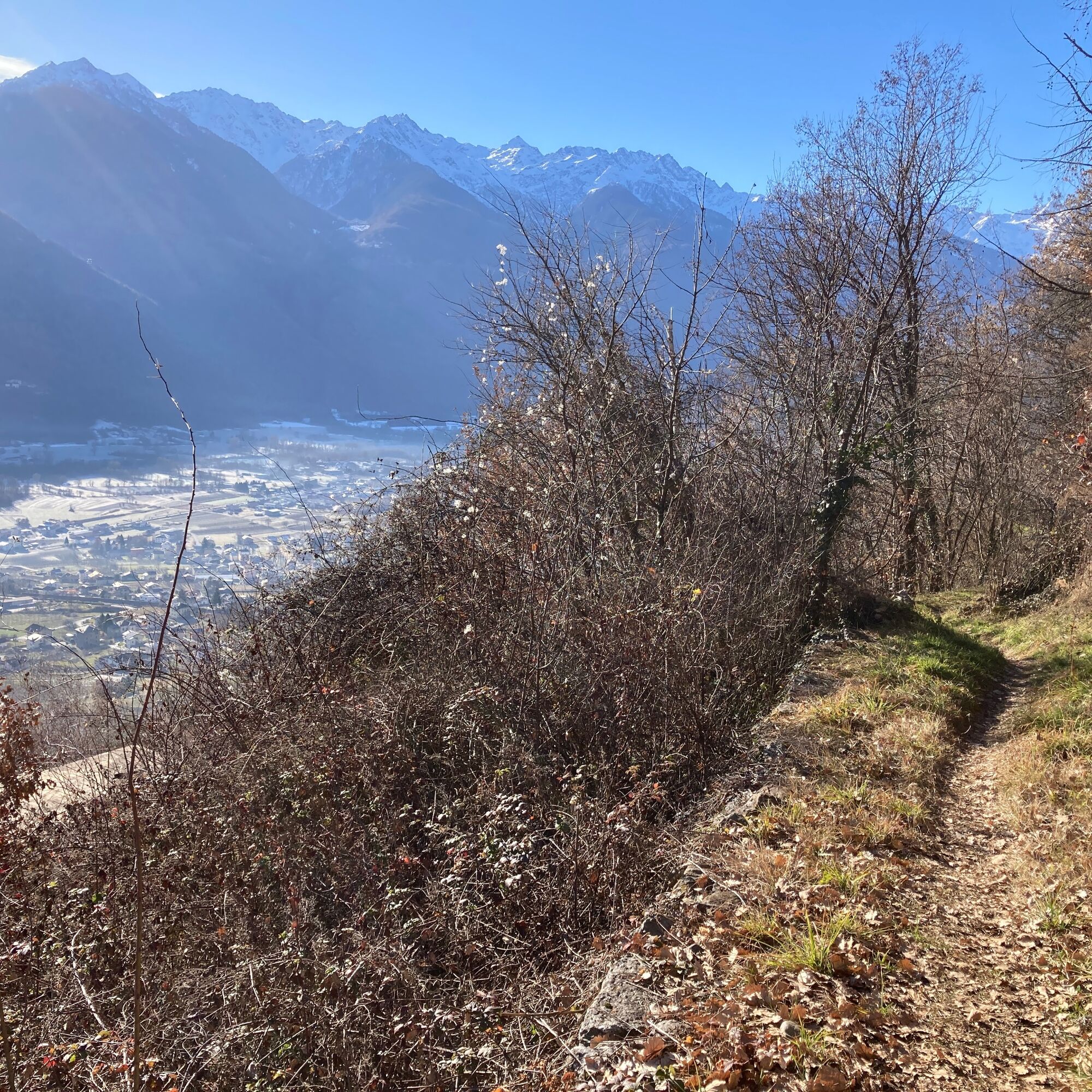
A narrow, steep mule track. This was the only link between Bratta and the village along with a few other paths until the middle of the last century. In the 1950s the construction of a new driveway began, which reached the hamlet in 1971, in time to unfortunately see the village depopulated. Since then Bratta has been frequented mostly in the summer period as a resort. The old road preserves evidence of past peasant life, particularly the typical stone 'baitei' with circular roofs. At several points the mule track, mostly immersed in the forest, meets the driveway. From the Hotel Altavilla one climbs along Via Ai Monti until it meets, crosses the Valle stream and continues on Via Prada where the paved road gives way to dirt road.

Follow the light green signs for the 'Vegia di Bratta Road'.
At certain times of the year Printed Materials it is possible to find nettles along the path so it is preferable to wear long pants.
It is not possible to get there by public transportation, unless you extend the route starting from Piazza Vanoni and following Via Ai Monti from there until you reach Hotel Altavilla.
It is possible to park at the public parking lot on Via Selva, however, trying to avoid lunchtime when it is difficult to find a free parking space.
It is a trail that is also accessible to mountain bikes, but be careful especially on the descent because in some places the slope is steep and the surface slippery.
There is a water fountain at the beginning of the route and one at the top of the town, at the büi de Prada Olta, but then up to Bratta there are no others available so it is advisable to bring a full water bottle, especially if you go in summer.
Oblíbené prohlídky v okolí
- 4.5
Rifugio Curo’ e lago del Barbellino - lago naturale del Barbellino - lago Gelt
heavyTuristika 26.4 km - 4.0
Giro del Lago - Le prese - Miralago
světloTuristika 7.43 km Val dal Saient - Short version
Turistika 11.4 km- 5.0
32.05 Poschiavo - Tirano, Trans Altarezia Bike
heavyMountainbike 29.1 km Stezka Valtellina
středníJízda na kole 113.2 km33.10 Le Prese - Tirano, Via Albula / Bernina
středníTuristika 14.6 km- 5.0
Runchett da Sotsassa
středníTematická stezka 1.54 km Charcoal Burner Route San Romerio
heavyTematická stezka 2.91 km30.06 Alp Grüm - S. Romerio, ViaValtellina
středníTuristika 20.0 km- 3.0
Gentle Forest Trail
světloTuristika 4.46 km
Pěší turistika a stopování


Nenechte si ujít nabídky a inspiraci pro vaši příští dovolenou
Vaše e-mailová adresa byl přidán do poštovního seznamu.





