


Donadivo - Cermine - Alpe Cima hike
Every mule track is a masterpiece of ingenuity and taste. The long mule track that climbs from Gordona to the Alpe Cermine is among the most beautiful in Valchiavenna. It is the so-called benefactor’s...
Every mule track is a masterpiece of ingenuity and taste. The long mule track that climbs from Gordona to the Alpe Cermine is among the most beautiful in Valchiavenna. It is the so-called benefactor’s mule track. The view that will open before your eyes during the route, as well as the one you will appreciate once you reach the top, will reward you for the effort of the climb.
To reach Donadivo by car you need to obtain a permit. You can request it at the bars in the municipality of Gordona or buy it online https://www.valbodengo.shop/
You then drive along the consortium road and when you reach Donadivo, you can leave the car in the parking area.
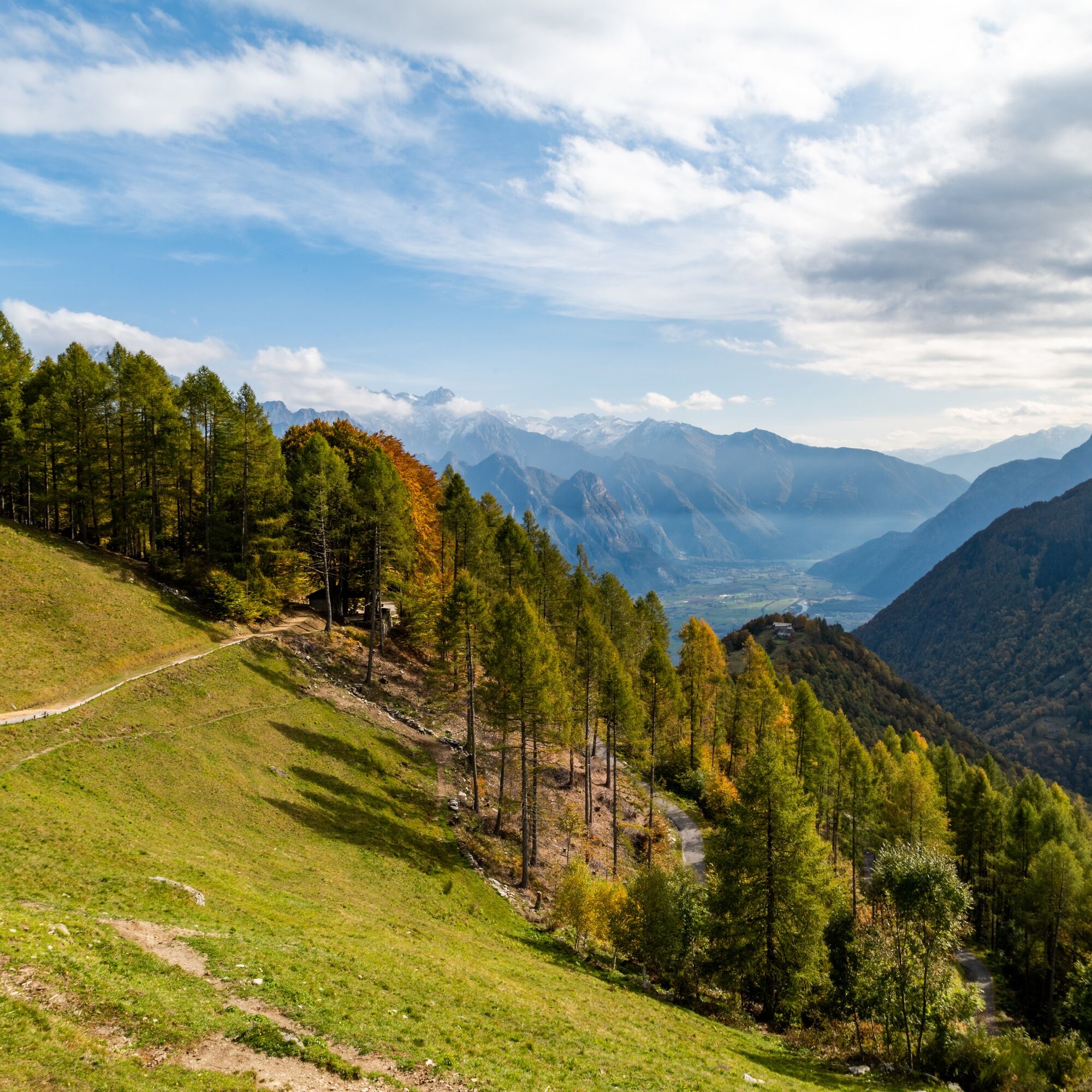
The start of the mule track is easy to find: from here the climb begins on the beautiful stone path that leads into the woods. The route offers no respite and from the 750 meters of Donadivo you climb until you reach Alpe Orlo at an altitude of 1165 meters. The route is fascinating, especially in autumn when the first cold spells start the slow change in the color of the leaves from green to shades of orange and yellow.
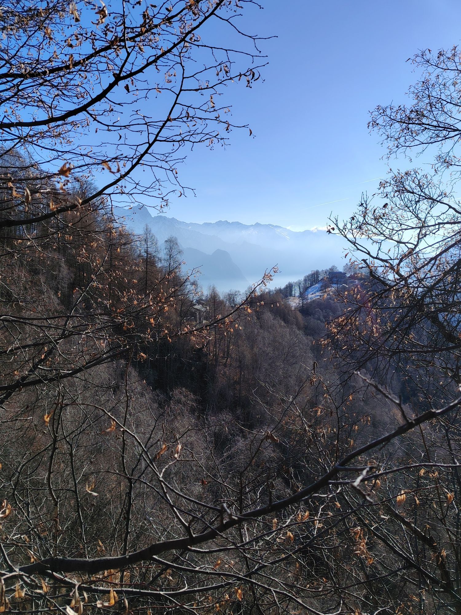
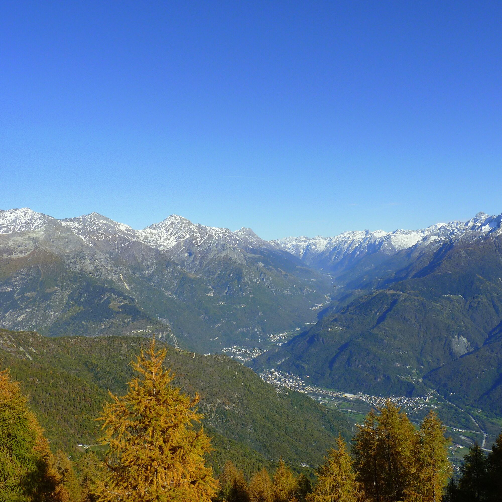
The panorama opens to the north towards Val Bregaglia and to the south on Lake Novate Mezzola. The route offers a very favorable perspective, enhanced by the hillside which during these months is often frequented by mushroom and chestnut lovers.
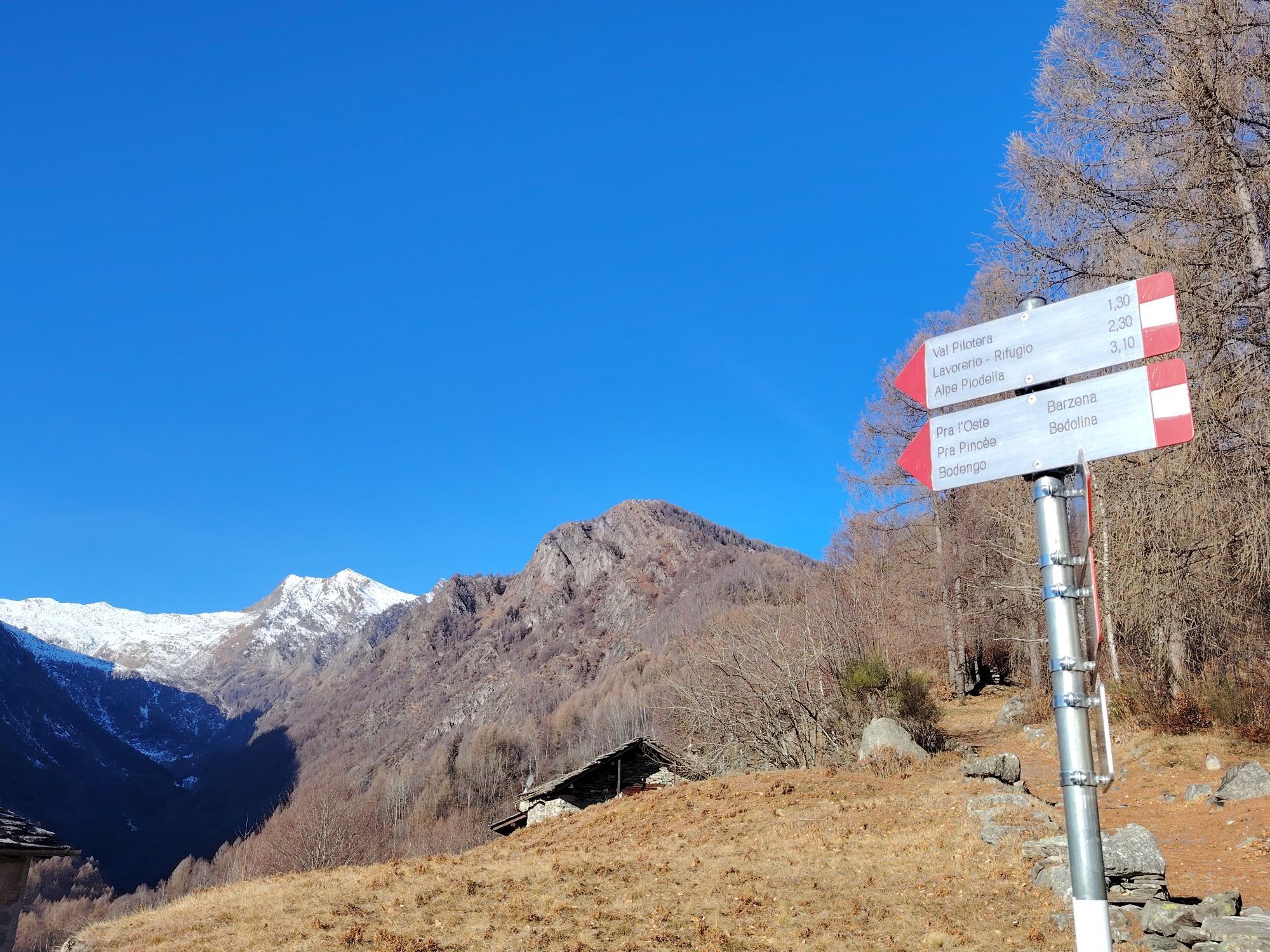
The first stage ends at Alpe Orlo from where you continue to Alpe Cermine (1350 m) always following the mule track once used to connect the alpine pastures with the valley and the inhabited centers.
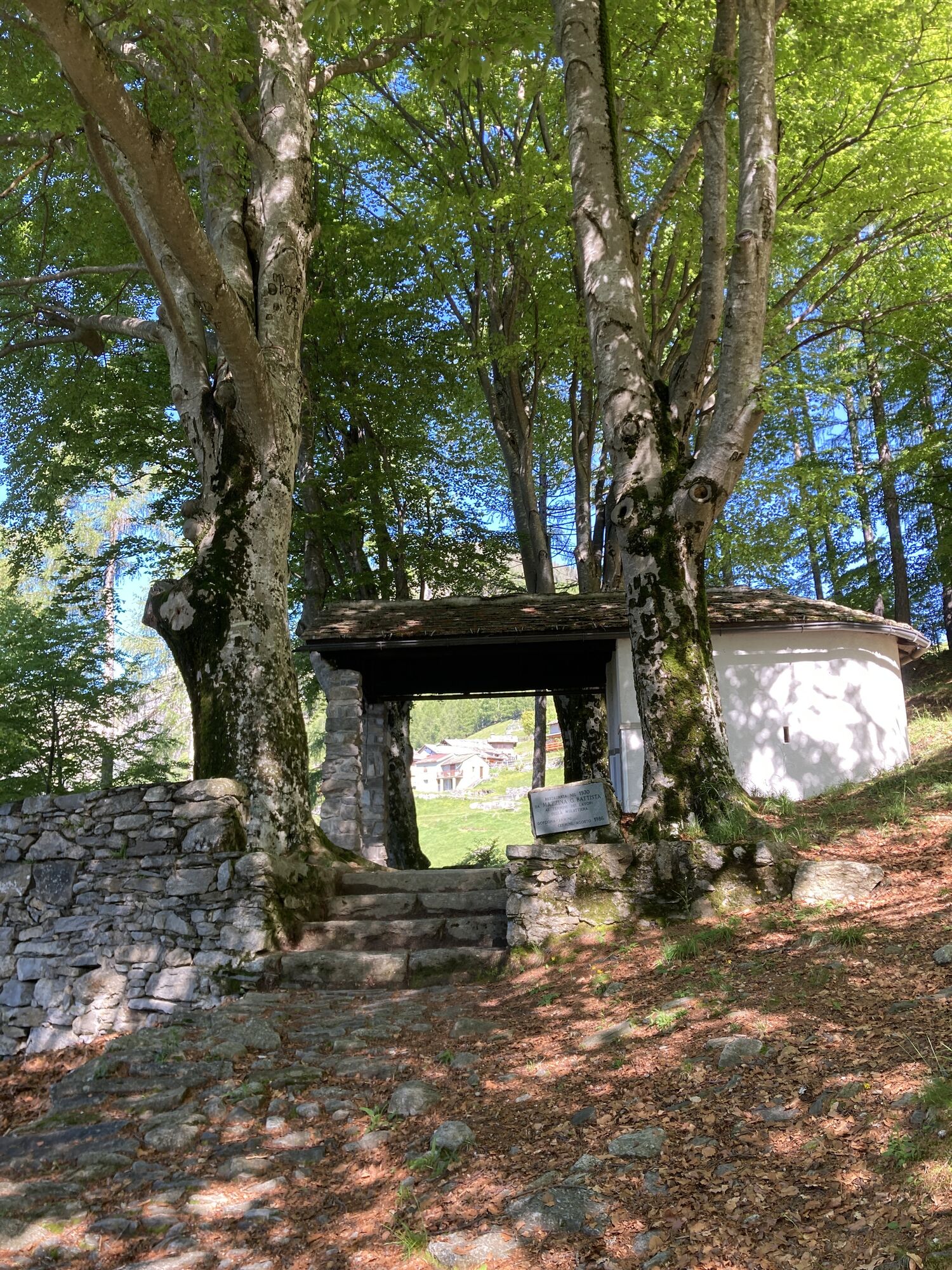
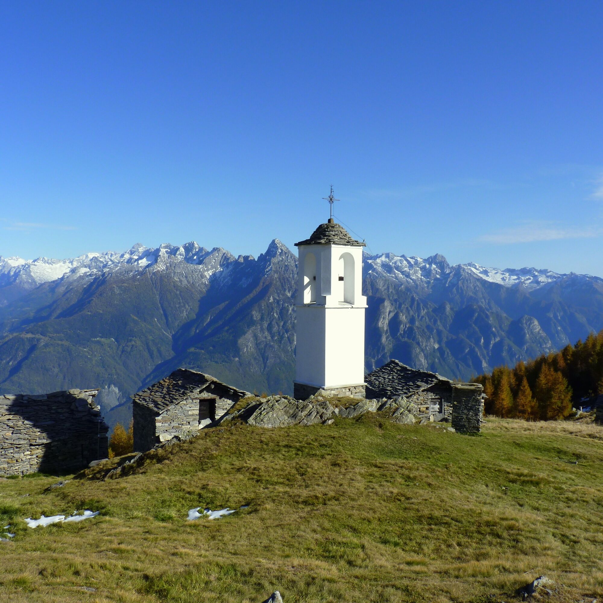
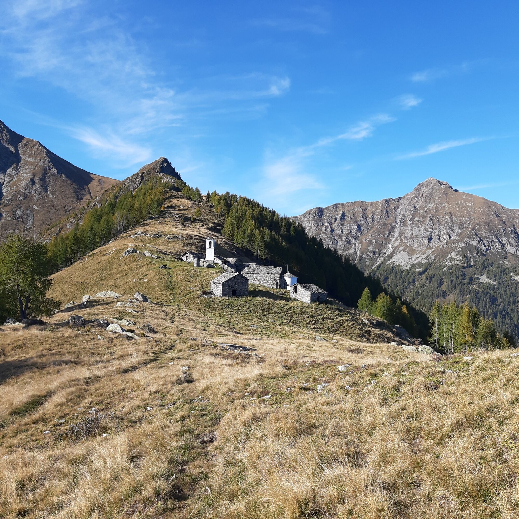
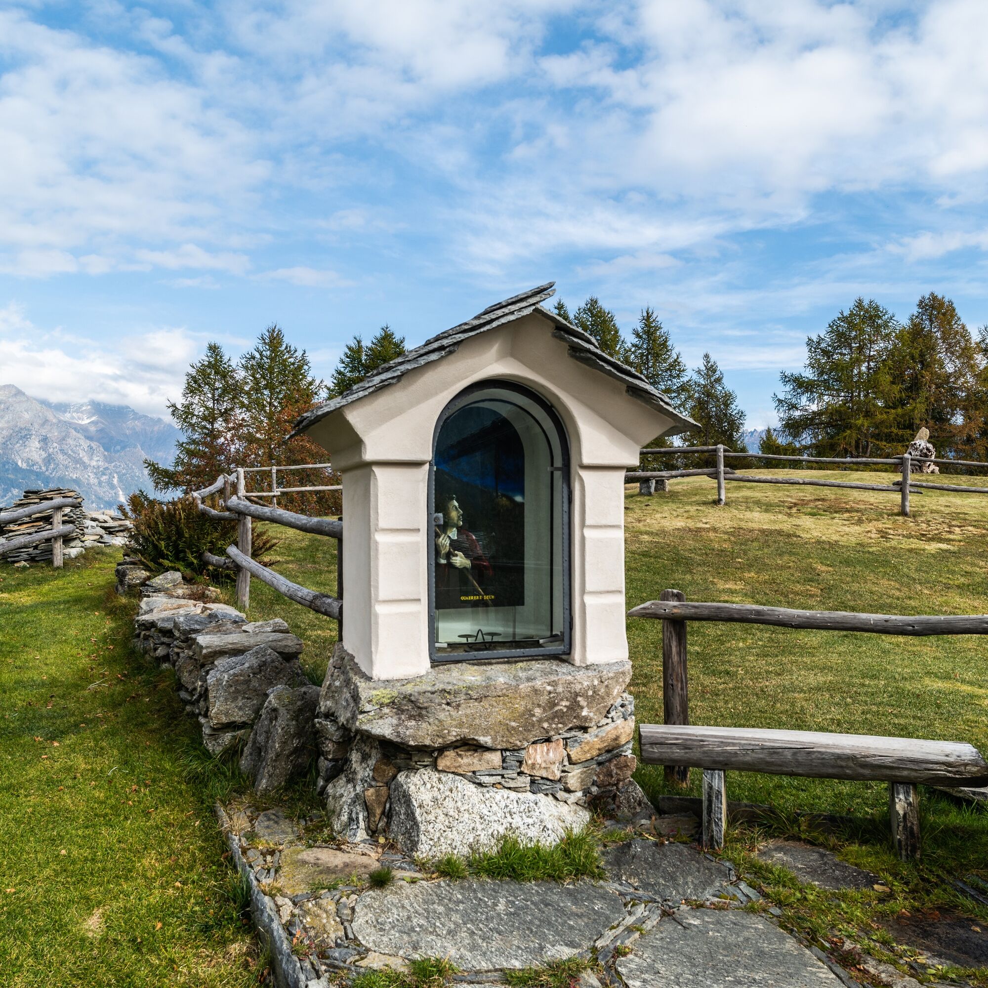
Just follow the signage placed along the ridge to gradually exit the woods. Then you will cross the mountain following the contour path, until you notice at the summit the characteristic white chapel with a circular plan that signals the arrival at Alpe Cima. Here the altitude is just below 1900 meters.
The panorama more than compensates for the effort and time spent walking.
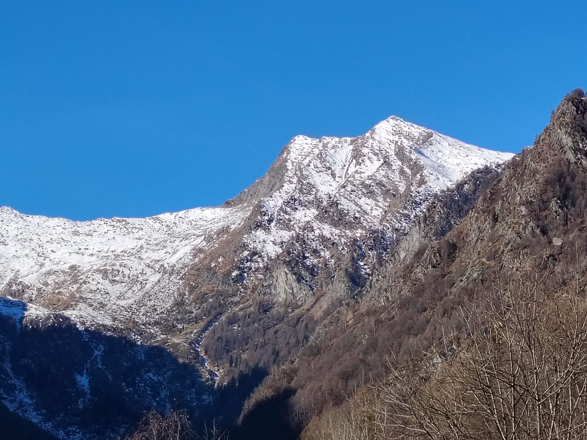
From the meadows of Alpe Cima the view ranges from the peaks of Val Codera to the granite mass of Pizzone di Prata, ascending further towards Bregaglia where the Sciora group with its five peaks dominates, framed by Cengalo and Badile.
Once you have reached the village of Gordona, it is possible to reach Donadivo by car upon purchase of a permit.
You can request it at the bars in the municipality of Gordona or buy it online https://www.valbodengo.shop/
Gordona can be reached by STPS bus, departing from Chiavenna
Oblíbené prohlídky v okolí
-
4.6
Monte Berlinghera da San Bartolomeo
středníTuristika 8.74 km -
5.0
Bocchetta Graglio Impressionante
středníTuristika 8.85 km -
5.0
Acqua Fraggia waterfall scenic loop - Savogno
světloTuristika 3.44 km -
5.0
Hike in Val Codera Novate - Rifugio Brasca ( Sentiero Roma first stage)
středníTuristika 10.7 km -
5.0
Berg und See „at it’s best“
středníHorská turistika 6.59 km -
5.0
Val Codera
středníTuristika 13.6 km -
4.0
Von Livo nach Alpe Motta
středníHorská turistika 12.3 km -
5.0
Lago di Darengo
středníTuristika 7.85 km -
4.3
Argigno, Italien
středníMountainbike 23.0 km -
4.0
Ciclabile Valchiavenna
světloJízda na kole 37.5 km
Pěší turistika a stopování


Nenechte si ujít nabídky a inspiraci pro vaši příští dovolenou
Vaše e-mailová adresa byl přidán do poštovního seznamu.