


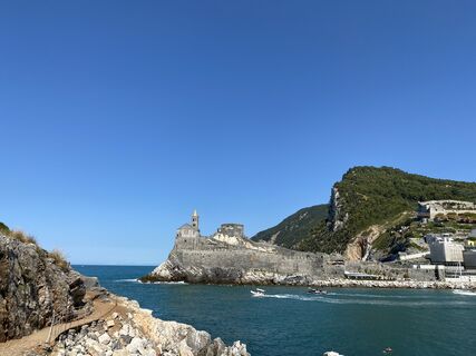
SP_06 Ring path of Palmaria island
by boat you reach Terrizzo, which is the starting point for a counter-clockwise loop around the island. From the pier walk rightwards to reach soon the restaurant “Lorena” and then proceed along the narrow...
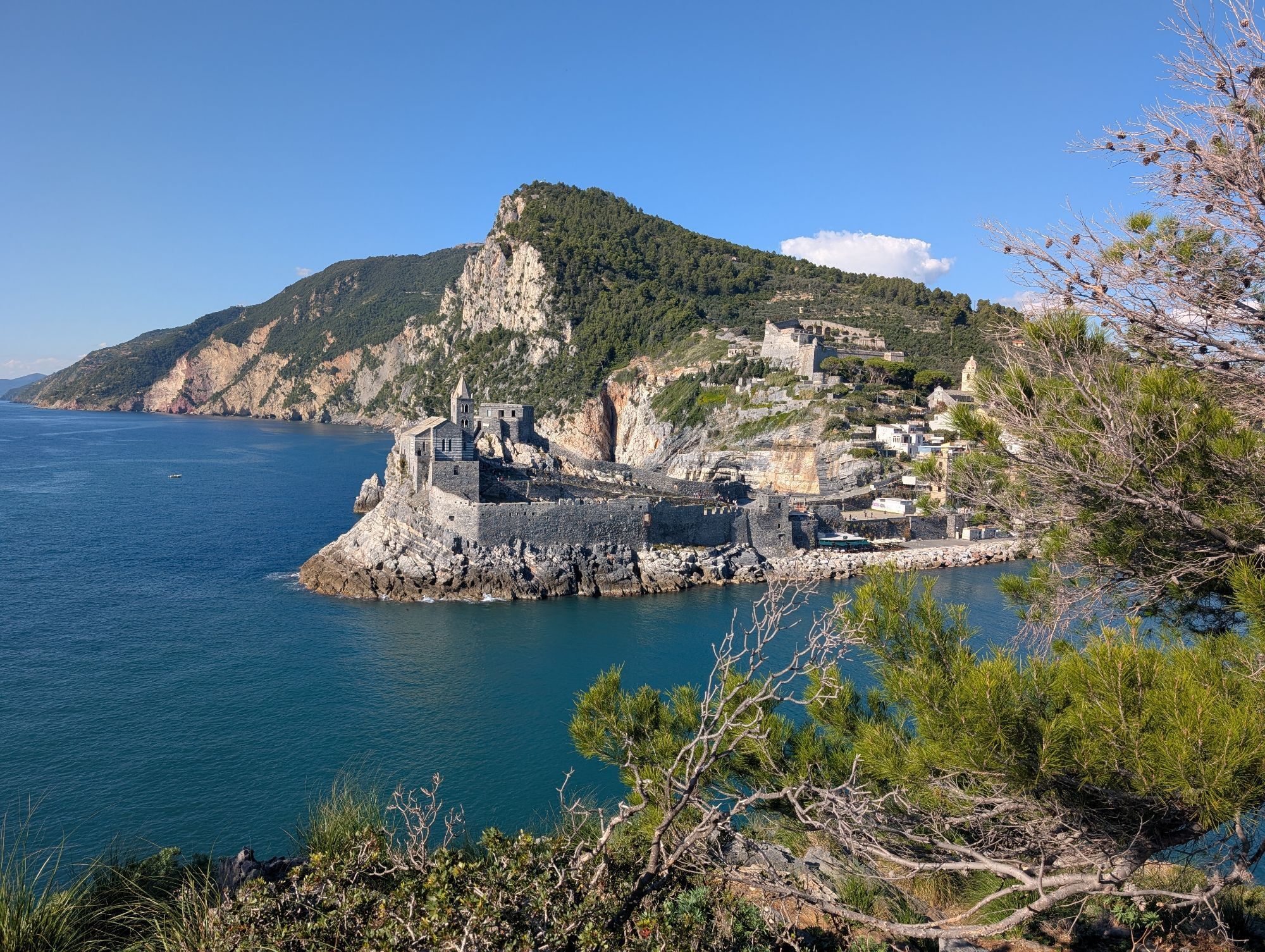
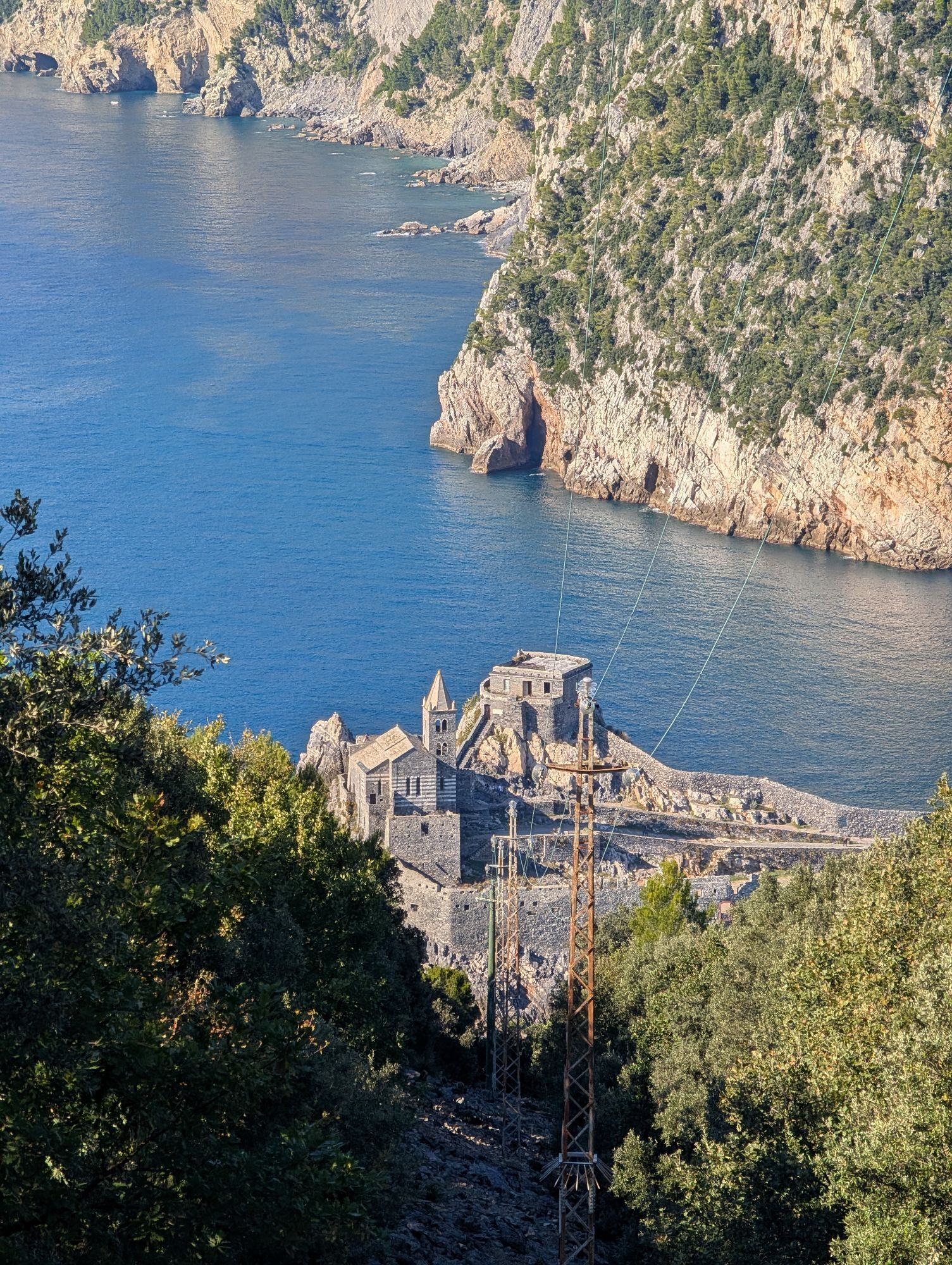
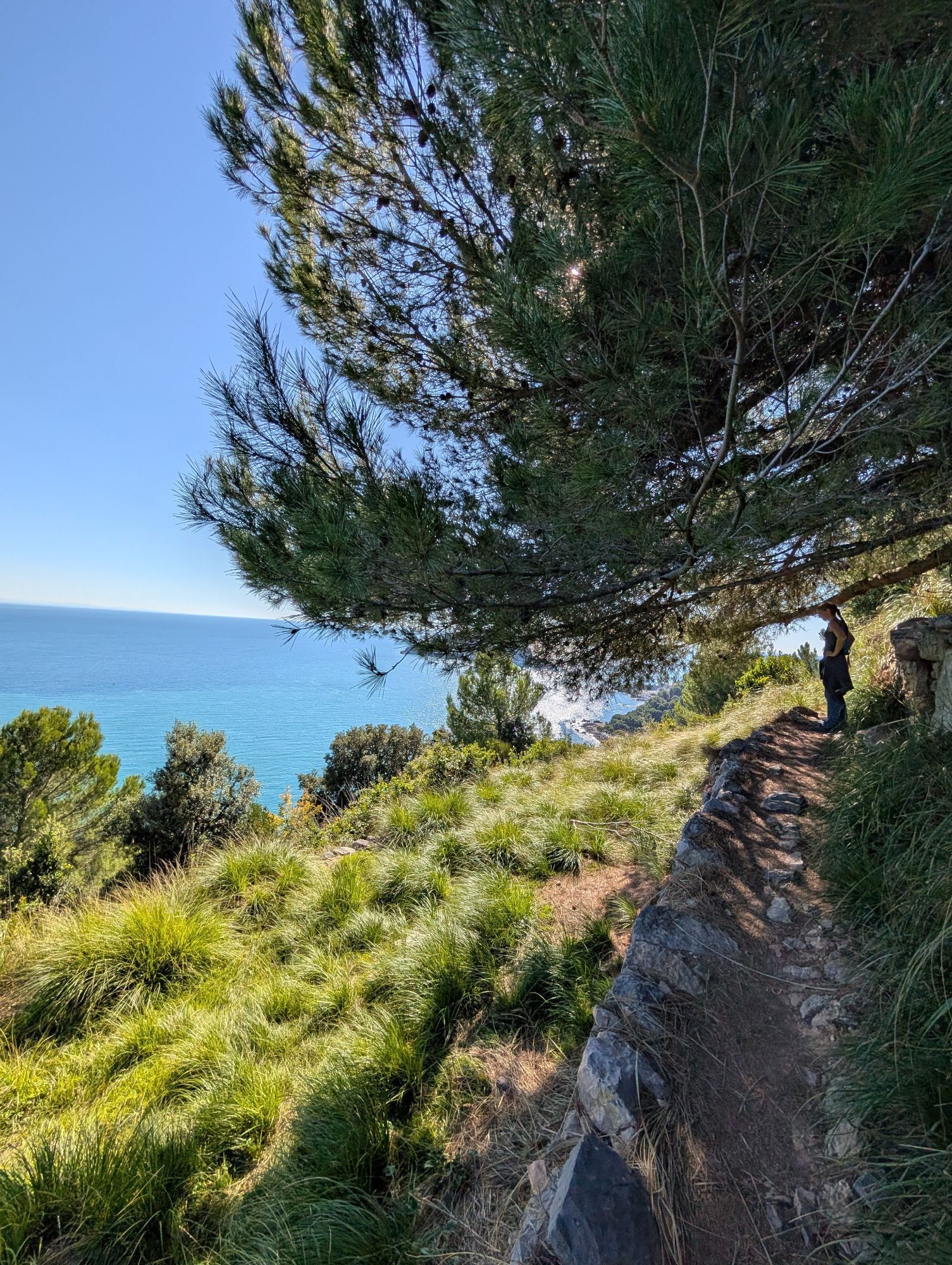
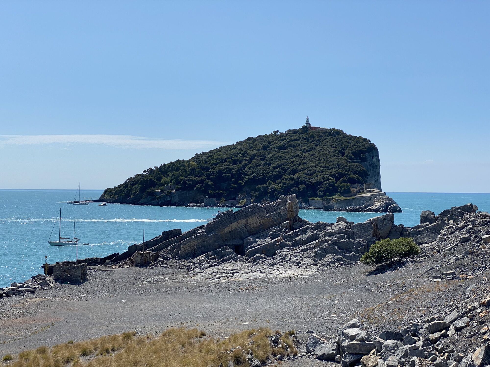
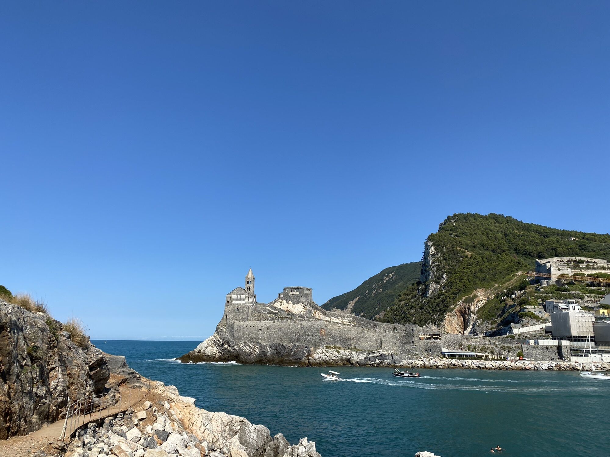
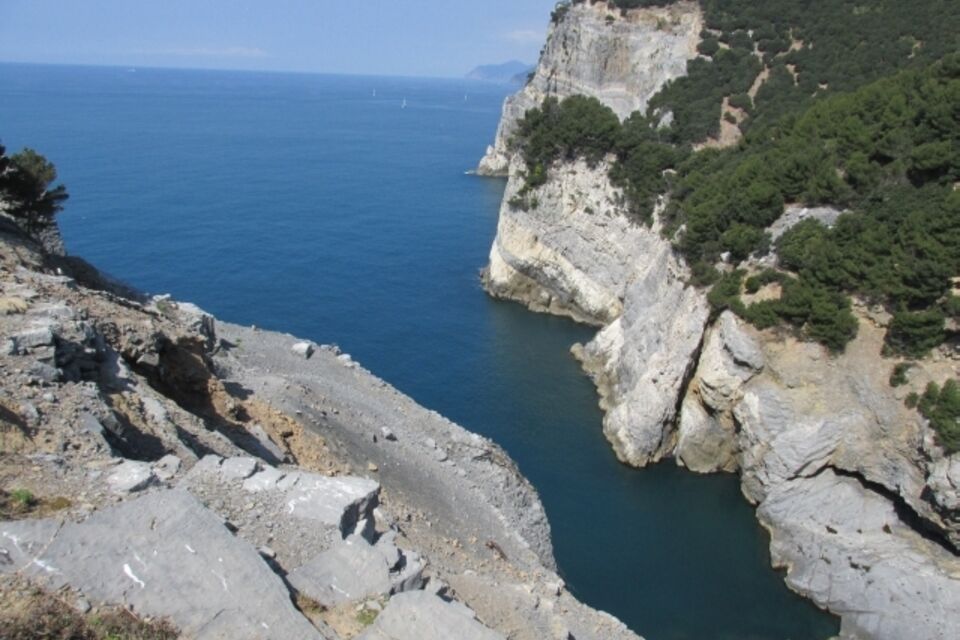
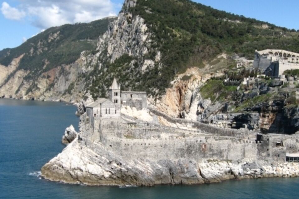
by boat you reach Terrizzo, which is the starting point for a counter-clockwise loop around the island. From the pier walk rightwards to reach soon the restaurant “Lorena” and then proceed along the narrow pebbly beach. Follow the white and red trail sign between some modern buildings and reach an area covered with brooms (bunker on the right) near Punta Befettuccio (30 minutes). We are standing in front of St. Peter's church and from here the footpath is particularly steep. From Punta Befettuccio the footpath is initially windy (panoramic point on the right) then, in the wood, it becomes steeper. You shortly reach a small platform from which you carry on walking on flat ground for a short stretch. After a short staircase you arrive at Batteria del Semaforo. Follow a flat unpaved road which you soon leave at a small widening (table and informative panel on geology and birdlife). Here there is a track on the right which steeply descends into a evergreen oak wood. The woodland is soon replaced by the mediterranean vegetation and the sight opens on the Cala Grande and Caletta bays below, while in front of us is the Tino Island. In the cliff at our right there are some abandoned Portoro quarries. Along the western side of Cala Grande a “via di lizza” is still visible. It is the sledge route which was used for moving down the blocks of marble to be loaded on the boats. Ignoring two deviations on the left, it is possible to reach, a little further on at our right, a quarrying area where the old mechanisms to drive the helicoidal wire which was used to cut the marble and a tank used to collect water are still visible. Back on the main footpath go down into the evergreen oak wood as far as the beach from where, carrying on walking leftwards, you soon arrive at Pozzale, second pier of the island (2.30 hours). From Pozzale, the trail rises between the building (a restaurant and a beach resort of the Aeronautica Militare), indicated by the white and red sign trail. After the buildings the footpath is characterised by steps and very steep stretches. Ignoring on the left the tracks which comes from the upper stretch of the pathway already done to go down to Pozzale, the trail proceeds along the eastern side of the island as far as an abandoned stone building on the left. These are the ruins of an old photoelectric station in “Il Roccio.” The view is stunning, both towards the Tino Island with the eastern part of the Gulf in the background (San Terenzo, Lerici, Tellaro and Montemarcello) and towards north-east (Torre Scola, little pentagonal-shaped fortress built in 1606 under the will of the Republic of Genoa). Follow the main footpath: the following descend, which has some steps carved into the rock to facilitate the passage, leads to a dirt road which you follow going leftwards. After c. 200 m you find a paved road which you ignore. Carry on walking to the right on the dirt road which here goes beside the “Batteria Albini”, a military post used during WW2 (but built in the 19th century, as the other fortifications in the island) where four anti-ship cannons were located. The road progressively turns to the left; a little further on, at our right, you walk beside Forte Umberto I. You then join another track which soon leads to Terrizzo,at the end of the loop trail and boarding point.

by train get off at La Spezia Centrale station, then take the bus “11/P” (linee ATC) for Portovenere, where you need to take the ferry.ferry trip: departure from Portovenere “taxi-boat”service (a few minutes); departure from La Spezia, c. 30 minutes, (boarding in Viale Italia, Passeggiata Morin, Consorzio Marittimo “5 Terre Golfo dei Poeti”: servizio Battellieri Golfo La Spezia: website www.navigazionegolfodeipoeti.it; tel 0187.732987).
From S. Stefano Magra motorway exit, follow the indication for La Spezia and thence for Portovenere: there is a car park in the locality Cavo, where it is recommended to leave the car. There is a shuttle bus from the car park which takes you to Portovenere, where you take the ferry (www.navigazionegolfodeipoeti.it). Tourist coaches: reaching the ferry boarding area in La Spezia (Viale Italia) is easy, while access and transit in Portovenere are regulated; www.prolocoportovenere.it; local police Portovenere tel. 0187794848. It is possible to park at Cavo and reach Portovenere by shuttle bus.
Nature and Landscape * * * * * * Family * * * Gourmet * * * Culture * * * * *


Oblíbené prohlídky v okolí
- 4,8
SP_07 Manarola - Volastra - Corniglia
Turistika 5,75 km - 4,1
Leg 4 from Riomaggiore to Monterosso
Turistika 15,1 km - 4,0
"Cinque Terre Wanderung" - 40km durch fünf verträumte Dörfer in Italien
světloTuristika 37,7 km - 5,0
Cinque Terre
středníTuristika 2,17 km Stretch 03: La Spezia- Riomaggiore
Turistika 13,5 km- 4,5
punta_persico.gpx
středníTuristika 15,0 km SP_04 Portovenere – Muzzerone - Campiglia
Turistika 5,17 kmSP_19 High way of La Spezia Gulf
Turistika 48,6 kmSP_20 Biassa – S. Antonio – Monesteroli
Turistika 6,63 km- 5,0
Leg 1 from Bocca di Magra to Lerici
Turistika 9,61 km

Pěší turistika a stopování


Nenechte si ujít nabídky a inspiraci pro vaši příští dovolenou
Vaše e-mailová adresa byl přidán do poštovního seznamu.