


GE_05 The five steeples of Zoagli
from Zoagli railway's station take Via Zoagli to the left, initially uphill and then downhill towards the main square (water fountain) where, on the opposite side of it, you take via XX Settembre. From...
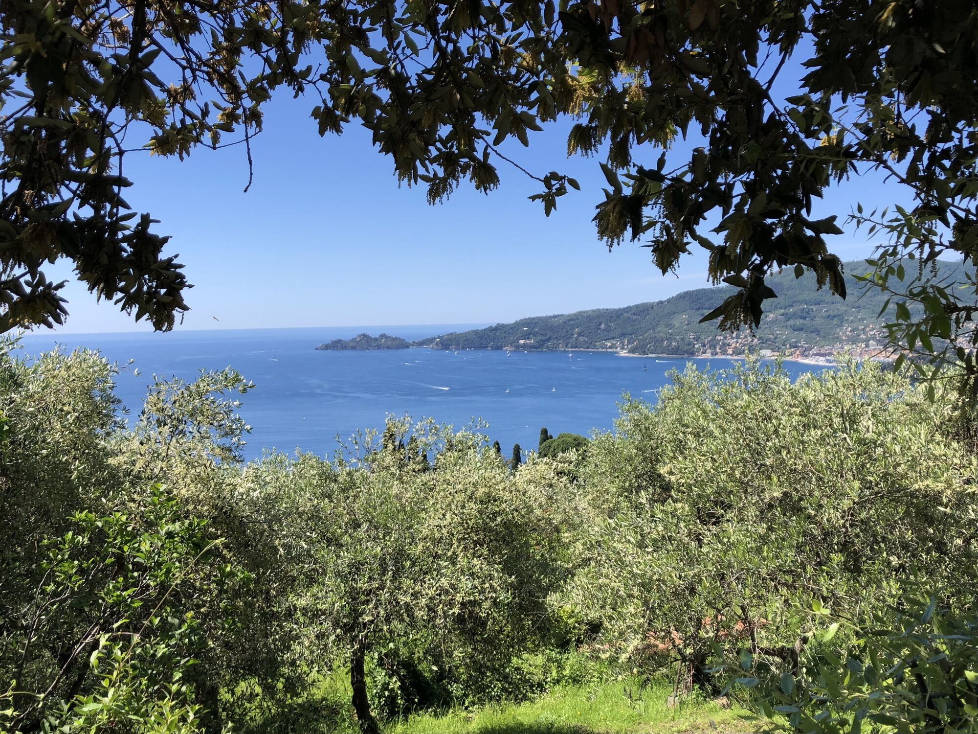
from Zoagli railway's station take Via Zoagli to the left, initially uphill and then downhill towards the main square (water fountain) where, on the opposite side of it, you take via XX Settembre. From here you follow the red and white trail sign number 5C, (pay attention as there are only a few signs along the path), walking up by the stairs and the crêuze of via Antica Romana. The latter road joins via Aurelia where you will have to take extra care as there is no pavement. After c.200 metres, just before a tunnel, you leave via Aurelia and take on the right the pedestrian road to San Pantaleo which passes above the tunnel and proceeds southbound between terraces sustained by dry-stone walls. After a couple of bends you reach the little church of San Pantaleo (170 m, 1 hour). To the right, you take the sealed road towards San'Ambrogio doing Via Pound to walk up a stair which leads to the parvis of Sant'Ambrogio's church (196 m) where you have a wonderful view on Rapallo and the coast as far as Portofino. Following trail sign 5C you reach the oratory and at the right of it you take a pathway through olive groves and terraces. From here the pathway is characterised by many ups and downs with cobbled or concrete stretches and steps; after a religious shrine long stretches under the olive trees feature the path. The itinerary crosses a wooded area, thence it reaches the pretty chapel of Santa Maria Maddalena (283 m). After another wide wooded area (some abandoned olive trees) you walk down a steep stair which leads to the crossing of the Semorile Brook. A few steps further on the path joins a mule track which you have to follow to the left (uphill) till the hamlet of Semorile (219 m; 2.30 hours from Zoagli). The following stretch, untill the village of Cerisola, is on the sealed road to Zoagli; you pass Cerisola and see to the left a stair (via dei Frantoi) which, above the sealed road, develops next to some little villas and gardens. The pathway is now almost level through the woodland on the local road Cassottana. At a junction you turn left going slightly uphill and after a few ups and downs you reach a concrete road which you almost immediately leave to take a little path to the right between the houses, keeping on walking along the hillside through the olive orchards as far as the church of San Pietro di Rovereto (3.30 hours) which you can reach in few metres uphill between the houses. From the church is it possible to continue on the level concrete driveway until the church of Sant'Andrea di Rovereto (197 m). From San Pietro's church you go back by the same road for a few meters between the houses, thence you follow a mule-track downhill: walking through the slope you reach a sealed road (Via San Pietro) which you take turning right. You walk next the “Seterie di Zoagli Cordani” and then you reach the Via Aurelia which you follow going to the right (possible shortcut with trail sign) untill you take the sealed road which goes down to the centre of Zoagli and the railway station (4.30 hours).


Mappa Alto AdigesentresAppl'Alto AdigeMappa Alto AdigesentresAppl'Alto AdigeMappa Alto AdigesentresAppl'Alto Adigepowered byMappa Alto AdigesentresAppl'Alto Adige- Portale Outdoor eMappa Alto AdigesentresAppl'Alto AdigeperMappa Alto AdigesentresAppl'Alto Adige
by train (Genova-La Spezia railway line) get off at Zoagli station.
from Rapallo motorway's junction (A12 motorway Genova-Livorno) drive through the town until the sea, then take the Aurelia road turning left towards Zoagli (please be aware that car parks in the area are limited)
Nature and Landscape * * * * * Family * * Gourmet * * * Culture * * * *

Oblíbené prohlídky v okolí
-
4.3
GE_37 Seafront S. Margherita Ligure – Paraggi - Portofino
Turistika 5.14 km -
5.0
GE_07 Portofino – San Fruttuoso – Camogli
Turistika 12.6 km -
4.5
GE_02 Sestri Levante – Punta Manara
Turistika 2.26 km -
Camogli - San Rocco- Batterie-Semaforo-Pietre strette-Portofino-Santa Margherita Ligure
Turistika 17.6 km -
Portofino-San Fruttuoso-S.Margeritha
středníTuristika 11.5 km -
High Variant Leg 8 Chiavari – Montallegro - Rapallo
Turistika 13.8 km -
5.0
Camogli - Passo del Bacio - Via dei Tubi - Camogli
středníDalší 14.6 km -
5.0
Leg 11 from Camogli to Genova Nervi
Turistika 16.4 km -
5.0
Rapallo-Montallegro-Monte Rosa- Rapallo
středníTuristika 13.9 km -
5.0
Sestri Levante, Monte Castello, Riva Trigoso
středníTuristika 8.46 km
Pěší turistika a stopování


Nenechte si ujít nabídky a inspiraci pro vaši příští dovolenou
Vaše e-mailová adresa byl přidán do poštovního seznamu.