


Luupää route, Leivonmäki National Park


The Luupää route, passing through varied ridge, mire, and lake scenery, is a 2.2-kilometer geological nature trail. Along it, you can find several natural phenomena caused by the Ice Age with information...
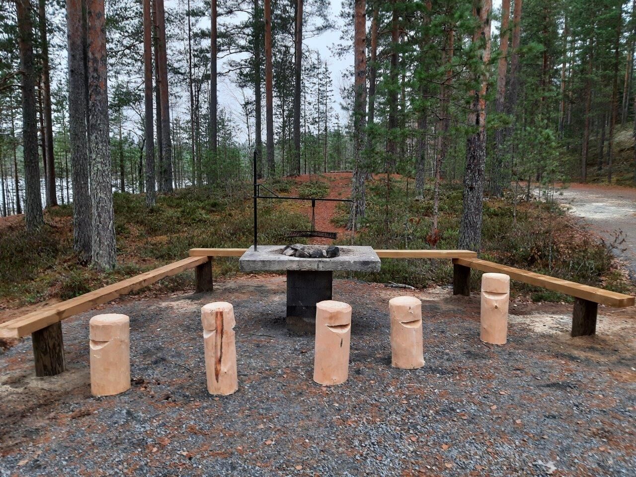
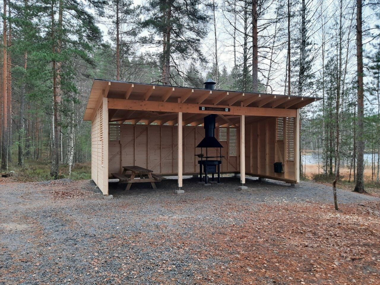
The Luupää route, passing through varied ridge, mire, and lake scenery, is a 2.2-kilometer geological nature trail. Along it, you can find several natural phenomena caused by the Ice Age with information boards, making the trail excellent for educational use or walking with children. The terrain has slight elevation changes, the paths are partially narrow, and there may be some fallen trees along the way, but otherwise the hiking is easy. Blue paint marks guide the way. It is advisable to bring snacks to enjoy at the cooking shelter along the route on the beautiful shore of Harjujärvi. The shelter has a barrier-free cooking shelter, a barrier-free fire site, firewood, and a dry toilet.
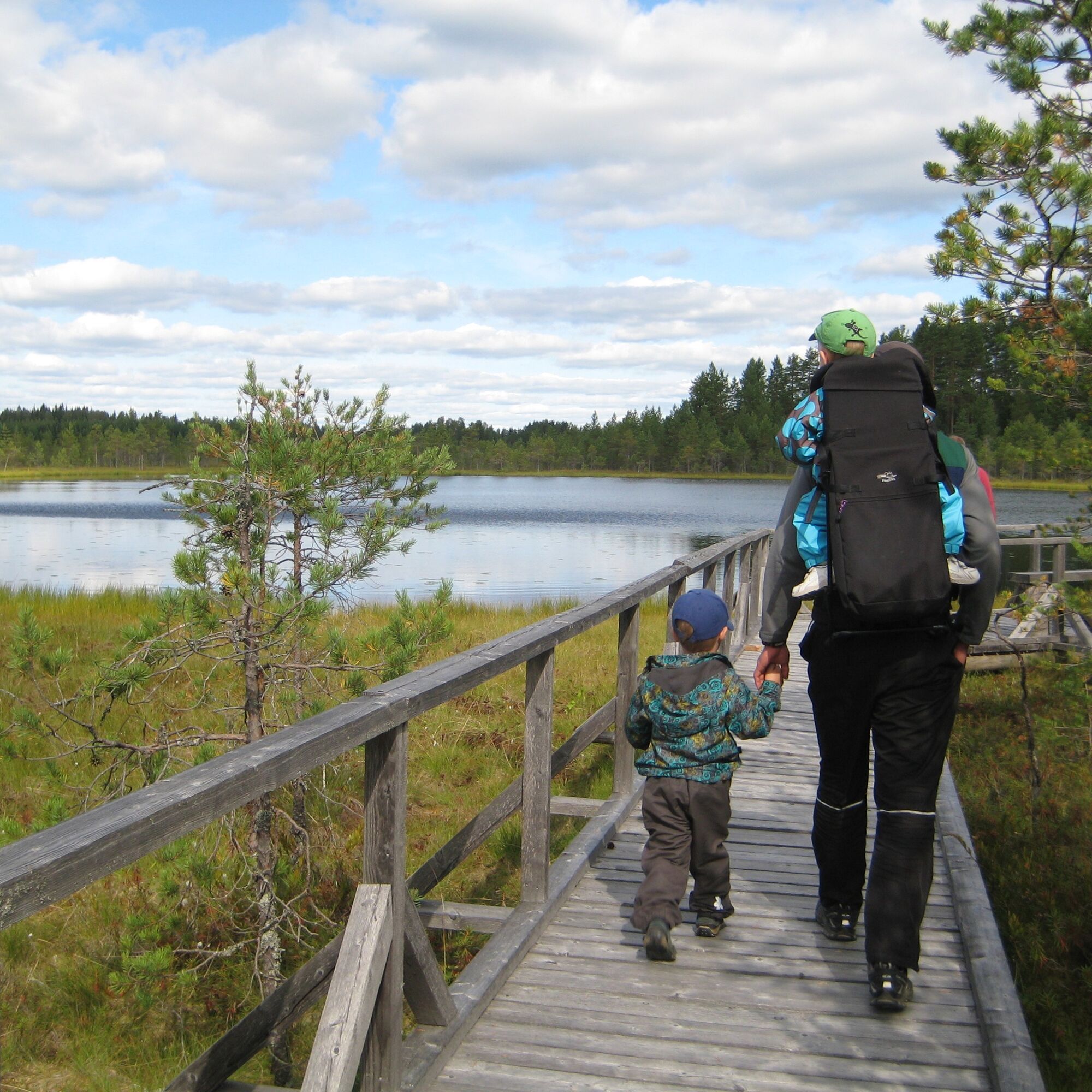
At the end of the route, there is also a 700-meter long barrier-free section.
Points of interest on the route
Peat column at Kirveslampi parking area Glacial boulder Turase ponds Harjujärvi cooking shelter
The route description has been created as part of the #Central Finland hiking trails world map project, funded by the Central Finland ELY Centre from the Agricultural Fund for Rural Development.

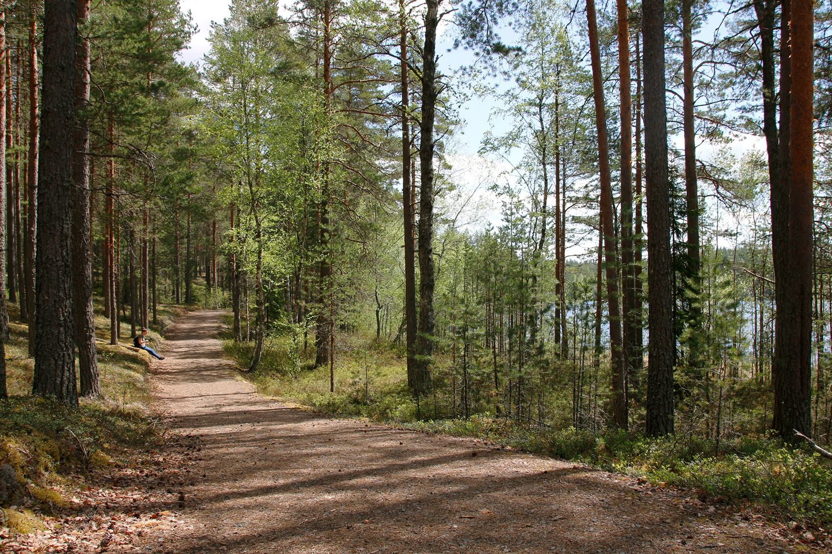
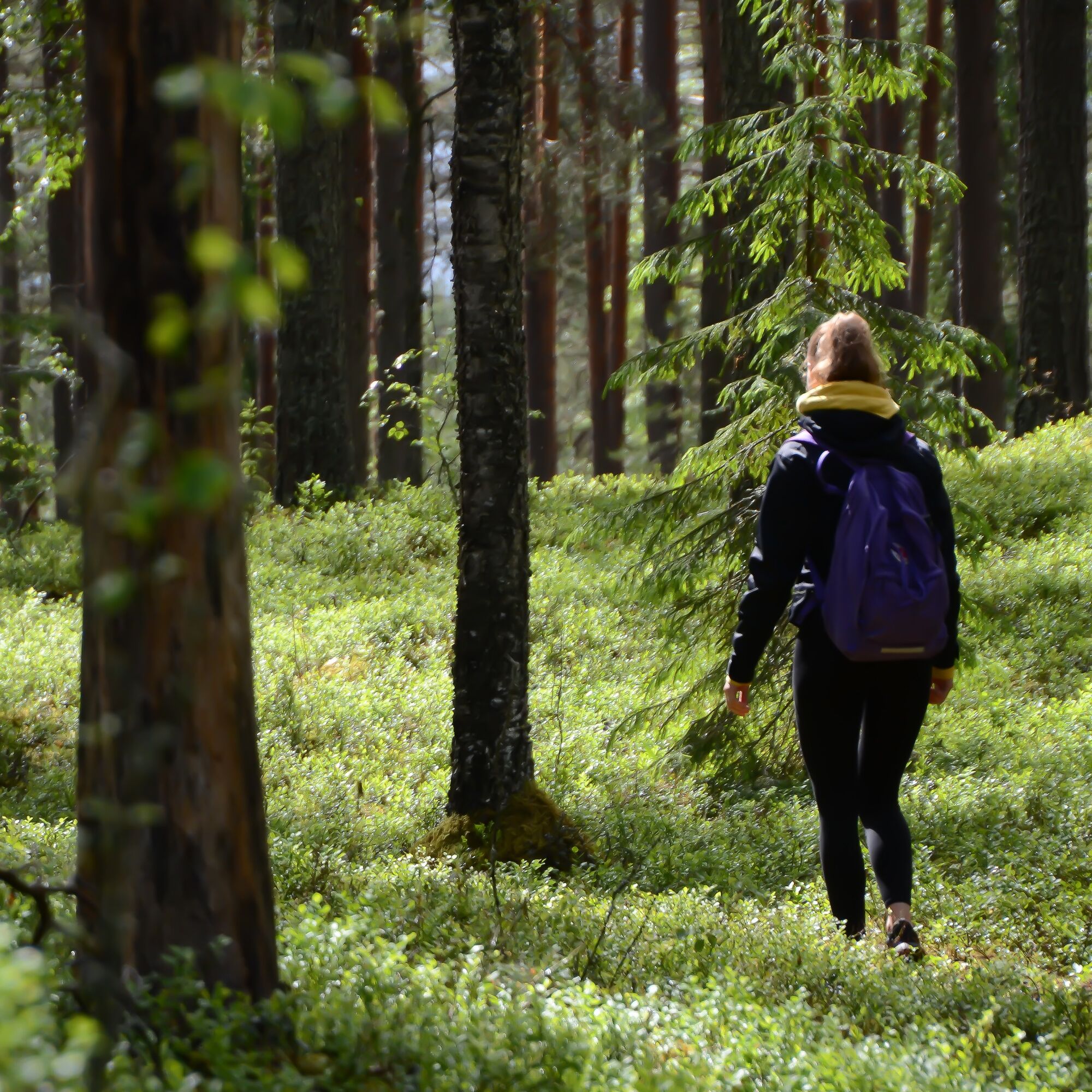
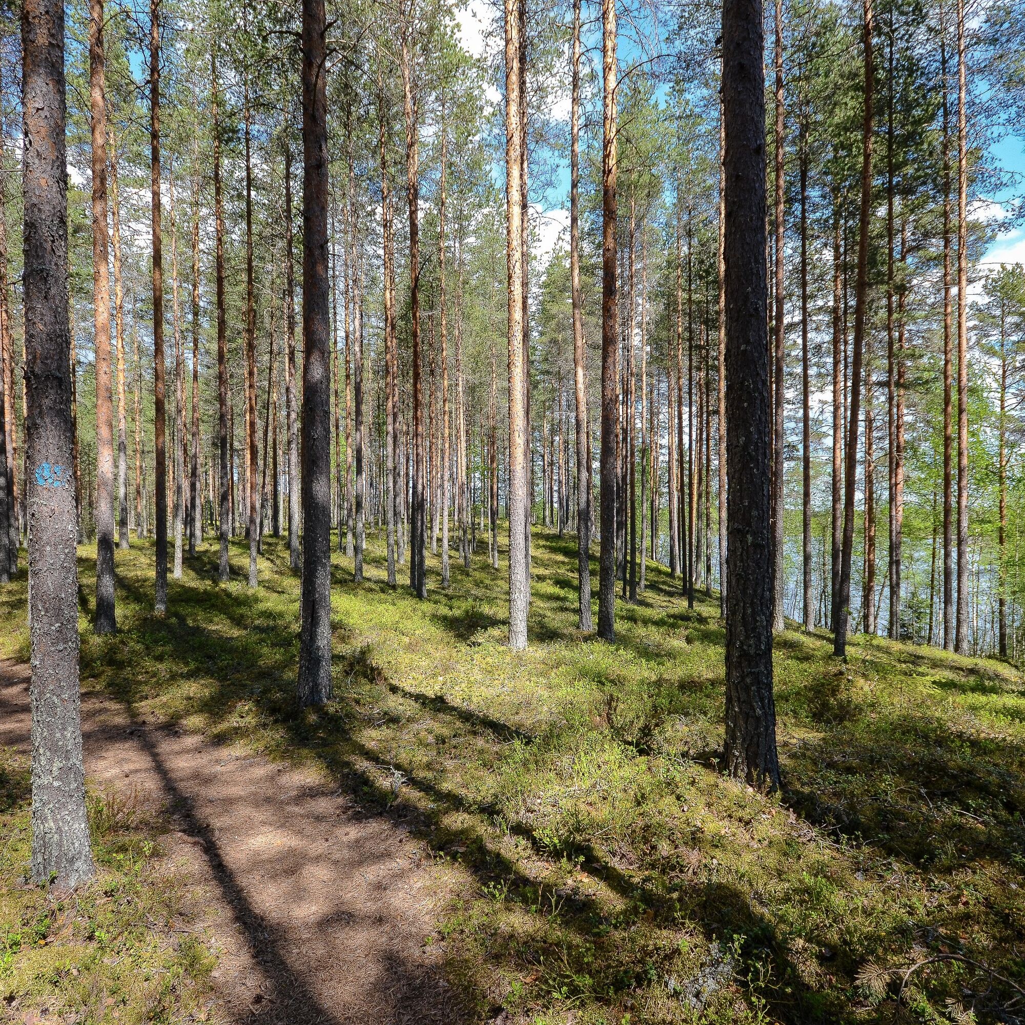
The Luupää route runs mostly through easy ridge terrain, but the paths may be narrow in places and there may be some fallen trees along the route. There are also some boardwalk sections along the route. About halfway through the route, you can also see a large glacial boulder. Shortly after this, you arrive at the shore of Turasenlampi, from where the journey continues via a wheelchair bridge.
From Turasenlampi, there is an approximately 700-meter barrier-free section to the Harjujärvi cooking shelter. This section is like a forest road and a wide path, so it is suitable for both wheelchair users and strollers. At the cooking shelter by the shore of Harjujärvi, there is an opportunity to make a fire and eat snacks. Next to the woodshed, there is also a disabled toilet. The route from the shelter back to the parking lot runs again on trails through a pine forest ridge terrain.
Ano
Ano
It is recommended to hike the route during the snow-free season, so when walking the trail in winter, it is advisable to use snowshoes.
Route classification
The route is easy in difficulty, making it suitable also for families with children, for example. Paths are narrow in some places and fallen trees may be on the trail. In addition, there are small elevation changes in the terrain. At the end of the route (from Harjujärvi cooking shelter to Turasenlampi), there is a 700-meter long barrier-free section that is also suitable for wheelchairs and strollers.
Signage
At the starting point at Kirveslampi parking area, there is a map and signs for the route. The trail is marked in the terrain with blue paint and signposts. The recommended direction to follow the trail is counterclockwise. In addition, there are boards along the route explaining the geology of the national park, which can also be used for educational purposes.
Fire making
Fire making is allowed only at designated spots. During forest fire or grass fire warnings, fires are allowed only in the fireplace with a chimney at the Harjujärvi cooking shelter. More info and current forest fire warnings
Coming from the south on Highway 4 (Lahti-Jyväskylä), turn left onto Harjunlahdentie (sign: Kivisuo). Go straight on Harjunlahdentie for 6.5 kilometers, then turn left onto Vartiamäentie. Drive 1.7 kilometers, after which the Kirveslampi parking area is on the left side of Vartiamäentie.
Outdoor Express buses run to Leivonmäki National Park in summer 2025: Sat 26.7., Sun 27.7., Sat 23.8., and Sun 24.8.
The nearest regular long-distance bus stop is located in Leivonmäki about 12 kilometers from the national park. Bus schedules can be found on the Matkahuolto website.
Kirveslampi parking area (Vartiamäentie, Joutsa).
Coordinates:
Euref-Fin (~ WGS84) lat: 61° 53.3592' lon: 26° 1.0189'
ETRS-TM35FIN: N: 6862241 E: 448326
ETRS89 geographical (~WGS84) lat: 61.889352180° lon: 26.016963695°
The Luupää route is a geological nature trail. Materials for teachers and students
Links:
The Kirveslampi Circuit (1.7 km), starting from the Kirveslampi parking area, is a nice addition to a day trip before the Luupää route. End your trip with a picnic at the Harjujärvi cooking shelter!
Pěší turistika a stopování


Nenechte si ujít nabídky a inspiraci pro vaši příští dovolenou
Vaše e-mailová adresa byl přidán do poštovního seznamu.