


Wetzlar 3-Towers-Route
The Wetzlar 3-Towers-Route is part of the Lahn facets, the certified hiking trails in the Lahn valley. The route has been rated as a “Quality Cultural Experience Trail” by the German Hiking Association....
The Wetzlar 3-Towers-Route is part of the Lahn facets, the certified hiking trails in the Lahn valley. The route has been rated as a “Quality Cultural Experience Trail” by the German Hiking Association. It runs some 20 kilometers around the former imperial city of Wetzlar. A shortcut divides the route into an 11.3-kilometer northern variant and a 15.7 kilometers long southern variant.
Spectacular views and a fascinating cultural landscape make the hike an experience. The towers of the medieval city fortifications are the focus of the hike: Garbenheim Watchtower, Brühlsbach Watchtower and Kalsmunt served to protect the population. The varied route passes through the idyllic cherry wood at Stoppelberg and along the national natural heritage site "Weinberg Wetzlar". Numerous basalt columns provide information about special features along the way.
An alternative entrance and information portal is located at Leitz Park. The parking lot at Stoppelberg is also a good starting point for the circular route.

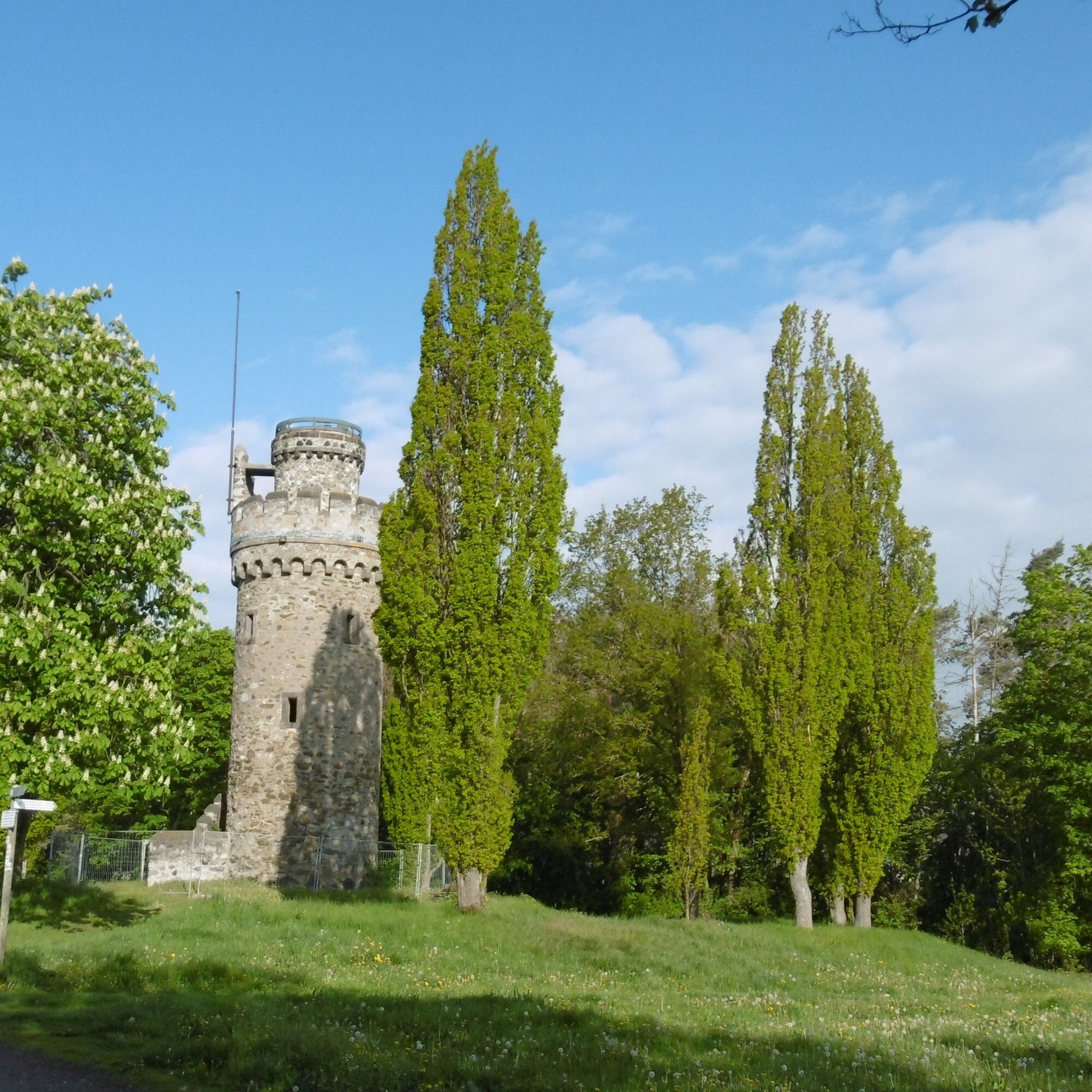

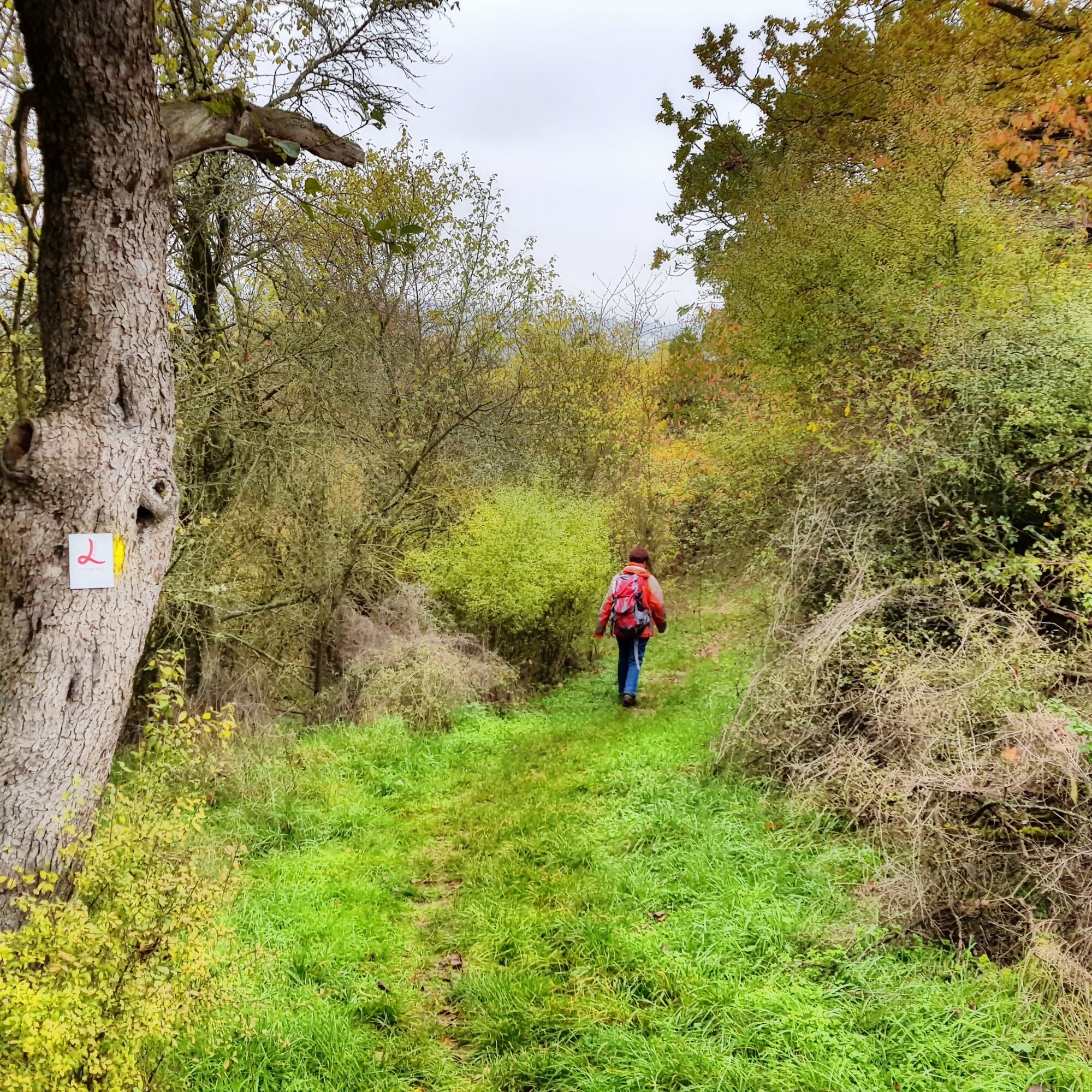
The starting point is located on the edge of Wetzlar's old town. From the information portal of the 3-Towers-Route at the Lahn Island, on the edge of Wetzlar's old town, we hike with a view of the Lahn through the beautiful Colchester area. The British city of Colchester and the Hessian Wetzlar have been twin towns since 1969. We then go up stairs to the open-air stage Rosengärtchen, where the Wetzlar Festival takes place in the summer. The path leads through the lovely park area. Following the signage, we then hike down along Wölbachertorstraße, past the Goethe fountain, and then up stairs and the street "Auf dem Hauserberg" to the city outskirts. With wide views of the surrounding area, the 3-Towers-Route now continues over field and meadow to the 18 m high Bismarck Tower, also called Garbenheimer Watchtower. Even without climbing the tower, we have an impressive view here, which we can enjoy during a break at the picnic area. A basalt column provides information about the history of the tower and the medieval fortification of the former imperial city of Wetzlar.
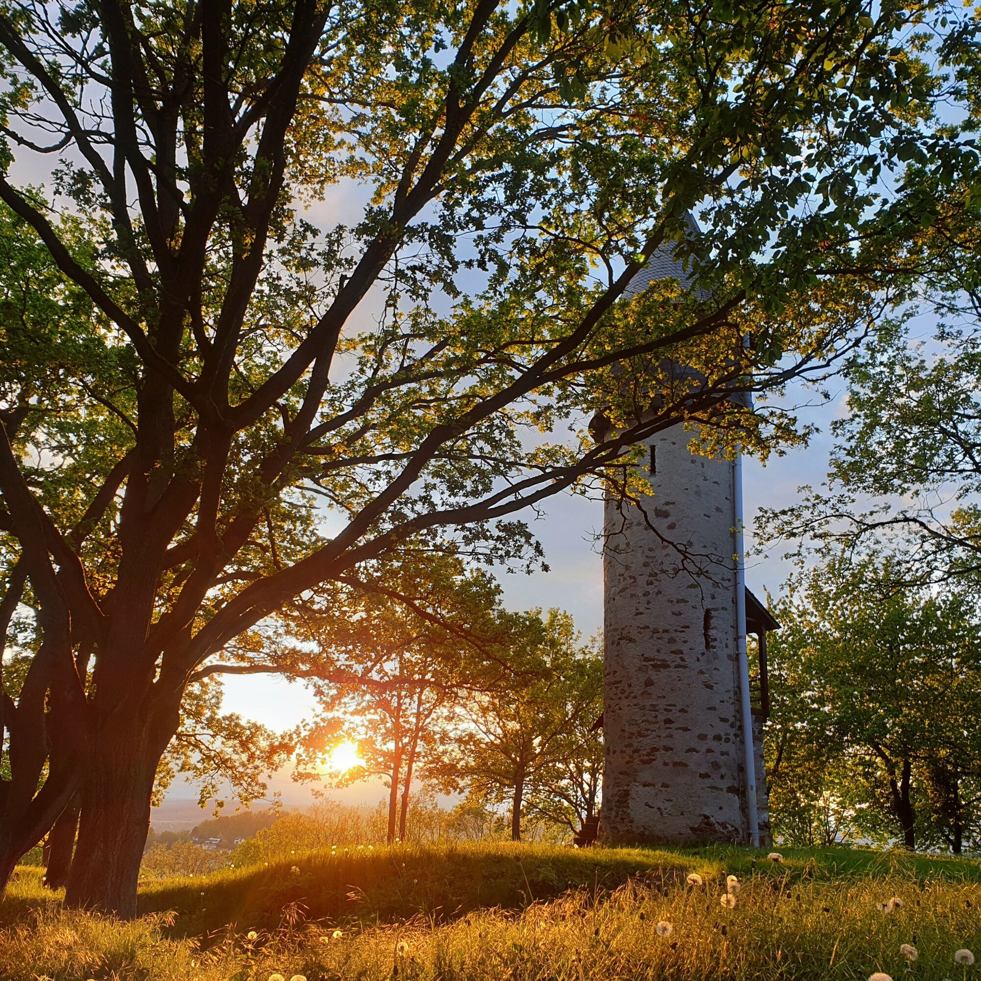
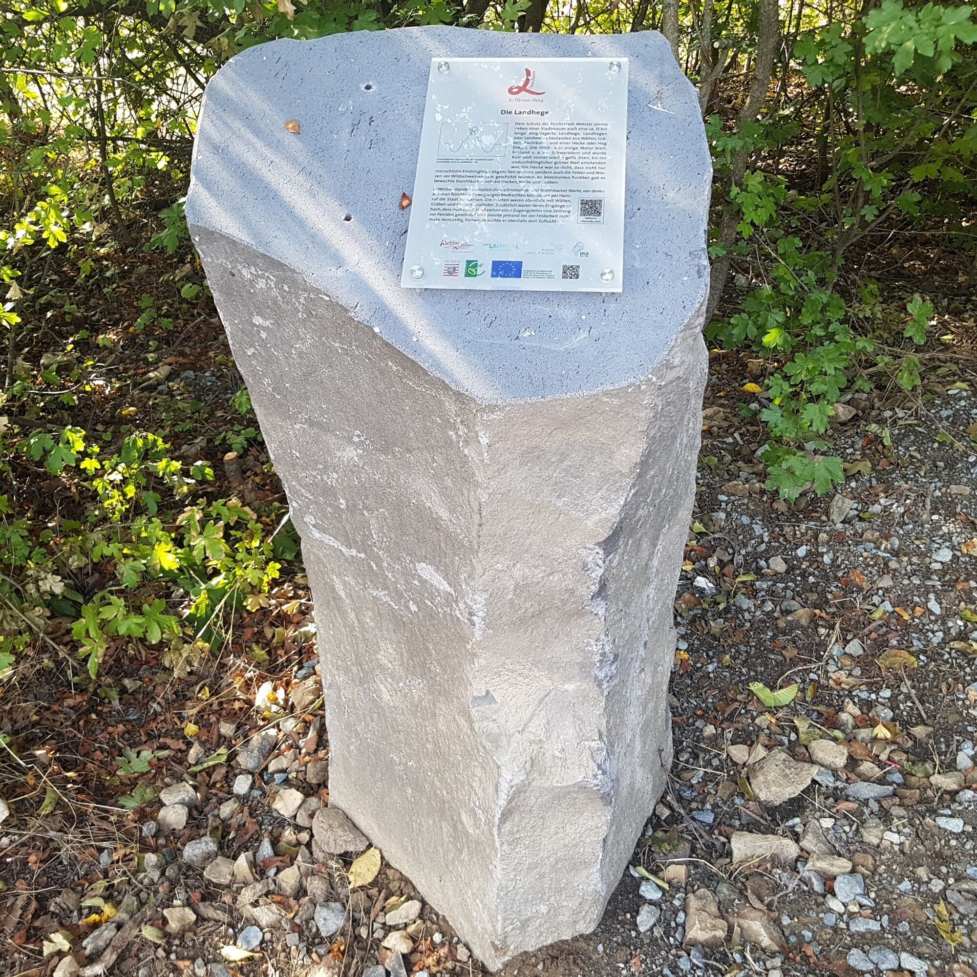
We now walk a short distance along the fence of the new cemetery until the path turns left across the field. Then we cross a forested area and arrive at Leitz Park. Here is another entrance and information portal of the 3-Towers-Route as well as a basalt column with information about the Landhege, which, like the watchtowers in the Middle Ages, served to protect Wetzlar. A visit to the Leica Experience World and the Ernst Leitz Museum is worthwhile for photography enthusiasts (observe opening hours). The Leitz Café treats you with coffee and cake from Wednesday to Sunday. We continue to follow the signage and cross Frankfurter Straße at the former Spilburg barracks (1914 - 1994). We then hike down into Kaisersgrund, where a memorial plaque recalls the "false emperor" Tile Kolup. Next, we walk left along Friedensstraße and then up a forest path diagonally to the right. Past the youth hostel, we now go up to Brühlsbach Watchtower. Among old Wetzlar residents it is known as the "pencil" because of its conical tip. Here a basalt column also provides information about historical events.
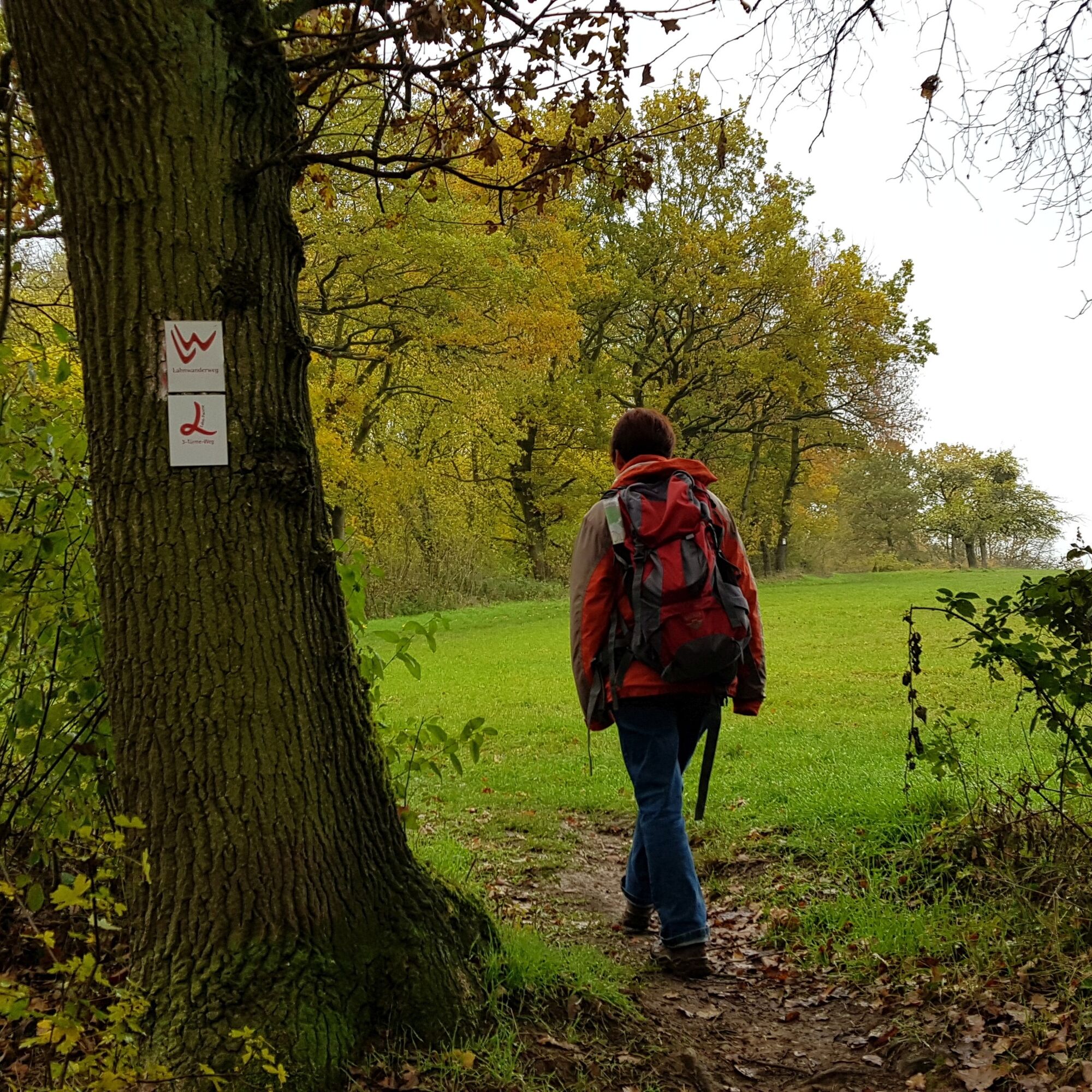
The Brühlsbach Watchtower is accessible to the public through guided tours. After enjoying the view at the watchtower, we follow the signage downhill. Here we can, if necessary, take the shortcut (red L on yellow background), which runs along Wetzlar’s southern city boundary and reconnects with the main route just before the Kalsmunt castle ruins. The hike is shortened to 11.3 km by this shortcut (see Wetzlar 3-Towers-Route North and Wetzlar 3-Towers-Route South).
But we leave the shortcut aside and continue on the main path. At the signpost, we turn left and pass two schools, always following the marking, until we reach the street "Stoppelberger Hohl." We follow this about 150 m to the left, then cross it and follow "Hardenbergstraße" through the residential area. We leave this area again after about 150 m and follow the signage along a meadow path before going down through the forest to the valley of the Brühlsbach brook. After about 300 m, we turn right and now hike steeply uphill through the forest towards Stoppelberg. After the strenuous climb, we reach district road K988 and hike on the path to the right beside the road to the Stoppelberg parking lot, located on the opposite side of the street. Here at 325 m, we reach the highest point of the hike. Since parking is free here, starting the circular route at Stoppelberg is a good alternative to starting in Wetzlar.
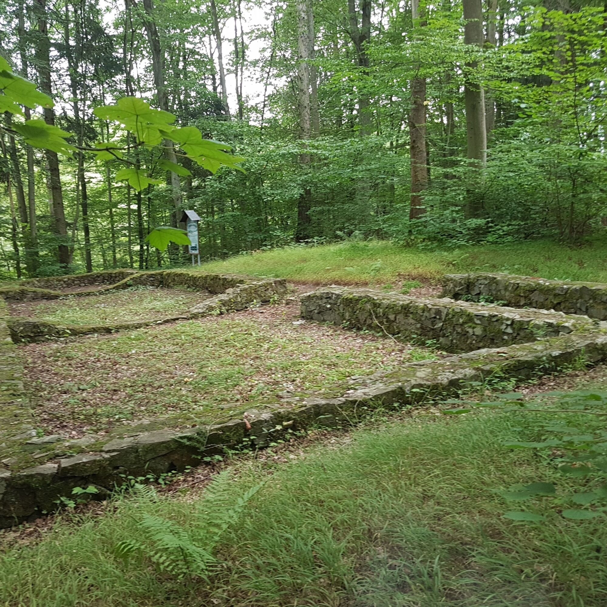
From the Stoppelberg parking lot, we follow the marking through the idyllic cherry wood. Keep your eyes open! Here are burial mounds dating from 750 - 450 BC. A basalt column gives additional information. After about 700 m and a short break on a recliner, we leave the cherry wood and have a view, in good weather, all the way to Feldberg in the Taunus. Shortly afterwards, we turn left and walk down into the Abach valley. We follow it for a good stretch. Ponds and pools line the path. The Honigmühle invites you to stop by (observe opening hours). According to the basalt column on site, it is one of 7 mills built along the Wetzbach between Niederwetz and Nauborn in the Wetzlar Seven Mills Valley. Before the mill, we turn right and cross state road L3284 at the Dickesmühle. Here a short detour up stairs to the ruins of Theutbirg Basilica is worthwhile. Around the year 778, a woman named Theutbirg is said to have bequeathed the small church, of which only the foundations remain today, to Lorsch Monastery.
Always following the path markings, we now hike uphill through the fields with beautiful views of Nauborn. Finally, the route crosses state road L3053. Mining played an important role in the recent history around Nauborn. On the Iron Stone Path, which started here, wagons ran from the Amanda mine to Wetzlar to the Sophienhütte. At the height of local mining, sometimes 50 wagon drivers were employed and earned a good extra income.
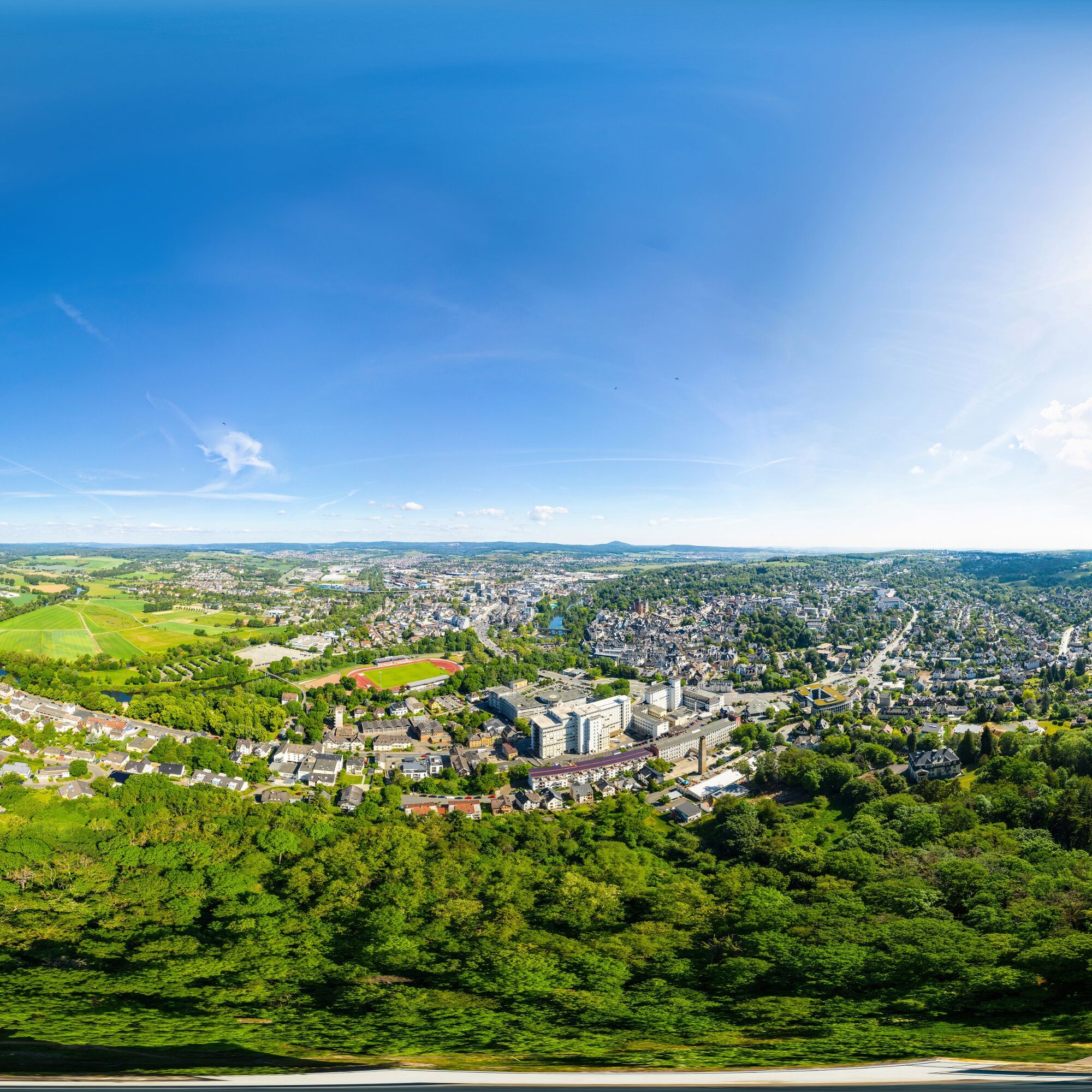
We meet the Lahn hiking trail and follow it through the nature reserve at the Weinberg. The formerly military-used area was classified as a Fauna-Flora-Habitat and an EU bird protection area in 2005. Here again we have a great view over the region. Subsequently, the path signage leads us along the forest edge. A basalt column points to a historic boundary stone that once marked Wetzlar’s border. Along the historic Landhege, some of these old boundary stones still remain today. We hike over more or less open terrain with beautiful views towards the west slope of Kalsmunt, where we finally reach a residential area again. Now it goes up to Kalsmunt.
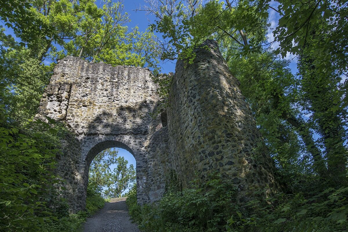
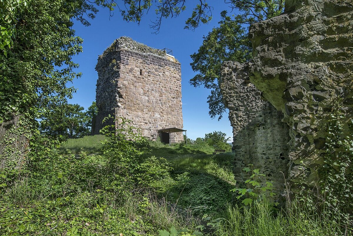
The Kalsmunt Support Association is dedicated to supporting the restoration and preservation of Kalsmunt. The ruins of the former imperial castle sit on a 256 m high basalt cone overlooking Wetzlar. A plaque and numerous basalt columns provide information about the history of Kalsmunt. A picnic group invites you to linger. We now follow the signpost and path markings down to Wetzlar. Over Kalsmuntstraße and through the Kalsmunt gate, we reach the street "Karl-Keller-Ring," which we cross at a traffic light. Along the Wetzbach and the mill channel, after a varied and eventful hike, we arrive back at the Lahn Island.
Ano
Ano
Normal hiking equipment is sufficient. Good footwear recommended. Don't forget a packed snack and drinks!
No special safety precautions are required. Be careful of ice in the winter months and slippery ground when wet!
Via the B49 to Wetzlar. Then via Karl-Keller-Ring to the Wetzlar Lahn Island parking lot (navigation: 35578 Wetzlar, Lahn Island). The information and entrance portal of the 3-Towers-Route is located at the bridge over the mill channel.
To the alternative entrance and information portal, drive via state road L3451 to Leitz Park (navigation: 35578 Wetzlar, Am Leitz-Park 5).
By German train to Wetzlar station. From there it is about a 15-minute walk to the starting point in Wetzlar's old town. The information and entrance portal of the 3-Towers-Route is located between the Lahn Island parking lot and the bridge over the mill channel.
Alternatively, from the station / central bus station, take bus line 11 to the stop "Am Leitz-Park" to start the circular route there.
Lahn Island Wetzlar (paid parking)
Leitz Park parking lot
Stoppelberg parking lot
Domplatz 8, 35578 Wetzlar
Tel. 06441/99-7755
Email: tourist-info@wetzlar.de
Visiting the Leica Experience World and the Ernst Leitz Museum is a highlight for all photography lovers (observe opening hours).
Oblíbené prohlídky v okolí
-
5.0
Wetzlar 3-Towers-Route North
středníTuristika 11.2 km -
Lahnwanderweg 11th stage upstream Braunfels - Wetzlar
světloTuristika 13 km -
Wetzlar Komfortweg Kirschenwäldchen
světloTuristika 2.93 km -
Braunfels - Owl Trail (forest adventure trail)
světloTematická stezka 3.49 km -
4.0
Die Raute - von Dutenhofen nach Wetzlar
středníTuristika 10.1 km -
Lahn cycle path
heavyCyklistika na velkou vzdálenost 248.9 km -
Biebertal Deceleration Path
světloTematická stezka 2.81 km -
DVV 8/10 km- Permanent Wetzlarer hiking trail Goetheweg with Grüngürtelweg
středníTuristika 10.2 km -
Lahnwanderweg 10th stage upstream Wetzlar - Rodheim-Bieber
středníTuristika 16.4 km -
MiningTrail Fortuna Mine
světloTematická stezka 3.83 km
Pěší turistika a stopování


Nenechte si ujít nabídky a inspiraci pro vaši příští dovolenou
Vaše e-mailová adresa byl přidán do poštovního seznamu.