


From St. Antönien over the Chleibach suspension bridge to Schiers
In the Walser village St. Antönien, near the postbus stop square, there are various inns where you can strengthen yourself for the ascent. Next to the postbus stop, follow the little road uphill towards...
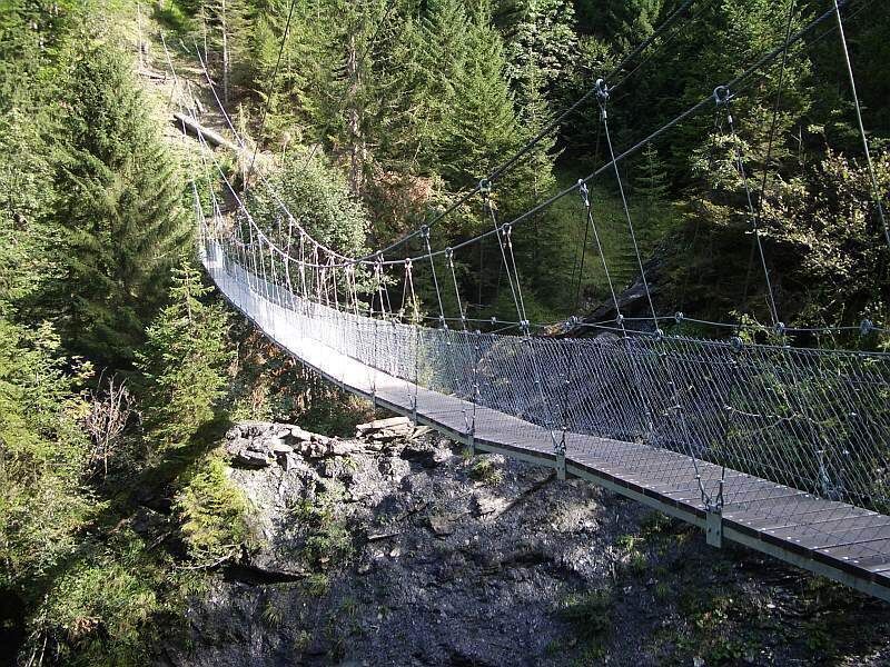
Directly after parking lot no. 21, the hiking trail towards «Salfsch/Schuders» begins; a soft meadow path leads over a moor - it is magical here during the early mountain spring! Where the path becomes wider, pay close attention to the markings - the descending path follows the Wissbach stream towards the forest for a short distance. Now crossing a wet pasture. Again in the forest, the route turns right along the slope, while a huge erosion gully opens up on the left. Wetlands alternate with dense forest; ferns line the path, you feel far away from civilization. In gentle ups and downs, you finally reach the Chleibach valley, descend to the suspension bridge which crosses the roaring wild brook.
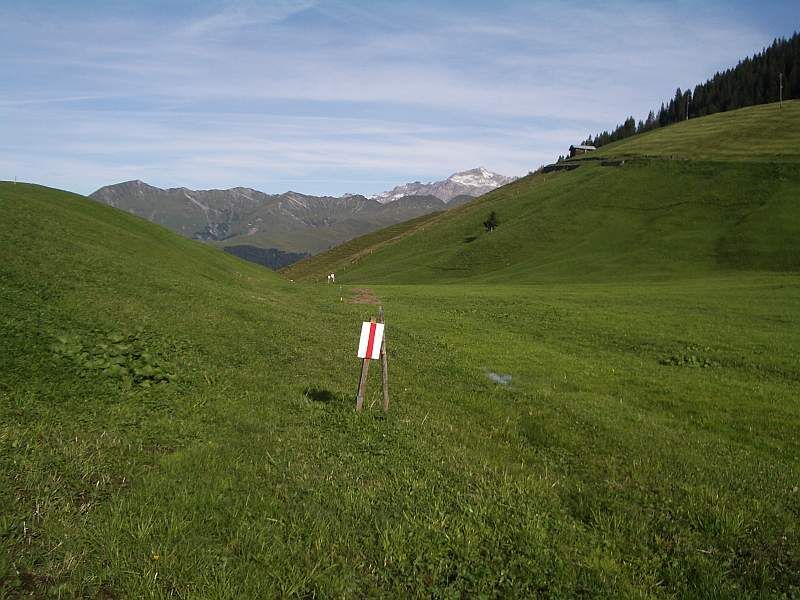
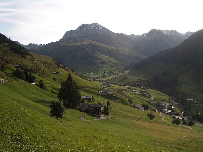
On the opposite slope, there are stairs back up to the high path, which now runs less wet and soft as fir needles along the contour. Countless small ravines are elegantly bypassed, a logging area crossed, and finally, you reach the beautifully located hamlet Salfsch. On the opposite side at the same height lies Schuders, with the Schraubach valley in between. Great view into the limestone walls of the «Bündner Dolomites».
From here, a forest road leads to Schiers, which is paved briefly at some wet sections. It winds into the Schraubach valley and follows the Schraubach stream downhill. At the Schuders sawmill, there is a branching possibility towards Schuders, see «author's tip».
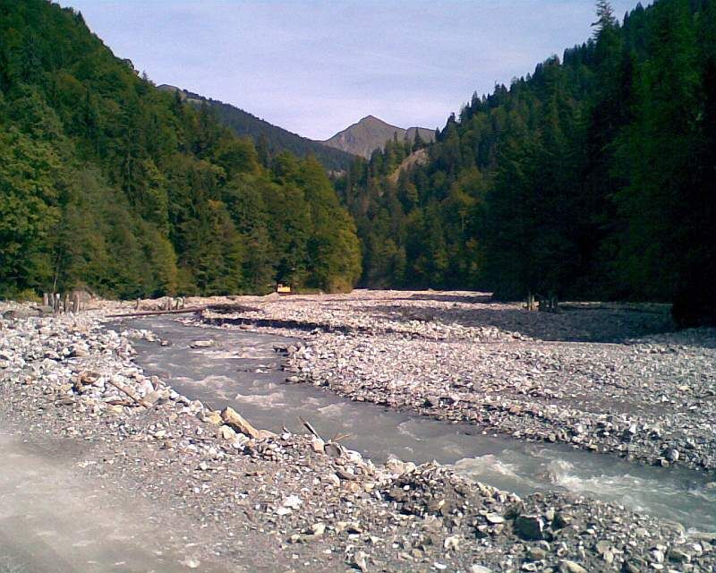
The rocks by the path and the brook are mighty. One continues to follow the course of the wild brook. Where the Wissbach joins, the brook bed becomes wide and the whole valley is full of debris. Several high concrete walls hold back the debris, forming impressive waterfalls.
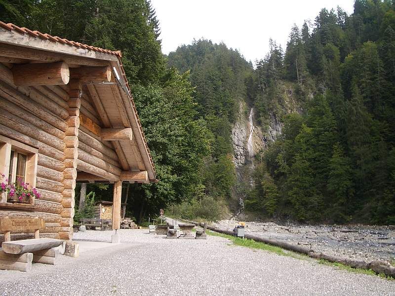
At the first signpost towards the «Salginatobel Bridge», the Salgina flows into the Schraubach. About 150 meters downstream, there is a comfortable picnic area with fire pits and a covered hut. The path continues beside the wide gravel bed to the gravel pit, where material is sorted and processed; the path leads right through the high gravel heaps - an unreal moon landscape. Shortly afterwards, you reach the primary school of Schiers. To the right, it's a 10-minute walk through the village to Schiers train station.

St. Antönien Platz 1414 m - Aschüel 1620 m - Chleibach suspension bridge 1320 m - Salfsch 1288 m - Schuderser sawmill in the Schraubach valley 1035 m - Hellstutz bridge - Salgina confluence / picnic area 758 m - Schiers 654 m
Ano
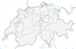
Via the A13 and N28 to Küblis, then follow Luzeinerstrasse to Pany / St. Antönien.
In St. Antönien all parking lots are subject to a fee. Payment can be made on the parking lots with cash, Parkingpay app, or Twint. Parking lot P2 is located in the village center, slightly above the church.
Panyerstrasse 39
CH-7243 Pany
Tel. +41 81 300 32 22
info@pany-stantoenien.ch
Prättigau Marketing
Feldweg 19
CH-7233 Jenaz
Tel. +41 (0)81 325 11 11
info@praettigau.info
Return via Schuders / postbus to Schiers: From the Schuders sawmill, a path leads to Schuders, from where there is a postbus connection to Schiers, but with only a few trips per day. This reduces the hiking time by about one hour. It is advisable to check the timetable before the ascent to Schuders (240 meters altitude gain, approx. 45 minutes). There is also a dining and overnight possibility at the mountain inn Post, Schuders.
Oblíbené prohlídky v okolí
- 5,0
Ski tour to the Lindauer Hut (1,744 m)
světloLyžařská trasa 14,0 km - 4,7
Smuggler’s path
středníTematická stezka 8,60 km - 4,4
Golm-Rundwanderweg im Rätikon
středníTematická stezka 7,28 km - 4,2
Golmerbahn Bergstaion Grüneck - Golmer Höhenweg - Geißspitze - Lindauer Hütte - Latschau
středníTuristika 11,5 km - 5,0
Douglasshütte, Lünersee, Gafalljoch Brand bei Bludenz, Vorarlberg
světloTuristika 9,16 km - 4,8
Douglashütte - Schesaplana
středníTuristika 7,31 km - 3,0
Bergstation Grüneck Golmerbahn - Alpe Latschätz - Lindauer Hütte - Latschau
světloTuristika 11,1 km - 3,3
Wanderbares Zalimtal
středníTuristika 12,2 km - 4,6
An den Fuß der Zimba
středníTuristika 5,43 km - 5,0
Around the Kirchlispitzen (2,552 m)
heavyTuristika 14,8 km
Pěší turistika a stopování


Nenechte si ujít nabídky a inspiraci pro vaši příští dovolenou
Vaše e-mailová adresa byl přidán do poštovního seznamu.