


Alpbüel summit circular hike
Fotografie našich uživatelů
The Alpbüel (2022m) is not one of the great summit figures in the Prättigau, but thanks to its good accessibility from Pany, it is a popular hiking destination. The ascent from the east and descent to...
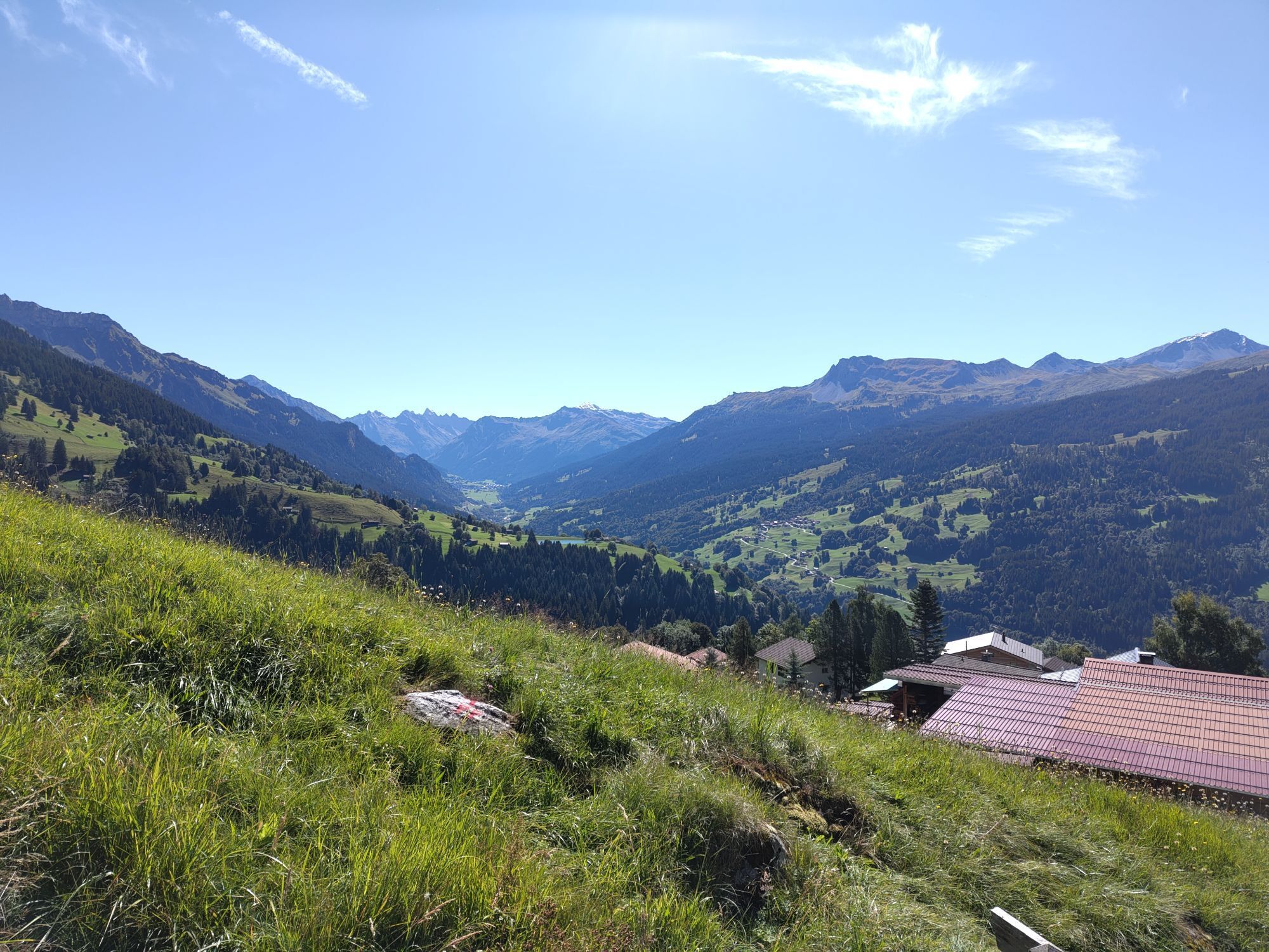
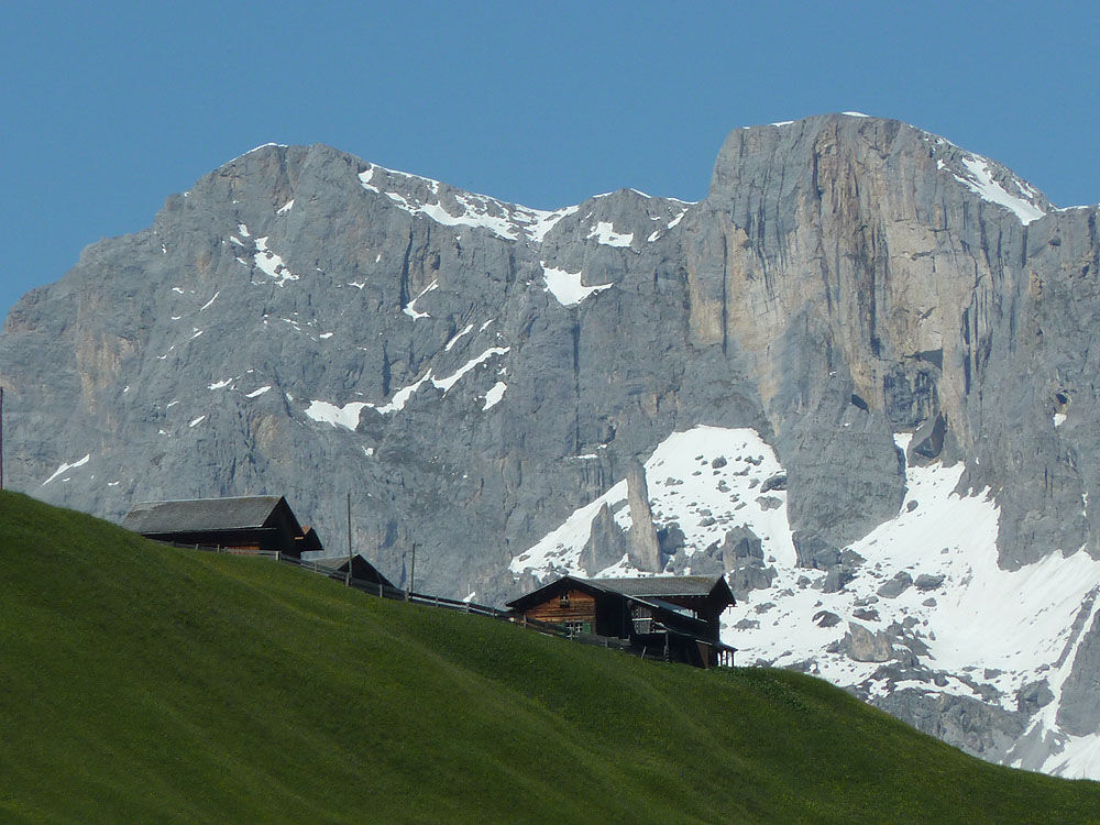
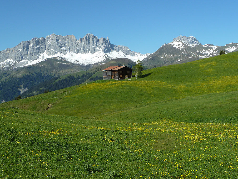
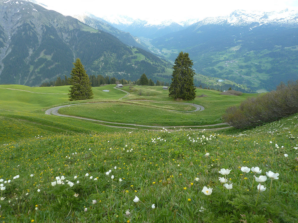
The Alpbüel (2022m) is not one of the great summit figures in the Prättigau, but thanks to its good accessibility from Pany, it is a popular hiking destination. The ascent from the east and descent to the south can be combined into a wonderful summit crossing. Its central location in the middle Prättigau grants the Alpbüel one of the most beautiful panoramas in the entire valley: from the limestone walls of the Rätikon in the north over the Silvretta and Davos mountains, the southern Prättigau summits to the view towards the Rhine Valley and beyond towards the Bündner Oberland and Glarus Alps. The southern slopes and the middle altitude ensure a long hiking season: generally possible from May to November.

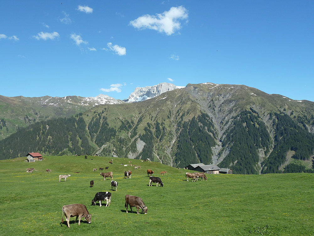
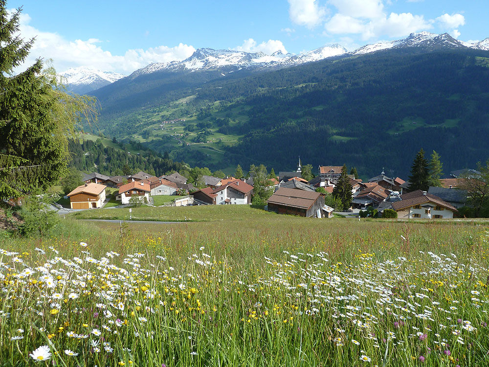
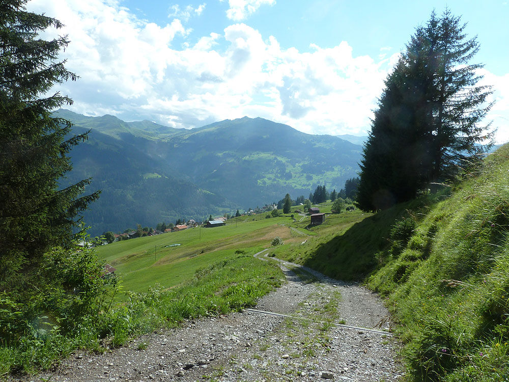
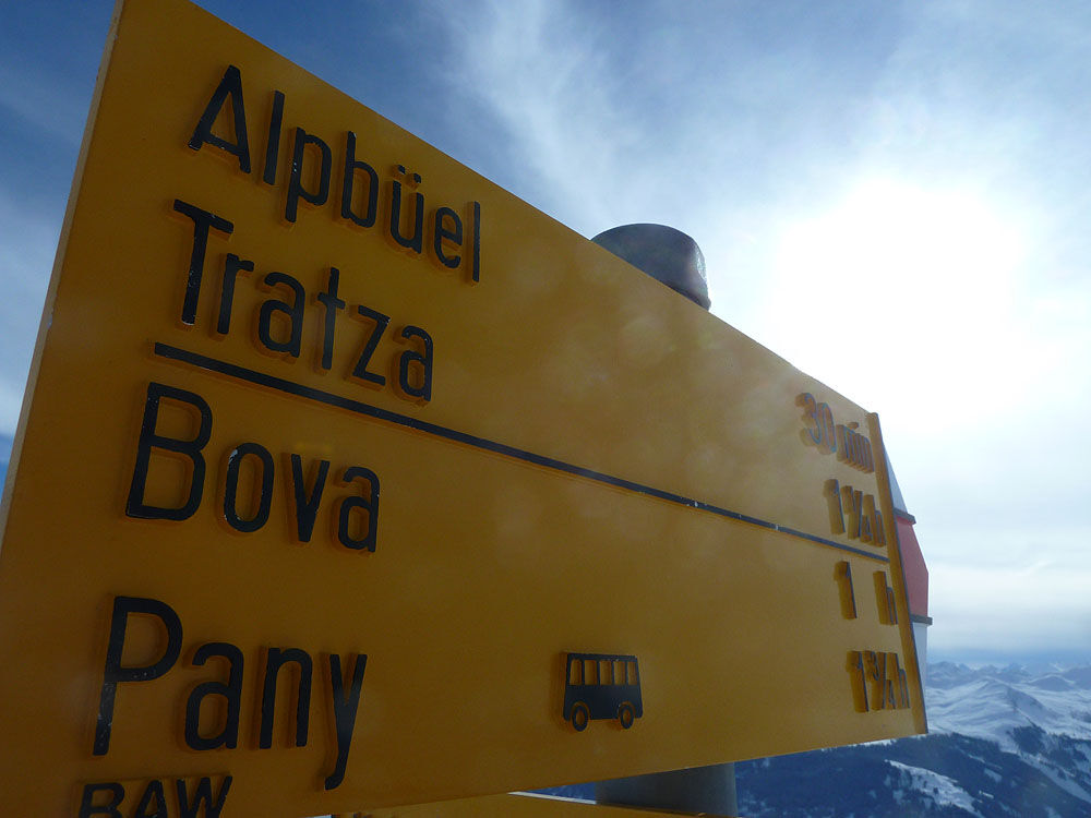
From the center of Pany, follow the yellow signs uphill towards Bova. Shortly after the alpine farm village of Bova, take the left turn towards Alpbüel. Through the varied alpine terrain and over the short, gentle summit ridge, you will reach the summit.
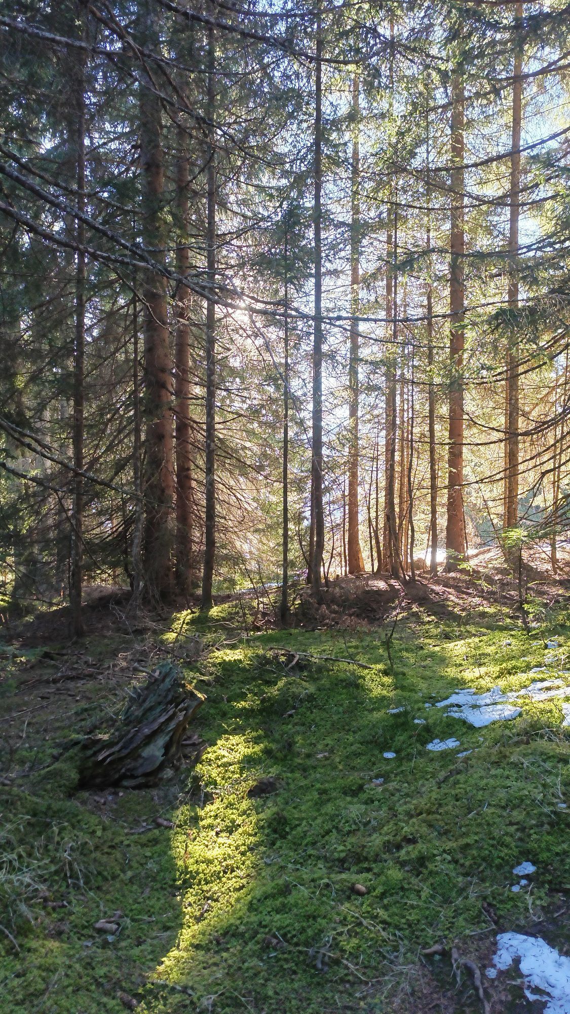
The descent leads southwards, steep at first, then more gently, down to Calondis and with a few meters of ascent still scenic to the alpine farm village Tratza. From the end of June to the end of October, you have the opportunity to indulge in local delicacies at the Tratza-Beizli. From here, it goes comfortably downhill through the open woods towards the village of Pany.
Ano
Good footwear, mountain hiking clothing adapted to the season, and a map in your backpack are recommended.
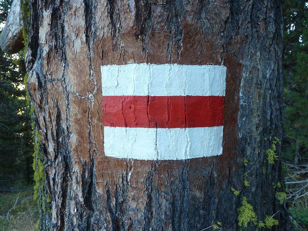
Easy and well-marked hiking trails. Do not leave the marked route in poor visibility.
Take the A13 to Landquart, continue on the B28 to Küblis, then follow Luzeinerstrasse uphill on the left (northwards) to Pany.
By Rhätische Bahn RhB to Schiers (90.218) or Küblis (90.222) and by post bus to Pany or St. Antönien.
Summer and winter: P41 ski lift, P42 Güggelstein, P43 swimming pool, parking spaces are subject to charges. Payment can be made with cash, Parkingpay app, or Twint.
Pany-St. Antönien Tourism
Panyerstrasse 39
CH-7243 Pany
Tel. +41 81 300 32 22
info@pany-stantoenien.ch
www.pany-stantoenien.ch
Prättigau Marketing
Feldweg 19
CH-7233 Jenaz
Tel. +41 (0)81 325 11 11
info@praettigau.info
www.praettigau.info
Webové kamery z prohlídky
Oblíbené prohlídky v okolí
-
5.0
Ski tour to the Lindauer Hut (1,744 m)
světloLyžařská trasa 14.0 km -
4.7
Smuggler’s path
středníTematická stezka 8.60 km -
4.4
Golm-Rundwanderweg im Rätikon
středníTematická stezka 7.28 km -
4.2
Golmerbahn Bergstaion Grüneck - Golmer Höhenweg - Geißspitze - Lindauer Hütte - Latschau
středníTuristika 11.5 km -
5.0
Douglasshütte, Lünersee, Gafalljoch Brand bei Bludenz, Vorarlberg
světloTuristika 9.16 km -
3.0
Bergstation Grüneck Golmerbahn - Alpe Latschätz - Lindauer Hütte - Latschau
světloTuristika 11.1 km -
4.7
Douglashütte - Schesaplana
středníTuristika 7.31 km -
5.0
Around the Kirchlispitzen (2,552 m)
heavyTuristika 14.8 km -
3.5
Golmer Höhenweg
středníTuristika 13.8 km -
5.0
Schesaplana
středníVysokohorská turistika 5.26 km

Pěší turistika a stopování


Nenechte si ujít nabídky a inspiraci pro vaši příští dovolenou
Vaše e-mailová adresa byl přidán do poštovního seznamu.