Navigace na stránkách
Pořiďte si tuto prohlídku do mobilního telefonu
Mapa
MTB route no. 6 On the trail of the abbey of Lucelle

heavy
Mountainbike
47.83 km
Naskenujte QR kód a spusťte navigaci v aplikaci bergfex.
QR Code
Pěší turistika a stopování

MTB route no. 6 On the trail of the abbey of Lucelle

Vzdálenost
47.8 km
Doba trvání
12:50 h
Ascent
986 hm
Hladina moře
478 - 733 m

Úroveň obtížnosti: S1

Stažení skladby
Mapa
MTB route no. 6 On the trail of the abbey of Lucelle
heavy
Mountainbike
47.83 km

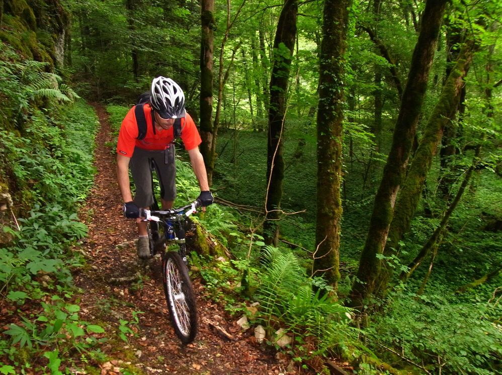
The attraction of this route, besides the many single tracks and the magnificent viewpoints, is that it allows an incursion and a connection with the MTB routes of the Canton and the Republic of Jura.
Trasa
Église Saint-Bernard-de-Menthon
(502 m)
Místo konání bohoslužeb
1.1 km
Rossberg
(675 m)
Summit
9.8 km
Église Saint-Laurent
(578 m)
Místo konání bohoslužeb
16.0 km
Église Saint-Martin
(536 m)
Místo konání bohoslužeb
19.9 km
Col du Neuneich
(731 m)
Horské sedlo
39.7 km
Église Saint-Georges
(490 m)
Místo konání bohoslužeb
43.9 km
Ligsdorf
(484 m)
Vesnice
44.0 km
Trasa
Mapa
MTB route no. 6 On the trail of the abbey of Lucelle
heavy
Mountainbike
47.83 km
Grosse Hallen
(533 m)
Koridor/terén
0.5 km
Basse Ville
(498 m)
Koridor/terén
1.1 km
Église Saint-Bernard-de-Menthon
(502 m)
Místo konání bohoslužeb
1.1 km
Ferrette
(491 m)
Vesnice
1.1 km
Kapellengarten
(496 m)
Koridor/terén
1.9 km
Vor dem Berg
(489 m)
Koridor/terén
2.5 km
Pfirterweg
(502 m)
Koridor/terén
2.6 km
Vieux-Ferrette
(474 m)
Vesnice
2.9 km
Raestel
(496 m)
Koridor/terén
4.0 km
Buergerwald
(565 m)
Koridor/terén
5.0 km
Schlund
(639 m)
Koridor/terén
6.6 km
Hirzenlachen
(629 m)
Koridor/terén
7.4 km
Ferrette
(491 m)
Vesnice
9.3 km
Rossberg
(675 m)
Summit
9.8 km
Alte Ruet
(594 m)
Koridor/terén
11.7 km
Entzematt
(548 m)
Koridor/terén
15.2 km
Chapelle Saint-Sébastien, Saint-Georges, Marie-Reine-du-Monde
(577 m)
Místo konání bohoslužeb
15.7 km
Église Saint-Laurent
(578 m)
Místo konání bohoslužeb
16.0 km
Winkel
(564 m)
Vesnice
16.0 km
Au cerf
(565 m)
Restaurace
16.3 km
Oberlarg
(524 m)
Vesnice
19.8 km
Église Saint-Martin
(536 m)
Místo konání bohoslužeb
19.9 km
Grotte du Mannlefelsen
(552 m)
Vchod do jeskyně
20.0 km
Source de la Largue
(545 m)
Zdroj:
20.2 km
Les Ébourbettes
(715 m)
Vypořádání
22.6 km
Le Grand Scholis
(654 m)
Vypořádání
25.2 km
Petit Scholis
(654 m)
Vypořádání
25.3 km
Route Nationale
(614 m)
Koridor/terén
25.8 km
Lucelle
(595 m)
Vypořádání
27.3 km
Le Relais de L'Abbaye
(593 m)
Restaurace
27.4 km
Lucelle
(610 m)
Koridor/terén
27.5 km
Moulin-Neuf
(501 m)
Koridor/terén
36.0 km
Neumühle/Moulin-Neuf
(504 m)
Vypořádání
36.0 km
Rossweid
(674 m)
Koridor/terén
38.7 km
Col du Neuneich
(731 m)
Horské sedlo
39.7 km
Taeufermatten
(563 m)
Koridor/terén
41.8 km
Rheinbach
(529 m)
Koridor/terén
42.5 km
Alte Ritti
(527 m)
Koridor/terén
43.1 km
Herrenmatten
(509 m)
Koridor/terén
43.3 km
Kapellengarten
(503 m)
Koridor/terén
43.6 km
Église Saint-Georges
(490 m)
Místo konání bohoslužeb
43.9 km
Ligsdorf
(484 m)
Vesnice
44.0 km
Haagmatten
(480 m)
Koridor/terén
44.6 km
Bitzenmatten
(488 m)
Koridor/terén
44.8 km
Maerzenegerten
(502 m)
Koridor/terén
45.0 km
Grossmatten
(568 m)
Koridor/terén
47.3 km
Stadtweiher
(539 m)
Koridor/terén
47.6 km
Informace o prohlídce

Probably one of the most difficult routes. It covers more than 42 km with nearly 1200 m of elevation gain. Needless to say, your calves are likely to burn. The attraction of this route, besides the many single tracks and the magnificent viewpoints, is that it allows an incursion and a connection with the MTB routes of the Canton and the Republic of Jura.
Charakter trasy
Zkouška
Technologie
2 / 6
Stav
5 / 6
Krajina
6 / 6
Zkušenosti
6 / 6
Nejlepší roční období
Led
Úno
Bře
Dub
Kvě
Čen
Čec
Srp
Zář
Říj
Lis
Pro
Sdílet prohlídku
Mapa
MTB route no. 6 On the trail of the abbey of Lucelle
heavy
Mountainbike
47.83 km
Chyba
Došlo k chybě. Zkuste to prosím znovu.
Informace o trase
Trasa

Specific MTB marking

Geologické zajímavosti

Ano

Vybavení

Wearing a helmet is highly recommended

Bezpečnostní pokyny

Safety instructions

Emergency number: 112

Mountain biking as you want! but…

Use the marked trails for your safety and respect the direction of the routes

Do not overestimate your abilities and keep control of your speed

Be careful and courteous when overtaking or crossing hikers as pedestrians have priority

Check the condition of your MTB and bring supplies and repair accessories

If you go alone, leave your route with someone

Respect private property and cultivated areas

Beware of agricultural and forestry machinery

Close the gates

Avoid wild picking of flowers, fruits and mushrooms

Do not disturb the peace of wild animals

Take your litter with you, be discreet and respectful of the environment

Informace o příjezdu
Příjezd

Ferrette (68)

Veřejná doprava

www.fluo.eu

Parkování

Free parking on site

Další informace a tipy
Úroveň obtížnosti

S1

Další informace

SUNDGAU TOURIST OFFICE

13 rue du Château

68130 Altkirch

Tel: 03 89 40 02 90

info@sundgau-sudalsace.fr

www.sundgau-sudalsace.fr

Pěší turistika a stopování

Pěší turistika a stopování

Pěší turistika a stopování
Více než 550.000 návrhů výletů, podrobné mapy a intuitivní plánovač tras dělají z aplikace nezbytnou výbavu pro všechny milovníky přírody.
bergfex