


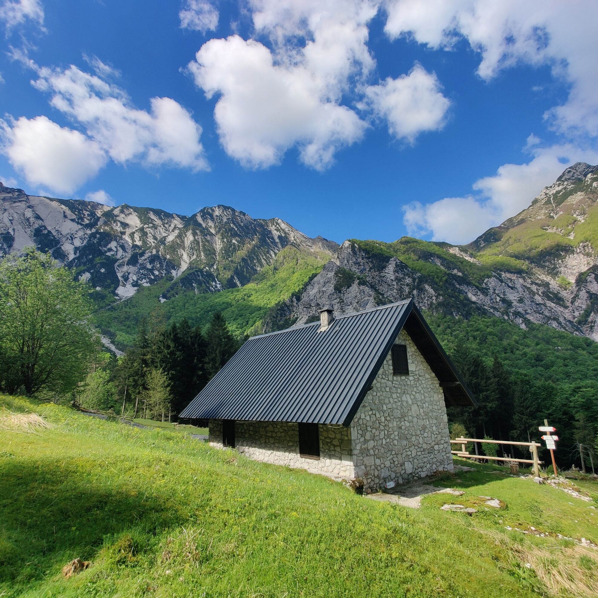
The valley and the Rio Nero shelter hut
Úroveň obtížnosti: T3
From locality Tigo (390 m) starts a suggestive route leading to the Rio Nero shelter hut (870 m), first following the new Val Resia Cycle Touring route and then the CAI 703 path. The trail runs for about...
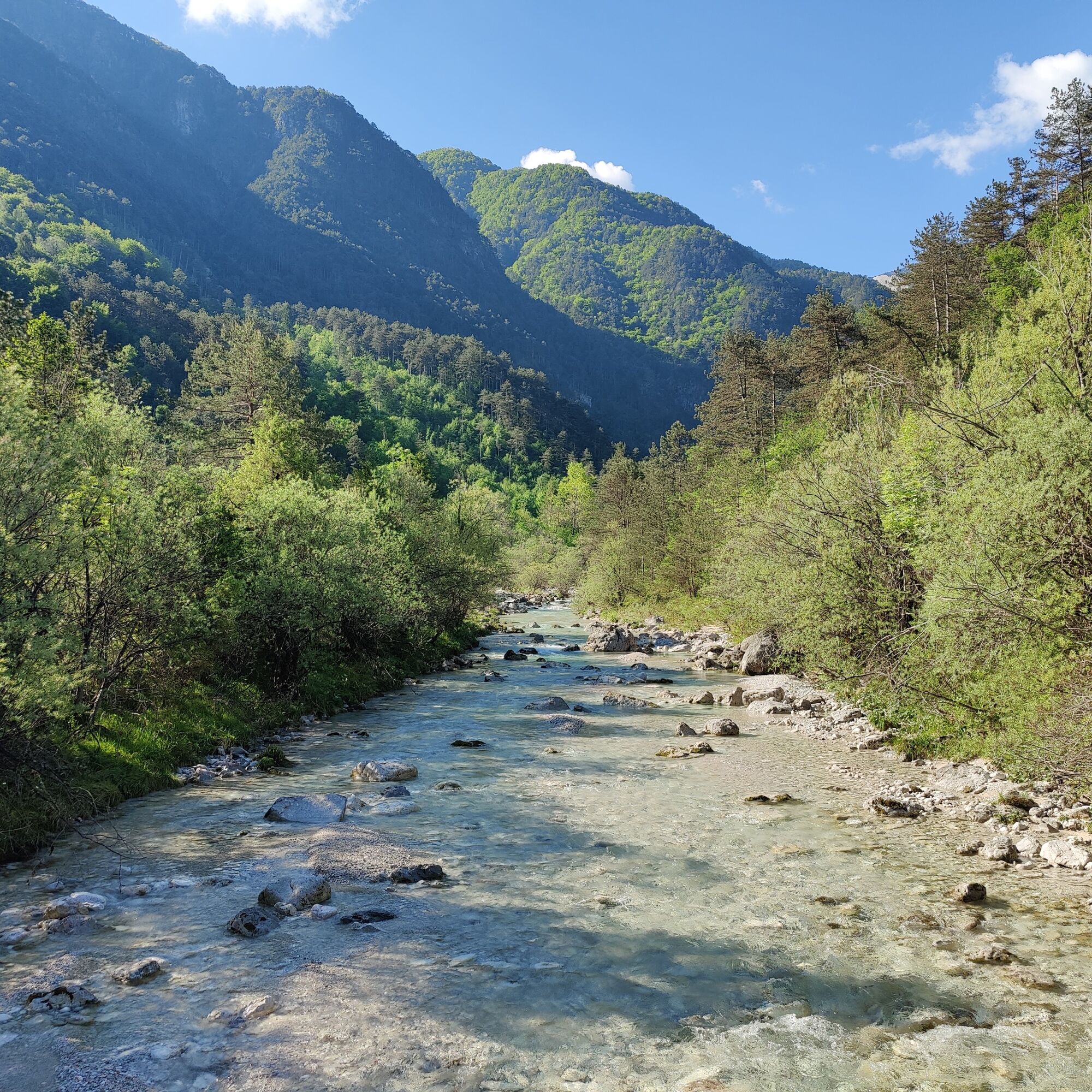
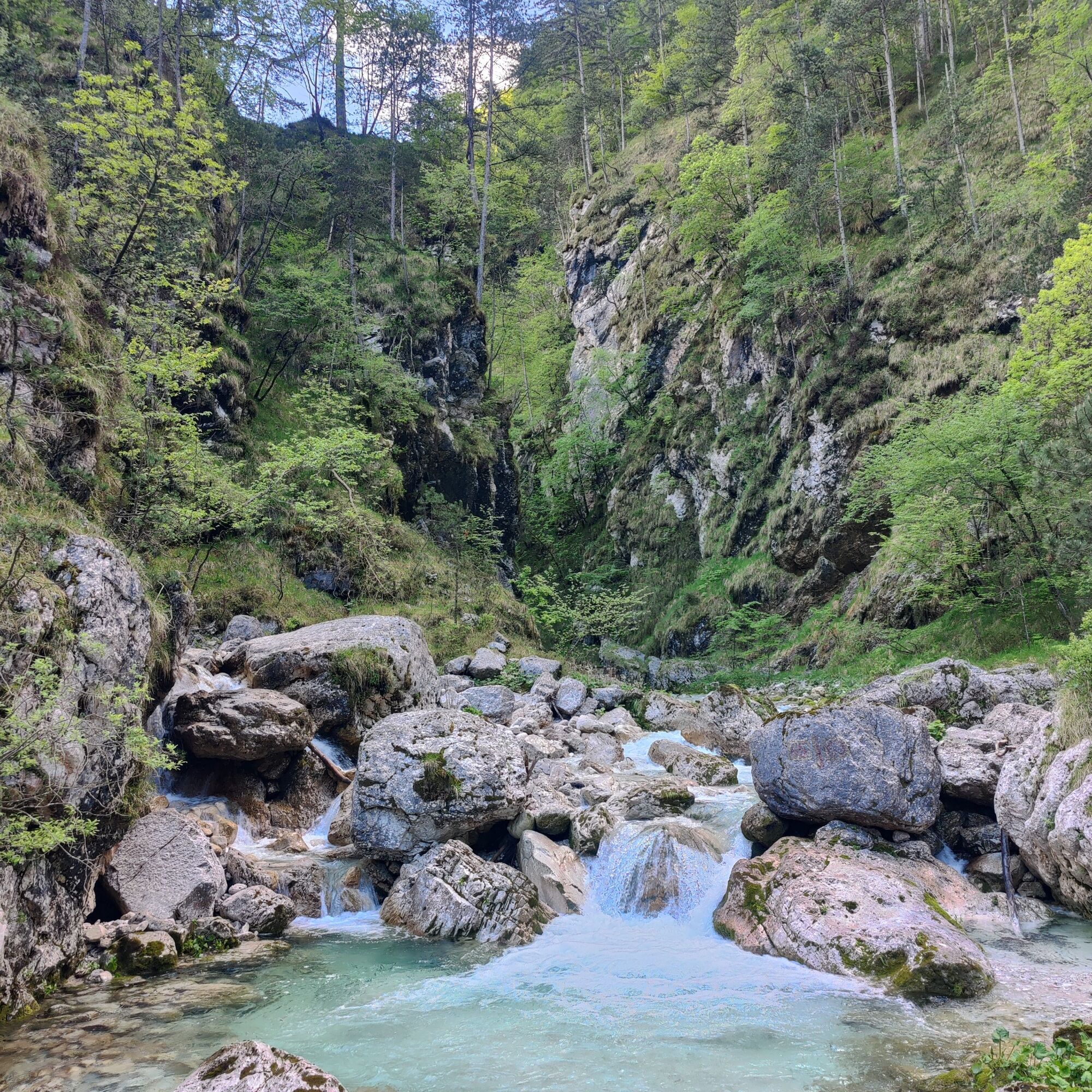
From locality Tigo (390 m) starts a suggestive route leading to the Rio Nero shelter hut (870 m), first following the new Val Resia Cycle Touring route and then the CAI 703 path. The trail runs for about 4 km through beech and pine woods, allowing you to climb the turbulent Rio Nero whose roaring sound accompanies the ascent. The environment, cool and shady, alternates with sunny clearings from which there are views over Val Resia and the peaks of the Julian Prealps (Monte Canin and Musi).
After a steeper section, the route softens until the clearing where the shelter hut stands, immersed in fir and beech woods under the watchful eye of the Musi Mountains' peaks.
The hike, suitable for moderately trained walkers, offers an authentic experience seeking those less frequented, remote areas with deep silences and the colors of a thousand flowers.
Ideal in all non-snowy seasons, it represents a perfect destination for those looking for nature, tranquility, and direct contact with the landscape of the Julian Prealps Natural Park.
Path CAI 703 is classified EE. Along the route, there are some metal cables that assist in progression even in brief more exposed passages. It is strongly discouraged to walk the path after heavy rain periods.

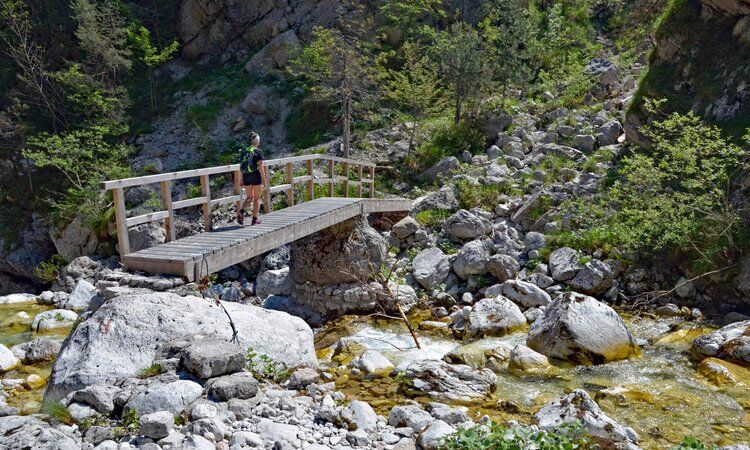
After leaving the car in the locality of Tigo, cross the footbridge over the Resia stream and turn right along the Val Resia cycle-pedestrian path. After a couple of kilometers, cross the Rio Nero with a small bridge and turn left. Continue always along the path until you reach the Rio Nero shelter hut.
Ano
Ano
A suitable equipment for outdoor activities is recommended:
Rain jacket; Long trousers; T-shirt; Sweatshirt; Hiking shoes or boots; Hat; Water and snacks; First aid kit; Tick repellent sprayIn case of injuries, the number to call is 112 NUE
Ticks are present throughout the Friuli Venezia-Giulia region, so it is advised to learn about prevention and protection techniques: Tick information Friuli Venezia Giulia region
The route is not recommended after and during adverse weather conditions and is not recommended during the hottest summer hours.
The hamlet of Tigo is conveniently reachable via SP42. From SS13-Pontebbana, heading towards Tarvisio, turn right at Resiutta and follow the SP42. Continue straight until you reach the Stari Mlin premises, just before which turn right and park at the indicated point.
Near the beginning of the path there is a free uncontrolled parking area: GPS point
Several free parking areas are also available in the immediate vicinity.
T3
It is recommended to take home all types of waste and to preserve the places crossed as best as possible.
Please note that collecting plant species or parts of them is prohibited within the Natural Park and may be subject to restrictions according to Regional Law 7/2009 in external areas. The list of protected species can be consulted at this link.
Please note that within protected areas dogs must be kept on a leash.
From the Rio Nero shelter hut it is possible to continue along the CAI 703 path to the hamlet of Lischiazze, where you can visit the Barman fountain, and return via the Ta Stara Pot path to complete a full loop.
From the Rio Nero shelter hut it is possible to continue along the CAI 726 path to reach Malga Confin.
Oblíbené prohlídky v okolí
-
4.7
Tarvisio - Venzone (C101)
středníCyklistika na velkou vzdálenost 64.7 km -
4.3
Monte Festa, a mountain rich in history
středníTuristika 13.5 km -
4.5
Gemona
středníMountainbike 20.6 km -
4.8
Tarvisio - Gorizia: z hor na vinice (CX01)
středníCyklistika na velkou vzdálenost 155.8 km -
5.0
Monte Stella, mezi malými vesnicemi a širokými výhledy
světloTuristika 9.18 km -
4.5
Loop of Val Venzonassa
středníTuristika 9.74 km -
3.0
Curtissons
Lyžařská trasa 8.50 km -
Montasch: Una bellissima passeggiata serale fino al Biv. SURINGAR
středníTuristika 3.79 km -
Moggio Udinese to Monticello
středníMountainbike 23.6 km -
4.5
Monte Flop loop from Val Aupa
středníTuristika 13.5 km

Pěší turistika a stopování


Nenechte si ujít nabídky a inspiraci pro vaši příští dovolenou
Vaše e-mailová adresa byl přidán do poštovního seznamu.