La Vigne - Saint-Domineuc - Saint-Docmaël de Saint-Domineuc - La Motte Linon
střední
Navigace na stránkách
Navigace na stránkách
Pořiďte si tuto prohlídku do mobilního telefonu
La Vigne - Saint-Domineuc - Saint-Docmaël de Saint-Domineuc - La Motte Linon
střední
Mountainbike
38.77
km
Naskenujte QR kód a spusťte navigaci v aplikaci bergfex.

Pěší turistika a stopování


La Vigne - Saint-Domineuc - Saint-Docmaël de Saint-Domineuc - La Motte Linon
střední
Vzdálenost
38.77
km
Doba trvání
02:46
h
Ascent
299
hm
Hladina moře
21 -
81
m
Stažení skladby
La Vigne - Saint-Domineuc - Saint-Docmaël de Saint-Domineuc - La Motte Linon
střední
Mountainbike
38.77
km
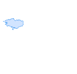
Trasa
Saint-Docmaël de Saint-Domineuc
(36 m)
Místo konání bohoslužeb
1.9 km
La Haye de Terre
(31 m)
Vypořádání
8.9 km
Le Rocher Bernard
(75 m)
Vypořádání
12.6 km
La Touche
(83 m)
Vypořádání
18.9 km
La Châtaigneraie
(36 m)
Vypořádání
24.3 km
Épine-Fort
(69 m)
Vypořádání
28.5 km
Saint-Docmaël de Saint-Domineuc
(36 m)
Místo konání bohoslužeb
36.9 km
Trasa
La Vigne - Saint-Domineuc - Saint-Docmaël de Saint-Domineuc - La Motte Linon
střední
Mountainbike
38.77
km
La Vigne
(37 m)
Sousedství
1.5 km
Saint-Domineuc
(36 m)
Vesnice
1.8 km
Saint-Docmaël de Saint-Domineuc
(36 m)
Místo konání bohoslužeb
1.9 km
La Motte Linon
(21 m)
Vypořádání
3.0 km
La Ramée
(24 m)
Vypořádání
5.9 km
Le Mottay
(27 m)
Vypořádání
6.0 km
Calaudry
(27 m)
Vypořádání
6.5 km
Le Village
(24 m)
Vypořádání
7.9 km
La Haye de Terre
(31 m)
Vypořádání
8.9 km
Le Mesnil
(40 m)
Vypořádání
9.2 km
La Ville Thebault
(38 m)
Vypořádání
10.0 km
La Frétochère
(48 m)
Vypořádání
10.4 km
La Vectais
(57 m)
Vypořádání
11.0 km
La Pivaudière
(76 m)
Vypořádání
11.6 km
La Bourdonnière
(77 m)
Vypořádání
11.7 km
Les Rondes
(68 m)
Vypořádání
11.8 km
Le Rocher Bernard
(75 m)
Vypořádání
12.6 km
Saint-Séliac
(83 m)
Vypořádání
12.7 km
Percotte
(80 m)
Vypořádání
14.3 km
La Harie
(81 m)
Vypořádání
14.4 km
La Croix des Brêches
(83 m)
Vypořádání
14.5 km
La Faverie
(80 m)
Vypořádání
15.8 km
La Mare
(80 m)
Vypořádání
16.0 km
La Gerdais
(77 m)
Vypořádání
17.9 km
La Touche
(83 m)
Vypořádání
18.9 km
La Ville Geffrend
(77 m)
Vypořádání
19.4 km
La Motte
(61 m)
Vypořádání
20.3 km
Le Mesnil
(40 m)
Vypořádání
20.7 km
La Chapronais
(39 m)
Vypořádání
20.7 km
La Ville Gouin
(50 m)
Vypořádání
22.3 km
La cour-ès-Comptes
(51 m)
Vypořádání
22.7 km
La chauchix-Marie
(52 m)
Vypořádání
23.0 km
La Châtaigneraie
(36 m)
Vypořádání
24.3 km
La Ville André
(41 m)
Vypořádání
24.8 km
Villeneuve
(36 m)
Vypořádání
26.2 km
Le Valet
(51 m)
Vypořádání
26.4 km
Le Vaux Picault
(49 m)
Vypořádání
26.8 km
La Courbe
(41 m)
Vypořádání
27.0 km
Louche
(72 m)
Vypořádání
27.4 km
Visseiche
(70 m)
Vypořádání
27.5 km
Épine-Fort
(69 m)
Vypořádání
28.5 km
La Courte ès Derennes
(69 m)
Vypořádání
29.0 km
Launay
(70 m)
Vypořádání
29.0 km
La cour-ès-Comptes
(51 m)
Vypořádání
29.8 km
La Ville Gouin
(50 m)
Vypořádání
30.0 km
La Chapronais
(39 m)
Vypořádání
30.5 km
Le Mesnil
(40 m)
Vypořádání
30.7 km
La Haye de Terre
(31 m)
Vypořádání
31.0 km
Le Village
(24 m)
Vypořádání
31.9 km
Calaudry
(27 m)
Vypořádání
33.4 km
Le Mottay
(27 m)
Vypořádání
34.0 km
La Ramée
(24 m)
Vypořádání
34.1 km
Saint-Docmaël de Saint-Domineuc
(36 m)
Místo konání bohoslužeb
36.9 km
Saint-Domineuc
(36 m)
Vesnice
36.9 km
La Vigne
(37 m)
Sousedství
37.1 km
Zatím žádné recenze
Oblíbené prohlídky v okolí
-
Dinan - Église Saint-Malo - Église Saint-Pierre - Évran
středníJízda na kole 13.9 km -
Le Quiou - Le Crêp'iou - Église Notre-Dame
světloTuristika 4.65 km -
Le Pré de L'Église - Ancienne église de Saint-André des Eaux - La Cahuette - Saint-André-des-Eaux
světloTuristika 3.49 km -
Le Port - Église Notre-Dame - Église Saint-Hélen - Dinan
Jízda na kole 48.7 km -
La Magdeleine - La Parfraire - La Pechetiere - La Sagerie
středníTuristika 9.40 km -
Lourmais - Église Saint-Martin-de-Tours - Église Saint-Martin - Église Sainte-Anne
středníŠotolinové kolo 50.0 km -
La Magdeleine - La Touche Aux Aubry - Rouyon - Église Saint-Martin-de-Tours
středníTuristika 10.4 km -
Église Saint-Martin-de-Tours - Église Saint-Pierre - Église de la Présentation-de-la-Sainte-Vierge - Le relais du Boulet
středníTuristika 18.4 km -
Les Iffs - La Forêt - Le Rocher - Église Saint-Ouen
světloTuristika 4.06 km -
La Roche Blanche - Ville Bué - Fortonnais - La Sagerie
světloMountainbike 20.4 km

Pěší turistika a stopování

Více než 550.000 návrhů výletů, podrobné mapy a intuitivní plánovač tras dělají z aplikace nezbytnou výbavu pro všechny milovníky přírody.

Nenechte si ujít nabídky a inspiraci pro vaši příští dovolenou
Přihlaste se k odběru newsletteru
Chyba
Došlo k chybě. Zkuste to prosím znovu.
Děkujeme za vaši registraci
Vaše e-mailová adresa byl přidán do poštovního seznamu.
Zájezdy po celé Evropě
Rakousko
Švýcarsko
Německo
Itálie
Slovenia
Francie
Nizozemsko
Belgie
Polsko
Lichtenštejnsko
Česko
Slovensko
Španělsko
Chorvatsko
Bosna a Hercegovina
Lucembursko
Andorra
Portugal
Iceland
United Kingdom
Ireland
Greece
Albania
North Macedonia
Malta
Norway
Montenegro
Moldova
Kosovo
Hungary
San Marino
Romania
Estonia
Latvia
Belarus
Cyprus
Lithuania
Serbia
Bulgaria
Monaco
Denmark
Sweden
Finland