


Across the forest to Elsenfeld

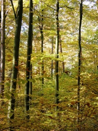
You start the hiking route at the parking lot at the upper entrance of the Forest Cemetery. From there, turn left onto an asphalt road, continue following the Nordic Walking 1 trail marker to the signpost Orgelwiese. You reach the upper Orgelwiese and turn left there according to the Nordic Walking 1 and Black Owl trail markers. The path initially leads along the edge of the forest with views of fields and then turns right through the forest on a gravel path to the school center. From here, follow the Black Owl trail marker uphill to the signpost “Platte.” From there, continue right following the Black Owl trail to the signpost Orgelwiese.
From the upper Orgelwiese, return along Nordic Walking 1 to the parking lot at the upper entrance of the Forest Cemetery.
State road 2309, turn right toward Forest Cemetery in Erlenbach-Elsenfeld. Access along the wall to the Upper Entrance.
Free parking at the Forest Cemetery, Upper Entrance
Oblíbené prohlídky v okolí
-
"Of Clay, Stones and Shards"
středníTuristika 8.31 km -
5.0
Dorfprozelten: Kollenburg-Chapel-Route
středníTuristika 11.8 km -
Obernburg - Eisenbach round
středníTuristika 10.7 km -
5.0
Kulturweg Niedernberg: Blechkatzen im Honischland
Turistika 10.2 km -
4.0
European cultural route: "From Hecke to Häcke in Hebboch"
středníTuristika 10.2 km -
5.0
Rüdenau mountain hike R1
heavyTuristika 13.8 km -
Miltenberg - Engelberg Monastery - Kleinheubach Castle - round trip
heavyTuristika 12.6 km -
3.0
Franconian Red Wine Hiking Route - 4th stage from Erlenbach to Klingenberg
světloTuristika 4.08 km -
5.0
Klingenberg: Hiking Trail Schnepfe
středníTuristika 5.03 km -
4.0
Elsenfeld district Rück: Via Eichelsbach and the Himmelthal monastery through the vineyards back to the car park in Churfranken
heavyTuristika 9.32 km
Pěší turistika a stopování


Nenechte si ujít nabídky a inspiraci pro vaši příští dovolenou
Vaše e-mailová adresa byl přidán do poštovního seznamu.