Sünching - St. Johann - Pfarrkirche St. Michael - Wallfahrtskirche Beata Maria Virgo Scheuer
střední
Navigace na stránkách
Navigace na stránkách
Pořiďte si tuto prohlídku do mobilního telefonu
Sünching - St. Johann - Pfarrkirche St. Michael - Wallfahrtskirche Beata Maria Virgo Scheuer
střední
Silniční kolo
42.23
km
Naskenujte QR kód a spusťte navigaci v aplikaci bergfex.

Pěší turistika a stopování


Sünching - St. Johann - Pfarrkirche St. Michael - Wallfahrtskirche Beata Maria Virgo Scheuer
střední
Vzdálenost
42.23
km
Doba trvání
02:12
h
Ascent
254
hm
Hladina moře
332 -
399
m
Stažení skladby
Sünching - St. Johann - Pfarrkirche St. Michael - Wallfahrtskirche Beata Maria Virgo Scheuer
střední
Silniční kolo
42.23
km
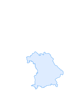
Trasa
St. Moritz
(343 m)
Místo konání bohoslužeb
1.6 km
Wallfahrtskirche Maria Schnee
(396 m)
Místo konání bohoslužeb
6.6 km
Pfarrkirche St. Michael
(343 m)
Místo konání bohoslužeb
24.3 km
Wallfahrtskirche Beata Maria Virgo Scheuer
(341 m)
Místo konání bohoslužeb
26.1 km
St. Stephan
(336 m)
Místo konání bohoslužeb
31.8 km
St. Jakobus
(338 m)
Místo konání bohoslužeb
34.5 km
St. Stephanus
(337 m)
Místo konání bohoslužeb
39.2 km
Trasa
Sünching - St. Johann - Pfarrkirche St. Michael - Wallfahrtskirche Beata Maria Virgo Scheuer
střední
Silniční kolo
42.23
km
Sünching
(343 m)
Železniční stanice
0.0 km
Gasthof Englberger
(340 m)
Restaurace
0.2 km
Sünching
(340 m)
Vesnice
0.7 km
St. Johann
(341 m)
Místo konání bohoslužeb
0.7 km
St. Moritz
(343 m)
Místo konání bohoslužeb
1.6 km
Haidenkofen
(342 m)
Vesnice
2.6 km
St. Ägidius
(344 m)
Místo konání bohoslužeb
2.6 km
Wallfahrtskirche Maria Schnee
(396 m)
Místo konání bohoslužeb
6.6 km
Aufhausen
(391 m)
Vesnice
6.6 km
Gailsbach
(361 m)
Vesnice
13.1 km
Hagelstadt
(365 m)
Vesnice
14.9 km
Neueglofsheim
(362 m)
Vypořádání
18.5 km
Thalmassing
(352 m)
Vesnice
20.2 km
Pfarrkirche St. Michael
(343 m)
Místo konání bohoslužeb
24.3 km
Köfering
(343 m)
Vesnice
24.8 km
Gasthof zur Post
(341 m)
Restaurace
24.8 km
Wallfahrtskirche Beata Maria Virgo Scheuer
(341 m)
Místo konání bohoslužeb
26.1 km
Scheuer
(339 m)
Vesnice
26.2 km
Osten
(336 m)
Vypořádání
27.0 km
Mangolding
(338 m)
Vesnice
27.3 km
Kapelle
(341 m)
Místo konání bohoslužeb
27.7 km
Mintraching
(332 m)
Vesnice
28.9 km
Tiefbrunn
(335 m)
Vypořádání
31.7 km
St. Stephan
(336 m)
Místo konání bohoslužeb
31.8 km
Moosham
(336 m)
Vesnice
33.0 km
Sengkofen
(337 m)
Vesnice
34.4 km
Gasthaus zum Goldenen Krug
(336 m)
Restaurace
34.4 km
St. Jakobus
(338 m)
Místo konání bohoslužeb
34.5 km
Taimering
(332 m)
Vesnice
36.7 km
Oberehring
(338 m)
Vypořádání
39.0 km
St. Stephanus
(337 m)
Místo konání bohoslužeb
39.2 km
Sünching
(340 m)
Vesnice
41.8 km
Sünching
(343 m)
Železniční stanice
42.2 km
Zatím žádné recenze
Oblíbené prohlídky v okolí
-
Straubing
heavyInline-Skating 42.3 km -
Große Laber-Radweg
světloJízda na kole 88.8 km -
Radtour R7 - Ins Drei Seen-Land
světloJízda na kole 23.0 km -
Barrierearme Tour: Barbinger Flure
světloTuristika 6.38 km -
Radtour R10 - Durch die Kornkammer Bayerns
středníJízda na kole 52.1 km -
Radtour R6 - Auf den Spuren Napoleons
světloJízda na kole 37.1 km -
"Entlang der Großen Laber"
světloJízda na kole 71.8 km -
4.0
Straubing - Mariä Himmelfahrt - St. Bartholomäus - Regensburg Hauptbahnhof
světloCyklistika na velkou vzdálenost 57.9 km -
An der schönen blauen Donau
Turistika 57.3 km -
Regensburg Hauptbahnhof - St. Wolfgang - Hanselberg - Saubuckel
středníCyklistika na velkou vzdálenost 203.9 km

Pěší turistika a stopování

Více než 550.000 návrhů výletů, podrobné mapy a intuitivní plánovač tras dělají z aplikace nezbytnou výbavu pro všechny milovníky přírody.

Nenechte si ujít nabídky a inspiraci pro vaši příští dovolenou
Přihlaste se k odběru newsletteru
Chyba
Došlo k chybě. Zkuste to prosím znovu.
Děkujeme za vaši registraci
Vaše e-mailová adresa byl přidán do poštovního seznamu.
Zájezdy po celé Evropě
Rakousko
Švýcarsko
Německo
Itálie
Slovenia
Francie
Nizozemsko
Belgie
Polsko
Lichtenštejnsko
Česko
Slovensko
Španělsko
Chorvatsko
Bosna a Hercegovina
Lucembursko
Andorra
Portugal
Iceland
United Kingdom
Ireland
Greece
Albania
North Macedonia
Malta
Norway
Montenegro
Moldova
Kosovo
Hungary
San Marino
Romania
Estonia
Latvia
Belarus
Cyprus
Lithuania
Serbia
Bulgaria
Monaco
Denmark
Sweden
Finland