







Cycling round route from the Main through the southern Spessart - Route 5
Úroveň obtížnosti: 3
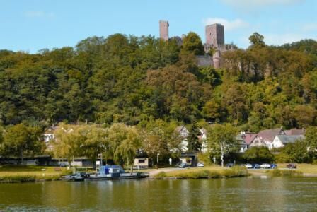
Stadtporzelten: Burg Henneburg with Romanesque-Gothic style elements (origin 10th century); parish church from the 14th century with high altar crucifixion group of the "Nuremberg School" (15th century);...
Stadtporzelten: Burg Henneburg with Romanesque-Gothic style elements (origin 10th century); parish church from the 14th century with high altar crucifixion group of the "Nuremberg School" (15th century); town hall built around 1520 with outstanding upper floor; half-timbered houses.
Fishing possibility, campsite, barbecue area for leisure activities.


We ride from Stadtprozelten along the Main to Faulbach. There we turn into the Faulbach valley and ride via Breitenbrunn to Altenbuch. From there we use the district road via Wildensee and Eschau. In Eschau we leave the district road and ride on a farm road to Mönchberg. From Mönchberg we ride on the district road up to the Eselsweg.
Here we reach the highest elevation of this route at 465 m above sea level. From the Eselsweg it goes swiftly downhill to Reistenhause-Fechenbach. From there we ride back along the Main on the cycle path via Dorfprozelten to Stadtprozelten.
Between Stadtprozelten and Fechenbach the Route 5 coincides with Route 4. We cross Route 8 in Mönchberg. In Eschau there is a connection possibility to Route 9.
The entire route leads over well-developed asphalted roads and paths. Between Fechenbach and Stadtprozelten we use a cycle path along the Main.
The district road between Altenbuch and Eschau as well as between Mönchberg and Fechenbach-Reistenhausen has only low to medium traffic volume. The other roads and paths have only minor motor vehicle traffic.
Ano
Trekking or touring bike with multiple gears
A3 to Wertheim exit then about 14 km towards Miltenberg/ Stadtprozelten
By train coming from Miltenberg direction to the stop Stadtprozelten. By train coming from Aschaffenburg direction to the stop Miltenberg, then change to the train towards Wertheim until the stop Stadtprozelten
Parking at the Main, directly at the Main ferry parking lot or at the train station.
3
Oblíbené prohlídky v okolí
-
"Of Clay, Stones and Shards"
středníTuristika 8.31 km -
5.0
Dorfprozelten: Kollenburg-Chapel-Route
středníTuristika 11.8 km -
5.0
Roman Route in Miltenberg M1
heavyTuristika 15.3 km -
Obernburg - Eisenbach round
středníTuristika 10.7 km -
4.0
European cultural route: "From Hecke to Häcke in Hebboch"
středníTuristika 10.2 km -
5.0
Rüdenau mountain hike R1
heavyTuristika 13.8 km -
MainRadweg Wertheim bis Miltenberg
Jízda na kole 35.7 km -
Miltenberg - Engelberg Monastery - Kleinheubach Castle - round trip
heavyTuristika 12.6 km -
3.0
Franconian Red Wine Hiking Route - 4th stage from Erlenbach to Klingenberg
světloTuristika 4.08 km -
5.0
Klingenberg: Hiking Trail Schnepfe
středníTuristika 5.03 km
Pěší turistika a stopování


Nenechte si ujít nabídky a inspiraci pro vaši příští dovolenou
Vaše e-mailová adresa byl přidán do poštovního seznamu.





