






Zwerenberg Village History Educational Trail
The approximately 7-kilometer-long fountain walk leads to the southern entrance of Zwerenberg, where you can learn a lot about what it meant to people before there was tap water. Along the way, you can...
The fountain walk can be nicely combined with a detour to Hornberg Castle or to the Baiermühle in the Köllbach Valley, where you can also dine on weekends or by prior arrangement.
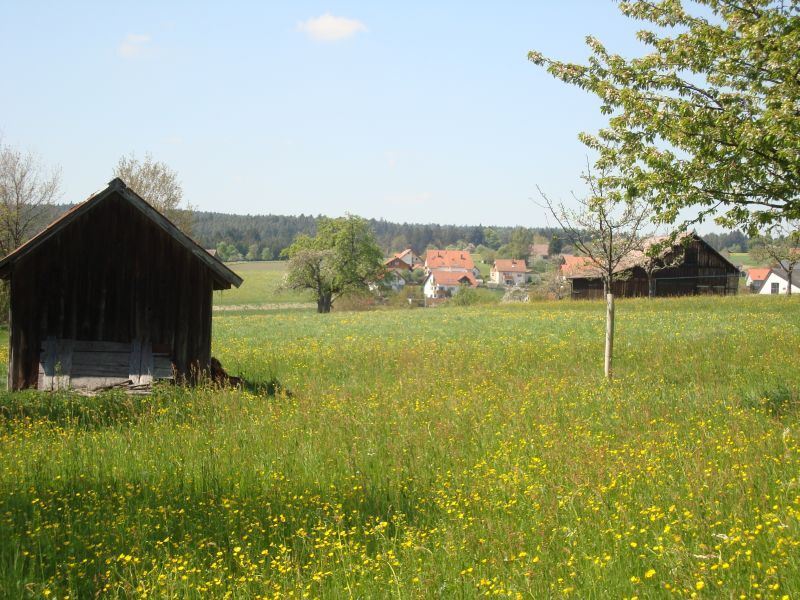

From Petershöhe, the route goes through the lower village of Zwerenberg past various fountains to the southern entrance of Zwerenberg. Here you can see several farms and continue towards the village center, where you will pass the former schoolhouse, community center, church, and many other old buildings. Finally, you reach Zwerenberg's craftsmen quarter, where you can eat something at the Landgasthof Ochsen.
Ano
Sturdy footwear, a small backpack snack, and drinks are recommended.
A8 Karlsruhe, Pforzheim-West exit, B294 to Calmbach and B296 to Oberreichenbach, then L346 Bad Teinach; A8 from Stuttgart, Leonberg exit, B295 towards Weil der Stadt, Calw, B463 Teinach station, then L347 to Neuweiler, via K4310 towards Gaugenwald and K4369 to Zwerenberg. A81 Herrenberg exit, B28 and B296 to Calw, B463 Teinach station, L347 to Neuweiler via K4310 towards Gaugenwald and K4369 to Zwerenberg.
Bus line 435 between Altensteig and Neuweiler
The trip to/from Zwerenberg Schwarzwaldstraße or Hofstett Forststraße must be registered at least 60 minutes before departure under phone no. 07051/968855.
Parking lot near Petershöhe
www.dorfgeschichten.zwerenberg.neuweiler.de
Oblíbené prohlídky v okolí
-
4.9
Der Teinacher (Premiumweg & Genießerpfad)
středníTuristika 12.0 km -
4.2
Kaltenbronn Circular Route No. 1 - Wildsee Moor Loop
světloTuristika 8.30 km -
4.7
premium hiking trail Enzquellenpfad
středníTuristika 19.9 km -
4.3
Nature experience tour Kaltenbronn
středníTuristika 14.2 km -
5.0
Water, Woods and Meadowtrail / Zavelstein > Calw (Premium trail & Genussweg)
heavyTuristika 14.4 km -
5.0
AugenBlick route Bad Teinach-Zavelstein Zettelberg
heavyTuristika 15.5 km -
5.0
Rundwanderweg Sulzkar
středníTuristika 12.4 km -
5.0
Hike through the idyllic Kälbertal
středníTuristika 8.01 km -
5.0
GeoTour Wildberg through the picturesque Lützenschlucht
heavyTuristika 2.80 km -
From nature experience to active experience
světloTuristika 10.5 km
Pěší turistika a stopování


Nenechte si ujít nabídky a inspiraci pro vaši příští dovolenou
Vaše e-mailová adresa byl přidán do poštovního seznamu.





