





Glottertäler Entdeckerpfad - Urgrabenvariante
There are three exciting route options: The "vineyard variant" leads over steep paths up into the vineyards of the "Roter Bur" site. The "Glotterbad variant " takes you on a historical journey to the origins...
There are three exciting route options: The "vineyard variant" leads over steep paths up into the vineyards of the "Roter Bur" site. The "Glotterbad variant " takes you on a historical journey to the origins of the legendary "Glotterbad Sanatorium" and the "Urgraben variant" takes you on a journey into the exciting history of medieval mining. The Urgraben variant runs along a section of the historic Urgraben, a water channel that was built in the late 13th century from the eastern flank of the Kandel to the Luser above the Glotterbad.
In contrast to the core circuit, there are no information boards on the Urgraben variant at the bottom of the valley. The information on this section of the trail is available in a small booklet. This is available at the tourist information centre or as a download.
TIP: Please download the booklet to your smartphone before the hike, as there is no sufficient internet connection on many sections of the route.


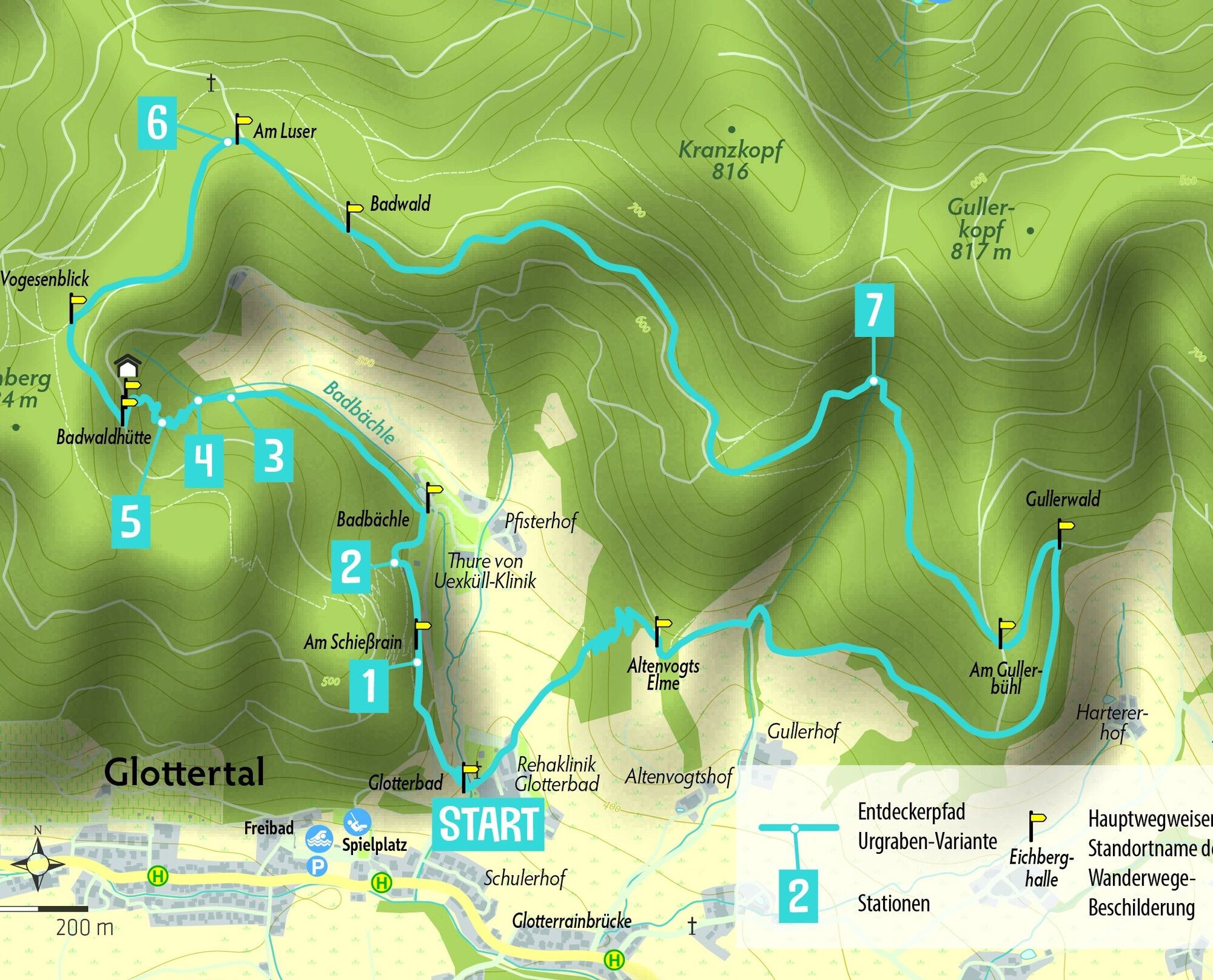

Die Namen der Wegweiserstandorte sind in dieser Beschreibung fett gedruckt. In Klammer jeweils die zugehörige Höhenangabe.
Vom Parkplatz beim Panorama-Freibad bzw. von der Bushaltestelle "Sonne" geht es zunächst Richtung Weinberg/Wegweiserstandort Sonnenbühl.
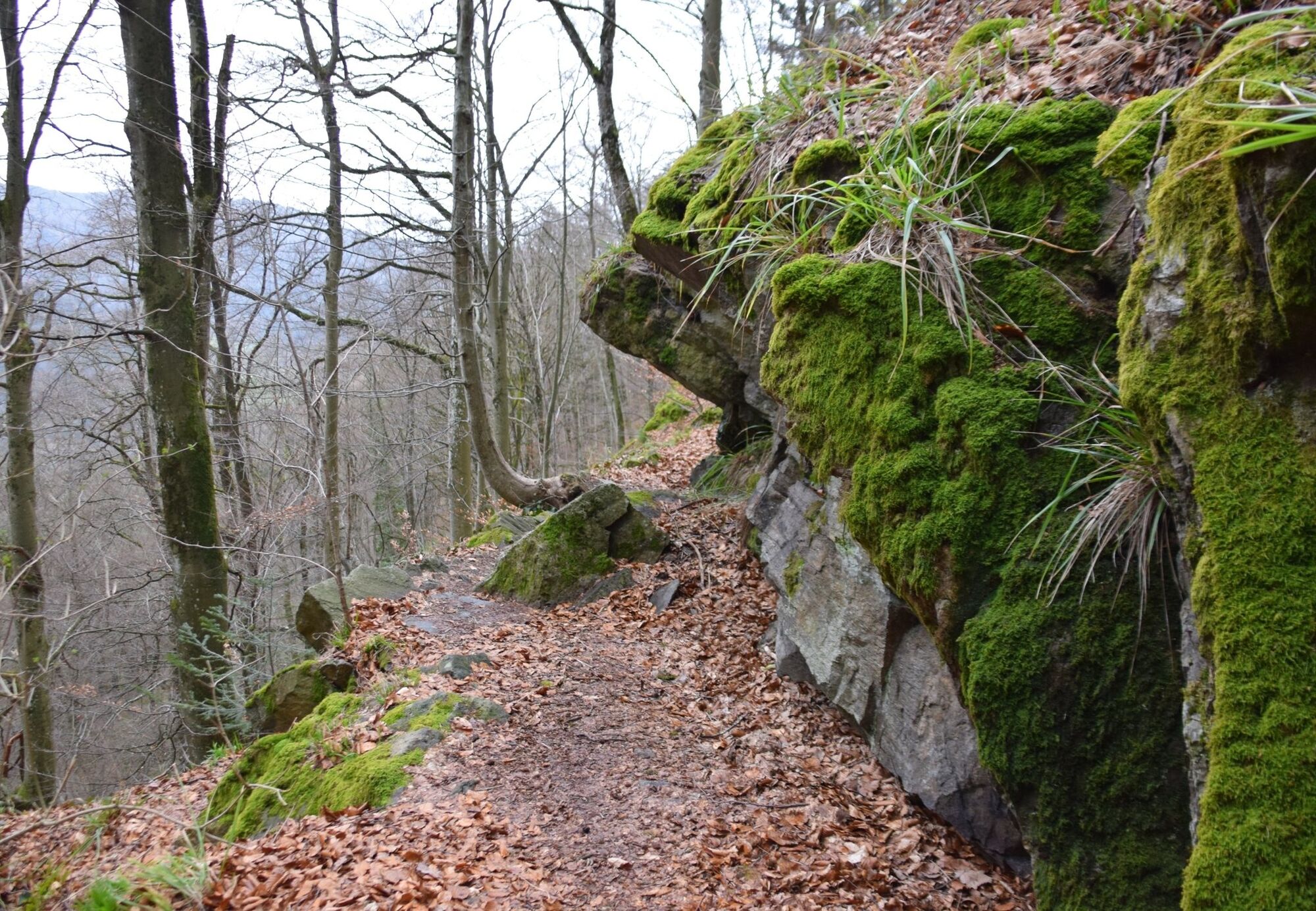
Beim Wegweiser-Standort Sonnenbühl (356 m.ü.M.) am Winzerpfad nahe der Rehaklinik Glotterbad zweigt die "Urgraben-Variante" von der Kernrunde ab. Diese Wegvariante führt zu den Spuren des mittelalterlichen Bergbaus und des legendären Urgrabens. Bis zum Badbächle (418 m.ü.M.) führt der Weg zunächst auf der gleichen Route wie die Glotterbad-Variante. Dann zweigt sie beim Löschweiher links ab. Über schmale Wege geht es am Fischbrunnenstollen vorbei durch einen verwunschenen Dobel hinauf zur Badwaldhütte (541 m.ü.M., Schutzhütte). Hier zunächst nur wenige Meter links auf dem breiten Weg gehen um dann gleich wieder rechts abzubiegen und dem schönen Waldweg zu den Standorten Am Vogesenblick (605 m.ü.M.) und Am Luser (610 m.ü.M.) folgen. Hier bietet sich ein kleiner Abstecher auf den Luser an wo man auf eine Infotafel des Suggentaler Silbersteigs trifft. Weiter führt der Weg immer dem Verlauf des historischen Urgrabens folgend über Badwald (610 m.ü.M.) auf schmalen und fast ebenen Pfad zum Standort Am Gullerbühl (597 m.ü.M.). Auf diesem Streckenabschnitt erreicht man eine Stelle an der man deutlich sieht wie der Wasserkanal einst in den Fels gehauen wurde. Am Gullerwald (592 m.ü.M.) rechts abbiegen zur Altenvogts Elme (485 m.ü.M.). Ein Serpentinenweg führt wieder hinunter zur Rehaklinik Glotterbad.
Ano
Ano
Für diesen Abschnitt des Entdeckerpfades ist Wanderausrüstung erforderlich.
Die Urgraben-Variante ist bei Eis und Schnee nicht begehbar.
Auf der L 112 bis Panorma-Freibad, Talstr. 101f, öffentlicher Parkplatz, Entdeckerpfad-Starttafel
Von Denzlingen oder St. Peter kommend: mit dem Linienbus 7205 bis Haltestelle Glottertal Sonne.
Nächster Bahnhof: Denzlingen
Získejte přehled
Vždy živě na místě s více než 9 500 webkamerami. bergfex Jako uživatel Pro si nyní můžete zobrazit odpovídající webové kamery pro mnoho prohlídek v aplikaci prohlídky z. Můžete si tak přímo prohlédnout aktuální podmínky.
Oblíbené prohlídky v okolí
-
4.4
Through the mystical Bannwald forest to the Zweribach Waterfall
středníTuristika 12.2 km -
5.0
Rund um den Kandelgipfel mit tollen Ausblicken
středníTuristika 7.46 km -
3.0
Thurner Panorama Trail
středníTuristika 11.8 km -
Hike to the Zweribach waterfalls
středníTuristika 7.32 km -
5.0
Potsdamer Platz - Hirschbachfälle- Zweribachfälle - Plattenhof
středníTuristika 9.34 km -
Panorama Trail from St. Märgen to St. Peter
středníTuristika 8.63 km -
Von St. Peter über den Sägendobel auf den Kandel
heavyTuristika 18.4 km -
5.0
Kandel - Berg der Kräfte
středníTuristika 16.5 km -
5.0
Circular Route around Breitnauer Roßberg
světloTuristika 4.75 km -
4.4
Simonswald - Haslachsimonswald - Mittelhaslach - Hugenhof
světloTuristika 10.1 km
Pěší turistika a stopování


Nenechte si ujít nabídky a inspiraci pro vaši příští dovolenou
Vaše e-mailová adresa byl přidán do poštovního seznamu.





