


Castle Cycle Path 3 - Four castle ruins in one go
Úroveň obtížnosti: 2
Hohenstoffeln, Mägdeberg, Hohenkrähen, and Hohentwiel are the volcanic mountains in the Hegau that form the backdrop on this route. These mighty relics from the Earth's primeval times stand abruptly in...
Hohenstoffeln, Mägdeberg, Hohenkrähen, and Hohentwiel are the volcanic mountains in the Hegau that form the backdrop on this route. These mighty relics from the Earth's primeval times stand abruptly in the landscape. All volcanoes are crowned by medieval castle ruins.


Starting point of our bike ride is the parking lot at the swimming pool in Hilzingen (460m). Along Riedheimerstraße it goes to Riedheim (480m). There, we turn right into Eduard-Presser-Straße. Next right, and we can already see the castle of Riedheim on the right-hand side. We continue driving on Turmstraße and after the last houses turn left. At the elevation, it goes right and at the next junction straight ahead onto a field path. We continue on this until a junction goes left. On grass grid stones, it goes uphill to the Hofgut, through it and then left. At the next junction, we keep right and then left on the field path. Soon we reach a paved road again. There we turn right and reach Hofgut Homboll (place to take a break and eat). We leave the Hofgut towards Weiterdingen (535m). We come via Pfaffwieserstraße into the village and turn right at the fountain into Kirchstraße. We turn right twice and reach Weiterdingen Castle at 8.5 km. We continue downhill and at the crossroads turn left into Amthausstraße. We keep right and leave the village via Binningerstraße. We drive on the connecting road to Binningen (537m) passing Seeweilerhof until shortly before the village, at 12.2 km. There we turn right and keep right again. We drive on the Kreisstraße to Welschingen (475m). At the beginning of Welschingen, at 16.7 km, we turn right towards Weiterdingen, then take the second paved road to the left. We do not leave this paved bike path anymore until Mühlhausen-Ehingen (452m). Through the underpass to the left down into the village. Continuing keeping right, we come to
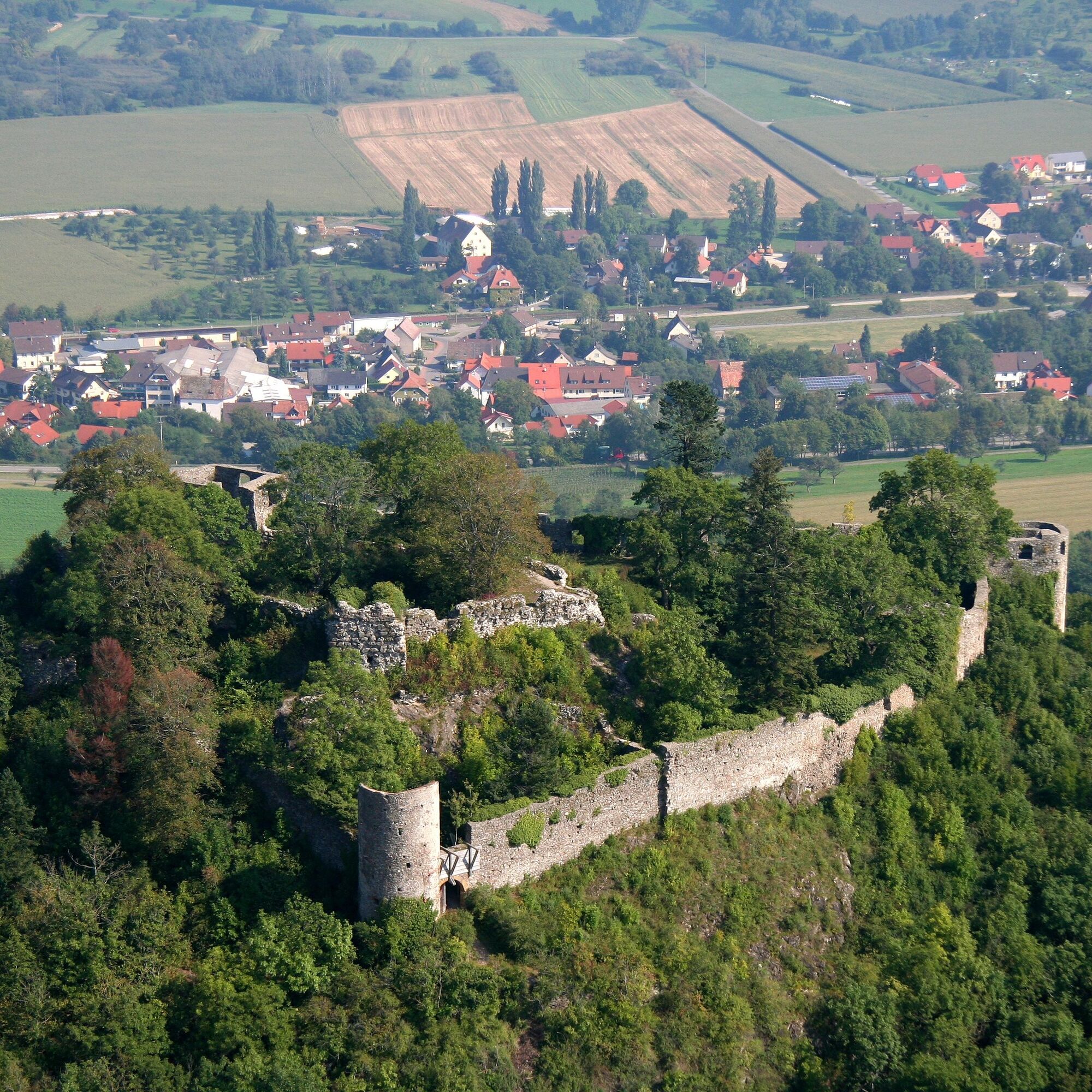
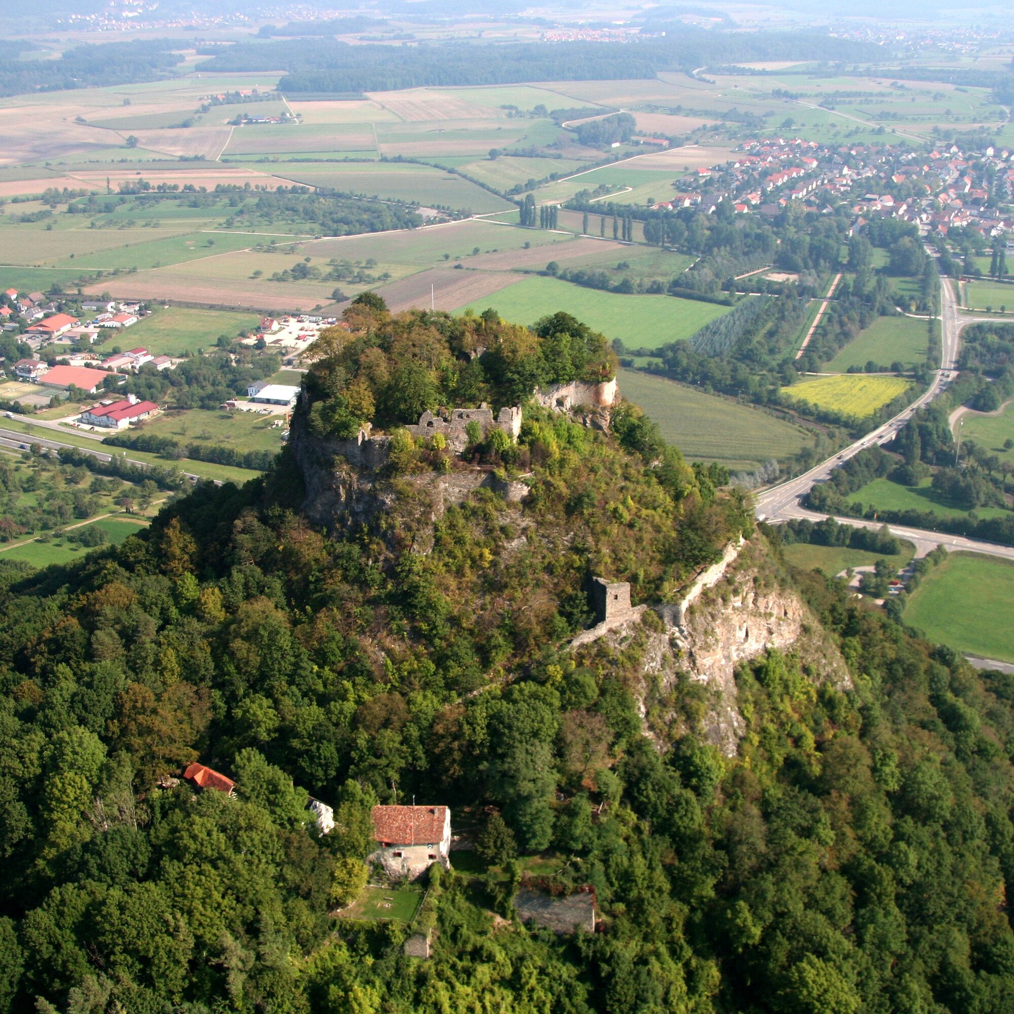
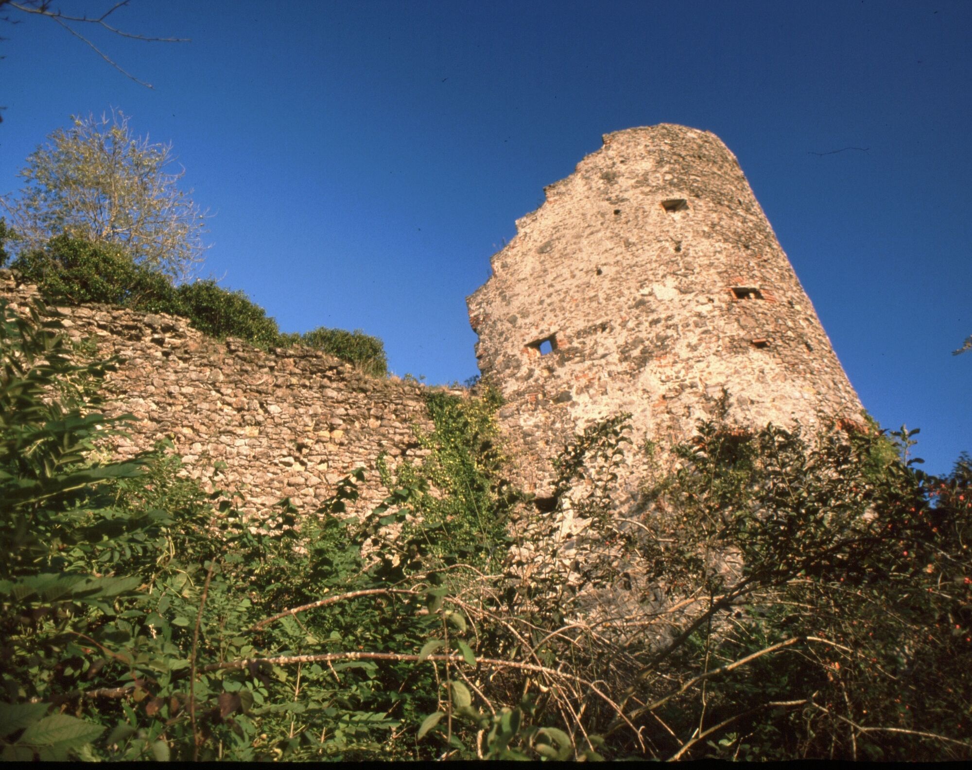
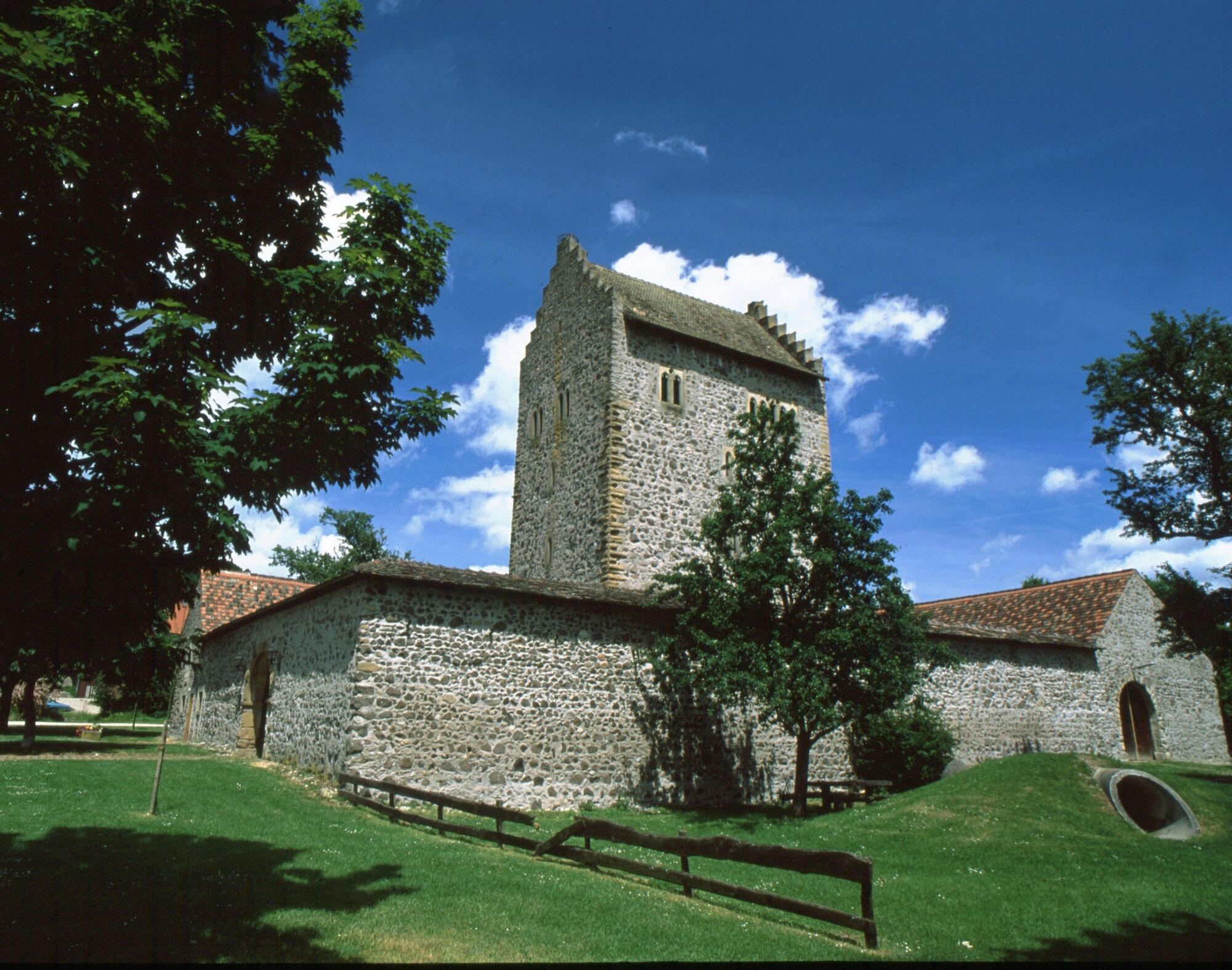
Mühlhausen Castle on the right side. We continue on Schlossstraße to the church. We drive back to the next junction and turn left. We cross a bridge leaving the village and turn right. On the bike path, we head back a bit. We turn left. There, at 23.1 km, begins the strenuous but rewarding path up to Mägdeberg ruin (654m) with a magnificent view of the Hegau. Please leave bikes at the parking lot. After the visit, it goes downhill towards Mühlhausen-Ehingen. We soon turn right. After a while, at the elevation, turn left and shortly thereafter right towards Hohenkrähen. In this area up to Hohenkrähen, the path becomes quite narrow, and it is advisable to push the bike in sections. At Hohenkrähen (642m) the footpath goes up to the summit to the Hohenkrähen ruin. Here again, we have a magnificent view of the Hegau. Our route continues towards Singen. On a gravel path, we reach a parking lot. There we must ride a short stretch down the Kreisstraße. At Hegauhaus, it goes right upward. We first turn right, then left. We pass by Paradieshof downhill and at the last farm, at 27.8 km, turn left. At the next junction, right into the forest. It continues left and then right again. We leave the forest and at 29.0 km below the Hohentwiel, we meet a gravel path. There we turn right. We continue until a paved road branches off left to Hohentwiel. We ride this uphill and reach the Hohentwiel Domain. Entry must be paid to visit the ruin. Via the Volcano Trail, it goes up to the Hohentwiel ruin (688m). We have already covered 31.5 kilometers. We ride back on the Volcano Trail, keep left, and soon meet the paved road that takes us left down towards Hilzingen. At the junction to Twielfeld, we keep right to Hilzingen. Via Hohentwielstraße, then left and right again, we enter the main street. We continue to the church and opposite the castle Hilzingen. From the castle, it goes right on the main street and then left towards the swimming pool into Riedheimerstraße to our starting point.
Ano
Via the A81 to the Hilzingen motorway junction
Regional bus 300 to the Hilzingen-Swimming Pool stop
Parking at the swimming pool in Hilzingen
2
Marking: red cycle path signage with No.3 and castle logo
The ascent to the Hohentwiel is worth it: The view from the old church tower of the fortress ruins extends to Lake Constance and the Alps!
Oblíbené prohlídky v okolí
- 4,7
"Hegauer Kegelspiel" Alter Postweg
středníTuristika 9,26 km - 5,0
"Hegauer Kegelspiel" Stettener Panoramaweg
středníTuristika 7,62 km - 3,3
"Hegauer Kegelspiel" Wannenberg hike
středníTuristika 9,35 km - 4,5
Nature trail Merishausen: Brown route
středníTematická stezka 11,4 km - 4,5
SchweizMobil 593: Nordspitze Panoramaweg
středníTuristika 13,7 km - 5,0
Vulkansee Höwenegg Rundweg
světloTuristika 7,05 km - 2,8
"Hegauer Kegelspiel" Hewensteig
středníTuristika 6,23 km Stein am Rhein - Hohenklingen Castle - Stein am Rhein
středníTuristika 7,79 km- 5,0
"Hegauer Kegelspiel" Hohentwieler
středníTuristika 7,21 km Aacher Geißbock
středníTuristika 13,4 km
Pěší turistika a stopování


Nenechte si ujít nabídky a inspiraci pro vaši příští dovolenou
Vaše e-mailová adresa byl přidán do poštovního seznamu.