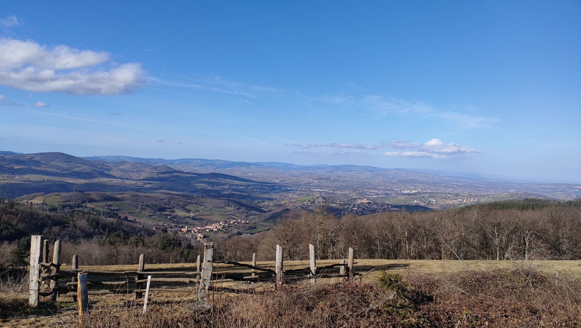
GR 7 in the Monts du Lyonnais
heavy
Navigace na stránkách
Navigace na stránkách
Pořiďte si tuto prohlídku do mobilního telefonu
GR 7 in the Monts du Lyonnais
heavy
Turistika
49.86
km
Naskenujte QR kód a spusťte navigaci v aplikaci bergfex.

Pěší turistika a stopování


GR 7 in the Monts du Lyonnais
heavy
Vzdálenost
49.86
km
Doba trvání
14:00
h
Ascent
1502
hm
Hladina moře
312 -
918
m
Stažení skladby
GR 7 in the Monts du Lyonnais
heavy
Turistika
49.86
km
Trasa
Chez Ligot
(840 m)
Vypořádání
0.1 km
Chapelle Saint-Roch
(552 m)
Místo konání bohoslužeb
14.9 km
Église de la Nativité-de-Saint-Jean-Baptiste
(548 m)
Místo konání bohoslužeb
15.2 km
Église Saint-Martin
(733 m)
Místo konání bohoslužeb
33.8 km
Signal de Saint-André
(934 m)
Summit
38.5 km
Église de la Conversion-de-Saint-Paul
(729 m)
Místo konání bohoslužeb
44.3 km
Petit Châtelard
(831 m)
Summit
48.9 km
Trasa
GR 7 in the Monts du Lyonnais
heavy
Turistika
49.86
km
Chez Ligot
(840 m)
Vypořádání
0.1 km
La Rivière
(771 m)
Vypořádání
1.8 km
La Brioude
(728 m)
Vypořádání
2.5 km
Villechenève
(716 m)
Vesnice
3.1 km
Les Olmes
(729 m)
Vypořádání
4.2 km
La Flachère
(701 m)
Vypořádání
5.4 km
Les Auberges
(730 m)
Vypořádání
7.3 km
Montchanin
(711 m)
Vypořádání
8.0 km
Saint-Martin
(645 m)
Vypořádání
8.9 km
Église Saint-Sulpice
(677 m)
Místo konání bohoslužeb
9.7 km
Montrottier
(674 m)
Vesnice
9.8 km
Bar-Restaurant du Centre Lesiz
(671 m)
Restaurace
9.9 km
La Déserte
(647 m)
Vypořádání
10.4 km
Bas Pothu
(577 m)
Sousedství
14.7 km
La Chapelle
(555 m)
Vypořádání
14.8 km
Chapelle Saint-Roch
(552 m)
Místo konání bohoslužeb
14.9 km
Brullioles
(550 m)
Vesnice
15.1 km
Bar-Restaurant Chez Agnès et Gilles Orsi
(550 m)
Restaurace
15.1 km
Église de la Nativité-de-Saint-Jean-Baptiste
(548 m)
Místo konání bohoslužeb
15.2 km
Chapotton
(533 m)
Sousedství
15.5 km
Les Alouettes
(505 m)
Vypořádání
17.4 km
Le Chambost
(445 m)
Vypořádání
18.1 km
Brussieu
(444 m)
Vesnice
18.3 km
La Randonnière
(367 m)
Vypořádání
20.4 km
Les Avergues
(662 m)
Vypořádání
23.3 km
Le Futerer
(660 m)
Koridor/terén
23.9 km
Croix Perrière
(772 m)
Vypořádání
29.1 km
Le Gazanchon
(744 m)
Vypořádání
29.9 km
Les Verchères
(710 m)
Vypořádání
31.9 km
Rochefort
(720 m)
Vypořádání
32.0 km
Église Notre-Dame-de-Pitié
(716 m)
Místo konání bohoslužeb
32.0 km
Point de vue Rochefort
(724 m)
Úhel pohledu
32.2 km
Rampeaux
(735 m)
Sousedství
33.2 km
Saint-Martin-en-Haut
(733 m)
Vesnice
33.7 km
Le Saint-Martin
(732 m)
Restaurace
33.8 km
Église Saint-Martin
(733 m)
Místo konání bohoslužeb
33.8 km
Le P'tit viand'art
(725 m)
Restaurace
34.2 km
La Charmance
(794 m)
Vypořádání
35.2 km
Les Flaches
(828 m)
Vypořádání
37.2 km
Signal de Saint-André
(934 m)
Summit
38.5 km
Croix Sainte-Agathe
(876 m)
Sousedství
39.5 km
Saint-André-la-Côte
(843 m)
Vesnice
39.9 km
Église Saint-André
(843 m)
Místo konání bohoslužeb
40.0 km
Le Rampaux
(843 m)
Sousedství
40.3 km
Bonnefond
(812 m)
Sousedství
40.3 km
Le Grand Molard
(858 m)
Koridor/terén
41.5 km
Brûle-Fer
(759 m)
Vypořádání
43.0 km
Les Rampeaux
(735 m)
Sousedství
43.3 km
Table d'orientation
(716 m)
Úhel pohledu
43.9 km
Le Châtel
(732 m)
Vypořádání
44.1 km
Église de la Conversion-de-Saint-Paul
(729 m)
Místo konání bohoslužeb
44.3 km
Les 3 Archers de la Table Ronde
(716 m)
Restaurace
44.5 km
Riverie
(711 m)
Vesnice
44.5 km
Les Farges
(707 m)
Sousedství
44.9 km
Châteauvieux
(698 m)
Vypořádání
45.9 km
Église Sainte-Catherine
(694 m)
Místo konání bohoslužeb
46.2 km
Le Bar & Vous
(698 m)
Restaurace
46.2 km
Sainte-Catherine
(697 m)
Vesnice
46.3 km
Le Châtelard
(802 m)
Vypořádání
47.8 km
Petit Châtelard
(831 m)
Summit
48.9 km
Autor
Poskytuje Monts du Lyonnais
Prohlídku GR 7 in the Monts du Lyonnais zajišťuje outdooractive.com.

Informace o trase
Geologické zajímavosti
Ano
Bezpečnostní pokyny
In case of emergency, call 112.
Další informace a tipy
Další informace
Be sure to take with you a sufficient amount of water, hiking shoes, and clothing suitable for your outing depending on the weather forecast. A small first aid kit is also recommended.
Zatím žádné recenze
Oblíbené prohlídky v okolí
-
Coise Riverbank Trail
středníTuristika 14.6 km -
The Signal - Monts du Lyonnais - Saint-André-la Côte
světloTuristika 14.5 km -
Trail of the landscapes of the Monts du Lyonnais
světloTuristika 12.0 km -
5.0
The Gimond dam - Monts du Lyonnais - Grézieu-le-Marché
světloTuristika 11.2 km -
Regina, Duroni, Sweetheart - Monts du Lyonnais - Bessenay
světloTuristika 13.6 km -
The Tacot, ephemeral journey
světloTematická stezka 1.91 km -
Monts du Lyonnais landscape trail - East loop by mountain bike
světloMountainbike 12.0 km -
Health-sport hike: the Croix Forest bridge
světloTuristika 9.78 km -
Let's walk in the woods - Monts du Lyonnais - Pollionnay
světloTuristika 12.6 km -
Route around the Tourette
světloTuristika 10.6 km

Pěší turistika a stopování

Více než 550.000 návrhů výletů, podrobné mapy a intuitivní plánovač tras dělají z aplikace nezbytnou výbavu pro všechny milovníky přírody.

Nenechte si ujít nabídky a inspiraci pro vaši příští dovolenou
Přihlaste se k odběru newsletteru
Chyba
Došlo k chybě. Zkuste to prosím znovu.
Děkujeme za vaši registraci
Vaše e-mailová adresa byl přidán do poštovního seznamu.
Zájezdy po celé Evropě
Rakousko
Švýcarsko
Německo
Itálie
Slovenia
Francie
Nizozemsko
Belgie
Polsko
Lichtenštejnsko
Česko
Slovensko
Španělsko
Chorvatsko
Bosna a Hercegovina
Lucembursko
Andorra
Portugal
Iceland
United Kingdom
Ireland
Greece
Albania
North Macedonia
Malta
Norway
Montenegro
Moldova
Kosovo
Hungary
San Marino
Romania
Estonia
Latvia
Belarus
Cyprus
Lithuania
Serbia
Bulgaria
Monaco
Denmark
Sweden
Finland