







From the Crêt de la Madone to the Col des Brosses - Monts du Lyonnais - Yzeron

You'll love:
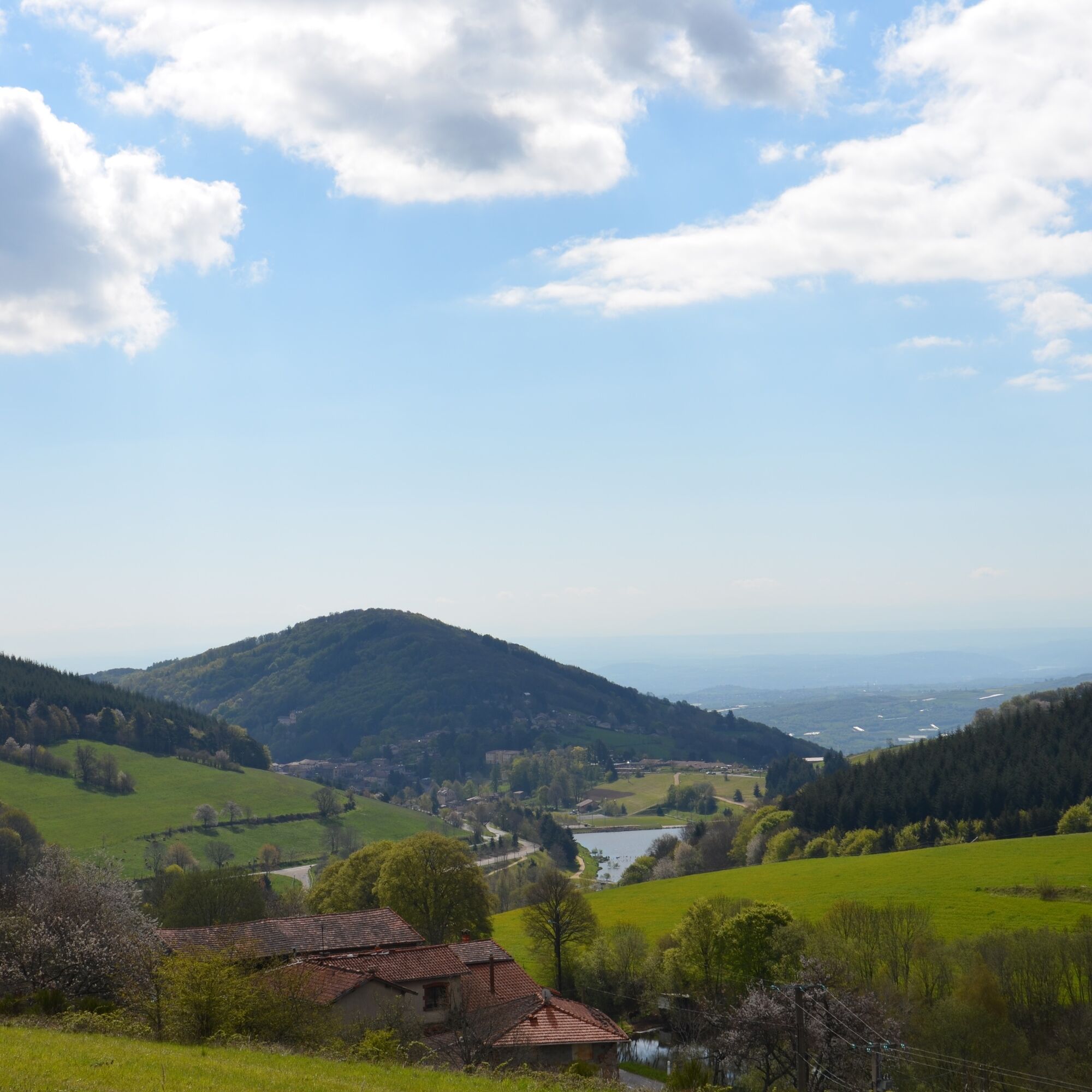
• A breath of fresh air on the heights of Yzeron, where nature and luminous landscapes are a source of tranquility.
• The calm of the Crêt de la Madone and Chapelle Saint-Clair sites.
• The contrast...
• A breath of fresh air on the heights of Yzeron, where nature and luminous landscapes are a source of tranquility.
• The calm of the Crêt de la Madone and Chapelle Saint-Clair sites.
• The contrast between the panoramas and the arrival in the beautiful undergrowth after Les Brosses.
• The Ronzey lake, which you can walk around and enjoy the facilities: shaded picnic tables, barbecues, descriptive panels dedicated to the flora and fauna...
You'll enjoy it best:
• In winter, when the air of the Monts du Lyonnais is invigorating. In spring, to commune with nature in full regeneration, or in fall, by collecting dead leaves on the paths to create large, colorful bouquets.
• On your return, sit down facing the pond while enjoying a coffee or a cold drink. • Combining walking and thrills, flying over the lake on a giant zip line from Le Plat.
A bit of culture:
Secrets of small heritage
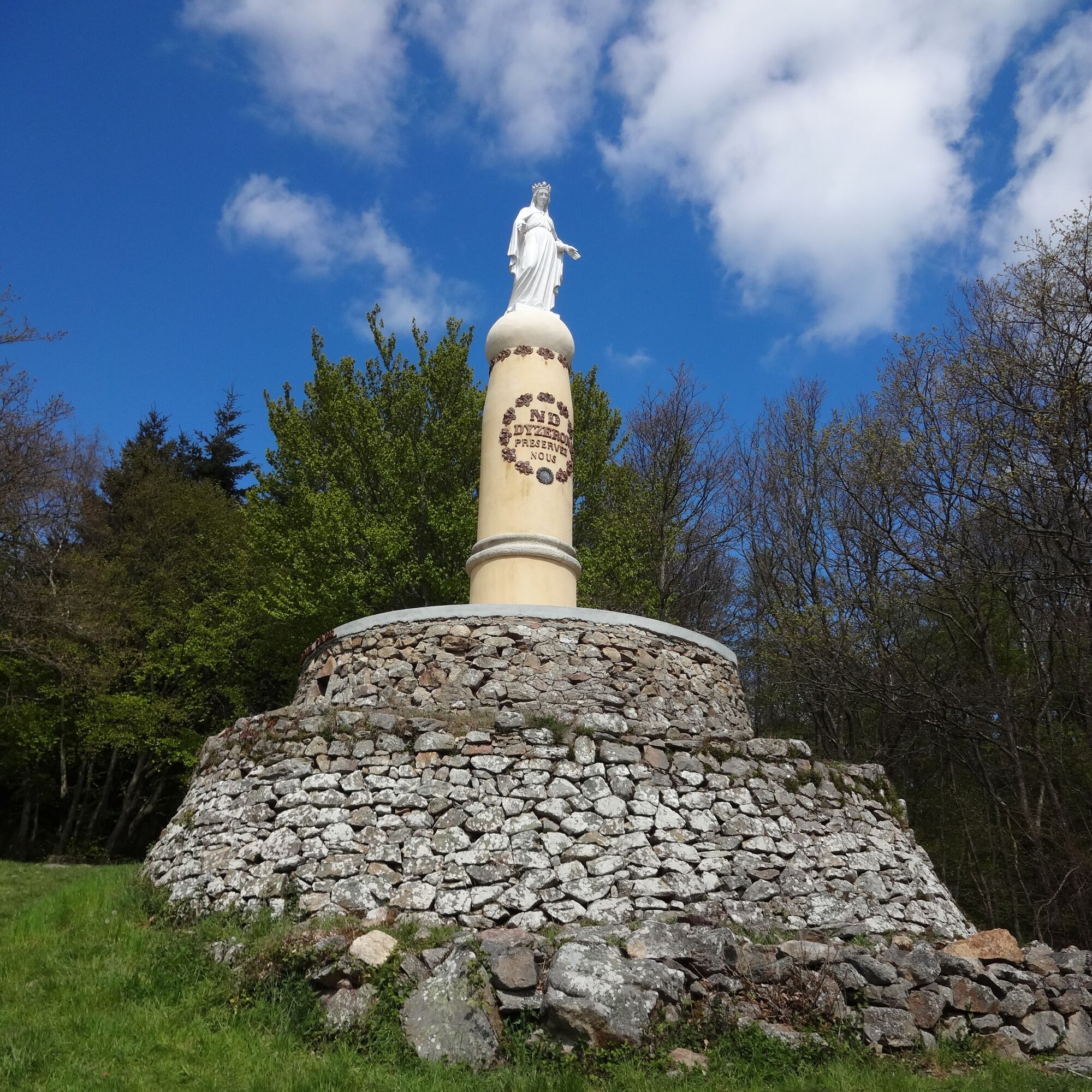
Notre-Dame-d’Yzeron
At the summit of the Bruyères mountain, at an altitude of 850 meters, the Virgin has watched over the village since 1893. Observing her, the locals will be struck by her familiar appearance. And for good reason: she is a copy of the one placed on the bell tower of the old Fourvière chapel.
The Saint-Clair Chapel
After the Crêt de la Madone, walkers will arrive at the intersection of the Saint-Clair Chapel.
Perhaps because the view is so magnificent, a chapel dedicated to Saint-Clair was erected there in the 14th century. Pilgrimages were held there to invoke this venerated figure, capable of curing or relieving eye ailments and blindness. On the ruins of the now-defunct building, a plaque created by the Courzieu Heritage Association tells the story of the site. An oratory was also built by the hamlet's inhabitants. 100 meters further along a path lies a miraculous spring.


Ano
Ano
Set out on your hike with a light spirit
Check the weather Suitable shoes and clothing A light backpack A first aid kit Water and food Go at your own pace Read maps, prepare your routeEmergency phone numbers :
European emergency number: 112
SAMU: 15
Police emergency: 17
Firefighters: 18
Emergency number for deaf and hard of hearing: 114
Wild animal care center l’Hirondelle: 04 74 05 78 85
French Office for Biodiversity: 04 74 69 49 32
48 min from Lyon, take via D25.
At the departure location
Please stay on the trails and respect the crops. Remember to bring a sufficient amount of water, hiking shoes, and clothing suitable for your outing according to the weather forecast. A small first aid kit is also recommended.

Oblíbené prohlídky v okolí
-
5.0
Walk to the Garon siphon bridge of the Roman Aqueduct of Gier
světloTuristika 6.08 km -
5.0
The Gimond dam - Monts du Lyonnais - Grézieu-le-Marché
světloTuristika 11.2 km -
Roman Gier Aqueduct path
heavyTuristika 44.4 km -
Trail of the landscapes of the Monts du Lyonnais
středníTuristika 12.0 km -
The Signal - Monts du Lyonnais - Saint-André-la Côte
světloTuristika 14.5 km -
The Tacot, ephemeral journey
světloTematická stezka 1.91 km -
Let's walk in the woods - Monts du Lyonnais - Pollionnay
světloTuristika 12.6 km -
Health-sport hike: the Croix Forest bridge
světloTuristika 9.78 km -
Regina, Duroni, Sweetheart - Monts du Lyonnais - Bessenay
světloTuristika 13.6 km -
Sentier découverte de l'aqueduc romain de la Brévenne
světloTuristika 5.42 km
Pěší turistika a stopování


Nenechte si ujít nabídky a inspiraci pro vaši příští dovolenou
Vaše e-mailová adresa byl přidán do poštovního seznamu.





