
Chemin pédestre de la Duis
světlo
Pořiďte si tuto prohlídku do mobilního telefonu
Chemin pédestre de la Duis
světlo
Turistika
6.67
km
Naskenujte QR kód a spusťte navigaci v aplikaci bergfex.


Pěší turistika a stopování





Chemin pédestre de la Duis
světlo
Vzdálenost
6.67
km
Doba trvání
02:15
h
Ascent
98
hm
Hladina moře
2023 -
2142
m
Stažení skladby
Chemin pédestre de la Duis
světlo
Turistika
6.67
km
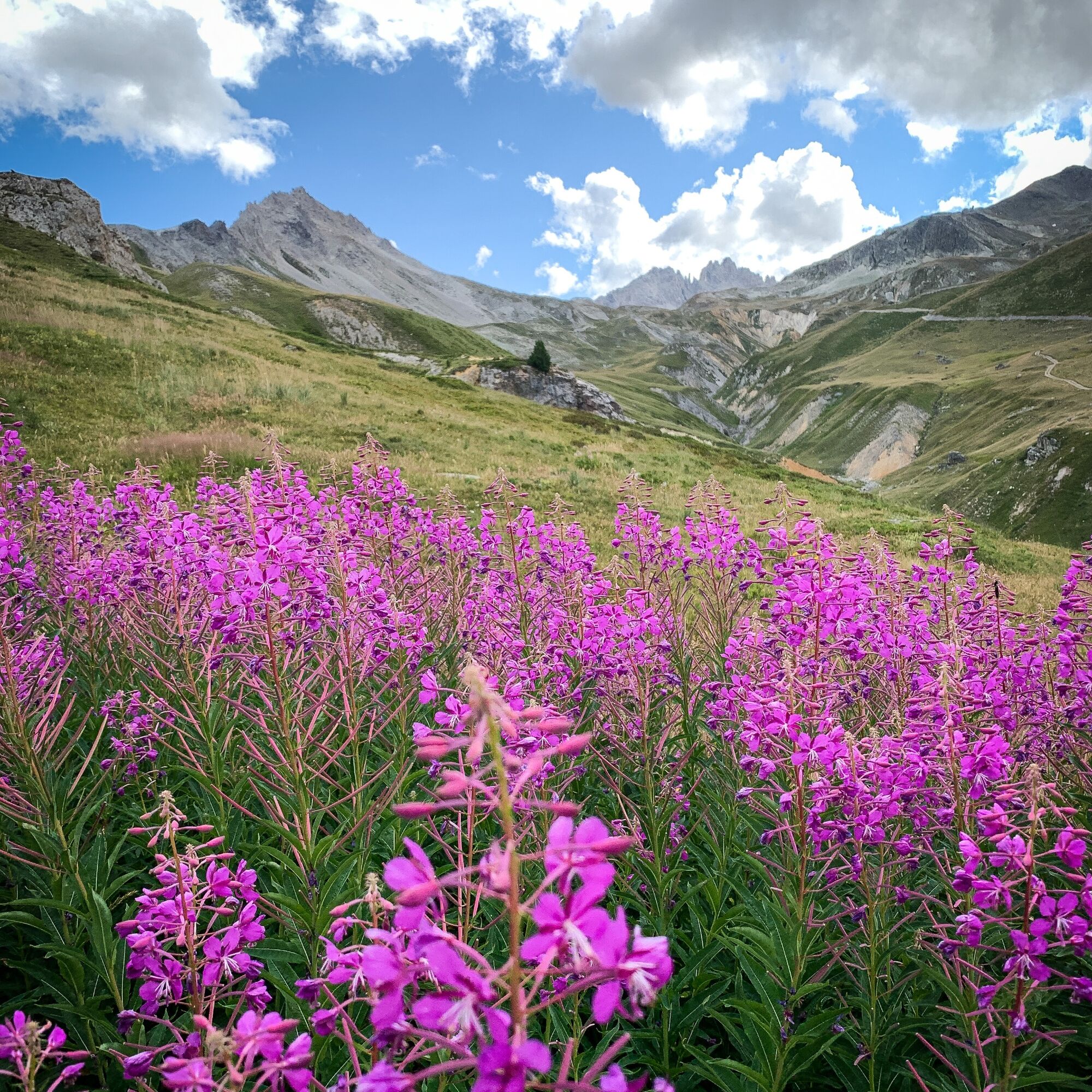
The tall willowherbs, gently caressed by the breeze, greet you with grace
as you pass by. In shades of vibrant fuchsia pink, they wipe everyday life
from your mind and the crowds of visitors you encountered...
Popis
The tall willowherbs, gently caressed by the breeze, greet you with grace
as you pass by. In shades of vibrant fuchsia pink, they wipe everyday life
from your mind and the crowds of visitors you encountered at Écot become
a distant memory.
Your feet are flying along this easy alpine trail, and around a bend, you enter
the Duis valley, humbly protecting the Sources de l'Arc, high up there, under
the glaciers of the Clavarini and Girard peaks.
The welcoming chalets of Duis appear, as the last signs of human presence
in this little haven of peace that just begs to be preserved.
Mesmerised by the tumbling torrent, your gaze transfixed by the cool blue
waters, you find you're already sitting down for a peaceful rest. But how far
will this agile trout swim among the rocks? Would it give us permission to
dip our hands in just for a moment, to cool off? No, of course not. The thick
cream we use to avoid bad sunburns isn't her best friend…
as you pass by. In shades of vibrant fuchsia pink, they wipe everyday life
from your mind and the crowds of visitors you encountered at Écot become
a distant memory.
Your feet are flying along this easy alpine trail, and around a bend, you enter
the Duis valley, humbly protecting the Sources de l'Arc, high up there, under
the glaciers of the Clavarini and Girard peaks.
The welcoming chalets of Duis appear, as the last signs of human presence
in this little haven of peace that just begs to be preserved.
Mesmerised by the tumbling torrent, your gaze transfixed by the cool blue
waters, you find you're already sitting down for a peaceful rest. But how far
will this agile trout swim among the rocks? Would it give us permission to
dip our hands in just for a moment, to cool off? No, of course not. The thick
cream we use to avoid bad sunburns isn't her best friend…
Trasa
Trasa
Chemin pédestre de la Duis
světlo
Turistika
6.67
km
Autor
Poskytuje Haute Maurienne Vanoise
Prohlídku Chemin pédestre de la Duis zajišťuje outdooractive.com.


Informace o trase
Trasa
To guide you in the field, consult the "step-by-step" directional diagram provided in pdf.
Jednosměrná prohlídka
Ano
Další informace a tipy
Další informace
The duration of hiking trails is calculated using reference paces: 300 m/h ascent, 500 m/h descent and 4 km/h on the flat.
As hazards may occur at any time on the routes, the GPX tracks provided are not contractual. They are given for information only. Riders use them at their own risk, depending on their level of technological proficiency and their understanding of the terrain.
As hazards may occur at any time on the routes, the GPX tracks provided are not contractual. They are given for information only. Riders use them at their own risk, depending on their level of technological proficiency and their understanding of the terrain.
Zatím žádné recenze
Oblíbené prohlídky v okolí
-
5.0
The Grand Méan lake via the Evettes circus
heavyTuristika 13.6 km -
5.0
CERESOLE REALE Bellagarda ponds
středníTuristika 7.60 km -
4.0
Thumel - Rifugio Benevolo
středníTuristika 12.5 km -
5.0
Vie Storiche di Montagna | Colle del Nivolet
heavySilniční kolo 18.5 km -
5.0
BALME Arnas Ring - Pian della Mussa
heavyTuristika 13.6 km -
NIVOLET PASS Lakes Rosset, Leità and Chanavey
středníTuristika 4.45 km -
5.0
Alta Via delle Valli di Lanzo | Stage 4 Rifugio Citt di Ciri - Rifugio Cibrario
heavyTuristika 12.0 km -
5.0
Goldtoni - Alpenbogen A120 Pialpette-Ceresole Reale
střednídálková pěší trasa 18.2 km -
Lake Dres - Ceresole Reale
středníTuristika 7.24 km -
Grande Traversata delle Alpi - GTA: Central Piedmont Section
středníTuristika 318.3 km

Pěší turistika a stopování

Více než 550.000 návrhů výletů, podrobné mapy a intuitivní plánovač tras dělají z aplikace nezbytnou výbavu pro všechny milovníky přírody.

Nenechte si ujít nabídky a inspiraci pro vaši příští dovolenou
Přihlaste se k odběru newsletteru
Chyba
Došlo k chybě. Zkuste to prosím znovu.
Děkujeme za vaši registraci
Vaše e-mailová adresa byl přidán do poštovního seznamu.
Zájezdy po celé Evropě
Rakousko
Švýcarsko
Německo
Itálie
Slovenia
Francie
Nizozemsko
Belgie
Polsko
Lichtenštejnsko
Česko
Slovensko
Španělsko
Chorvatsko
Bosna a Hercegovina
Lucembursko
Andorra
Portugal
Iceland
United Kingdom
Ireland
Greece
Albania
North Macedonia
Malta
Norway
Montenegro
Moldova
Kosovo
Hungary
San Marino
Romania
Estonia
Latvia
Belarus
Cyprus
Lithuania
Serbia
Bulgaria
Monaco
Denmark
Sweden
Finland





