


Navigace na stránkách
Pořiďte si tuto prohlídku do mobilního telefonu
Mapa
MTB route 170 - The Great Tour of the Pays Mornantais

heavy
Mountainbike
90.97 km
Naskenujte QR kód a spusťte navigaci v aplikaci bergfex.
QR Code
Pěší turistika a stopování

MTB route 170 - The Great Tour of the Pays Mornantais

Vzdálenost
91.0 km
Doba trvání
10:55 h
Ascent
2262 hm
Hladina moře
169 - 916 m
Stažení skladby
Mapa
MTB route 170 - The Great Tour of the Pays Mornantais
heavy
Mountainbike
90.97 km

The route alternates a wide variety of paths and configurations and allows you to discover all the facets of the Pays Mornantais. Remember to replenish water supplies in the villages. Lunch break in Rontalon,...

Popis

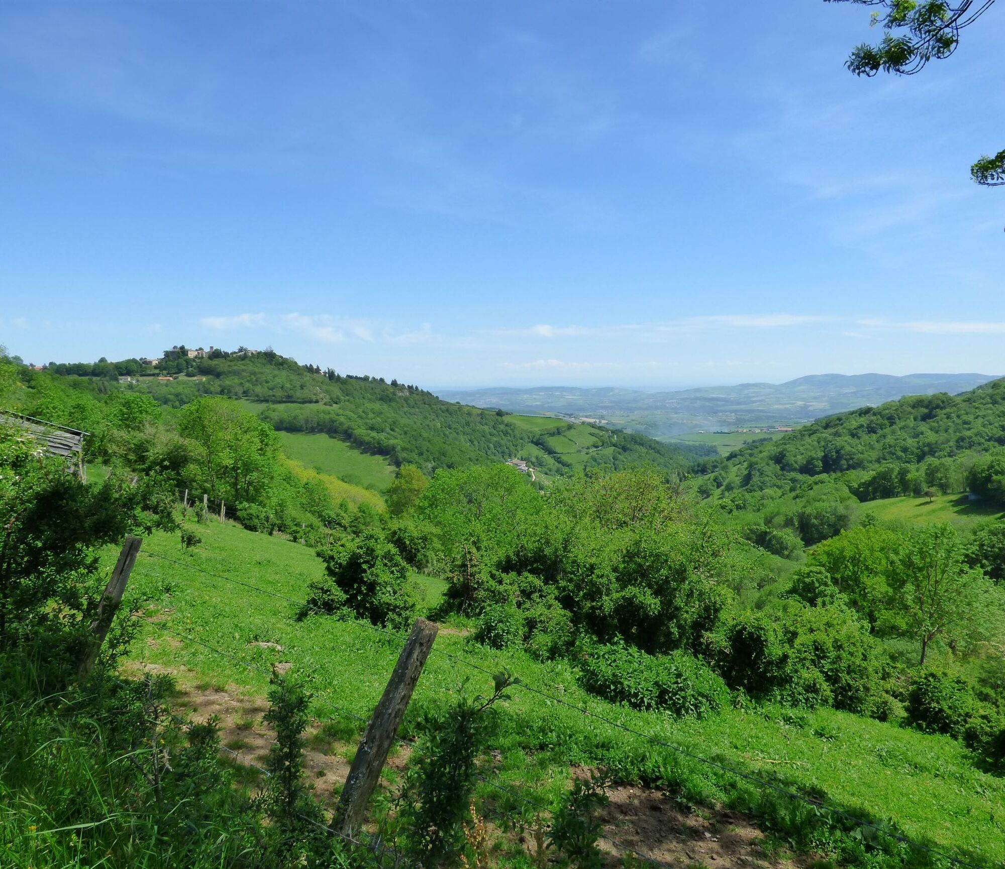
The route alternates a wide variety of paths and configurations and allows you to discover all the facets of the Pays Mornantais. Remember to replenish water supplies in the villages. Lunch break in Rontalon, Riverie (medieval village labeled Small Town of Character and climbing site Les Roches with 24 routes) or Sainte-Catherine. After Sainte-Catherine, keep some energy for the final climbs and enjoy the panorama and variety of paths. The hardest part is done, then the descent, finally.

Trasa
Mornant
(366 m)
Vesnice
0.0 km
Église de la Nativité-de-Notre-Dame
(340 m)
Místo konání bohoslužeb
22.3 km
Les Curallières
(277 m)
Sousedství
26.7 km
Signal de Saint-André
(934 m)
Summit
52.1 km
Église Sainte-Catherine
(694 m)
Místo konání bohoslužeb
61.8 km
Petit Châtelard
(831 m)
Summit
65.8 km
Église Saint-Pierre
(365 m)
Místo konání bohoslužeb
90.6 km
Trasa
Mapa
MTB route 170 - The Great Tour of the Pays Mornantais
heavy
Mountainbike
90.97 km
Mornant
(366 m)
Vesnice
0.0 km
La Gare
(365 m)
Sousedství
0.2 km
La Guillotière
(367 m)
Sousedství
0.8 km
Monteclare
(345 m)
Sousedství
1.0 km
Saint-Andéol-le-Château
(313 m)
Vesnice
5.1 km
La Joannas
(316 m)
Sousedství
5.7 km
La Rivoire
(306 m)
Vypořádání
5.8 km
Saint-Martin-de-Cornas
(322 m)
Vypořádání
8.0 km
La Revolière
(297 m)
Vypořádání
9.3 km
La Forestière
(294 m)
Vypořádání
9.9 km
Chassagny
(315 m)
Vesnice
12.3 km
Église Saint-Blaise
(314 m)
Místo konání bohoslužeb
12.4 km
Sourzy
(283 m)
Vesnice
17.1 km
Aux Prisons
(283 m)
Restaurace
17.2 km
Montagny
(332 m)
Vesnice
19.2 km
Église de la Nativité-de-Notre-Dame
(340 m)
Místo konání bohoslužeb
22.3 km
Le Chater
(340 m)
Vypořádání
22.4 km
Taluyers
(339 m)
Vesnice
22.6 km
Balanche
(303 m)
Koridor/terén
23.1 km
Le Grand Gara
(283 m)
Koridor/terén
26.0 km
Trève du Gain
(284 m)
Sousedství
26.2 km
Les Barbières
(293 m)
Sousedství
26.7 km
Les Curallières
(277 m)
Sousedství
26.7 km
Le Gontey
(287 m)
Sousedství
26.9 km
La Cognacière
(275 m)
Sousedství
26.9 km
Orliénas
(301 m)
Vesnice
27.6 km
Le Boulard
(316 m)
Vypořádání
28.3 km
Du Côté de Marjon
(435 m)
Restaurace
38.6 km
Le Haut Marjon
(449 m)
Vypořádání
39.2 km
Le Rantonnet
(414 m)
Vypořádání
42.5 km
Les Chareilles
(468 m)
Sousedství
42.5 km
Rontalon
(492 m)
Vesnice
43.0 km
Le Roman
(433 m)
Vypořádání
43.2 km
Le Violet
(445 m)
Vypořádání
43.8 km
Le Bézin
(561 m)
Vypořádání
44.9 km
Le Pinay
(517 m)
Vypořádání
45.6 km
Les Assiers
(541 m)
Vypořádání
46.7 km
Le Niguet
(625 m)
Vypořádání
48.1 km
Signal de Saint-André
(934 m)
Summit
52.1 km
La Villardière
(798 m)
Vypořádání
54.0 km
Chavagneux
(762 m)
Vypořádání
56.0 km
La Paponnière
(809 m)
Vypořádání
58.8 km
Les Rampeaux
(735 m)
Sousedství
59.0 km
Riverie
(711 m)
Vesnice
59.6 km
Les 3 Archers de la Table Ronde
(716 m)
Restaurace
59.9 km
Table d'orientation
(716 m)
Úhel pohledu
60.0 km
Le Châtel
(732 m)
Vypořádání
60.2 km
Le Versieu
(687 m)
Koridor/terén
60.4 km
Les Farges
(707 m)
Sousedství
60.5 km
Châteauvieux
(698 m)
Vypořádání
61.5 km
Église Sainte-Catherine
(694 m)
Místo konání bohoslužeb
61.8 km
Sainte-Catherine
(697 m)
Vesnice
61.9 km
Le Bar & Vous
(698 m)
Restaurace
62.0 km
Charbonnières
(849 m)
Vypořádání
64.1 km
Le Barrot
(832 m)
Vypořádání
64.9 km
Petit Châtelard
(831 m)
Summit
65.8 km
Flassieux
(547 m)
Vypořádání
69.6 km
Savernas
(510 m)
Vypořádání
69.9 km
La Jurière
(518 m)
Vypořádání
70.6 km
Le Manellier
(553 m)
Vypořádání
71.6 km
Le Gambu
(430 m)
Koridor/terén
74.1 km
Le Journoux
(401 m)
Vypořádání
78.1 km
Palavézin
(359 m)
Vypořádání
79.9 km
Écossieux
(334 m)
Vypořádání
80.9 km
Paradis
(323 m)
Vypořádání
81.3 km
La Gibertière
(329 m)
Vypořádání
82.4 km
Saint-Andéol-le-Château
(313 m)
Vesnice
84.7 km
La Pavière
(338 m)
Vypořádání
88.9 km
La Marconnière
(338 m)
Koridor/terén
89.4 km
Trillonnière
(328 m)
Koridor/terén
90.1 km
Église Saint-Pierre
(365 m)
Místo konání bohoslužeb
90.6 km
Mornant
(366 m)
Vesnice
90.7 km
HOTEL RESTAURANT DE LA POSTE
(366 m)
Restaurace
90.8 km
Informace o prohlídce
Warning: route temporarily impassable on some sections.
This route requires very good physical condition. No seasonal issue but avoid in case of high heat.
Technologie
n.a.
Stav
6 / 6
Krajina
5 / 6
Zkušenosti
5 / 6
Celoročně přístupné
Led
Úno
Bře
Dub
Kvě
Čen
Čec
Srp
Zář
Říj
Lis
Pro
Sdílet prohlídku
Mapa
MTB route 170 - The Great Tour of the Pays Mornantais
heavy
Mountainbike
90.97 km
Chyba
Došlo k chybě. Zkuste to prosím znovu.
Další informace a tipy
Další informace

Adapt your equipment and choice of route according to your level and the weather. Do not leave the trails.

Pěší turistika a stopování

Pěší turistika a stopování

Pěší turistika a stopování
Více než 550.000 návrhů výletů, podrobné mapy a intuitivní plánovač tras dělají z aplikace nezbytnou výbavu pro všechny milovníky přírody.
bergfex


