



Navigace na stránkách
Pořiďte si tuto prohlídku do mobilního telefonu
Mapa
Mountain bike route 155 - Upper Mornantet basin
světlo
Mountainbike
17.74 km
Naskenujte QR kód a spusťte navigaci v aplikaci bergfex.
QR Code
Pěší turistika a stopování

Mountain bike route 155 - Upper Mornantet basin

Vzdálenost
17.7 km
Doba trvání
01:56 h
Ascent
351 hm
Hladina moře
331 - 553 m
Stažení skladby
Mapa
Mountain bike route 155 - Upper Mornantet basin
světlo
Mountainbike
17.74 km

At the start, the markers are painted along the crossing of Mornant. Depending on physical condition, everything is suitable for mountain biking. The descent from Saint-Sorlin and Chaussan is eroded at...

Popis

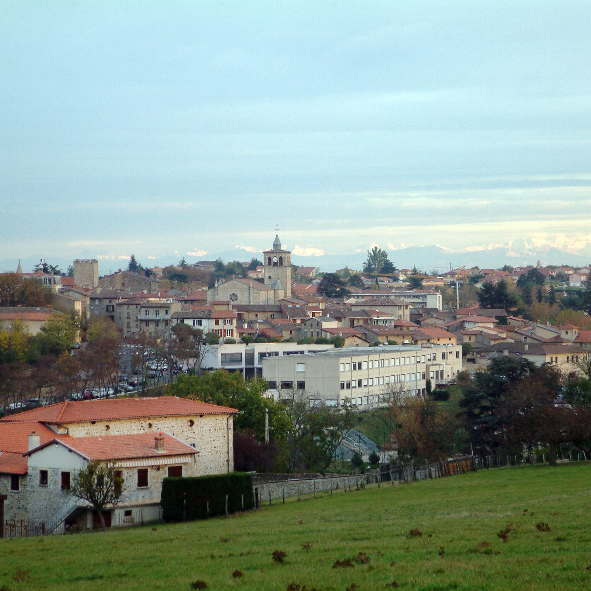
At the start, the markers are painted along the crossing of Mornant. Depending on physical condition, everything is suitable for mountain biking. The descent from Saint-Sorlin and Chaussan is eroded at the bottom. Beautiful route with views up to the Alps depending on the weather.

Trasa
Église Saint-Pierre
(365 m)
Místo konání bohoslužeb
0.0 km
Église Saint-Saturnin
(499 m)
Místo konání bohoslužeb
4.1 km
Saint-Sorlin
(500 m)
Vesnice
4.1 km
Église Saint-Jean-Baptiste
(473 m)
Místo konání bohoslužeb
6.0 km
Le Charmay
(462 m)
Vypořádání
6.6 km
Chapelle Saint-Vincent
(485 m)
Místo konání bohoslužeb
13.4 km
Saint-Vincent
(465 m)
Vypořádání
13.7 km
Trasa
Mapa
Mountain bike route 155 - Upper Mornantet basin
světlo
Mountainbike
17.74 km
Église Saint-Pierre
(365 m)
Místo konání bohoslužeb
0.0 km
Mornant
(366 m)
Vesnice
0.1 km
Le Bois
(393 m)
Vypořádání
1.9 km
Grandes Terres
(420 m)
Sousedství
2.7 km
Église Saint-Saturnin
(499 m)
Místo konání bohoslužeb
4.1 km
Saint-Sorlin
(500 m)
Vesnice
4.1 km
Les Côtes
(506 m)
Sousedství
4.3 km
Lotissement des Menestrels
(429 m)
Sousedství
5.7 km
Pré Maillard
(442 m)
Koridor/terén
5.7 km
BAR DE LA POSTE
(473 m)
Restaurace
6.0 km
Église Saint-Jean-Baptiste
(473 m)
Místo konání bohoslužeb
6.0 km
Chaussan
(473 m)
Vesnice
6.0 km
Le Bourg
(477 m)
Koridor/terén
6.1 km
Le Charmay
(462 m)
Vypořádání
6.6 km
Le Boulard
(555 m)
Vypořádání
8.7 km
Montplan
(549 m)
Vypořádání
9.2 km
Croix Carye
(529 m)
Koridor/terén
10.0 km
Mauvais Pas
(509 m)
Koridor/terén
10.6 km
Fayolle
(503 m)
Koridor/terén
11.5 km
Combe
(460 m)
Koridor/terén
12.1 km
Chapelle Saint-Vincent
(485 m)
Místo konání bohoslužeb
13.4 km
Saint-Vincent
(465 m)
Vypořádání
13.7 km
Vernay
(413 m)
Vypořádání
14.7 km
Les Ollagnons
(352 m)
Vypořádání
16.6 km
Serpaton
(363 m)
Sousedství
16.9 km
La Gare
(365 m)
Sousedství
17.2 km
HOTEL RESTAURANT DE LA POSTE
(366 m)
Restaurace
17.6 km
Mornant
(366 m)
Vesnice
17.7 km
Église Saint-Pierre
(365 m)
Místo konání bohoslužeb
17.7 km
Informace o prohlídce

Discovery route of the Mornant hillsides. On this beautiful route with views up to the Alps depending on the weather, everything is suitable for mountain biking according to your physical condition.

Technologie
n.a.
Stav
2 / 6
Krajina
5 / 6
Zkušenosti
5 / 6
Celoročně přístupné
Led
Úno
Bře
Dub
Kvě
Čen
Čec
Srp
Zář
Říj
Lis
Pro
Sdílet prohlídku
Mapa
Mountain bike route 155 - Upper Mornantet basin
světlo
Mountainbike
17.74 km
Chyba
Došlo k chybě. Zkuste to prosím znovu.
Vybavení

Equipment suitable for mountain biking is recommended.

Bezpečnostní pokyny

Be careful on the descent from Saint-Sorlin and Chaussan, the path is eroded at the bottom, be careful.

Informace o příjezdu
Parkování

Park at Parking des Bruyères in Mornant

Další informace a tipy
Další informace

Adapt your equipment and route choice according to your level and the weather. Do not leave the trails.

Tipy

Take the time to take a short walk through the alleys of the old medieval village of Mornant, you will discover its pointed-arch church, its Vingtain tower, and also its Mornant traboule...

Pěší turistika a stopování

Pěší turistika a stopování

Pěší turistika a stopování
Více než 550.000 návrhů výletů, podrobné mapy a intuitivní plánovač tras dělají z aplikace nezbytnou výbavu pro všechny milovníky přírody.
bergfex



