


Circular hike - Gießübler Schweiz nature trail - Gießübel - Thuringian Forest
Úroveň obtížnosti: T2


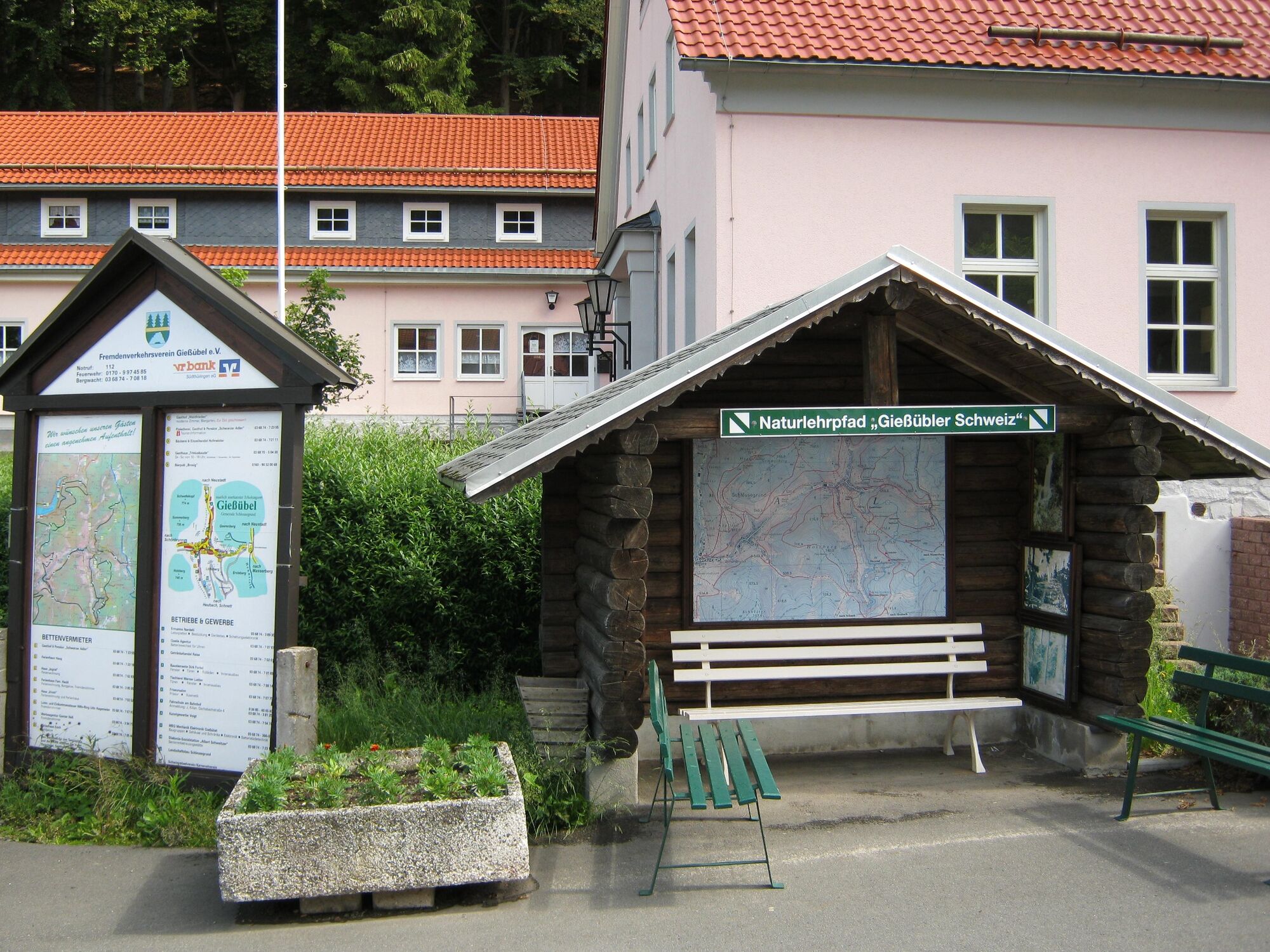
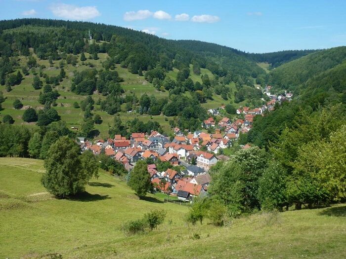
The start and finish is the car park at the clubhouse in Gießübel. It is located at the end of the village in the direction of Masserberg on the left-hand side. After crossing the road, turn right up Löffelbergstraße....
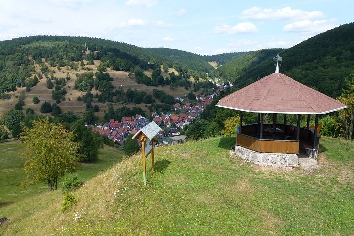
The start and finish is the car park at the clubhouse in Gießübel. It is located at the end of the village in the direction of Masserberg on the left-hand side. After crossing the road, turn right up Löffelbergstraße. After the first house on the left, turn left along a grass path between the properties. Now walk steadily up the hill to the Löffelberg. Once you reach the pavilion, a magnificent panoramic view of Gießübel opens up.
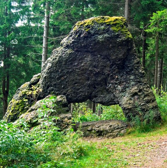
Now turn left into the Dachsbach valley. In the beautiful deciduous forest with charming views over the wide meadows, follow the course of the Dachsbach stream. After a while, the nature trail branches off to the left into the short Neuntal valley of Gießübler Schweiz. If you are looking for a little challenge, you can shorten the nature trail at the waterfall. Otherwise, follow the trail further up the valley to the south. It is worth continuing along this path. The diverse rock groups at the end of the Dachsbach valley are really worth seeing.
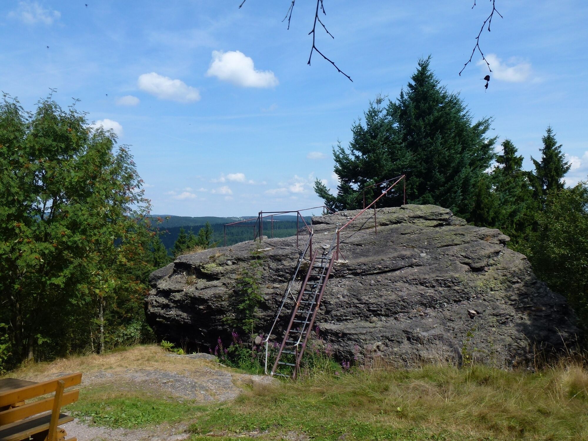
At the loop, leave the main trail and follow the signpost to the Dachsbachkanzel viewpoint. As the trail continues, the Schröderfelsen and the Nadelöhr with its imposing rock gate now appear. After a few metres, you cross the road and walk up to the Langertsfelsen. From here you have a fantastic distant view towards Neustadt am Rennsteig. Continue straight along the path at the info point and you will soon reach the Rennsteig and can turn left and take a detour to the Triniusbaude.
From Langertsfelsen, the nature trail takes the same route across the road back to the circular trail. At the fork, continue to turn right and follow the main trail downhill through the spruce forest back to Gießübel.
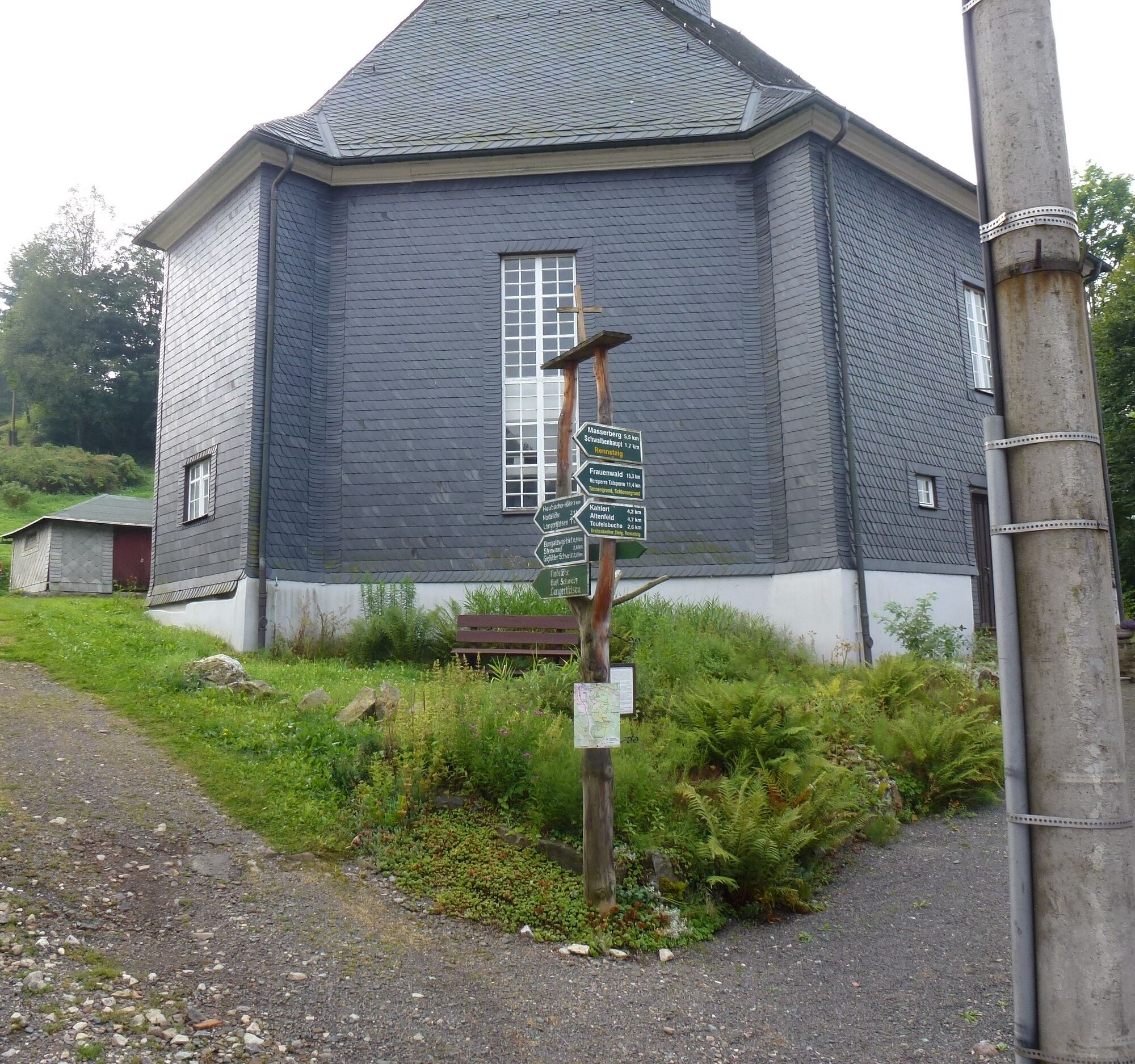
Along the nature trail there are many small boards explaining plants and trees. On large display boards there is information on geology and insights into the cultivation of the fields of yesteryear, as well as much worth knowing about the rock group at Langertsfelsen, Nadelöhr, Gießübler Schweiz and the Church "Zur Heiligen Dreifaltigkeit" in Gießübel itself.
Every year at the summer solstice, a large bonfire is lit at the Löffelberg hut. At the Triniusbaude, the Trinius Festival is held every year in August.
Photos from Gießübler Schweiz


Car park at the Kulturhaus in Gießübel - Löffelberg - Steinwand - Neuntal - Kessel - Dachsbachkanzel - Schröderfelsen - Nadelöhrfelsen - Langertfelsen - Gießübel
Ano
Ano
The hiking trail requires sturdy shoes. You will partly hike on narrow paths. Due to the danger of slipping, avoid stepping on moss-covered stones and rocks and watch out for deadwood, branches and fallen trees.
First aid kit GPS navigation device Up-to-date maps Rainwear
Be aware of the typical dangers of the forest!
Walk at your own risk!
The instructions of the forestry office staff must always be followed.
Coming from the A73, take exit 4 (Schleusingen) and continue on the L3004 towards Schmiedefeld. In the village of Hinternah, turn right over the level crossing onto Waldauer Straße towards Waldau. Turn left there in the direction of Masserberg. After approx. 3 km you will reach Schönbrunn. Follow the L1137 through the village to Gießübel.
You can reach Gießübel from the direction of Suhl (Deutsche Bahn connection) with the bus line 203 of WerraBus GmbH (direction Masserberg).
To plan your journey, simply use the Deutsche Bahn portal at the following link:
Travel to Gießübel
.
Use the free parking spaces directly at the start of the hike (Kulturhaus Gießübel) - Google NAV point
.
T2
A detour to the Triniusbaude on the Rennsteig is well worth it!
Oblíbené prohlídky v okolí
-
3.0
Rundwanderung - "4-Teiche-Wanderung" Neustadt am Rennsteig - Thüringer Wald
středníTuristika 12.6 km -
5.0
Naturlehrpfad Gießübler Schweiz
středníTuristika 7.99 km -
The Rennsteig - long-distance hiking trail from Hörschel to Blankenstein - Thuringian Forest
heavydálková pěší trasa 169.0 km -
5.0
Rundwanderweg - TOP 1 - Werraquelle - Masserberg - Thüringer Wald
středníTuristika 5.95 km -
Rundwanderung - Um die Talsperre Schönbrunn - Thüringer Wald
středníTuristika 15.6 km -
4.0
Drafted on November 12, 2016
středníTuristika 11.5 km -
Rundwanderweg - TOP 3 - Wanderung mit Weitblick - Masserberg - Thüringer Wald
středníTuristika 17.3 km -
Circular hike - To the Schönbrunn Dam - Frauenwald
středníTuristika 15.1 km -
5.0
Rundwanderweg - "Frankenblick" - Schönbrunn - Thüringer Wald
středníTuristika 12.3 km -
4.0
Rundwanderweg - TOP 2 - Masserberg - "Kulturerlebnis" - Friedrichshöhe - Thüringer Wald
středníTuristika 15.2 km
Pěší turistika a stopování


Nenechte si ujít nabídky a inspiraci pro vaši příští dovolenou
Vaše e-mailová adresa byl přidán do poštovního seznamu.