


Via Geoalpina | Stage 3 Alpe Curgei - Alpe Pian di Boit


Fotografie našich uživatelů
From the bivouac of Alpe Curgei, descendtowards Cicogna along the VBAP06 path, a track that is not always clear. The path runs from the 1338 m of Curgei to the 921 m of Varola, the ridge that closes the...
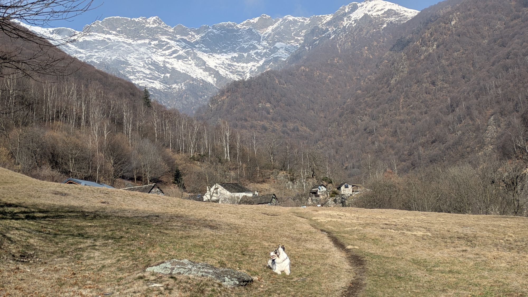
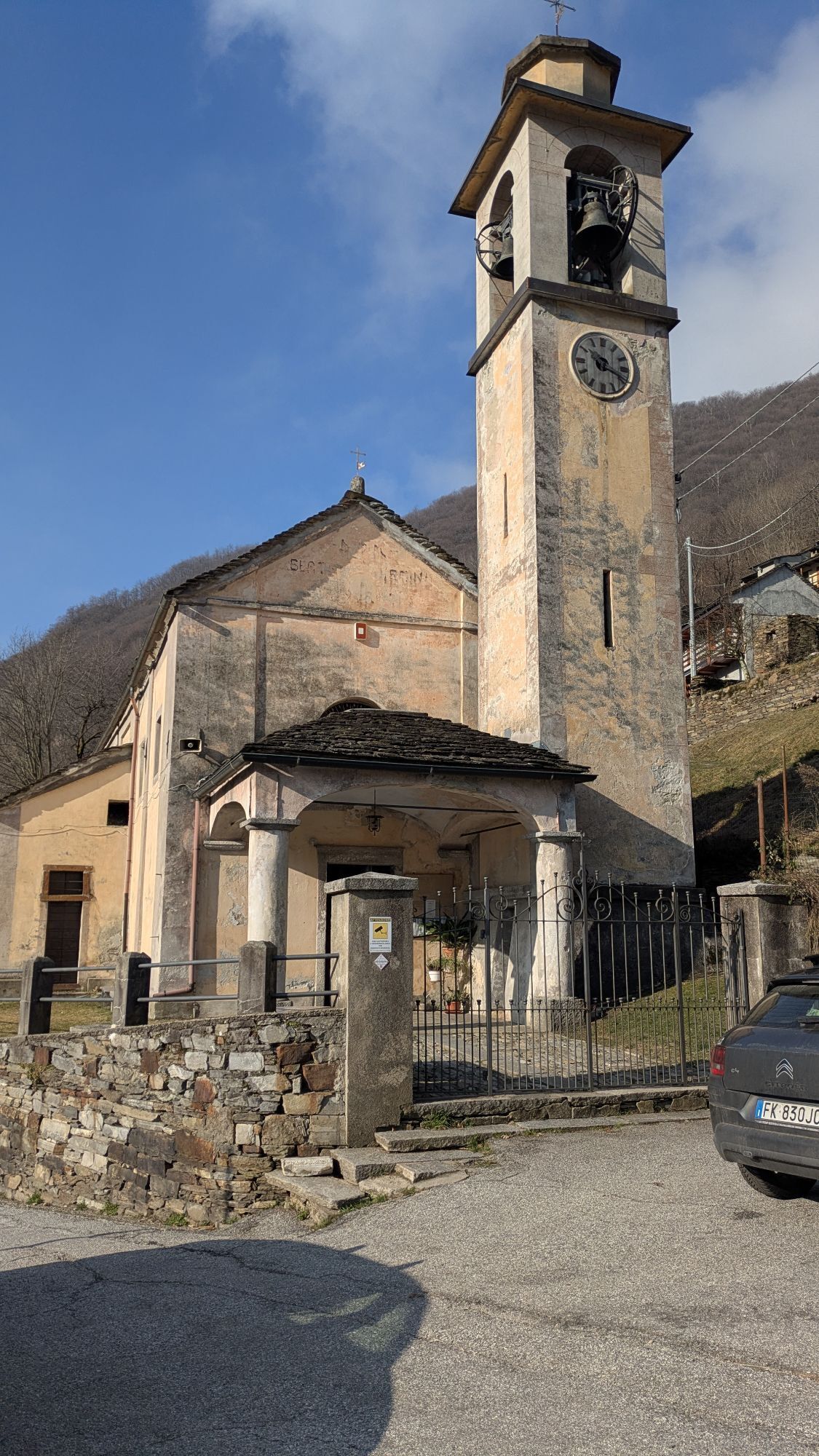
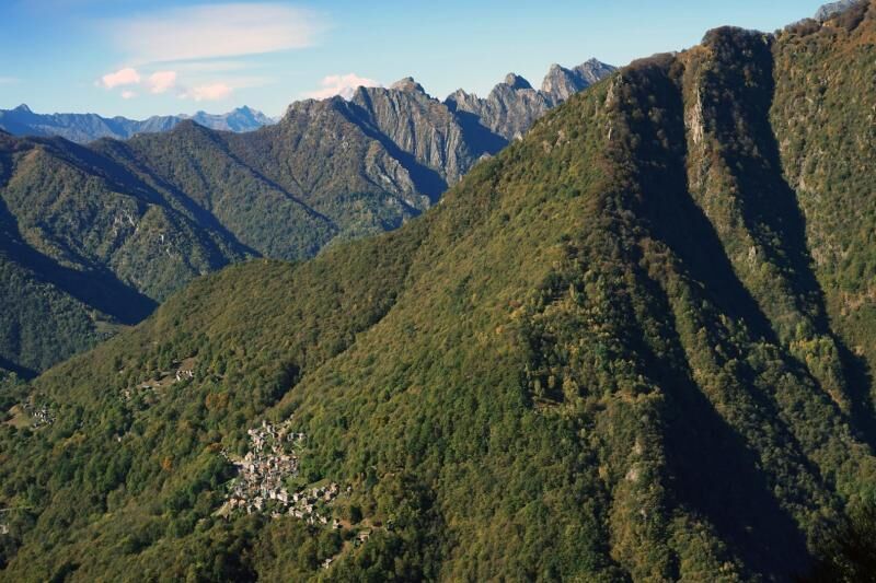
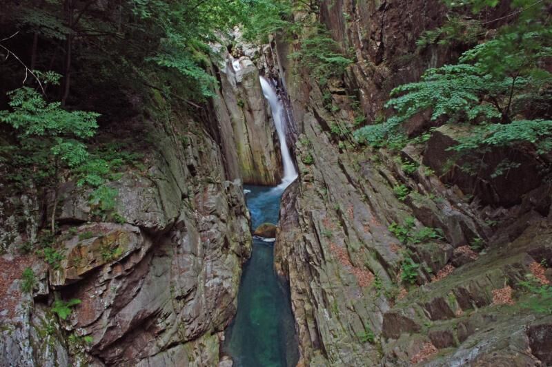
From the bivouac of Alpe Curgei, descendtowards Cicogna along the VBAP06 path, a track that is not always clear. The path runs from the 1338 m of Curgei to the 921 m of Varola, the ridge that closes the Fornale della Val Pobbi to the south-west, moving mainly in the beech wood and crossing pastures and hay meadows that once opened around pastures and short fallow meadows - which have now become wild and disappear - colonised by fern, broom and birch.From Varola, the path descends again along the ridge to an altitude of about 750 m, then turning left, in a southerly direction and reaching the Corte di Premiago (altitude 695 m) with an easy crossing. From here,along a steep mule track, you lose altitudein a natural watershed and, bypassing a hump, you reach the gorge of the Pogallo brook, which you cross at the Ponte della Buia bridge (463 m). Once over the bridge, the route climbs steeply up a mule track that preserves, for long stretches, the ancient stepped cobblestones, until you intercept, just downstream of the village of Cicogna, the VBP00 path that goes up the gorge of the Pogallo brook, from Cicogna to Pogallo.Take the VBP00 path to the right, in the direction of Pogallo, along the imposing Sutermeister road, a historic stone paved road, which runs high above the stream on the western side of the valley, passing numerous small valleys, gullies and channels, supported by dry stone walls and, in some stretches, cantilevered over the gorge. With an ascent and descent of about 150 m, in an hour and a half you reach the wide meadow of Pogallo. After crossing the meadow and before reaching the village, follow the VBAP12 path on the right along the edge of the meadow until you take the stone mule track which, hidden by the wood, descends steeply towards the gorge of the Ghina brook, which you cross over on a stone bridge. The path climbs alternating left and right orographic sections, going past the pastures of C.le dei Galli, Alpe Preda di Qua and Alpe Preda di L, up to Alpe Pian di Boit (1128 m), where the Park's homonymous bivouac is located, which concludes the stage of the itinerary. The bivouac, unguarded and always open, sleeps eighton boards under the roof; it is heated with a fireplace and has a fountain in the appurtenant area. For information, please refer to the Park Authority at 0324/87540.

Ano
The bivouac, unattended and always open, offers space for approximately 8 beds on planks in the attic, is heated with a fireplace and has a fountain in the appurtenant area. For information, refer to the Park Authority at no. 0324/87540.
Between Cicogna and Pogallo the itinerary is equipped with information panels on geological and naturalistic themes. In particular, the geological path, called the "Pogallo Line", is a deeper exploration of the "Via GeoAlpina". The route follows the Sutermeister Path and takes place mostly within metamorphic rocks of the geological unit called Strona-Ceneri area. It consists of two types of paragneiss, metamorphic rocks of sedimentary origin: the Gneiss Minuti (stop 1) and the Gneiss Ceneri (stop 2), both with Cambrian deposition age. They are interspersed with orthogneiss lenses (stop 3) derived from granite in the Ordovician period. All these rocks were transformed, around 340 million years ago (ma), by the metamorphism associated with Hercynian orogenesis when they descended to depths of at least 20 km and were affected by temperatures above 500C. In the following Permian period (270 ma) intense magmatic activity gave rise to the infiltration of granites into these formations, which were practically not involved in the events that later (from about 90 ma) led to the formation of the Alps. Once past the wooden walkway (stop 4) the milonites emerge, which are rocks produced by the friction action during the movement that occurred along the Pogallo fault. In the last stretch before Pogallo we cross kinzigiti (stop 5), rocks which are also metamorphic but which are not part of the "Serie dei Laghi" but of the adjacent Ivrea-Verbano area.
Oblíbené prohlídky v okolí
-
5.0
Cicogna, Strada Sutermeister, Alpe Pogallo, Alpe Pra, Cicogna
středníTuristika 9.83 km -
Monte Faiè
středníTuristika 6.37 km -
2.0
Alpe Quaggione - Monte Massone - Alpe Quaggione
středníTuristika 15.8 km -
5.0
Oggonio
světloTuristika 7.55 km -
4.3
Pian Cavallone
světloTuristika 7.55 km -
Alpe Faievo - Monte Tignolino - Alpe Faievo
středníTuristika 15.6 km -
Val Pale - Pizzo Pernice, Piemonte/Italia
středníTuristika 6.14 km -
Montofano - Mergozzo, Piemonte/Italia
středníTuristika 8.61 km -
Goldtoni - Alpenbogen A132 Domodossola-Alpe in la Piana
heavydálková pěší trasa 23.4 km -
Isolino-Candoglia-Rifugio Renato Brusa Perona
světloE-MTB 53 km
Pěší turistika a stopování


Nenechte si ujít nabídky a inspiraci pro vaši příští dovolenou
Vaše e-mailová adresa byl přidán do poštovního seznamu.