


Tour dello Chaberton: Stage 1 Oulx - Cesana Torinese


The stage starts from the town of Oulx, taking path 715 in Sotto la Rocca (there is a large car park) towards Pierremenaud and then joining the Balcony Path, at an equipped area and continuing towards...
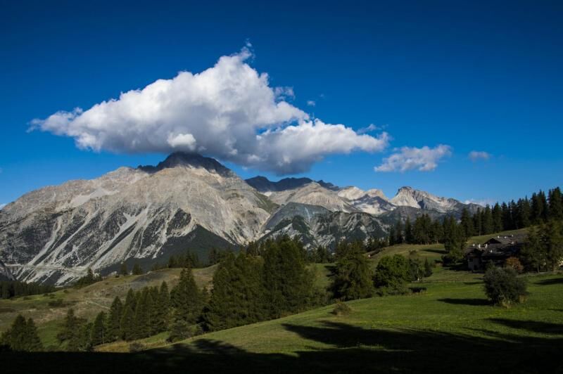
The stage starts from the town of Oulx, taking path 715 in Sotto la Rocca (there is a large car park) towards Pierremenaud and then joining the Balcony Path, at an equipped area and continuing towards the Vazon village. You then continue on SB (ETOS716000A) passing through Desertes, Colletto Grigio area, and then descending towards Fenils. From here we continue, always coinciding with part of stage 6 of the SB, on the hydrographic right of the Dora Riparia, up to the town of Cesana Torinese.
The stage starts from the town of Oulx, taking trail 715 in Sotto la Rocca (there is a large car park here) towards Pierremenaud to join the Sentiero Balcone, at the height of a well-equipped stopover area and continue towards the village of Vazon. Continue on SB (ETOS716000A), passing through Desertes, area Colletto Grigio, and descend towards Fenils. From here, continue on, always coinciding with part of stage 6 of the SB, on the hydrographic right of the Dora Riparia, until the village of Cesana Torinese.

The stage starts from the town of Oulx, taking path 715 in Sotto la Rocca (there is a large car park) towards Pierremenaud and then joining the Balcony Path, at an equipped area and continuing towards the Vazon village. You then continue on SB (ETOS716000A) passing through Desertes, Colletto Grigio area, and then descending towards Fenils. From here we continue, always coinciding with part of stage 6 of the SB, on the hydrographic right of the Dora Riparia, up to the town of Cesana Torinese.
Considering the route takes place in high mountain areas, we recommend the use of trekking boots, fleece, trousers and a windbreaker in technical fabric.
Nothing to report in this regard
By car: SS24 or A32 exit Oulx Est
By train: Metropolitan railway service Line 3, Oulx stop
Oblíbené prohlídky v okolí
-
5.0
BARDONECCHIA Colle Sommeiller
středníMountainbike 25.4 km -
5.0
BARDONECCHIA Decauville
světloTuristika 7.29 km -
5.0
BARDONECCHIA Col des Acles - Passo della Mulattiera
heavyTuristika 6.57 km -
4.5
BARDONECCHIA Sentiero Walter Bonatti - Grange della Rho
středníTuristika 6.12 km -
5.0
CESANA T.SE To Fenils (No. 48)
světloTuristika 4.29 km -
5.0
BARDONECCHIA Forte Jafferau Ring
heavyMountainbike 36.8 km -
BARDONECCHIA Punta Colomion - Passo della Mulattiera - Pian del Colle Ring
heavyMountainbike 25.1 km -
BARDONECCHIA Punta Quattro Sorelle
heavyTuristika 8.69 km -
SESTRIERE Assietta Road
středníMountainbike 43.3 km -
BARDONECCHIA Rocce della Sueur - Tour jaune de Barabbas
středníTuristika 4.12 km
Pěší turistika a stopování


Nenechte si ujít nabídky a inspiraci pro vaši příští dovolenou
Vaše e-mailová adresa byl přidán do poštovního seznamu.