


PRALI Colle di Fontane Ring


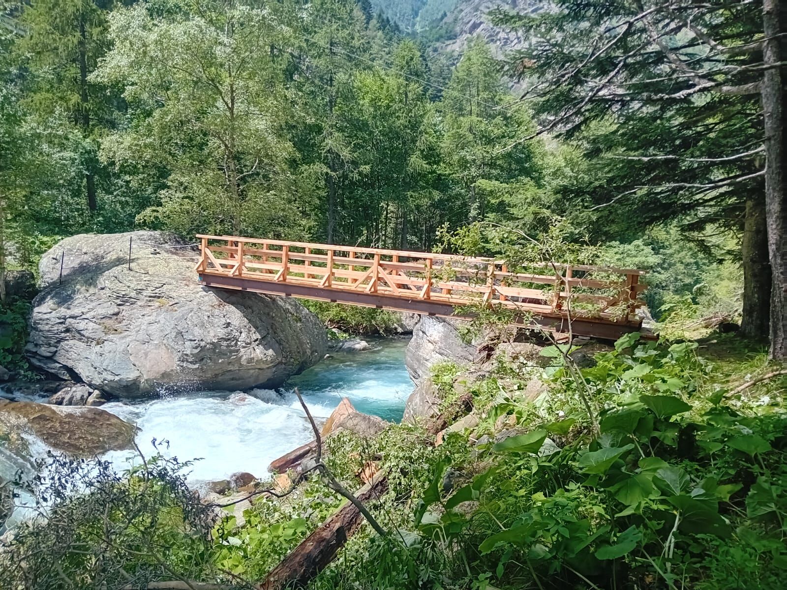
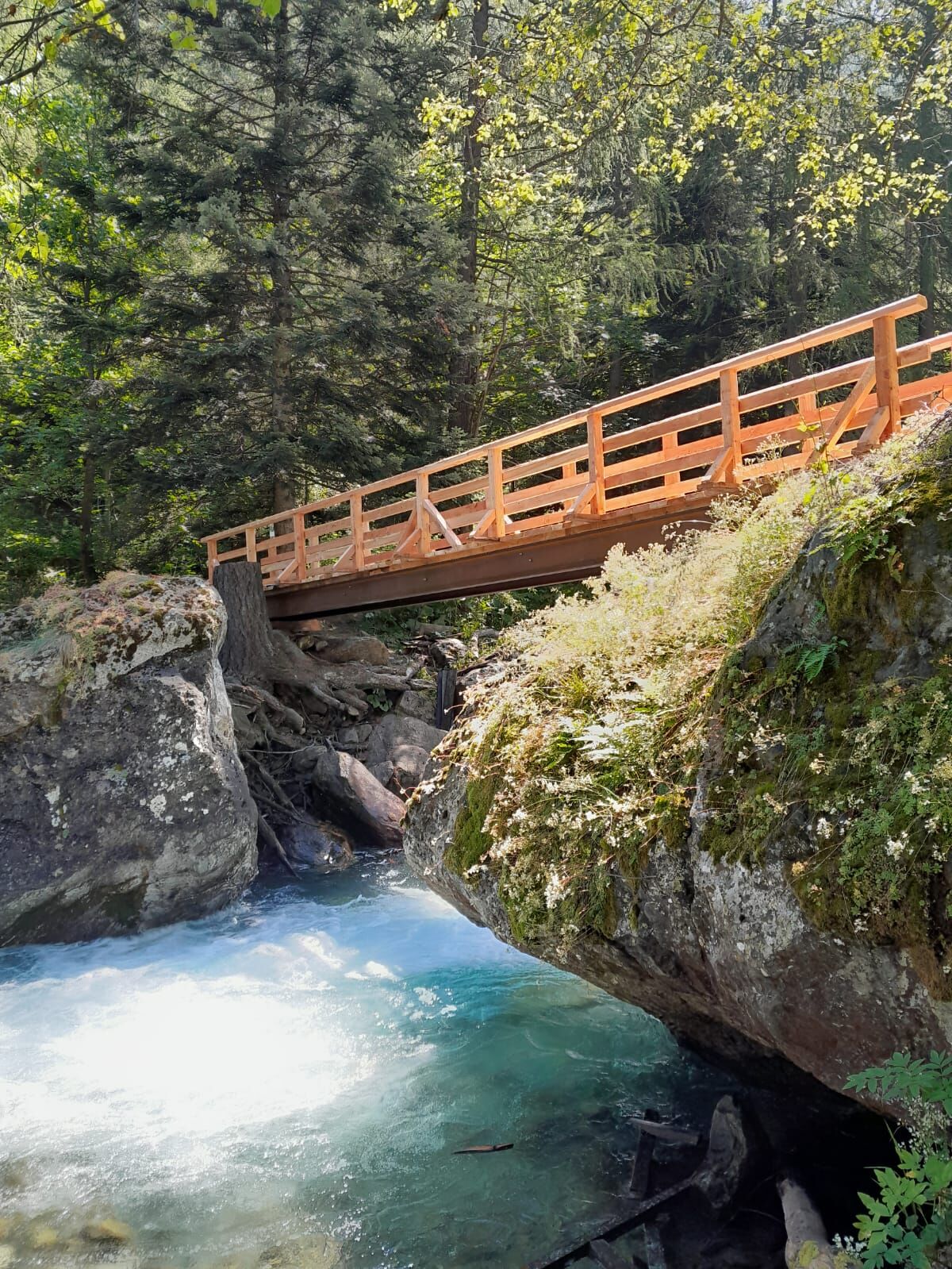
From Ghigo take the "Children's Path" on the orographic right the in the direction of Villa, and then take the path that runs alongside the Germanasca stream. Taking care in some particularly steep sections,...
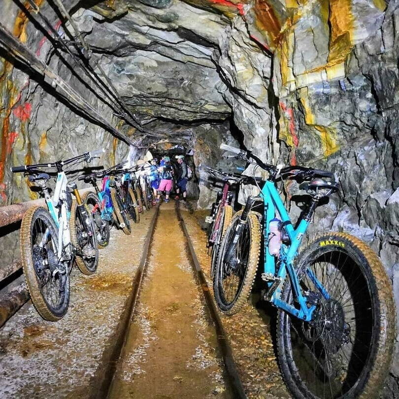
From Ghigo take the "Children's Path" on the orographic right the in the direction of Villa, and then take the path that runs alongside the Germanasca stream. Taking care in some particularly steep sections, you descend to a footbridge that allows you to cross the stream and climb up the ridge to reach the road. Nearby is theMines and Germanasca Valley Ecomuseum: a fascinating underground journey to discover local mining activity.
Go up to the Fontane hamlet, then continue to reach the Colle di Fontane (1,572 m) with a few hairpin bends. From the picnic area, take the forest track that climbs to Serrevecchio Pass (1,705 m), then descend to the hamlets of Rodoretto.
From here it is possible to take an interesting detour up the Vallone di Rodoretto to the Balma bergeria (1,890 m), via a very scenic dirt road.
The return to the starting point is via the provincial road.
From the centre you descend the valley, first along the cross-country track to the hamlet of Villa, then along the state road to the turning for Maniglia. You go up the valley to the aforementioned hamlet and then follow a road that, skirting the valley at an altitude of 1200 m, takes you to Salza with gradients that are always very rideable. When you reach the hamlet of Didiero, where you will find two bar-restaurants well stocked with local products, just after the bridge on the left, the dirt road that climbs to the Colletto delle Fontane begins, a couple of hard hairpin bends on a dirt road and a few interminable traverses to reach the pass.
After a falsopiano (false plain) you start to descend again, and with a few hairpin bends you arrive at the Fontane hamlet.
After the hamlet, leave the tarmac road and take the off-road track to the right that climbs to Serre Vecchio; here another demanding climb awaits us with a gradient at the limit of cyclability, some stretches with a cement surface. When we reach the hamlet the hostilities are over, we take the path between the houses and descend in the saddle to the hamlet of Bounous: from here the carriage road starts and shortly afterwards arrives at Rodoretto.
Beyond the hamlet, climb up the opposite slope on a dirt road to the Galmont pass and continue along the path, initially on the level and then downhill towards Cugno and Ghigo di Prali and back to the starting point.
Ano
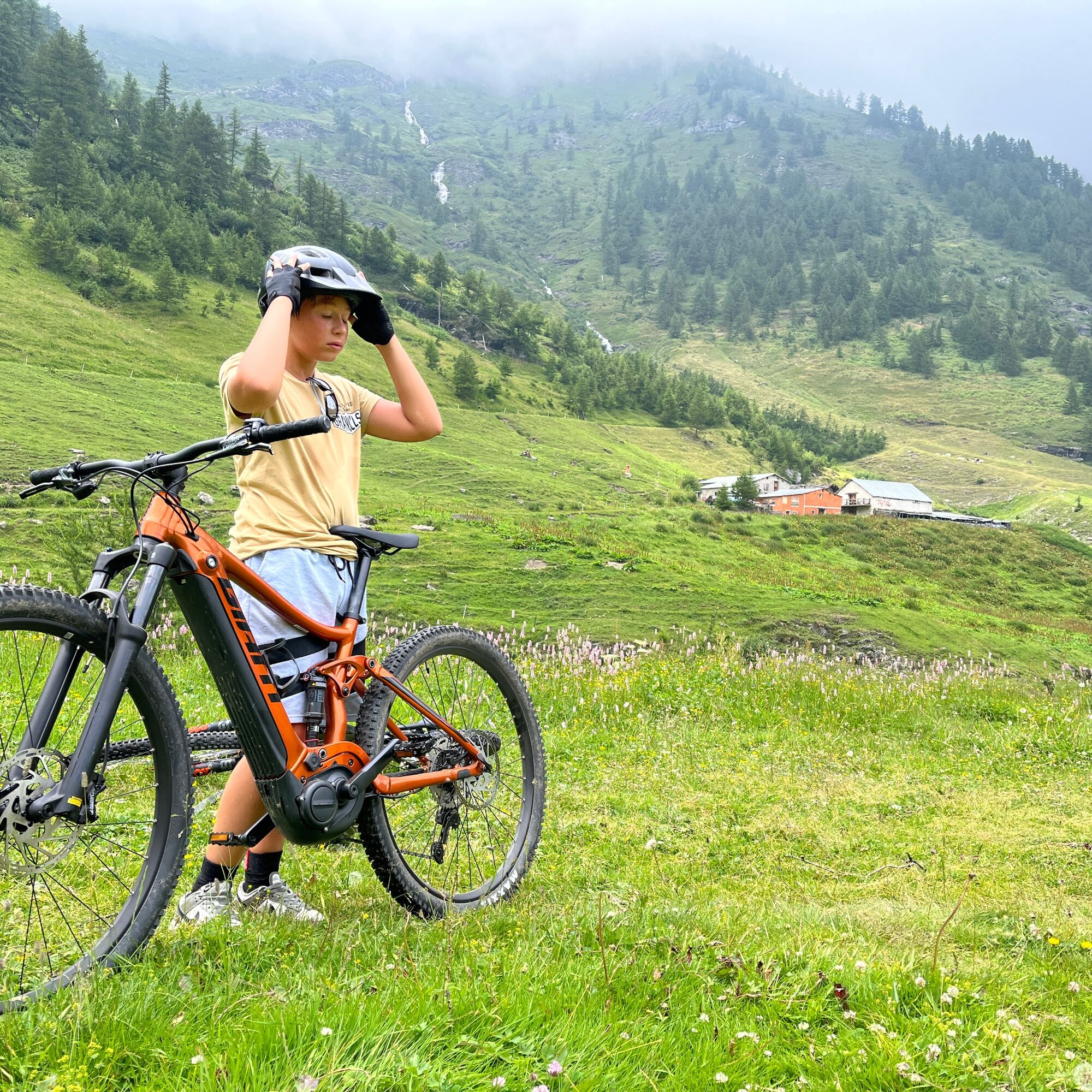
Appropriate clothing and footwear for the environment and season are recommended.
Before embarking on any excursion, it is advisable to consult weather reports or ask for information at local Tourism Offices.
It is good practice not to embark on a hike alone, always notify your destination.
Do not throw garbage into the environment but take it with you picking up any garbage left by others.
The travel times given are approximate and may vary depending on weather conditions, your own abilities and the type of bike you use
For those coming from Turin, follow the A55 to Pinerolo, then take the SR23 Sestriere and follow the signs to Prali.
Several free parking lots are located at the village center.
It is possible, with prior reservation, to make the "BIKE&MINE" variant, which involves cycling underground along the more than 2 km of the Gianna Mine. In this way, the descent to the Rabbioso Bridge is avoided, as you "disembark" directly into the Salza Valley. For info https://www.ecomuseominiere.it/territorio/bike-bikers/
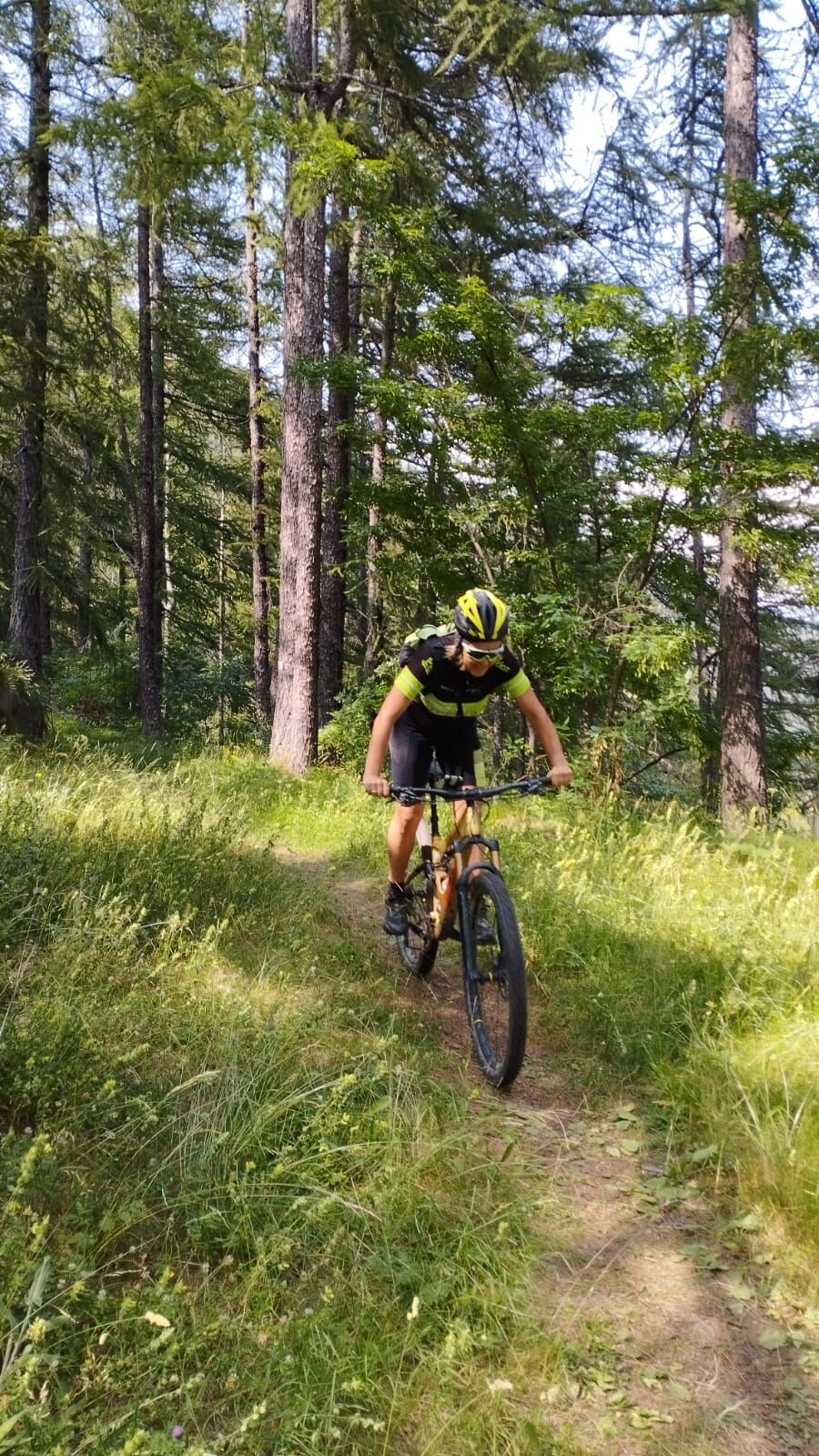
Between Ghigo and Villa, the route passes along the "Children's Path," where you can admire the benches and sculptures made by Daniele Viglianco with a chainsaw, or peek at the gnomes and their houses, cross the forest of talking trees and have fun discovering hidden surprises.
It is possible, with prior reservation, to make the "BIKE&MINE" variant, which involves biking underground along the more than 2 km of the Gianna mine, "coming out" in the Vallone di Salza and then going up to the Colle di Fontane; for info https://www.ecomuseominiere.it/territorio/bike-bikers/
Oblíbené prohlídky v okolí
-
The Roads of the Forts - stage 11 from Massello to Prali
heavyTuristika 13.7 km -
SAUZE DI CESANA Argentera Valley
středníMountainbike 30.7 km -
PRALI Ring of Rocca Bianca
heavyMountainbike 17.9 km -
PERRERO The lakes of Conca Cialancia
heavyMountainbike 21.6 km -
PRALI Thirteen Lakes - Giulian Hill - Villanova
středníMountainbike 19.0 km -
The Roads of the Forts - stage 6 from Perosa Argentina to Fenestrelle
heavyTuristika 18.7 km -
Argentera Valley : Brusà del Plan- Ponte Montenero (no. 39)
světloTuristika 6.02 km -
From Torre Pellice to Bars d'la tajola (and Mount Castlus).
středníTuristika 4.40 km -
Path of the Invincibles
středníTuristika 19.1 km -
VILLAR PELLICE Upslowtour - Invincibles Loop 5
středníJízda na kole 17.7 km
Pěší turistika a stopování


Nenechte si ujít nabídky a inspiraci pro vaši příští dovolenou
Vaše e-mailová adresa byl přidán do poštovního seznamu.