


Mountain route over Rotsteinpass to Säntis


Fotografie našich uživatelů
 © Kurt GassmannVytvořeno dne 12.08.2025
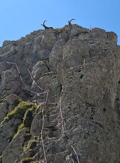 © Kurt GassmannVytvořeno dne 12.08.2025
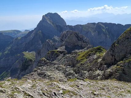 © Kurt GassmannVytvořeno dne 12.08.2025
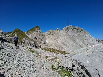 © Kurt GassmannVytvořeno dne 12.08.2025
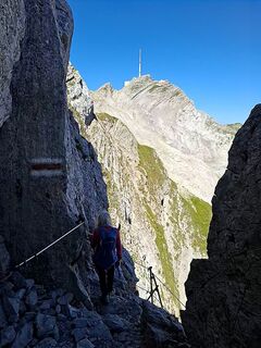 © Kurt GassmannVytvořeno dne 12.08.2025
 © Kurt GassmannVytvořeno dne 12.08.2025
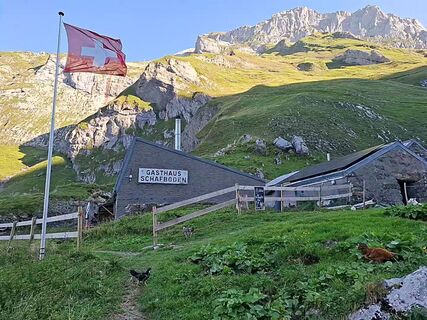 © Kurt GassmannVytvořeno dne 12.08.2025
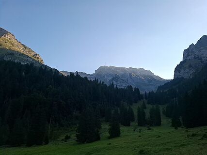 © Kurt GassmannVytvořeno dne 12.08.2025
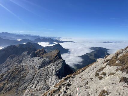
 © ukanVytvořeno dne 02.11.2024
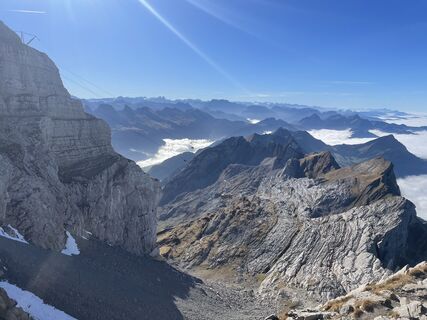 © ukanVytvořeno dne 02.11.2024
 © ukanVytvořeno dne 02.11.2024
 © ukanVytvořeno dne 02.11.2024
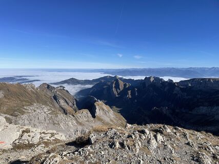 © ukanVytvořeno dne 02.11.2024
 © ukanVytvořeno dne 02.11.2024
 © ukanVytvořeno dne 02.11.2024

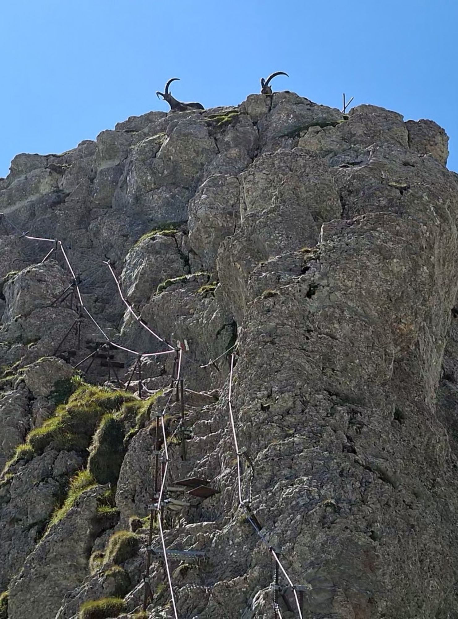
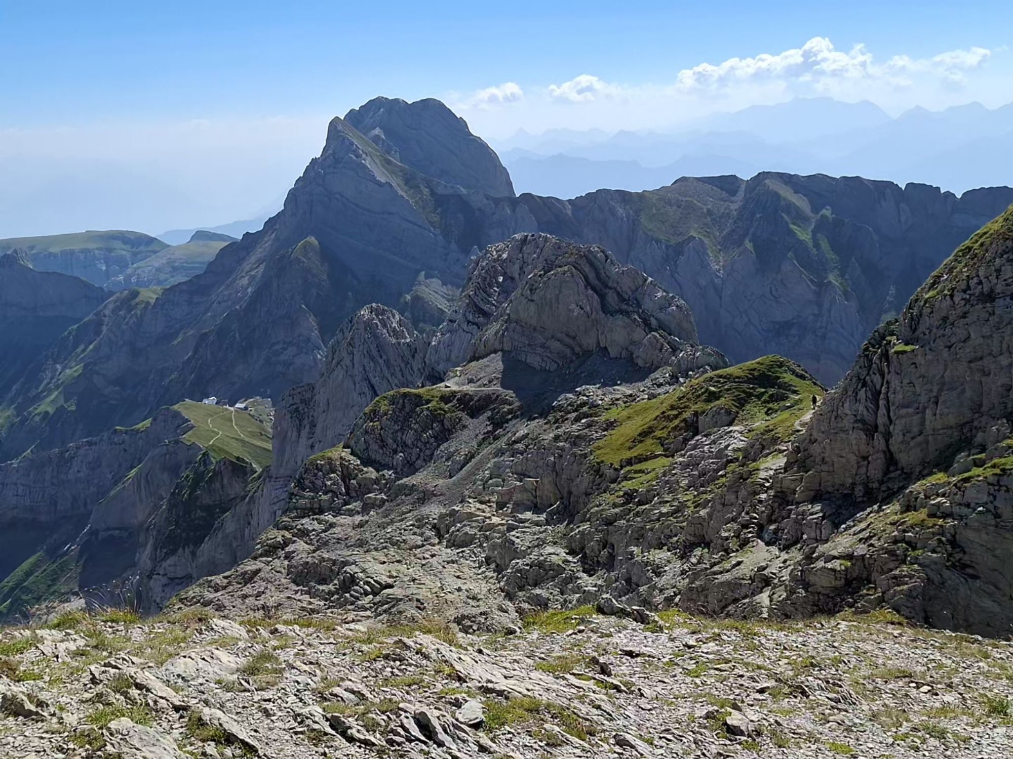


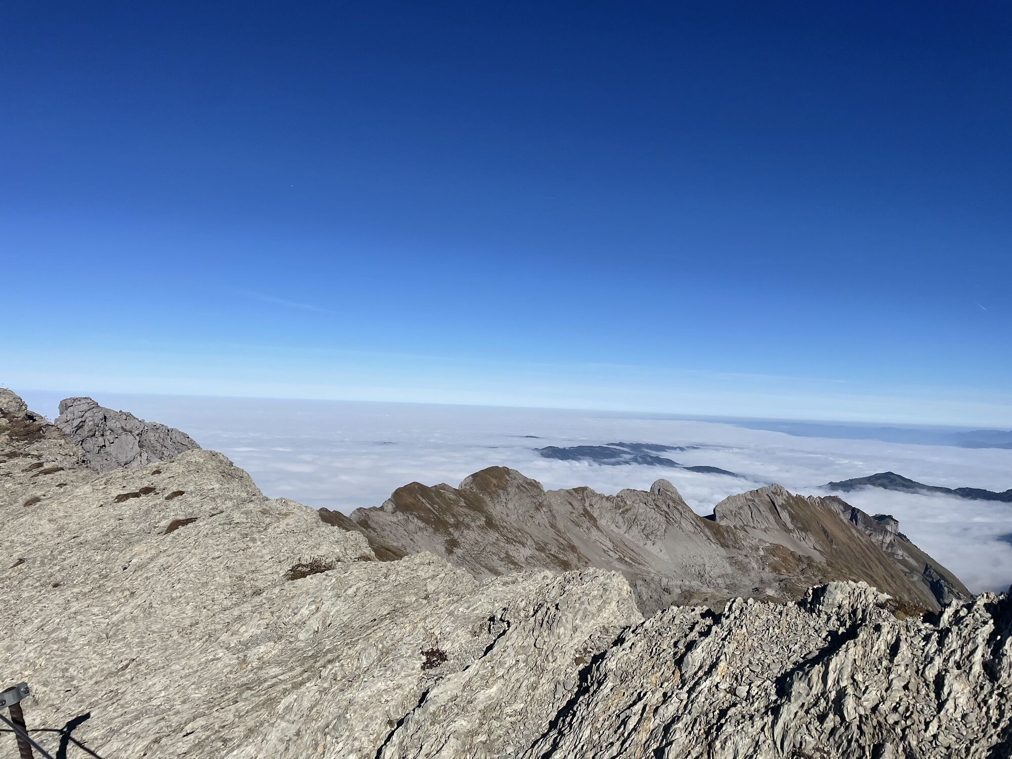
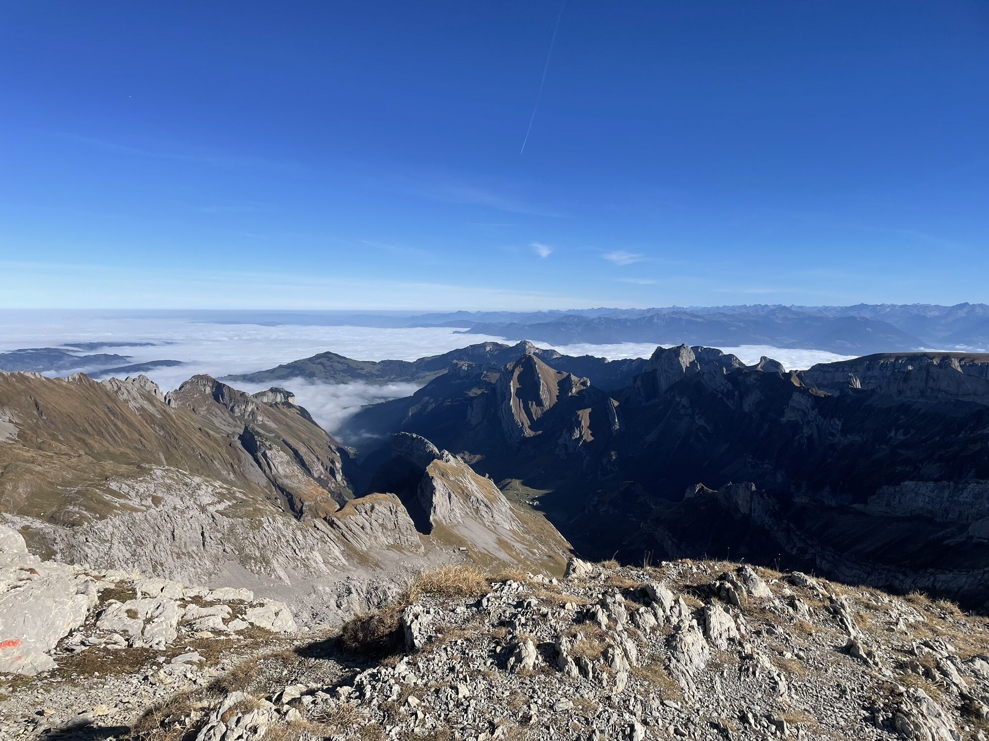
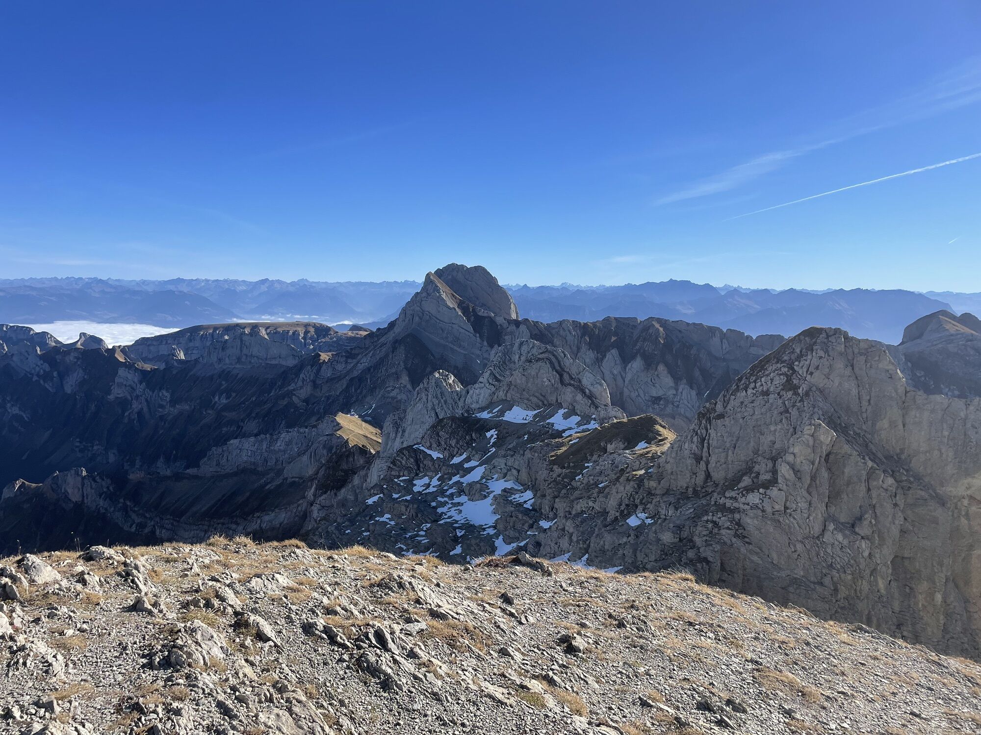
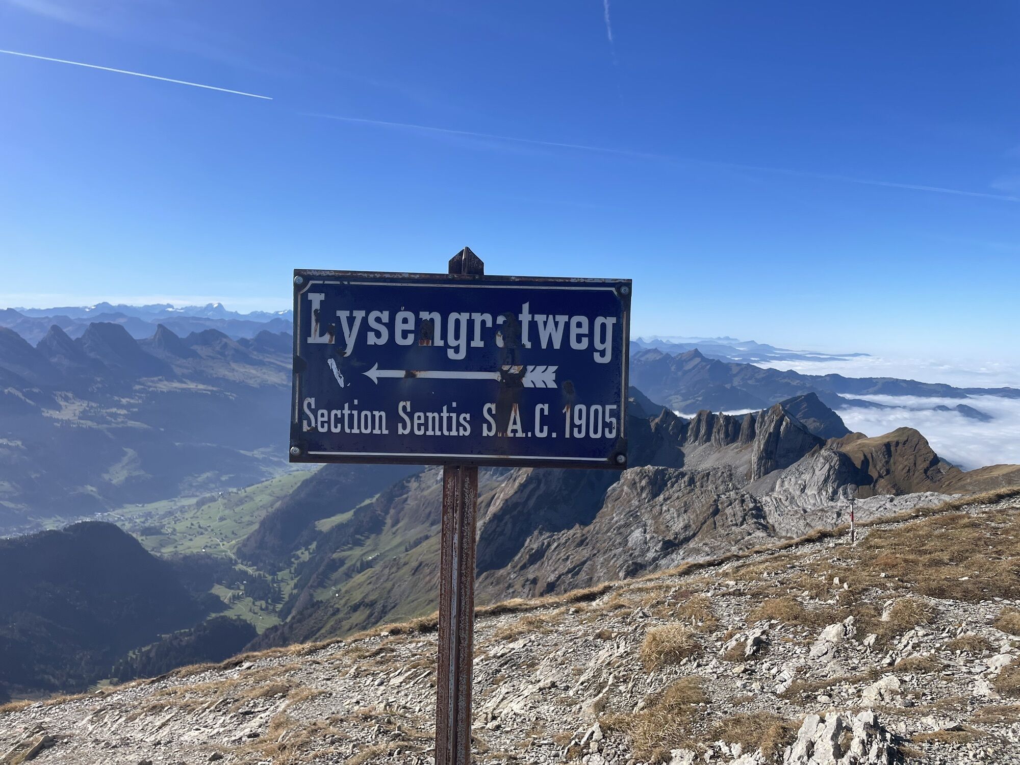
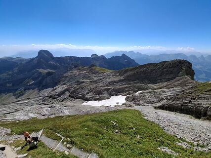
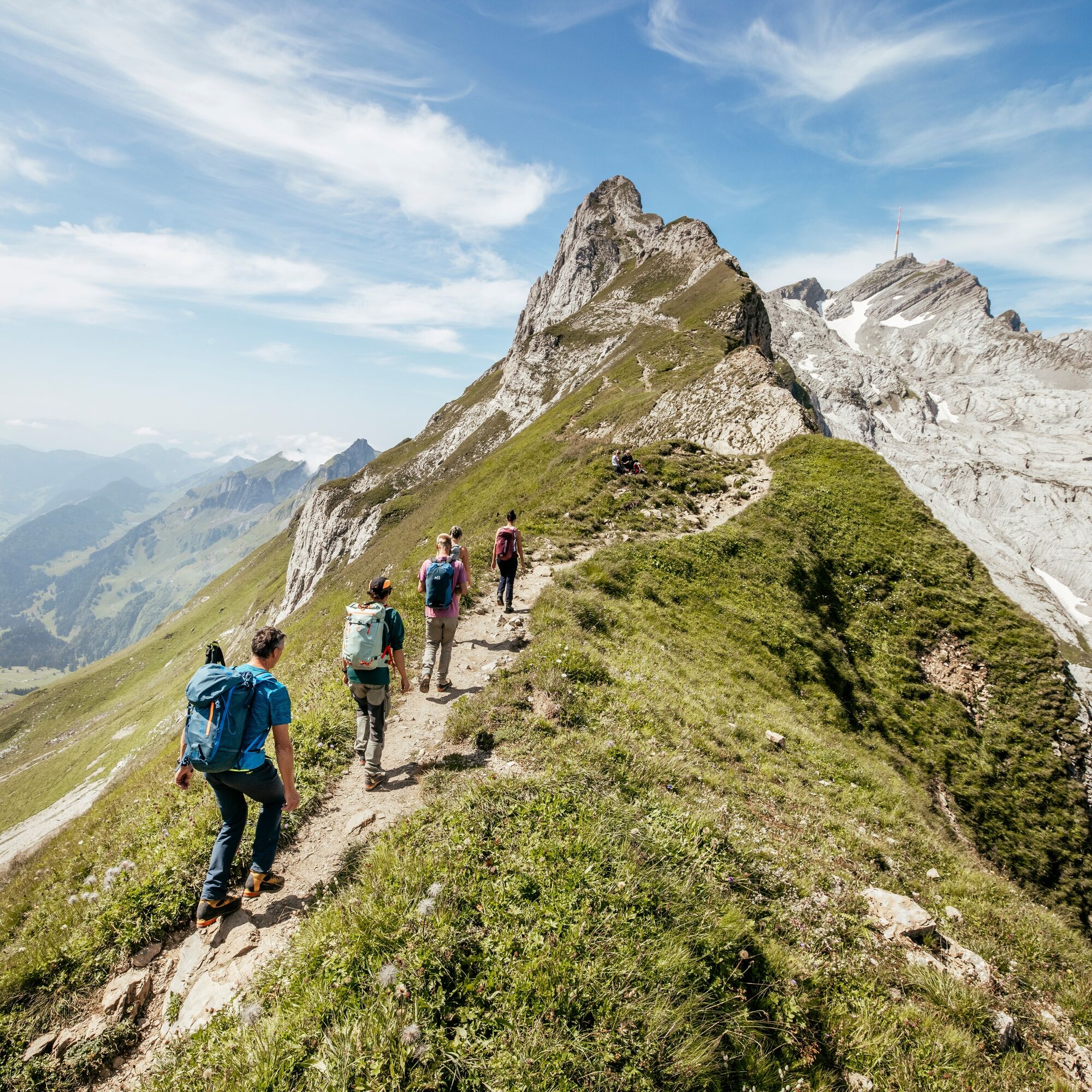
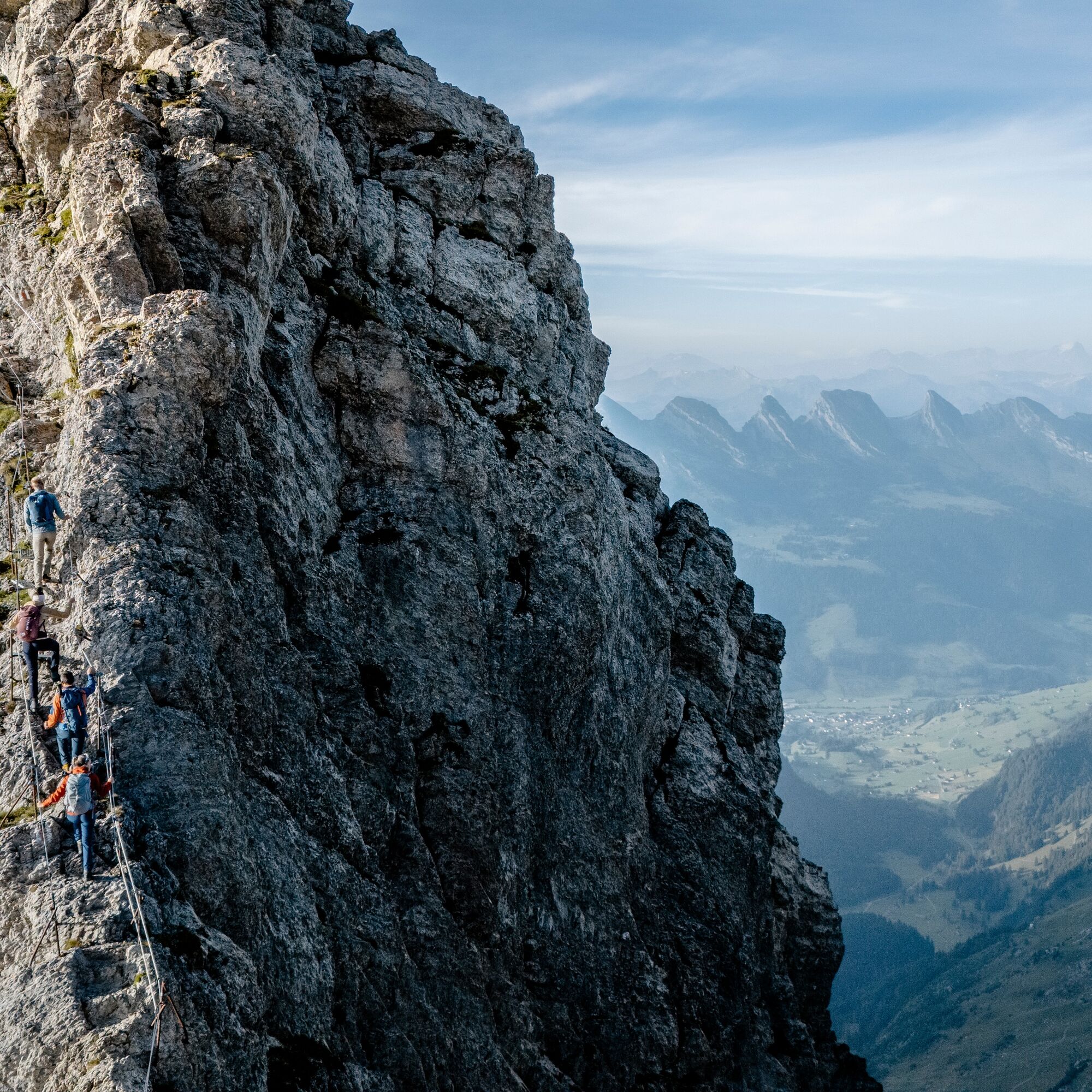
From Rotsteinpass over the Lisengrat to the summit of Säntis: a hiking delight! The path secured with wire ropes requires good hiking boots, surefootedness, and a head for heights. The hike can be extended...
From Rotsteinpass over the Lisengrat to the summit of Säntis: a hiking delight! The path secured with wire ropes requires good hiking boots, surefootedness, and a head for heights. The hike can be extended to a two-day route with an overnight stay in one of the mountain guesthouses.
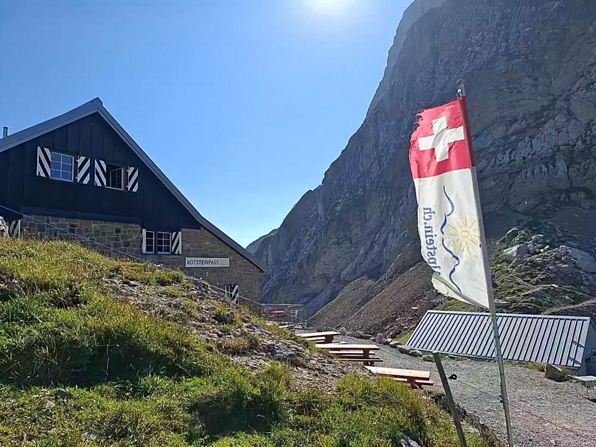
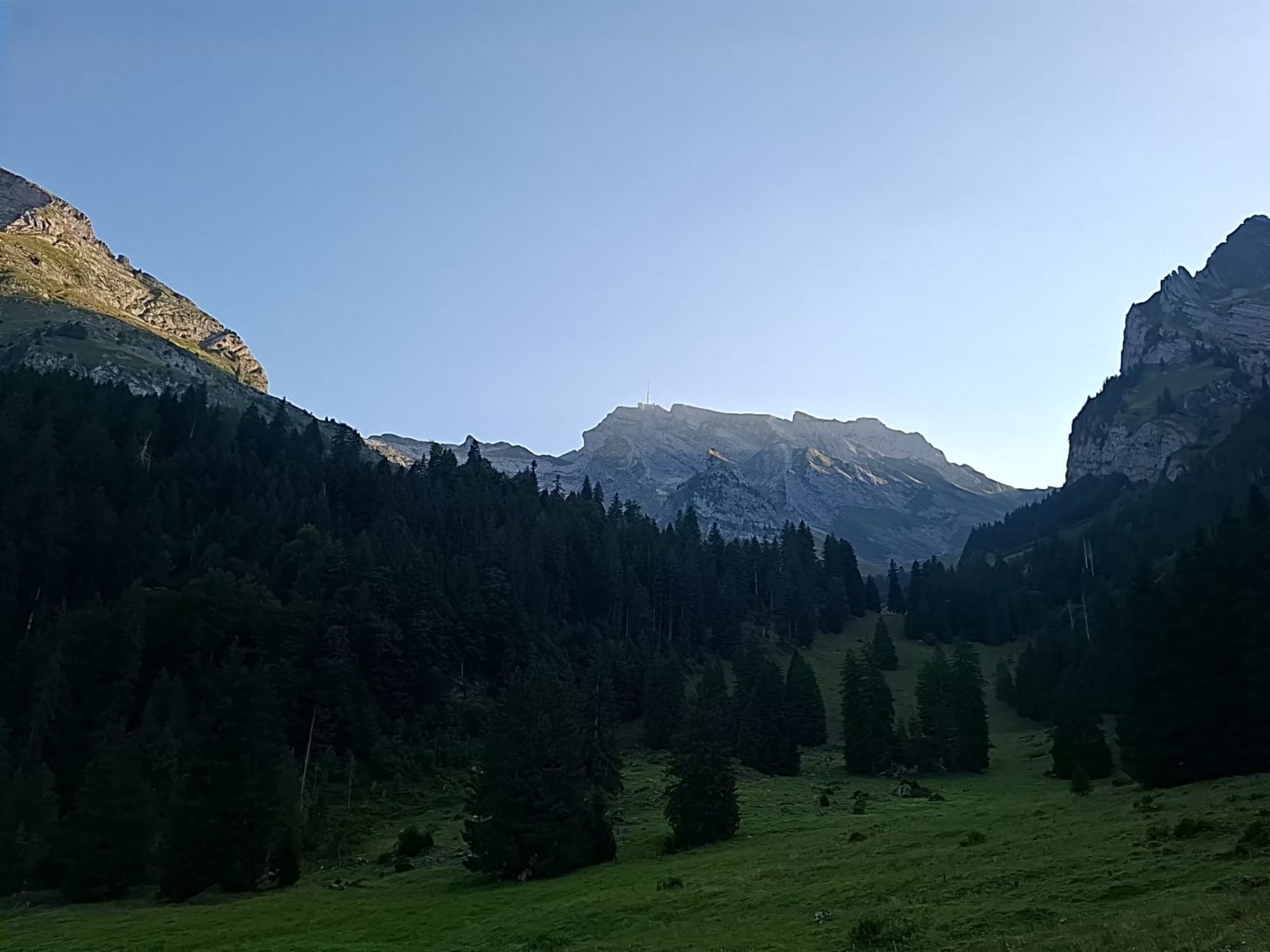
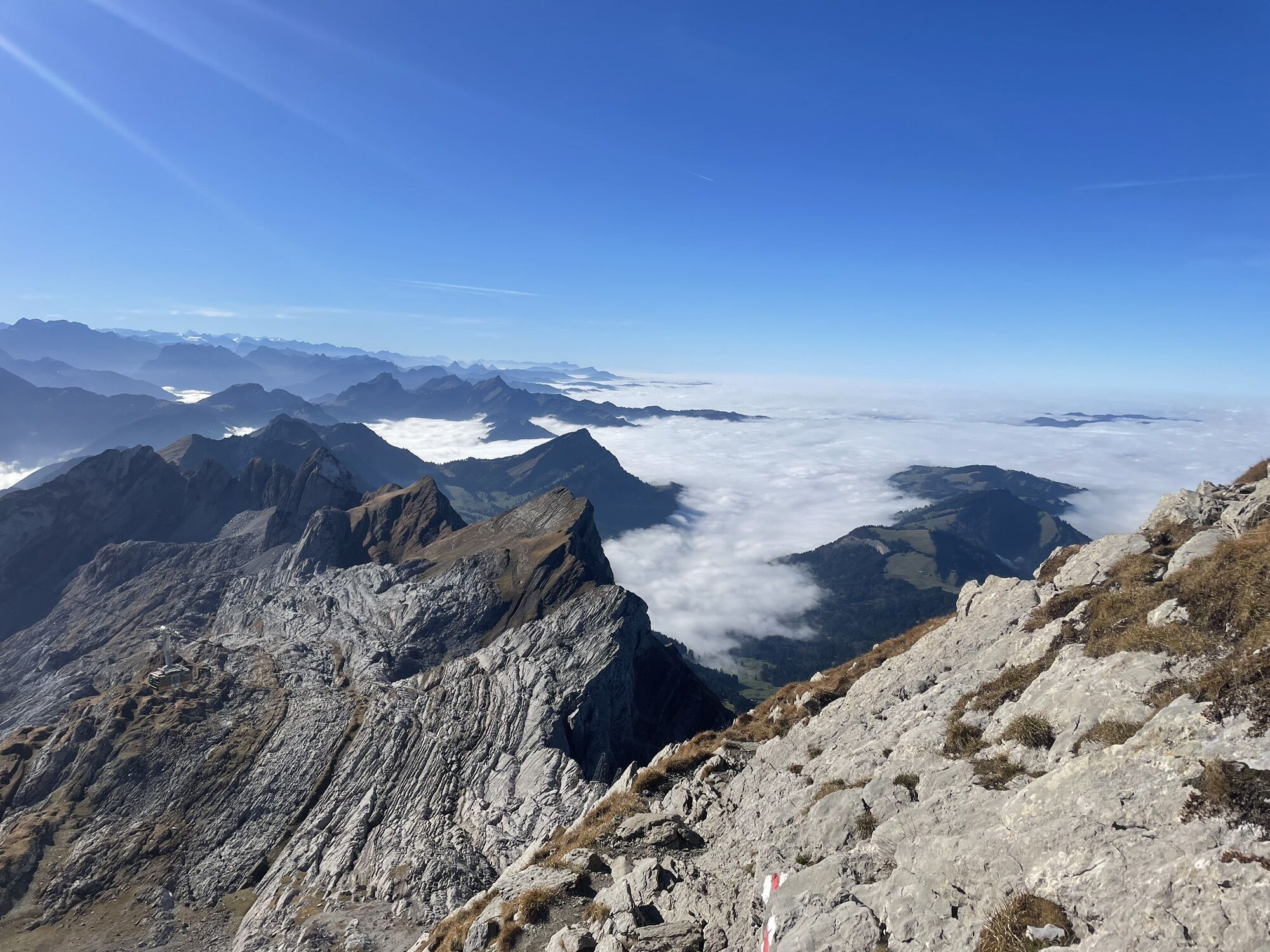
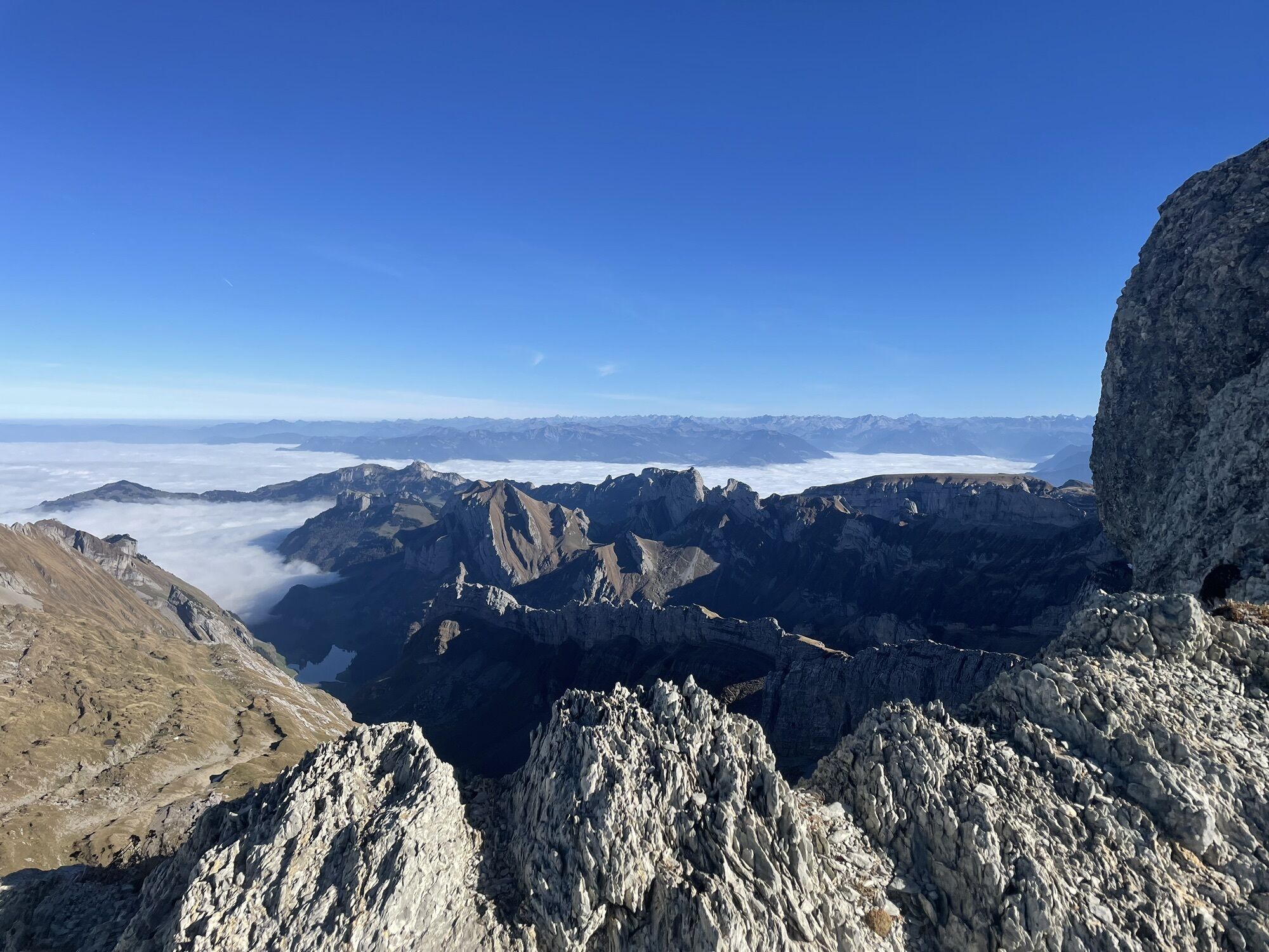
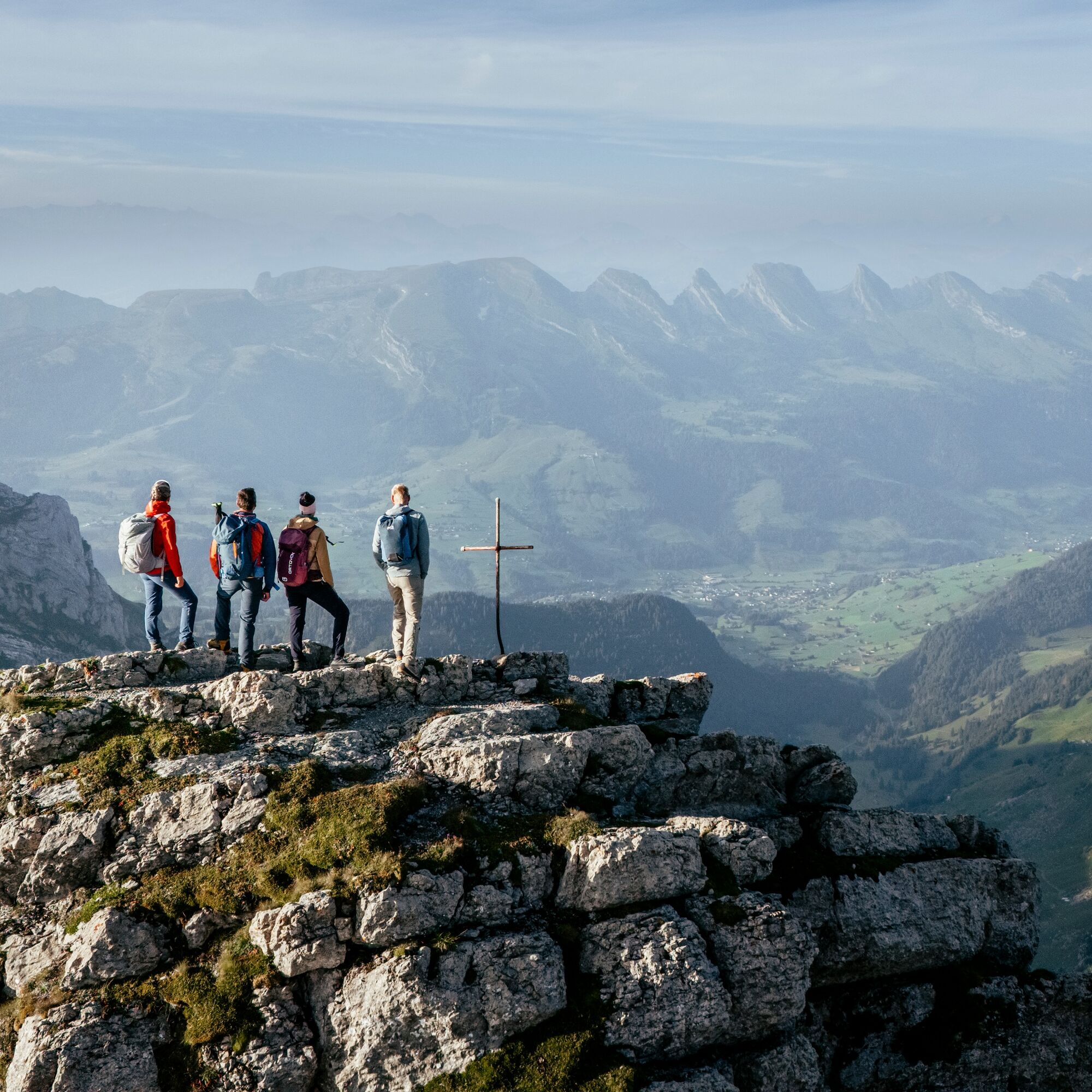
The start of the hike is already worthwhile from Unterwasser. Through the Chämmerlitobel with the Thur waterfalls and via Chüeboden, it's not far to Laui. From here, the route continues to Alp Thurwis, where the terrain opens up and the beauty of the south side of Säntis is revealed, then via Schafboden to Rotsteinpass. With a constant view of Säntis with its 123-meter-high antenna tower, the hike continues to the Lisengrat, where a head for heights is required. The balancing act between Alpstein and Toggenburg is breathtaking and impressive in every respect! Via Chalbersäntis and a final steep ascent, the goal is finally reached, and nothing stands in the way of a well-deserved meal with a far-reaching view from Lake Constance over the Alpstein, opposite the Churfirsten, all the way to the Glarus Alps.
See also
Toggenburg Tourism
Hauptstrasse 104
CH-9658 Wildhaus
Tel: +41 (0)71 999 99 11
Email: info@toggenburg.swiss
Website: www.toggenburg.swiss


Laui - Älpli - Thurwis - Schafboden - Rotsteinpass - Lisengrat - Chalbersäntis - Säntis
Ano
Ano
Take the train to Nesslau Neu St. Johann station and then the bus to Unterwasser Post.
From the Rhine Valley, take the train to Buchs station and then the bus to Unterwasser Post.
Oblíbené prohlídky v okolí
- 4,5
Tour Brülisau - Saxerlücke - Hoherkasten⛰
heavyTuristika16,6 km - 4,7
Riviera Walensee Walenstadt - Quinten
středníTuristika10,4 km - 4,9
Säntis-Gipfeltour, Wasserauen / Appenzell Innerrhoden
heavyTuristika21,1 km - 4,7
Wasserauen - Seealpsee - Wasserauen
středníTuristika7,71 km - 5,0
Staubern-Runde (15.8.2021)
středníTuristika8,65 km - 4,8
Seealpsee
středníTuristika12,3 km - 5,0
Seealpsee Runde
středníTuristika8,22 km - 3,0
Ebenalb, Aescher, Seealpsee, Meglisalp, Wasserauen
heavyTuristika13,6 km - 5,0
Traumhafte 3-Seen/Hütten Runde in Appenzell Schweiz
středníVysokohorská turistika19,7 km Wasserauen-Seealpsee-Mesmer-Ageteplatte-Meglisalp-KleinHütten-Wasserauen
středníHorská turistika15,4 km
Pěší turistika a stopování


Nenechte si ujít nabídky a inspiraci pro vaši příští dovolenou
Vaše e-mailová adresa byl přidán do poštovního seznamu.