Path of the Hills
světlo
Navigace na stránkách
Navigace na stránkách
Pořiďte si tuto prohlídku do mobilního telefonu
Path of the Hills
světlo
Turistika
9.60
km
Naskenujte QR kód a spusťte navigaci v aplikaci bergfex.

Pěší turistika a stopování


Path of the Hills
světlo
Vzdálenost
9.60
km
Doba trvání
03:30
h
Ascent
149
hm
Hladina moře
186 -
270
m
Stažení skladby
Path of the Hills
světlo
Turistika
9.60
km


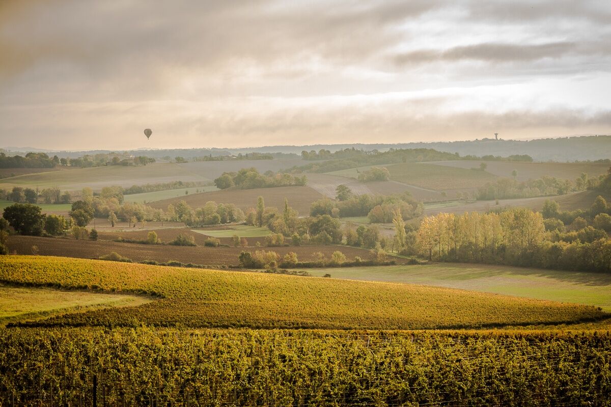
During your journey, you will also discover the very picturesque and charming rural heritage, with its pigeon lofts and its wash houses, witnesses of the activities of our ancestors.
Trasa
Lou Cantoun
(243 m)
Restaurace
0.0 km
Cestayrols
(243 m)
Vesnice
0.0 km
Lincarque
(253 m)
Vesnice
4.3 km
As Plots
(243 m)
Koridor/terén
5.0 km
Église Saint-Michel
(242 m)
Místo konání bohoslužeb
9.5 km
Trasa
Path of the Hills
světlo
Turistika
9.60
km
Lou Cantoun
(243 m)
Restaurace
0.0 km
Cestayrols
(243 m)
Vesnice
0.0 km
Las Bordes
(272 m)
Koridor/terén
2.5 km
Lincarque
(253 m)
Vesnice
4.3 km
As Plots
(243 m)
Koridor/terén
5.0 km
Plaine de Daurias
(192 m)
Koridor/terén
6.6 km
Église Saint-Michel
(242 m)
Místo konání bohoslužeb
9.5 km
Cestayrols
(243 m)
Vesnice
9.5 km
Lou Cantoun
(243 m)
Restaurace
9.5 km
Zatím žádné recenze
Oblíbené prohlídky v okolí
-
Œnorando® From vine to olive tree
středníTuristika 11.4 km -
Œnorando® The winegrowers' round
světloTuristika 7.68 km -
Circuit Vélo - C3 De Sainte Cécile au vignoble Gaillacois
světloSilniční kolo 38.6 km -
Circuit de Lacapelle Sainte Lucie
světloTuristika 11.5 km -
Vignoble et Châteaux Path
heavyTuristika 17.7 km -
Path of the lavoirs
heavyTuristika 17.0 km -
Œnorando® The Pompirac Path
světloTuristika 7.28 km -
The Téroundel Path
světloTuristika 3.21 km -
The Heritage Path of Cordes sur Ciel
světloTuristika 15.0 km -
Path of the Doves
heavyTuristika 14.5 km
Pěší turistika a stopování

Více než 550.000 návrhů výletů, podrobné mapy a intuitivní plánovač tras dělají z aplikace nezbytnou výbavu pro všechny milovníky přírody.

Nenechte si ujít nabídky a inspiraci pro vaši příští dovolenou
Přihlaste se k odběru newsletteru
Chyba
Došlo k chybě. Zkuste to prosím znovu.
Děkujeme za vaši registraci
Vaše e-mailová adresa byl přidán do poštovního seznamu.
Zájezdy po celé Evropě
Rakousko
Švýcarsko
Německo
Itálie
Slovenia
Francie
Nizozemsko
Belgie
Polsko
Lichtenštejnsko
Česko
Slovensko
Španělsko
Chorvatsko
Bosna a Hercegovina
Lucembursko
Andorra
Portugal
Iceland
United Kingdom
Ireland
Greece
Albania
North Macedonia
Malta
Norway
Montenegro
Moldova
Kosovo
Hungary
San Marino
Romania
Estonia
Latvia
Belarus
Cyprus
Lithuania
Serbia
Bulgaria
Monaco
Denmark
Sweden
Finland