


Circular hike Crappa Grossa


The hike begins at the bridge over the Rhine at Cumpadials and takes you along the right bank of the Rhine towards Disentis. Once you have left the nature trail behind you, the spectacular part begins....
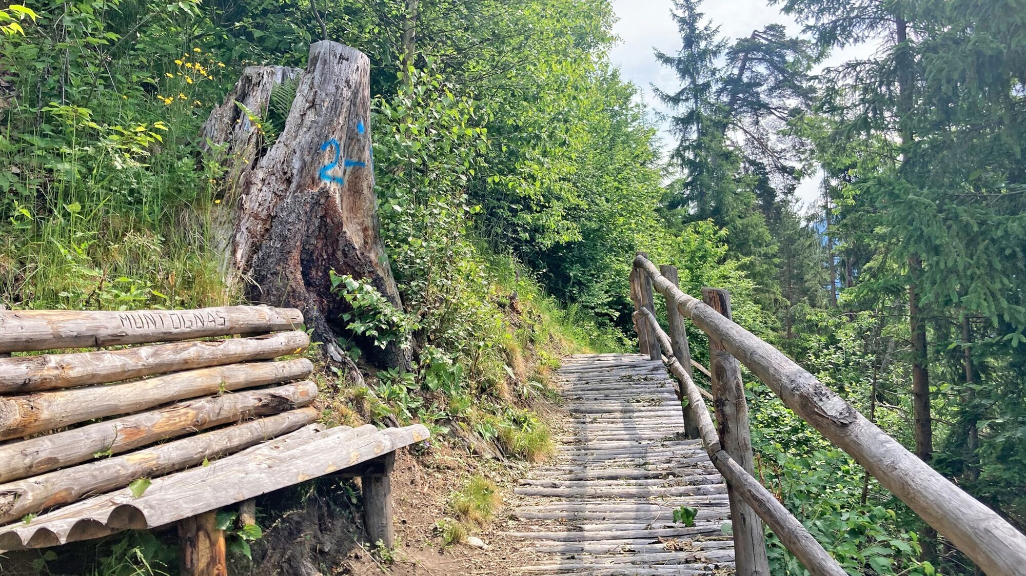
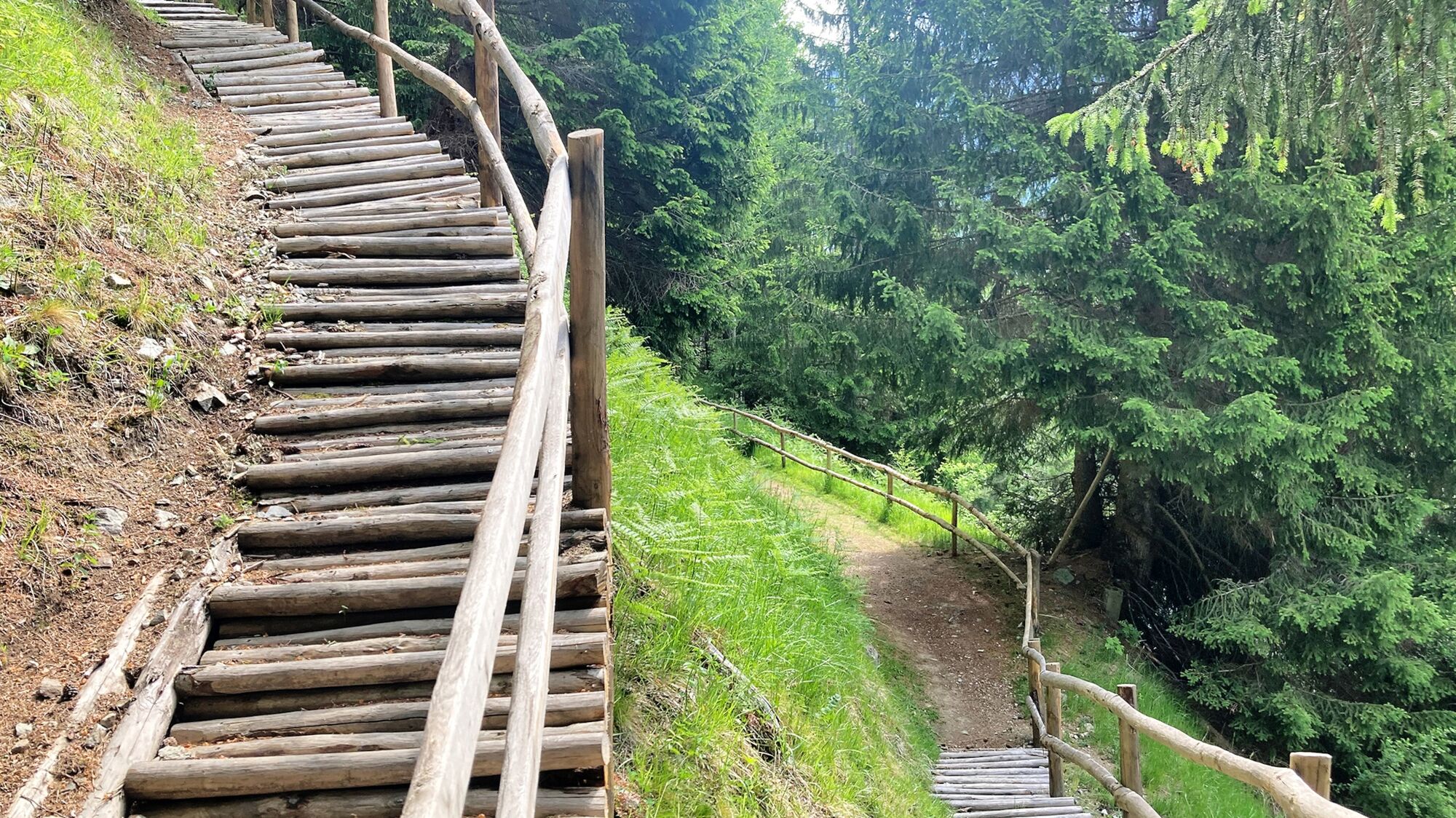
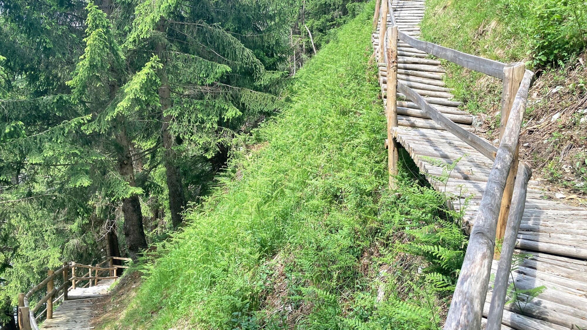
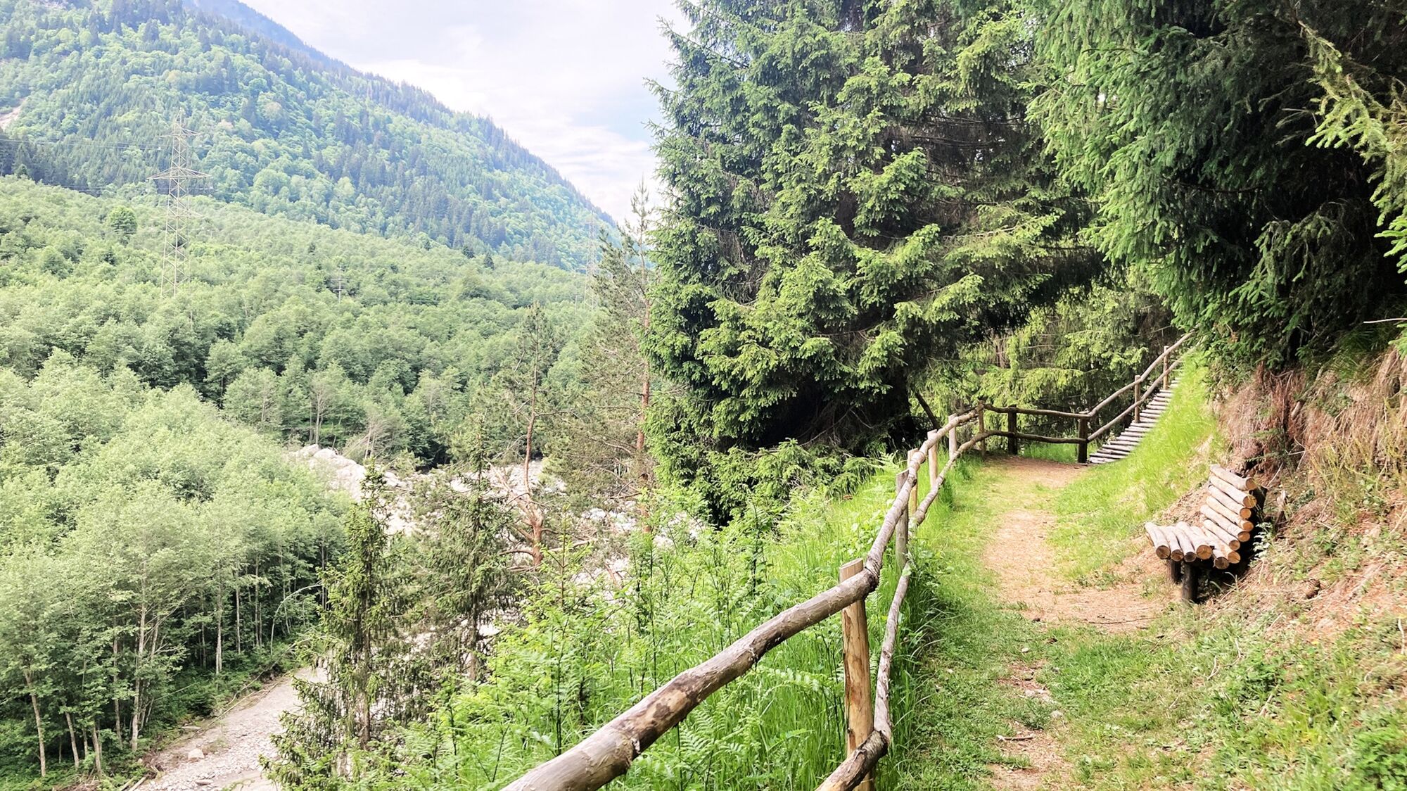
The hike begins at the bridge over the Rhine at Cumpadials and takes you along the right bank of the Rhine towards Disentis. Once you have left the nature trail behind you, the spectacular part begins. The section built with logs was completely rebuilt in 2021 to avoid the slippery right bank of the Rhine. It zigzags up to the highest point and then down through a moss-covered path to Grappa Grossa (large stones) and on to the hydroelectric power station at the foot of the wild Russeinertobel. From here you have a spectacular view up to the three bridges of the Val Russein. You then cross the Rhine bridge at Pardomat. On the other side of the river, the trail leads you along the side road back to Pardomat Dado. You cross the alluvial forest of the wild “Darguns” (torrent) Dadens and Dado and return to the starting point via the hamlet of Falens.
The circular route can also be followed in the opposite direction or from Disentis via Madernal.
ATTENTION: The Rundholzweg is not suitable for bikers!

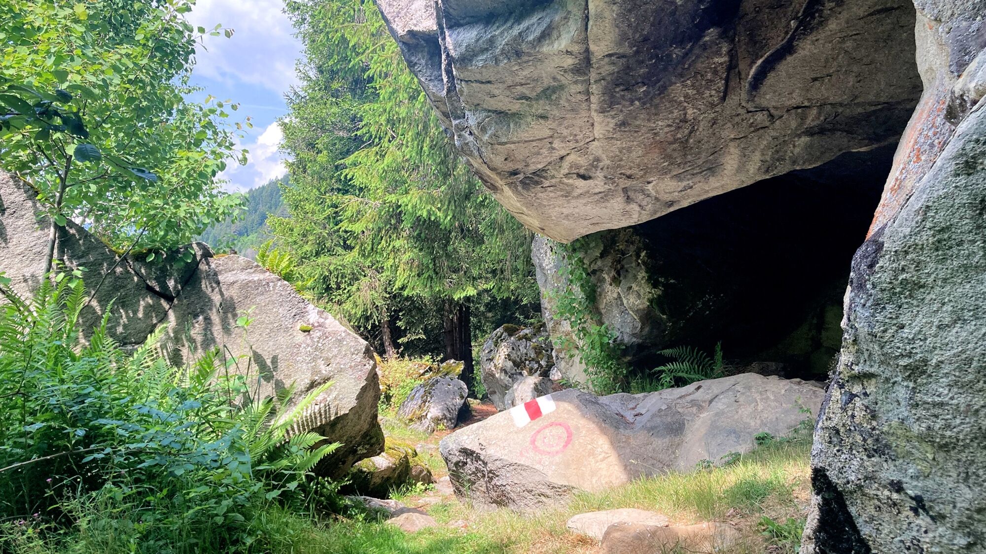
Cumpadials - Crappa Grossa - Crest la Resgia - Pardomat - Falens - Plaun Petschen - Cumpadials
Ano
Good hiking boots with a good tread, clothing suitable for the weather (rain jacket), first aid kit, drink, food, possibly hiking poles
The tour should not be undertaken in uncertain weather conditions. Weather changes are frequent in the mountains. If a rain front or similar is approaching during the hike, you should turn back in good time.
By car via Chur
From Zurich on the N 3 or from St. Gallen on the N 13 to Chur and continue to the Reichenau exit in the direction of Disentis/Ilanz/Flims as far as Cumpadials to the Plaun Petschen playground.
By car via Göschenen
From Basel on the N 2 via Lucerne to Göschenen, continue on the old pass road through the Schöllenen Gorge to Andermatt and drive over the Oberalp Pass/Disentis to Cumpadials to the Plaun Petschen playground.
By train via Chur or Göschenen
From Göschenen via Disentis or from Chur directly with the RhB to Sumvitg/Cumpadials.
From Sumvitg/Cumpadials station it is 30 minutes to the starting point of the hike.
Parking facilities at the Plaun Petschen playground.
Surselva Tourismus AG
Bahnhofstrasse 25
CH-7130 Ilanz
Tel.: 0041 81 920 11 00
Email: ilanz@surselva.info
Internet: www.surselva.info
Linger at the nearby Plaun Petschen playground, where a Swiss family fireplace and a beautiful natural lake await you.
Oblíbené prohlídky v okolí
Rueras - Hexensee - Rueras
středníTuristika9,71 km- 5,0
Breil/Brigels - Val Frisal Rundwanderung
středníTuristika20,8 km - 4,5
Die Puntegliashütte am Fusse des Tödimassivs
heavyTuristika13,5 km - 5,0
Kistenpasshütte-Breil/Brigels
středníTuristika13,7 km Lag Serein: A long circular hike from S. Benedetg
středníTuristika13,4 km- 4,3
678 Hochtal Val Frisal
středníTuristika11,9 km The Greina plateau and its arch
středníTuristika18,0 kmArco della Greina (Greina Naturbogen)
Turistika7,09 kmKronenwanderung (12 Etappen)
heavydálková pěší trasa213,1 km- 4,8
Blenio, Svizzera
středníTuristika22 km
Pěší turistika a stopování


Nenechte si ujít nabídky a inspiraci pro vaši příští dovolenou
Vaše e-mailová adresa byl přidán do poštovního seznamu.