


Monts du Lyonnais - Around Mont Arjoux - Loop 2.2
Úroveň obtížnosti: 5


Sporty side
One thousand m drop: fans of climbs will appreciate this course.
From Saint-Forgeux the slope rises on a road with very little traffic in the forest area for about ten kilometres to reach the...
Sporty side
One thousand m drop: fans of climbs will appreciate this course.
From Saint-Forgeux the slope rises on a road with very little traffic in the forest area for about ten kilometres to reach the highest point of the route. The next 35 km allow ample time to recover on a rolling and uncrowded road. The last 5 km is difficult: a steep 2 km bump and also a very steep descent on a small road. Remember to check the equipment (especially the brakes) before departure.
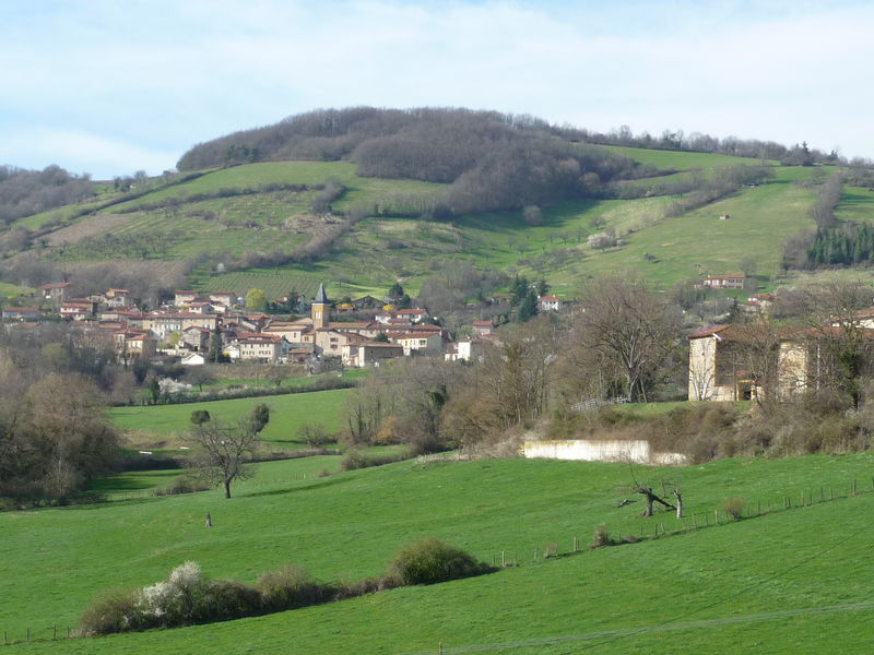
Tourism side
During the first kilometres, the road goes through wooded passages and then reaches panoramas facing the Monts du Forez. From the second part of the route, hills occupied by fruit crops are looming. A “season” loop to discover especially in spring just for the pleasure of admiring the flowering cherry groves in the Bessenay region.
Good tips:
To enjoy your hike safely, here are our tips:
- Check the condition of your bike before setting off (brakes, transmission, tightening of screws,...) and of the battery for EVs
Cyclists are subject to the highway code and must respect it (pedestrian crossings, traffic lights, etc.). The road does not belong to cyclists any more than to motorists. The highway code prohibits cyclists from following a car when it overtakes;
5
APIDAE tourism data updated on 13/11/2022 by "Rhône Tourisme".
Spotted an error? Write to the owner with the following information:
File name: Monts du Lyonnais - Autour du Mont Arjoux - Boucle 2.2 | Record identifier: 5006514 | URL (link) for this Outdooractive page.
Oblíbené prohlídky v okolí
-
Regina, Duroni, Sweetheart - Monts du Lyonnais - Bessenay
světloTuristika 13.6 km -
Circuit de découverte du patrimoine
světloTuristika 2.19 km -
Regina, Duroni, Sweetheart - Monts du Lyonnais - Bessenay
světloTuristika 13.6 km -
La forêt de la Flachère - Beaujolais - Légny
světloTuristika 6.68 km -
Tour autour de la Tourette
světloTuristika 10.6 km -
La Panoramique
světloTuristika 7.56 km -
The forest of Brou - Beaujolais - Dième
světloNordic Walking 10.5 km -
Courz'y Trail Park - Circuit n°1 : La Découverte
světloTrailrunning 7.27 km -
Let’s walk in the woods - Monts du Lyonnais - Pollionnay
světloTuristika 12.6 km -
From the Crêt de la Madone to the Col des Brosses - Monts du Lyonnais - Yzeron
světloTuristika 12.8 km
Pěší turistika a stopování


Nenechte si ujít nabídky a inspiraci pro vaši příští dovolenou
Vaše e-mailová adresa byl přidán do poštovního seznamu.